Mitchell’s School Atlas – S. Augustus Mitchell – 1855 | 32 Maps

Mitchell’s School Atlas 1855 with 32 hand-colored maps and U.S. census tables in original pictorial boards.
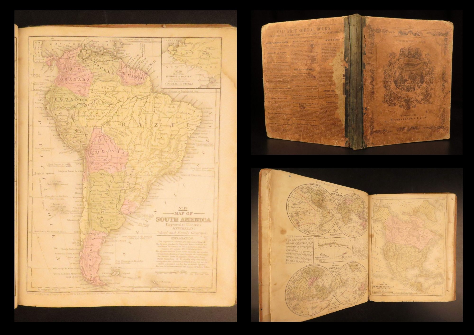

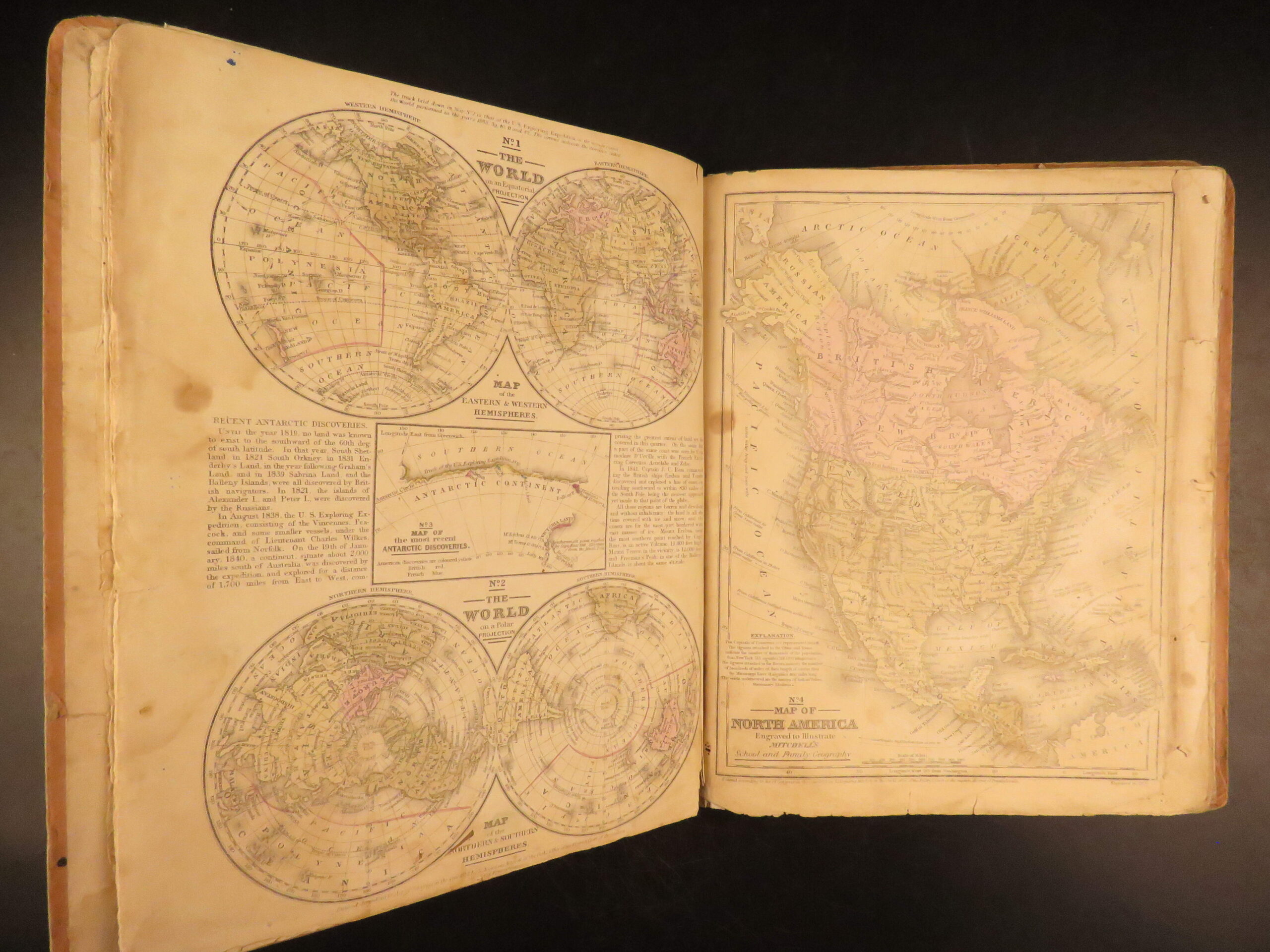
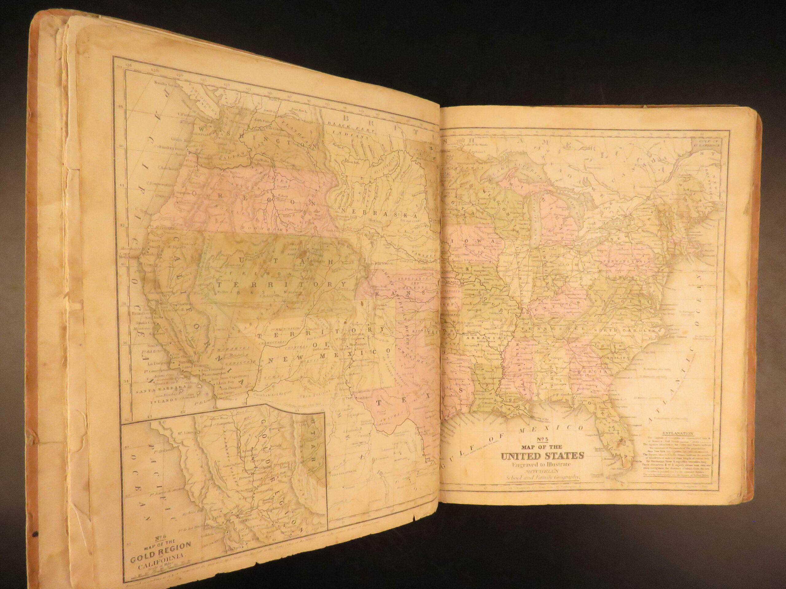
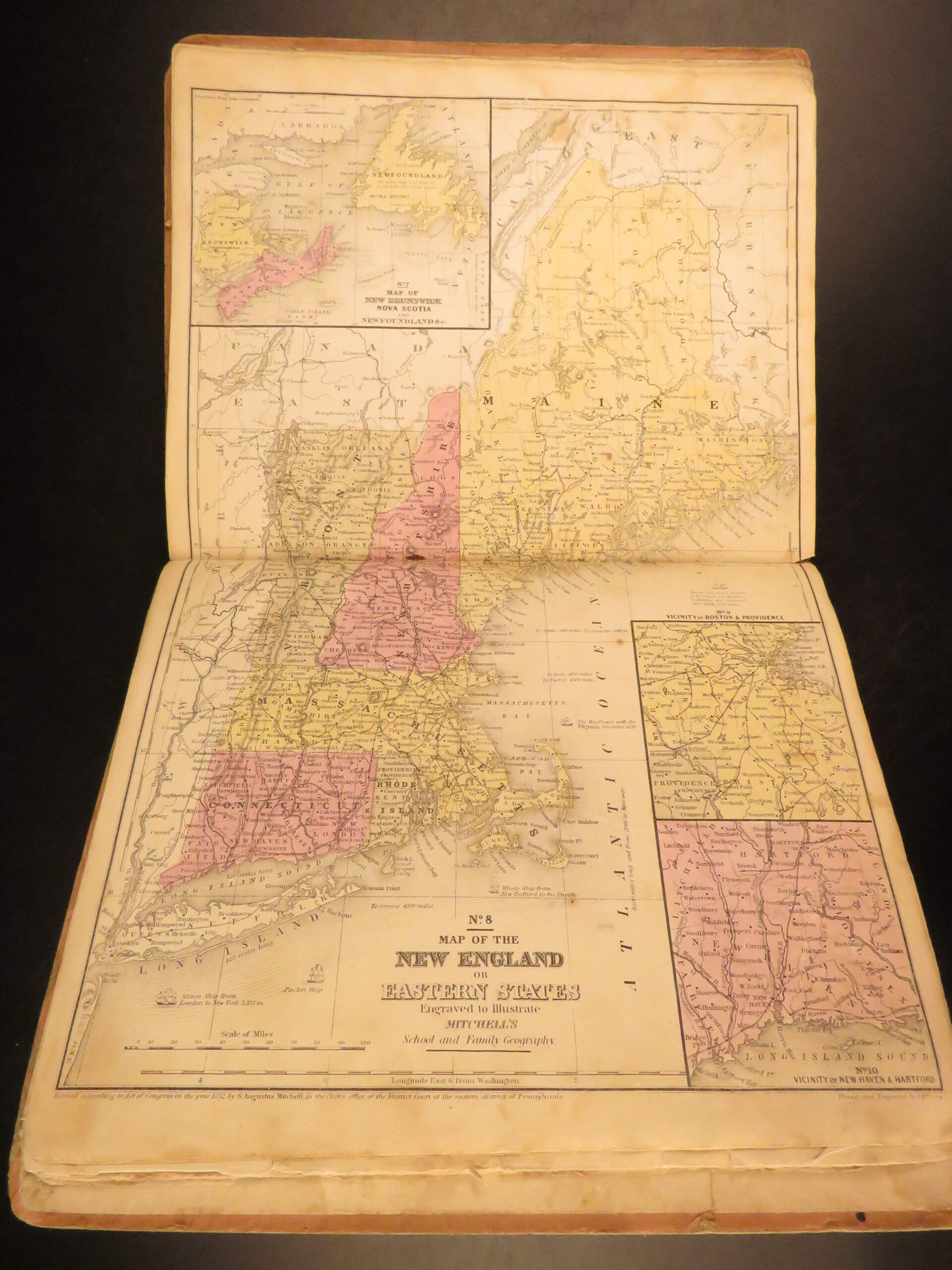
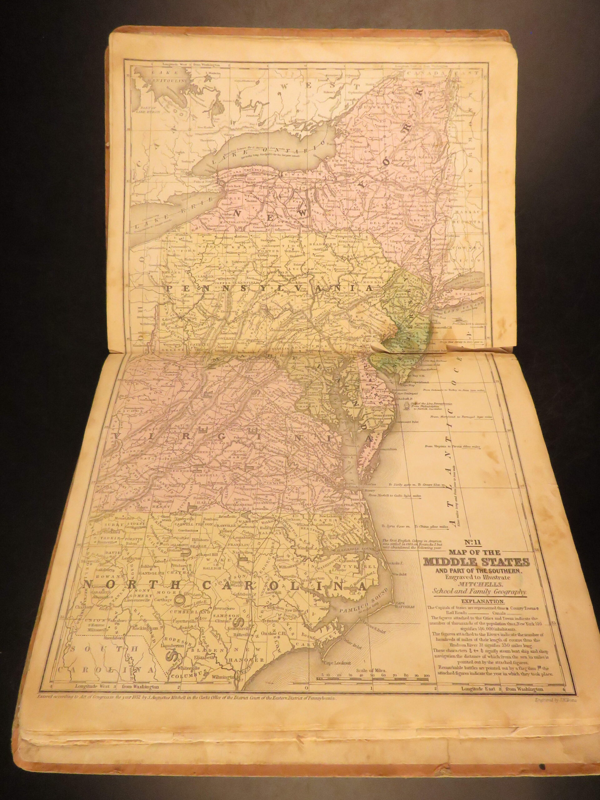
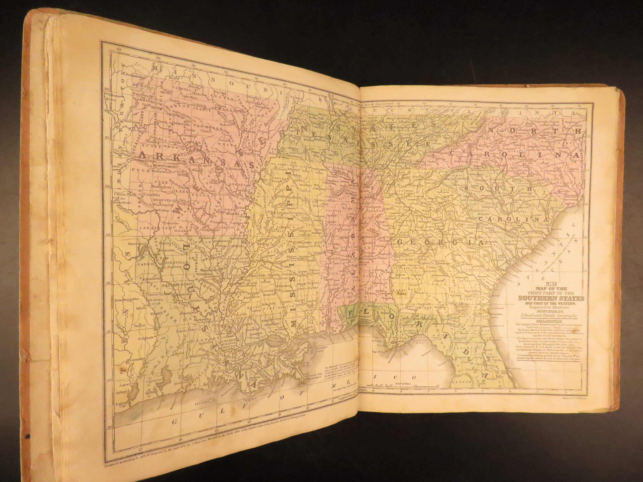
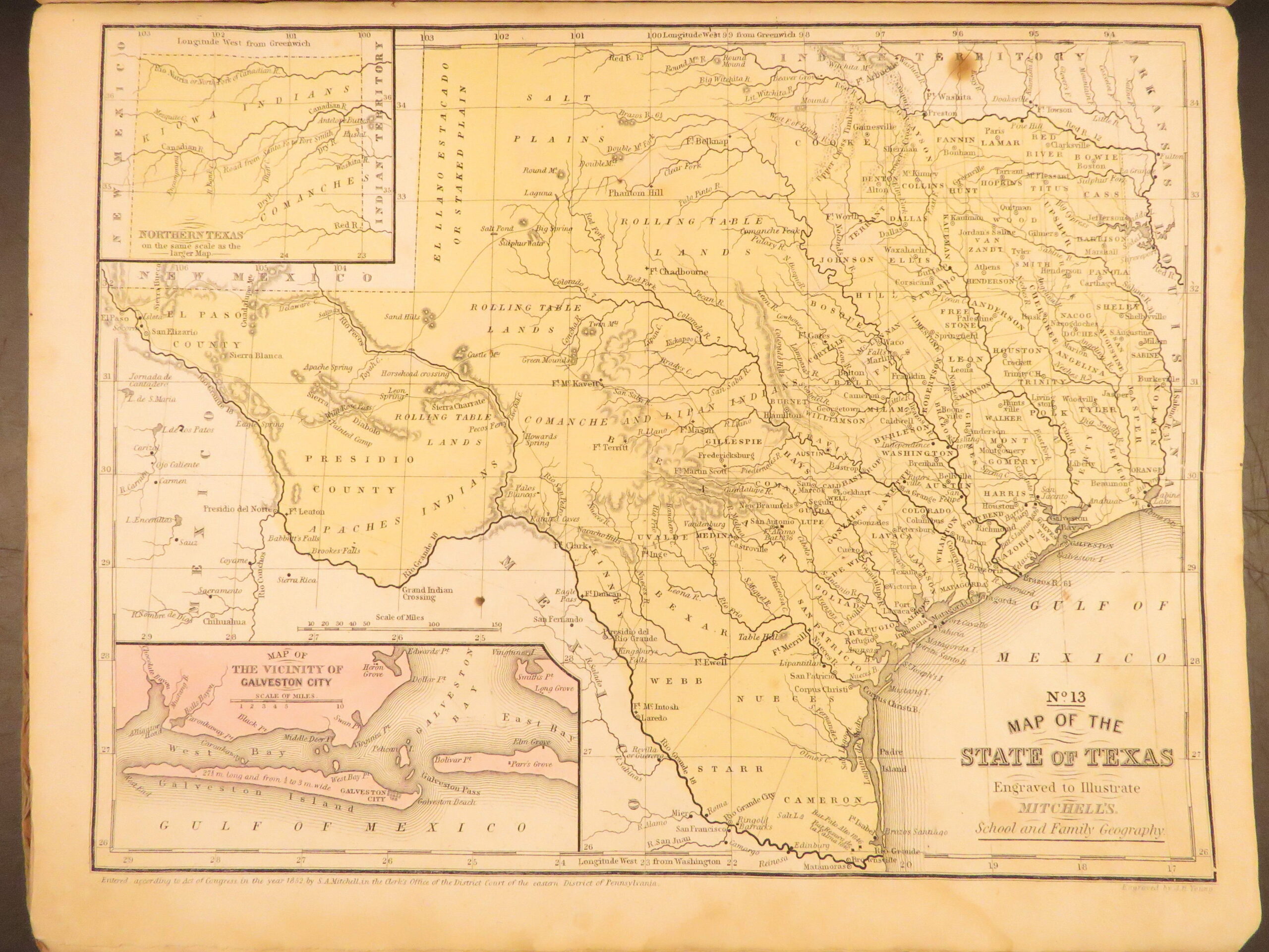
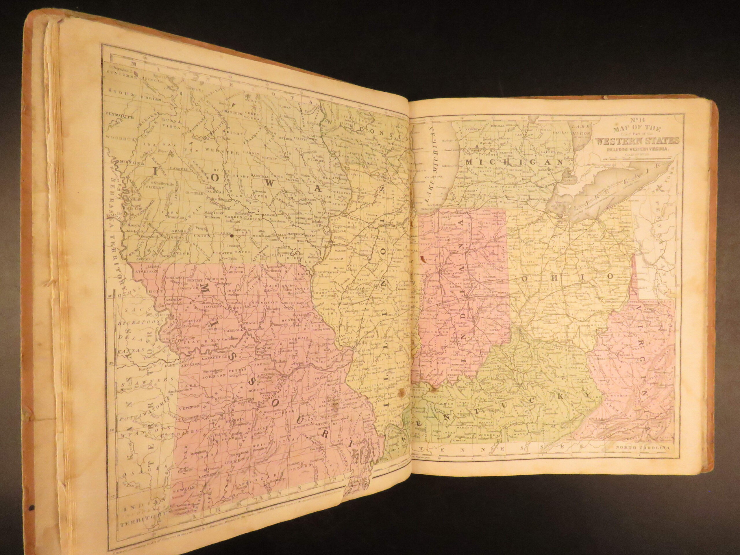
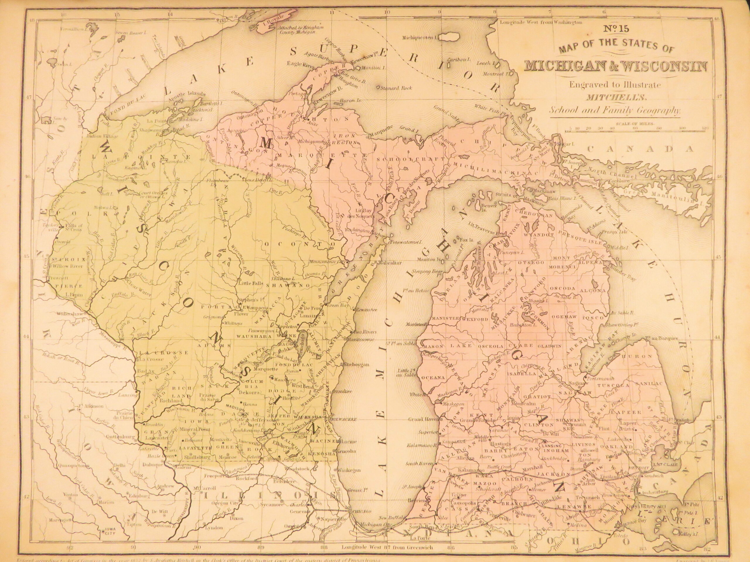
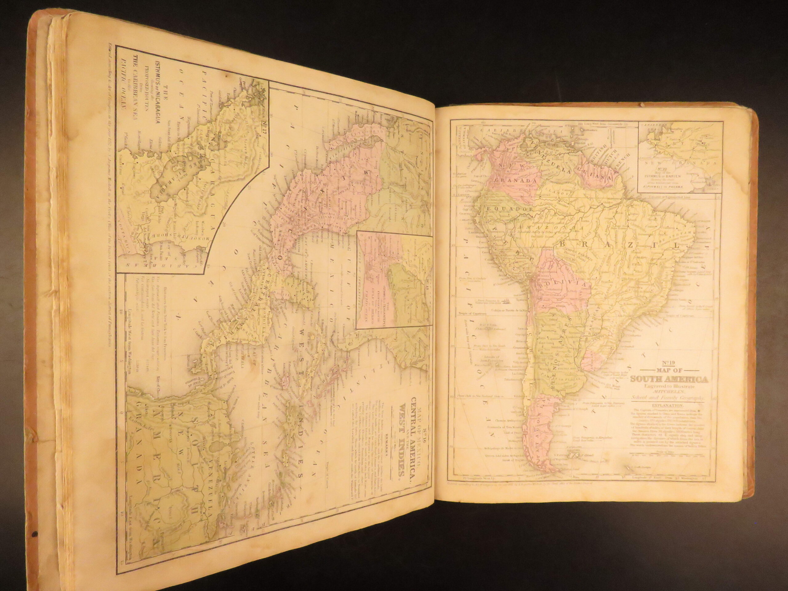
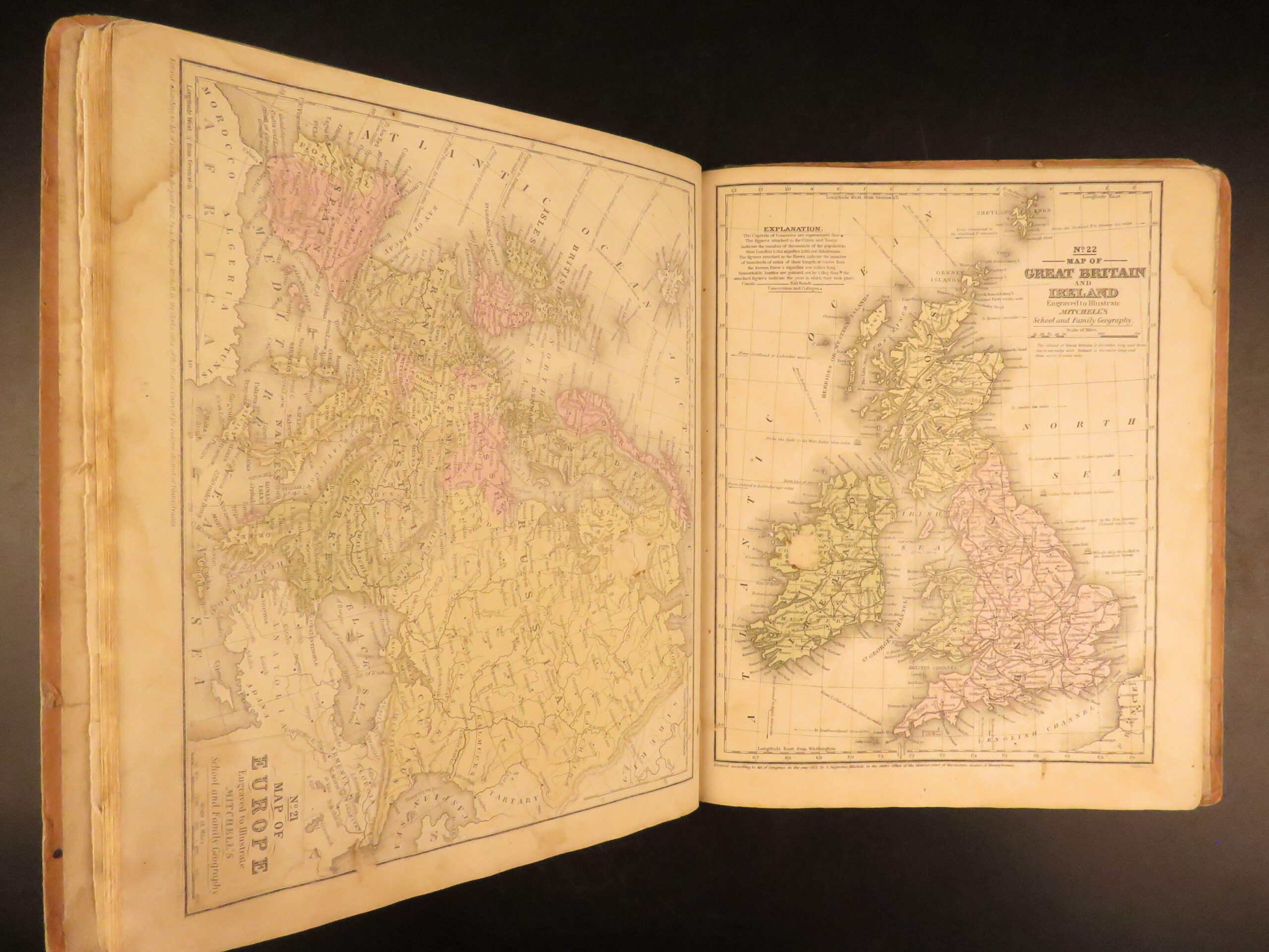
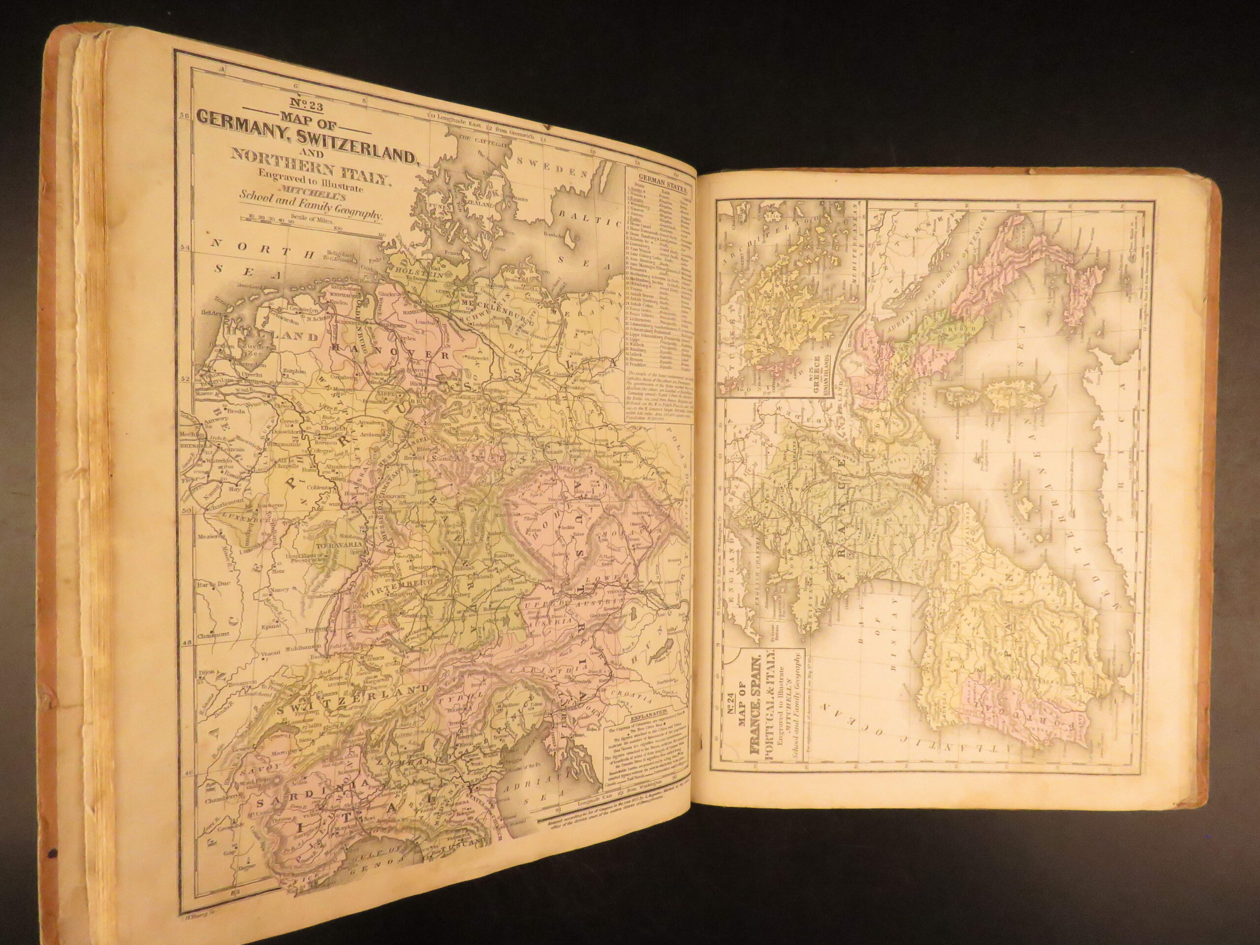
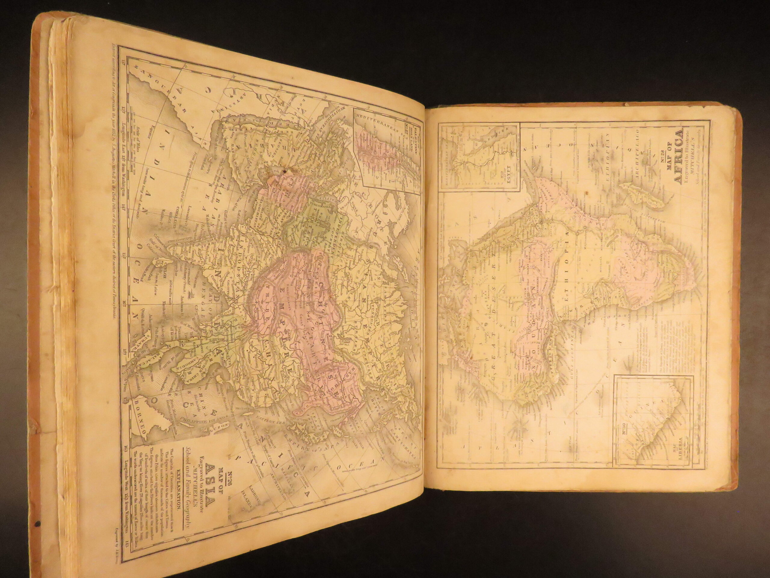
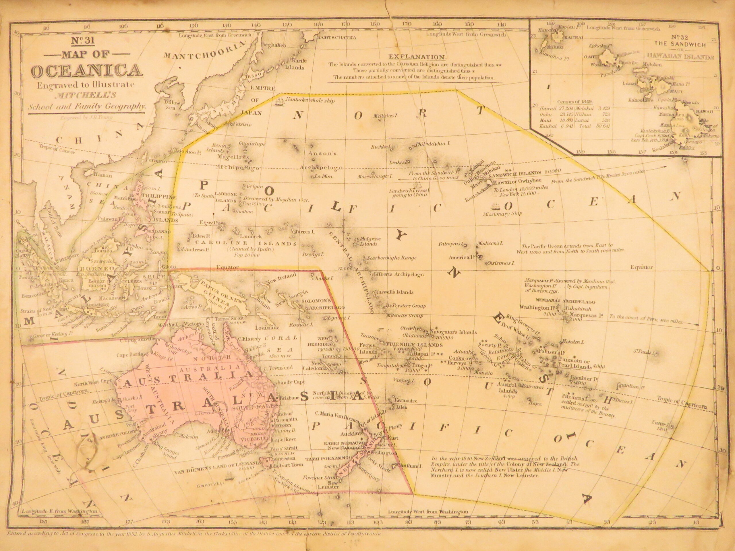
Mitchell’s School Atlas 1855 remains one of the most recognized educational atlases of 19th-century America. The name Mitchell has long been synonymous with 19th-century maps; in fact, Mitchell maps are often considered the best of atlas maps from the 1800s. This edition contains 32 hand-colored maps and statistical tables that align with census data and political divisions from the 1850s. Among the most notable inclusions are dedicated maps for the Gold Region of California, Central America, and Hawaii—locations of strategic or cultural relevance during the 1850s. The statistical sections quantify land area, religious demographics, crop output, and educational facilities, reinforcing its value as a primary teaching tool.
Bibliographic Details
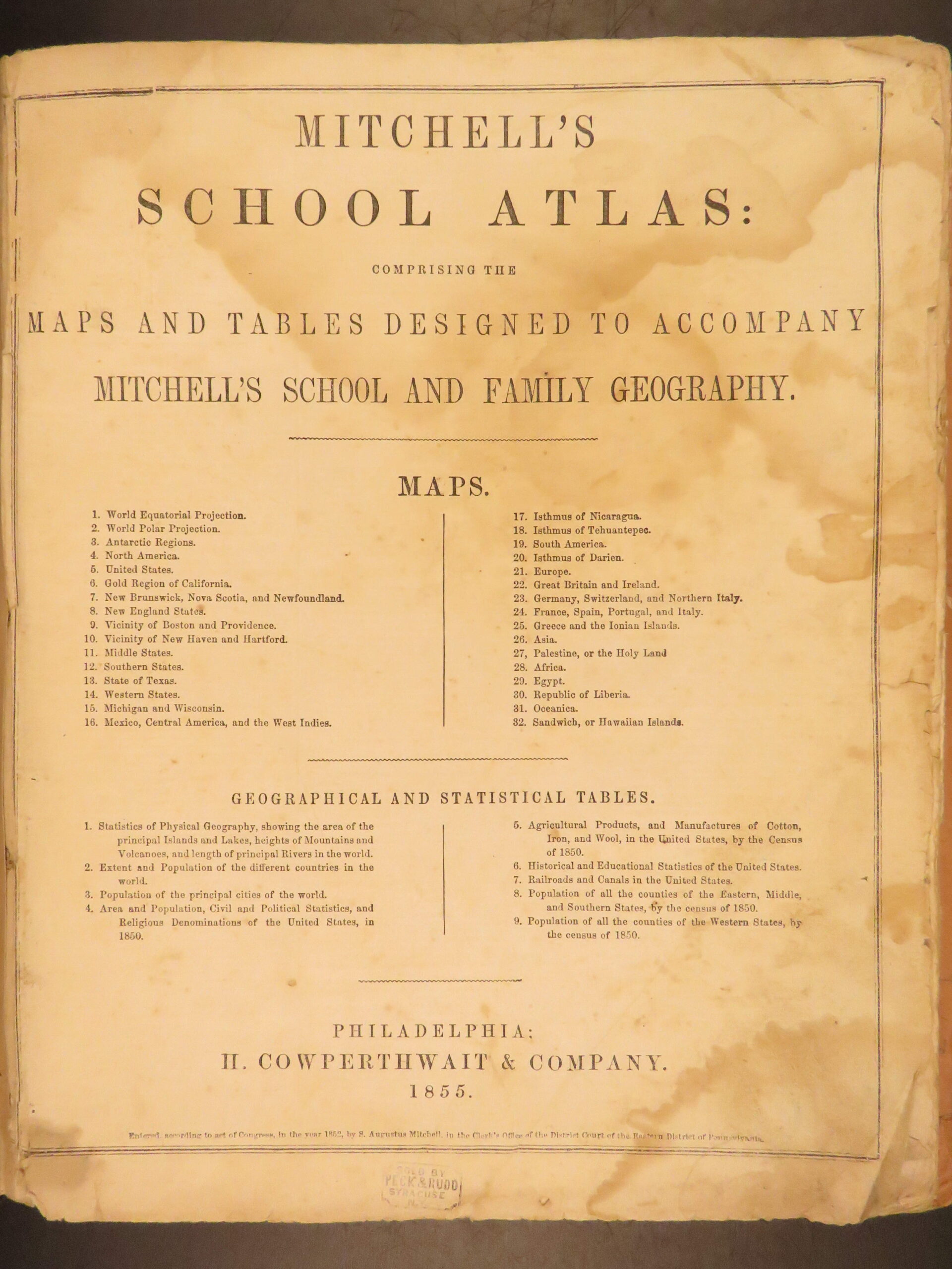
- Title: Mitchell’s School Atlas: Comprising the Maps and Tables Designed to Accompany Mitchell’s School and Family Geography
- Author(s): S. Augustus Mitchell
- Publisher: Philadelphia: H. Cowperthwait & Company
- Edition: Fourth Revised Edition, 1855.
- Format: Quarto, single volume
- Binding: Printed boards with green cloth spine
- Size: 12in X 9.75in (30.5cm x 25cm)
- Collation: 32 maps; statistical tables included
- Illustrations: 32 hand-colored lithographed maps
- Contents Include:
- World Equatorial and Polar Projections
- Map of the Gold Region of California
- U.S. States including Texas, Michigan, and Wisconsin
- Europe, Africa, Asia, South America, and Palestine
- Sandwich Islands and Republic of Liberia
- Tables on population, area, religion, agriculture, education (U.S. Census of 1850)
Condition:
The binding shows wear at corners, chipping to edges, and darkening to surfaces consistent with prolonged use. The cloth spine is partially split but intact. Internally, all maps are present with some toning.
Why Collect This?
- Complete 1855 school atlas with all maps intact
- period-specific maps including Liberia, the Hawaiian Islands, and California during the Gold Rush
Item Number: #28705
Categories
Americana, American History
Voyages & Exploration & Maps
Authors
S. Augustus Mitchell
Printing Date
19th Century
Language
English
Binding
Hardcover
Book Condition
Good
Collation
Complete
Other Books you might like...
-
Sale!
 Add to cart
1864 Civil War Fort Pillow Massacre Prisoner of War POW Illustrated CSA Forrest
Original price was: $550.00.$450.00Current price is: $450.00. -
Sale!
 Add to cart
1841 Singer’s Own Book Patriotic Songs Star-Spangled Banner Traditional Music
Original price was: $499.00.$399.00Current price is: $399.00. -
Sale!
 Add to cart
1760 Adventures of Bampfylde Moore Carew Beggars Gypsies America Tobacco Goadby
Original price was: $499.00.$399.00Current price is: $399.00. -
Sale!
 Add to cart
1873 1ed Osgood New England ATLAS Traveler Guide MAPS New York Quebec Geography
Original price was: $499.00.$399.00Current price is: $399.00.