Index Villaris – John Adams – 1690 | English Topographical Reference w/ Geography Tables

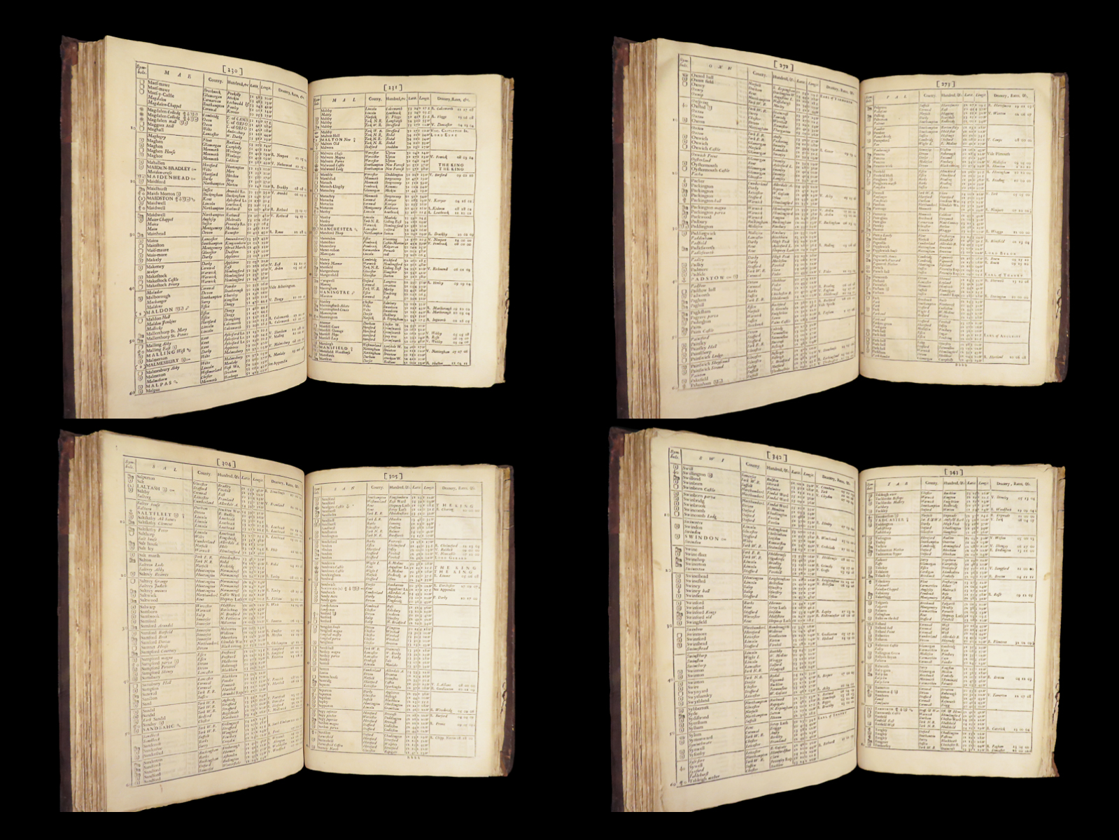
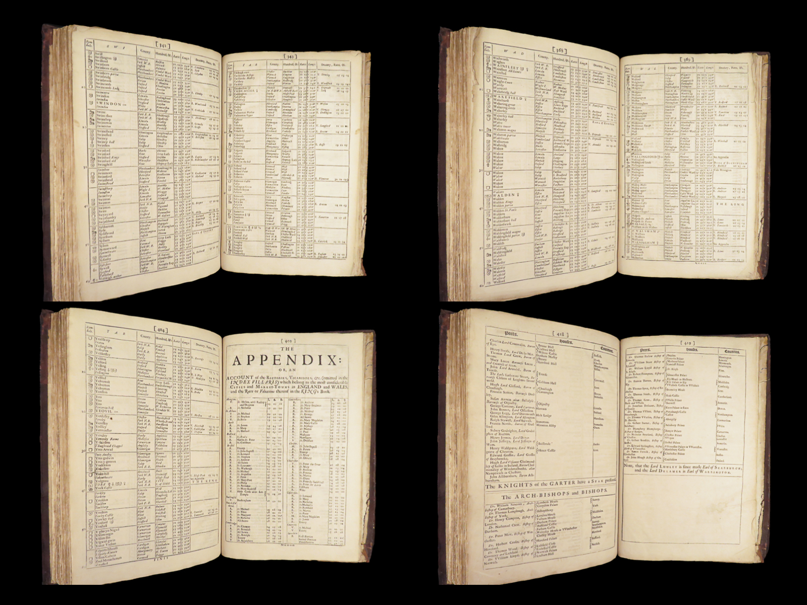
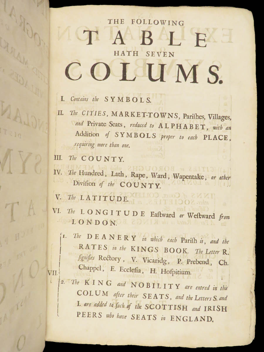
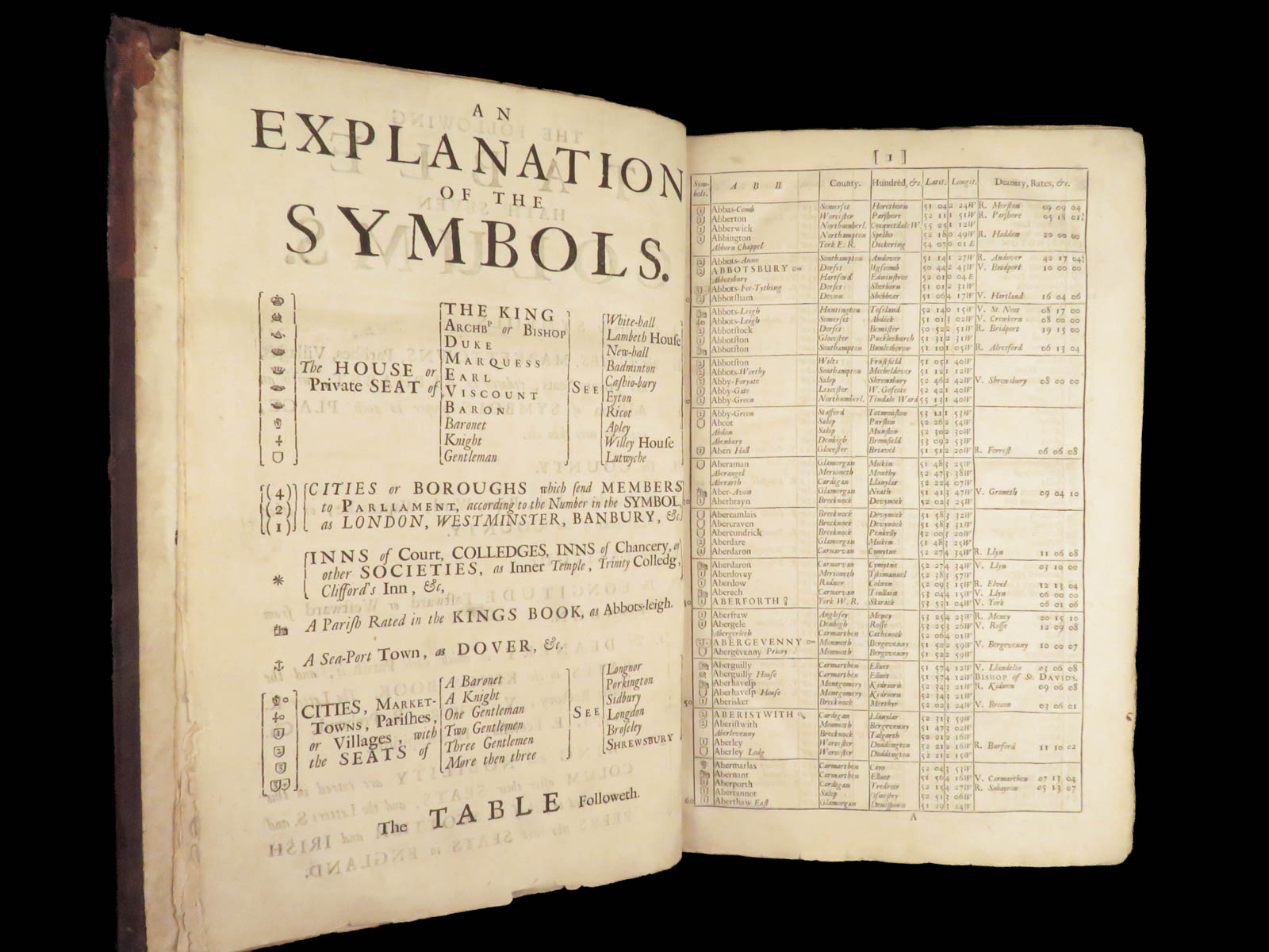
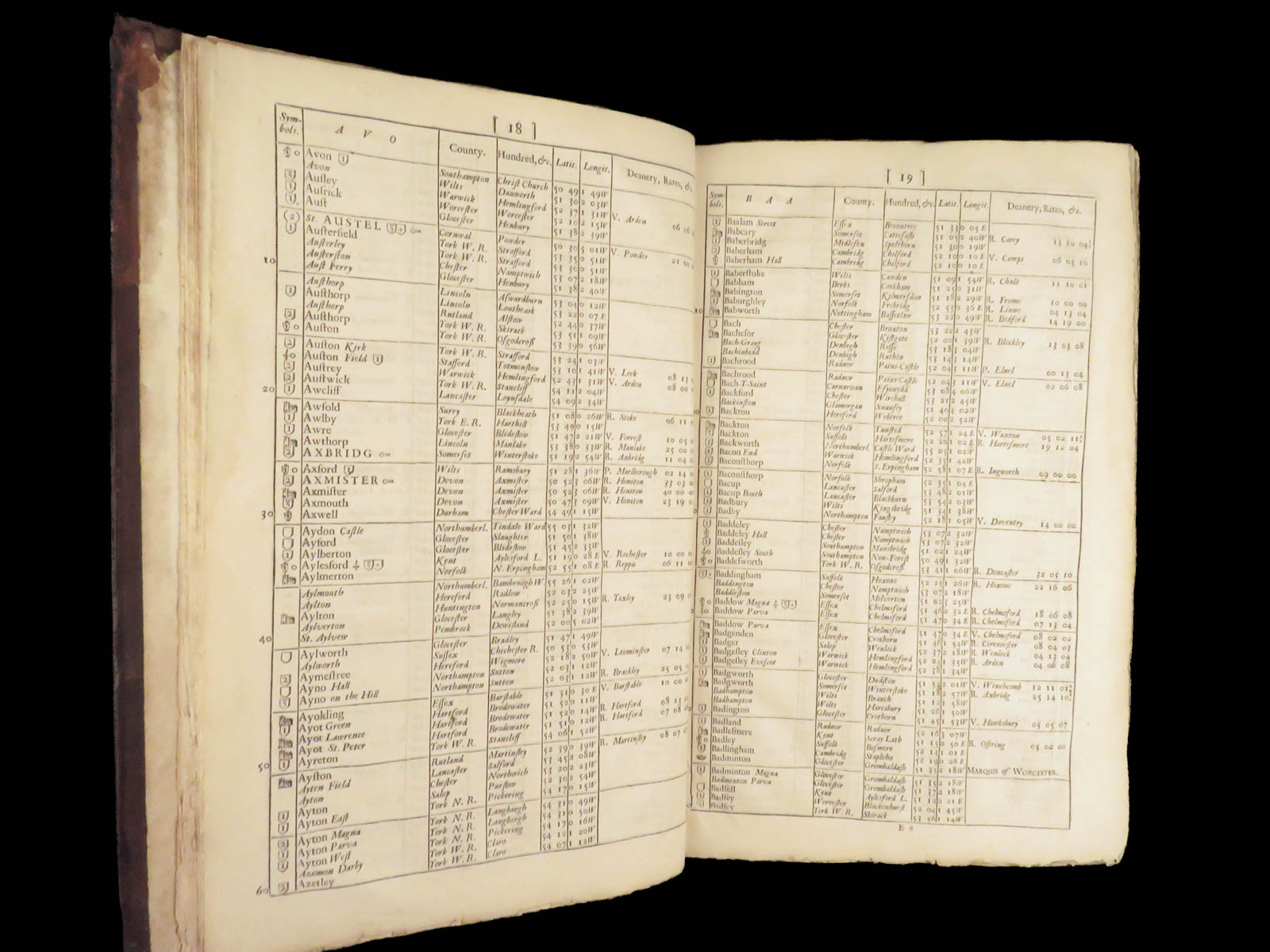
John Adams’s 1690 Index Villaris is a folio-sized English register listing all known cities, parishes, and counties in England and Wales, including their administrative and ecclesiastical divisions.
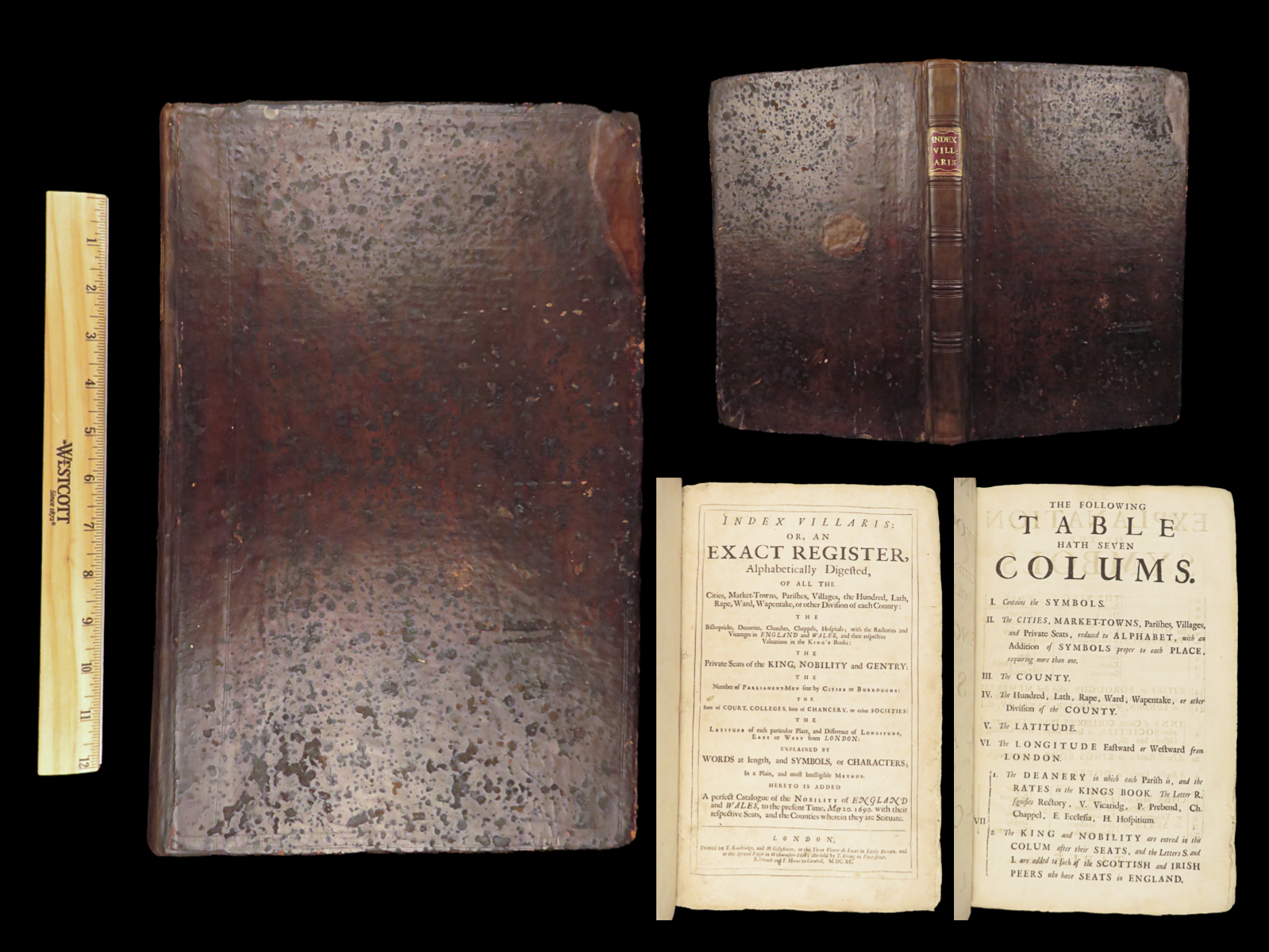
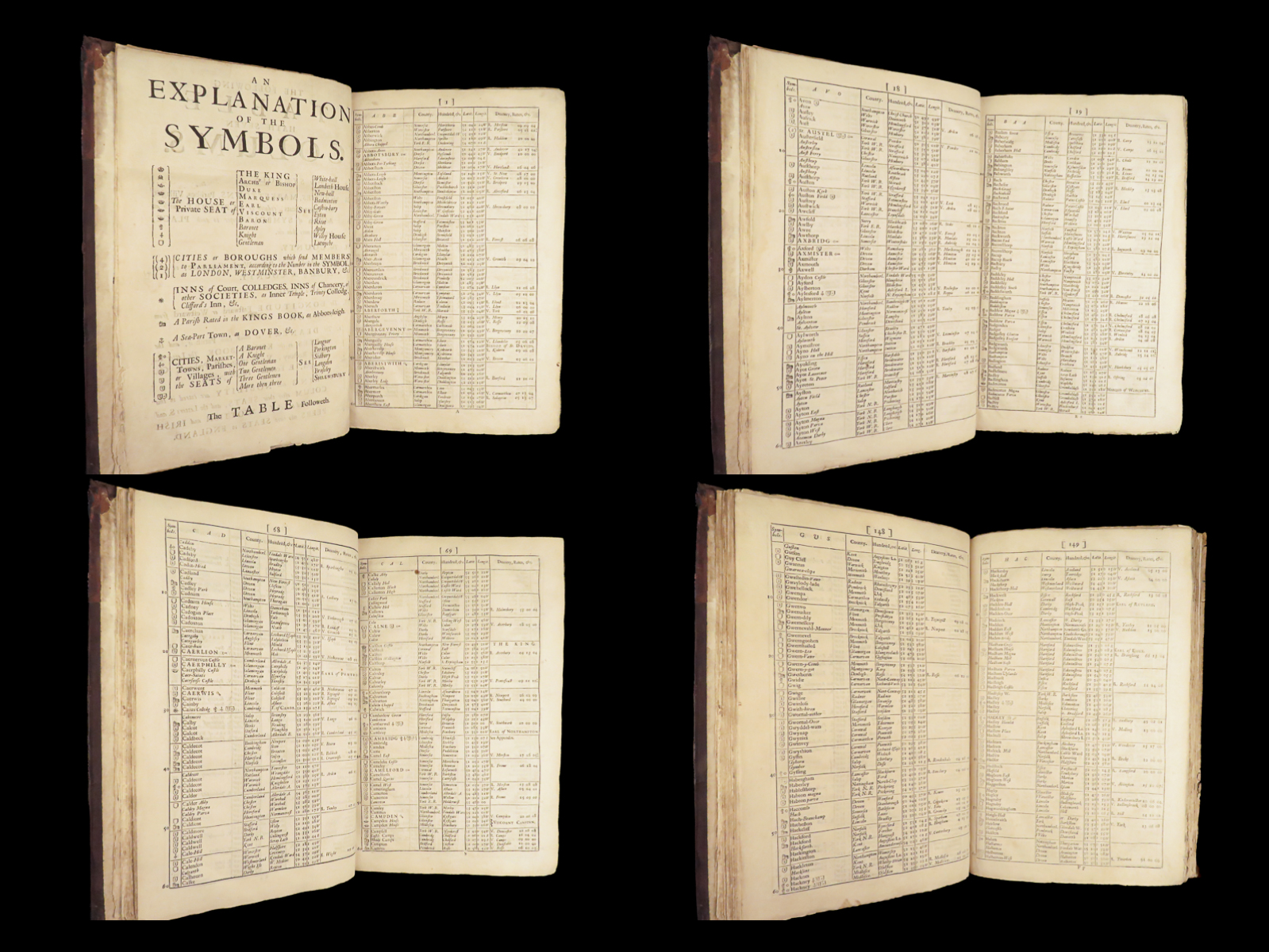
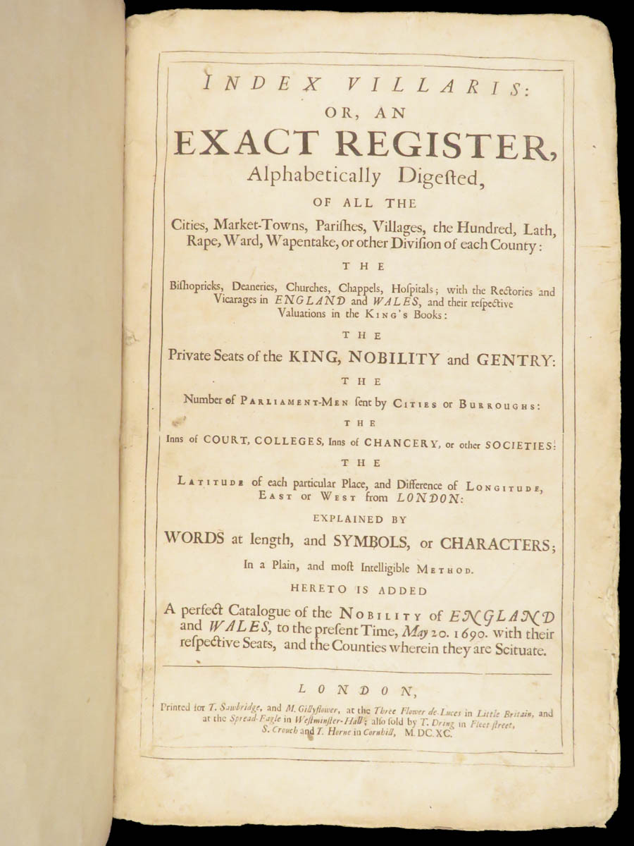
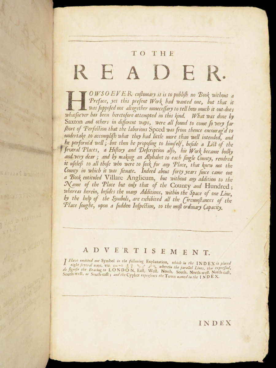
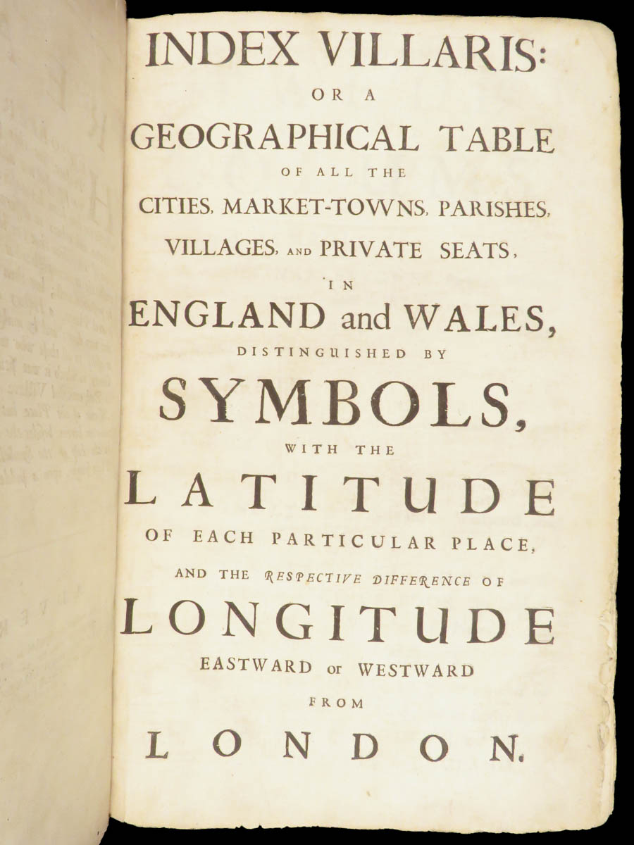
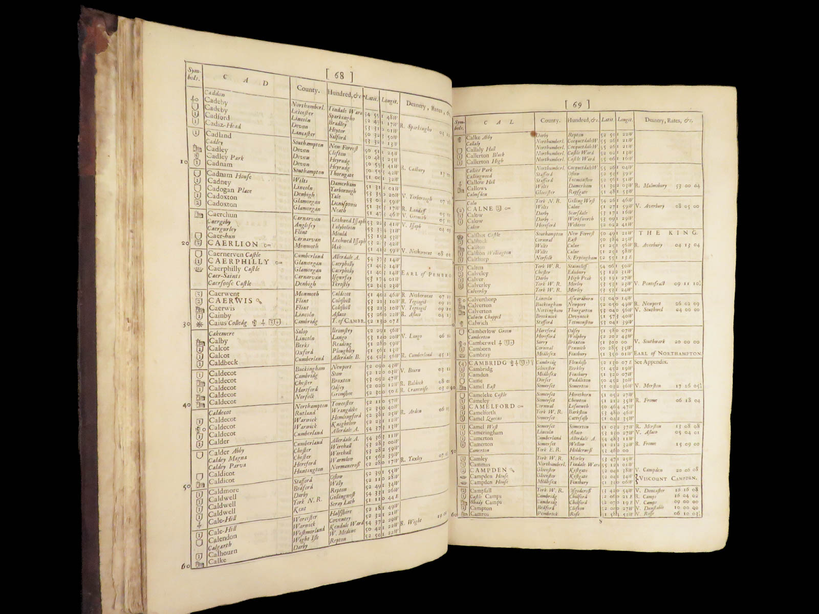
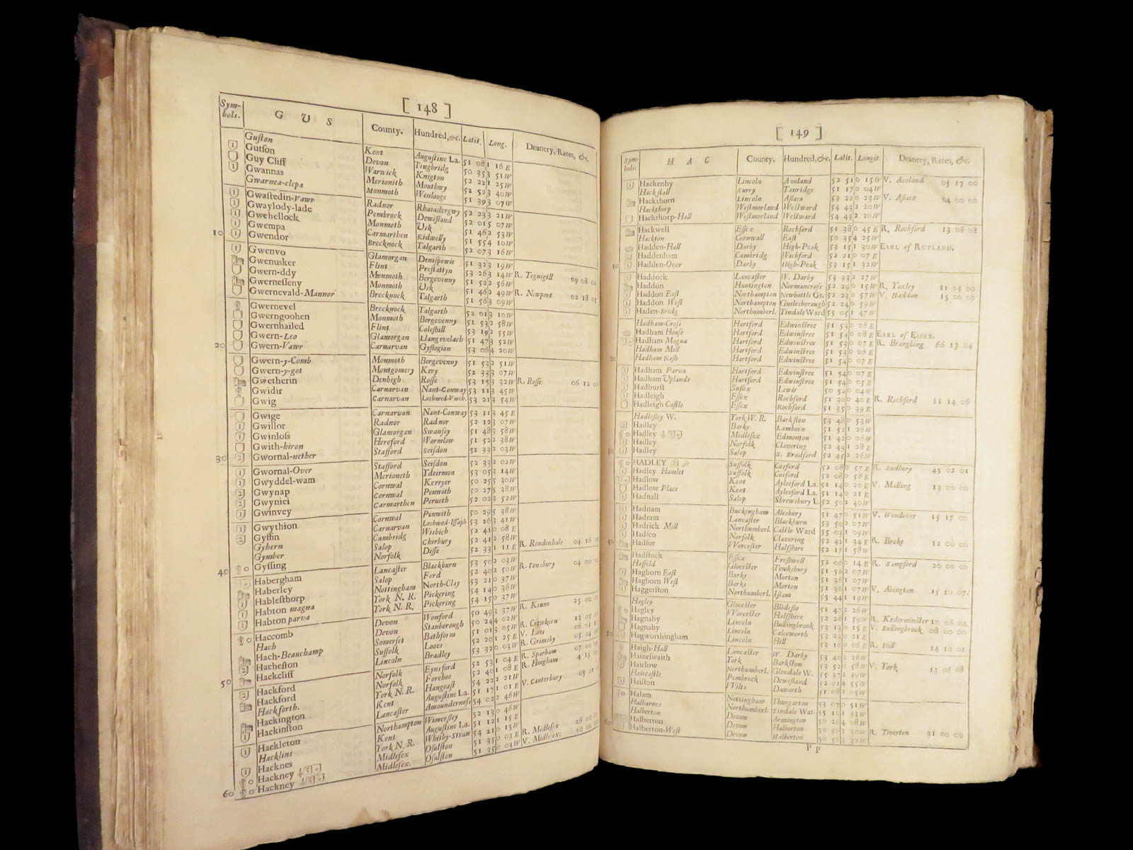
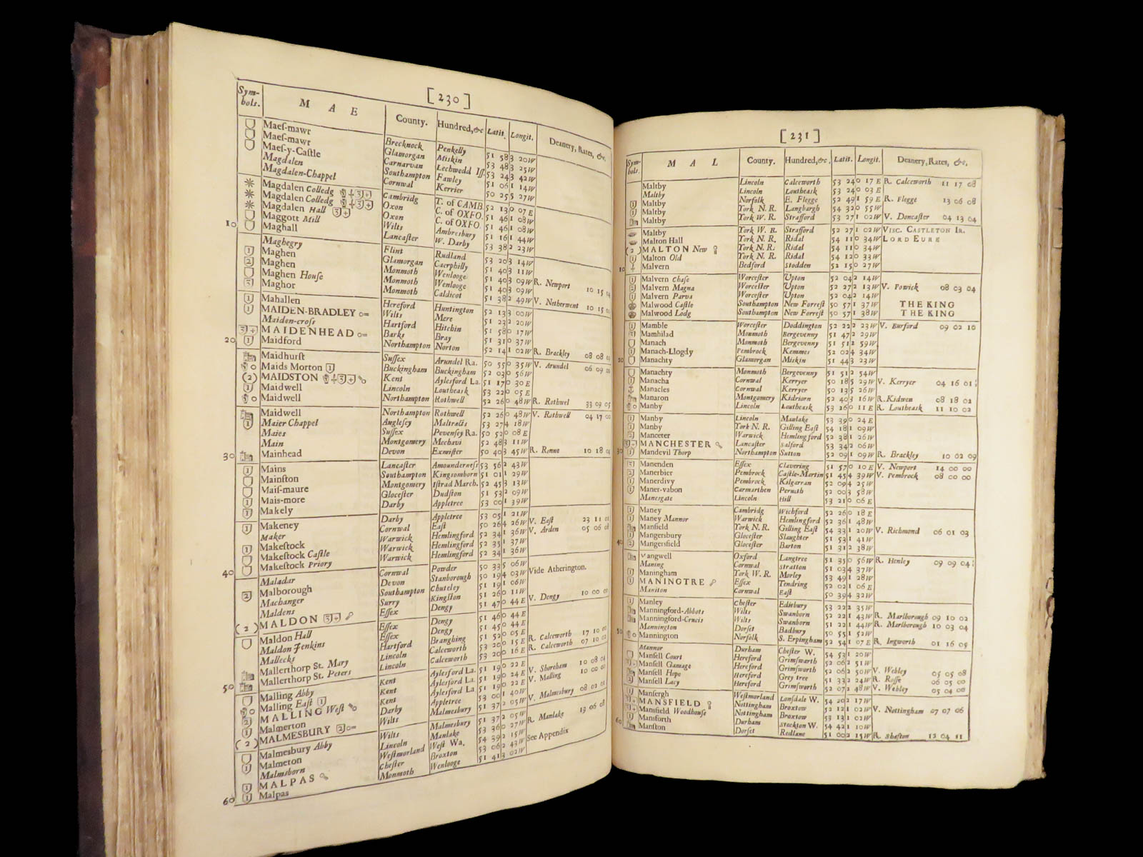
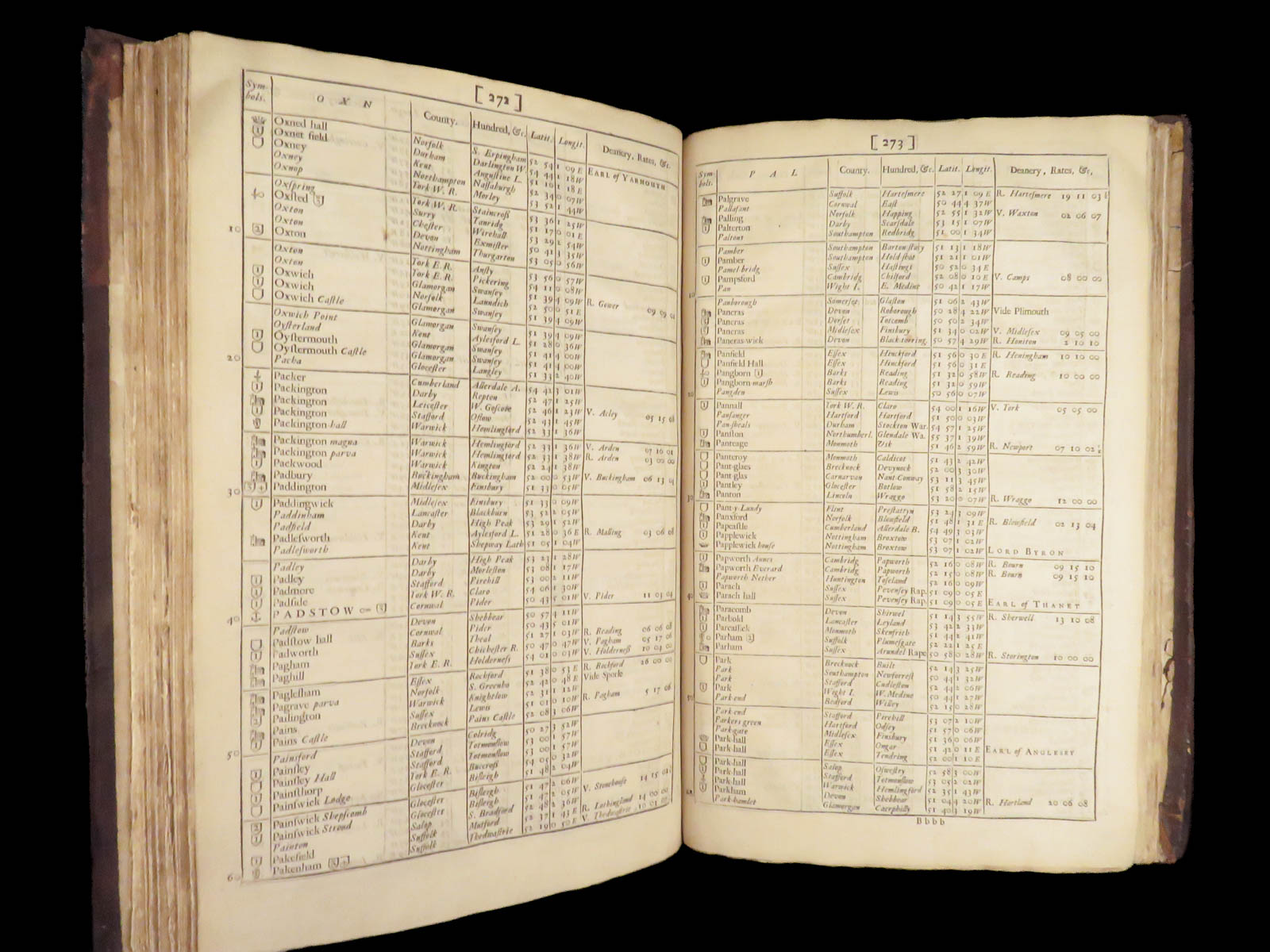
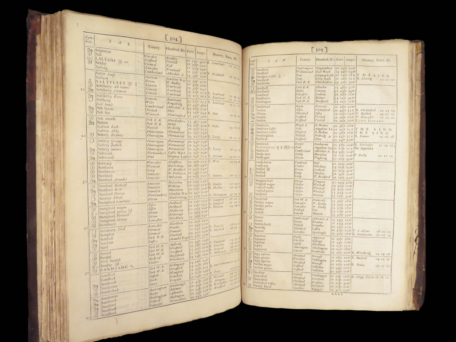
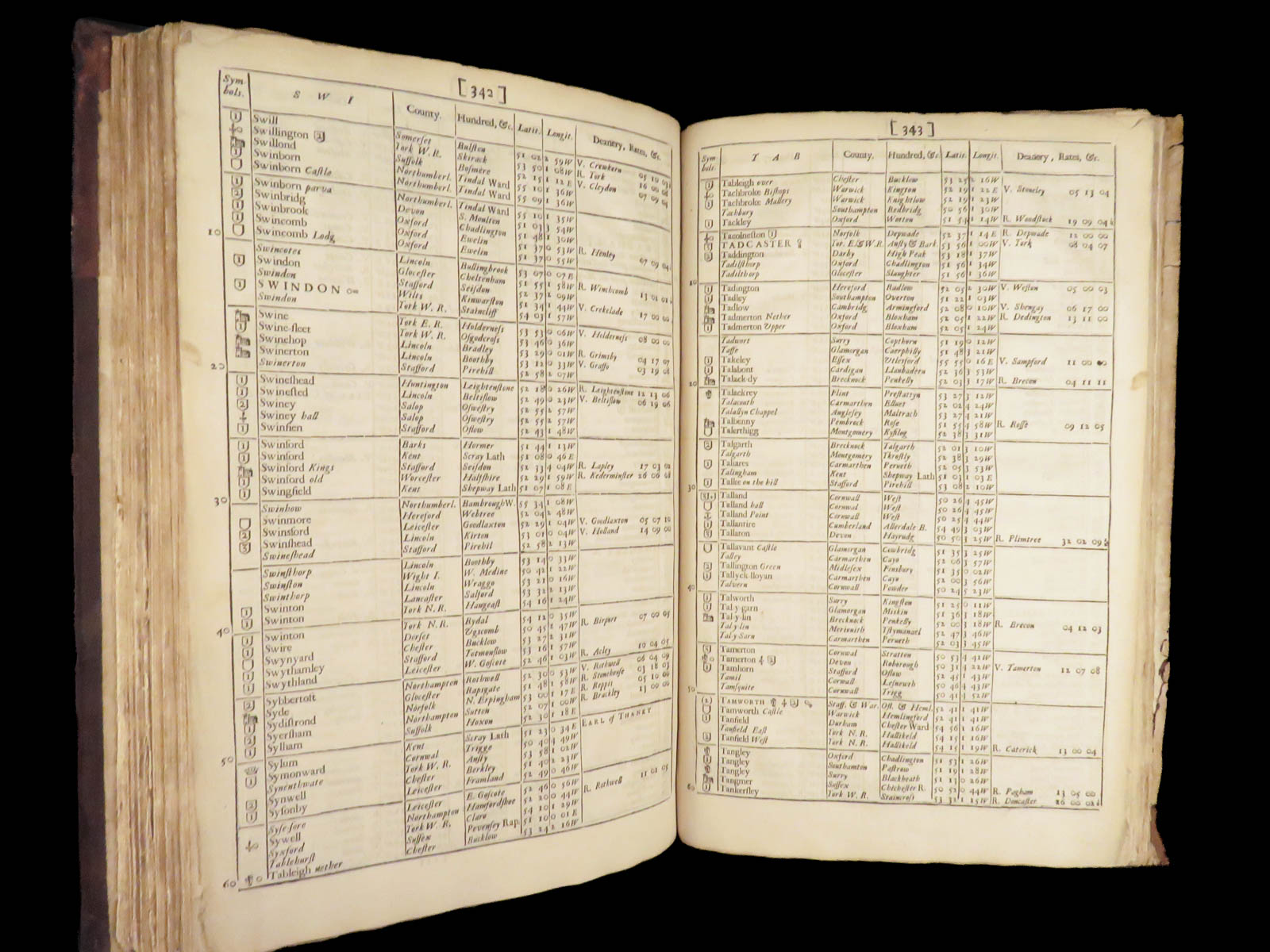
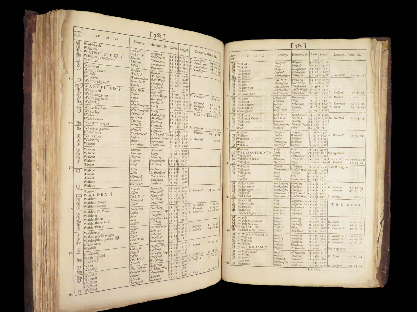
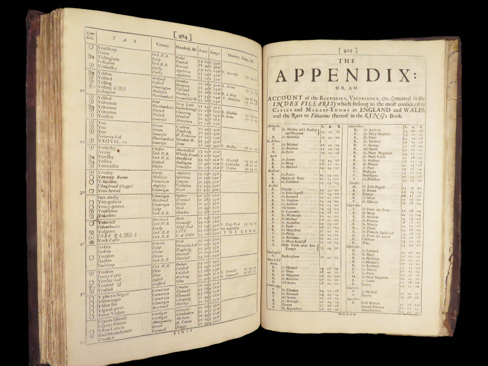
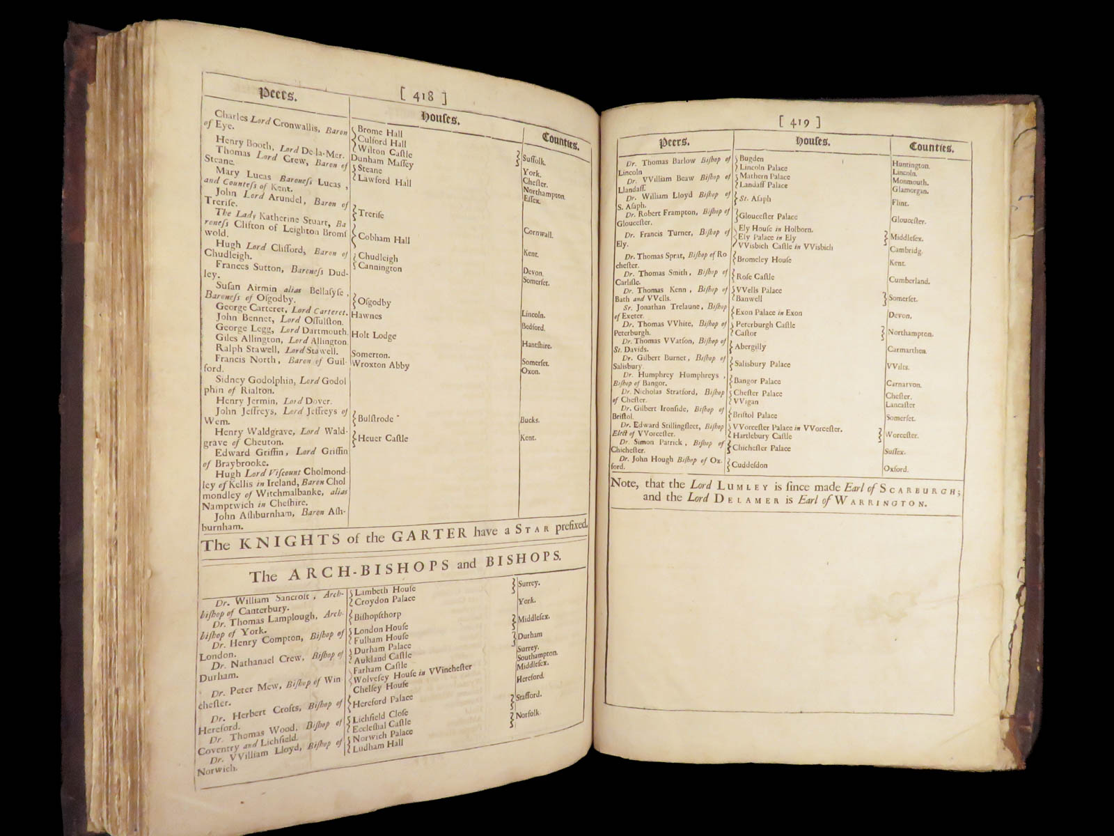
John Adams, not to be confused with the American founding father, was a 17th-century English lawyer who is best known for his topographical studies of England, Index Villaris or an Exact Register Alphabetically Digested. In 1677, he produced a map of England and Wales that many considered to be quite lacking. To satisfy those that were left off the map, Adams published an enormous Index that categorized and registered each city, town, village, and county in England and Wales.
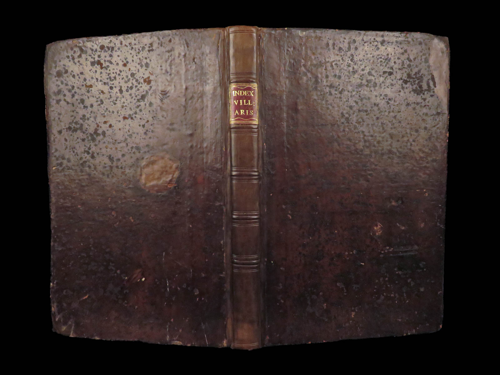
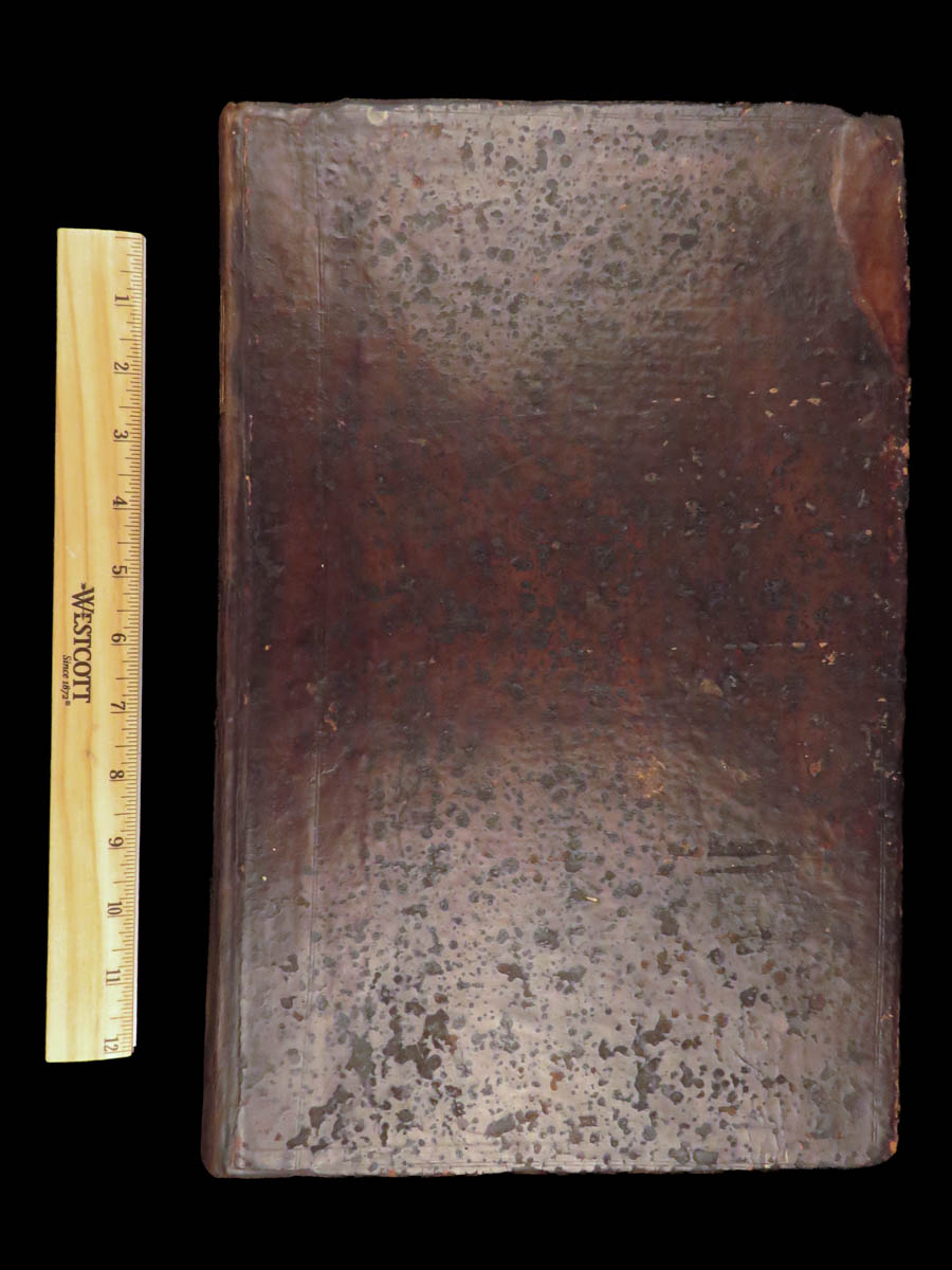
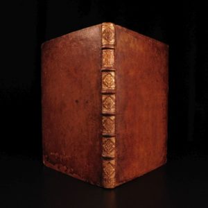
Index Villaris was first published in 1680 and was edited and republished in 1690 with numerous additions. This 1690 edition is leather bound; an impressive 17th-century piece of English topography.
Bibliographic Details
- Title: Index Villaris, or, An Exact Register, Alphabetically Digested, of All the Cities, Market-Towns, Parishes, Villages…
- Author(s): John Adams
- Publisher: London: T. Sawbridge & M. Gilleynower
- Edition: Second edition, 1690.
- Format: Folio, single volume
- Binding: Leather
- Size: 14.25in x 9.5in (36.5cm x 24cm)
- Collation: [8], 419, [1]
- Contents Include:
- Alphabetical List of Places
- Administrative Divisions
- Ecclesiastical Valuations
- Churches, Rectories, and Vicarages
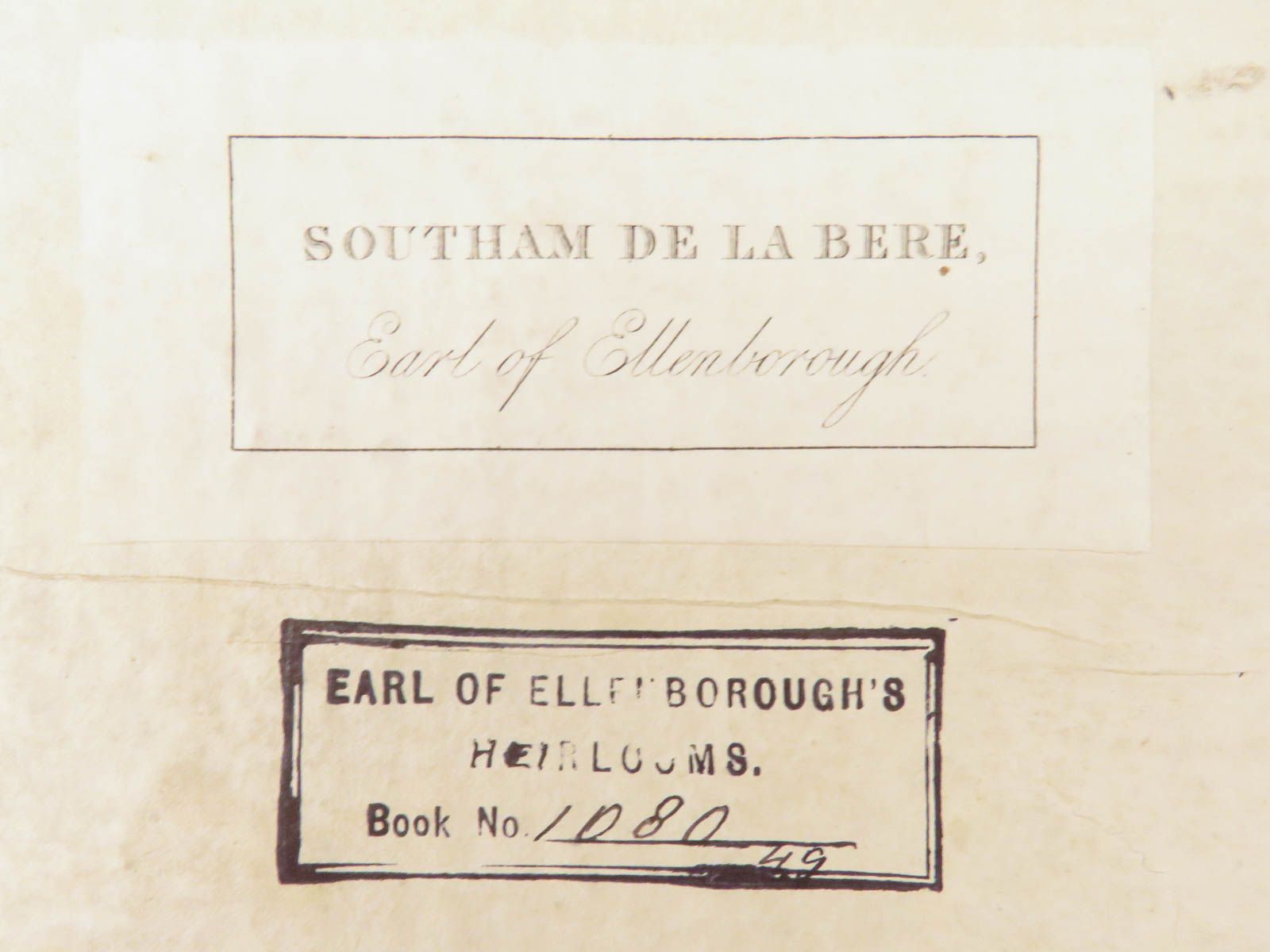
- Provenance: bookplate – Southam de la Bere, Earl of Ellenborough
- Generally thought to be Edward Law, 1st Earl of Ellenborough
- Reference(s): Wing A 480
Condition:
Very Good. Leather binding professionally restored, spine and hinges reinforced. Covers show mild surface wear. Internal text block clean and complete. Pages remain crisp with light toning. Secure binding with no text loss.
Why Collect This?
- 17th century edition of an early English geographic register
- Includes expanded place listings from the 1680 version
- Suitable for topographic, genealogical, and legal research collections
Item Number: # 29410
Categories
Law & Government
European History
Language Study & Reference
Maps
Voyages & Exploration & Maps
Authors
John Adams
Printing Date
17th Century
Language
English
Binding
Leather
Book Condition
Very Good
Collation
Complete
Other Books you might like...
-
Sale!
 Add to cart
1696 Hugo Grotius de Jure Belli Dutch Legal Masterpiece Catholic Natural LAW
Original price was: $599.00.$550.00Current price is: $550.00. -
Sale!
 Add to cart
1598 Lesina Company Dialogues Italian Political Satire Cuisine Finance Orvieto
Original price was: $950.00.$750.00Current price is: $750.00. -
Sale!
 Add to cart
1547 LAW Andrea Alciati Commentary on Justinian Codex Catholic & Byzantine FOLIO
Original price was: $950.00.$795.00Current price is: $795.00. -
Sale!
 Add to cart
1603 NAPLES Italian Law Decisiones Sacri Regii Consilii Neapolitani Italy Capece
Original price was: $550.00.$450.00Current price is: $450.00.