1873 ATLAS MAPS of Huron County OHIO Bellevue Norwalk HUGE MAPS Color USA
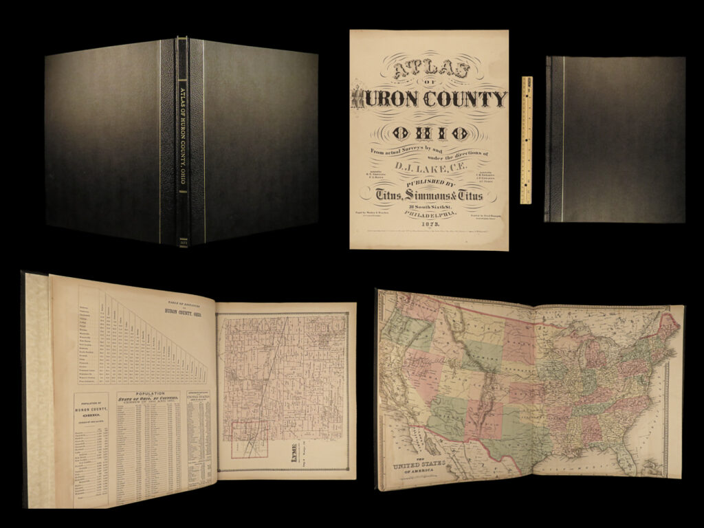
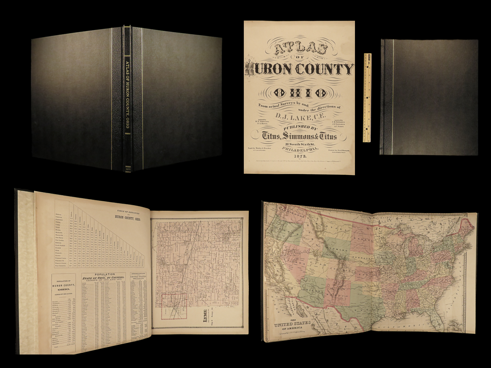
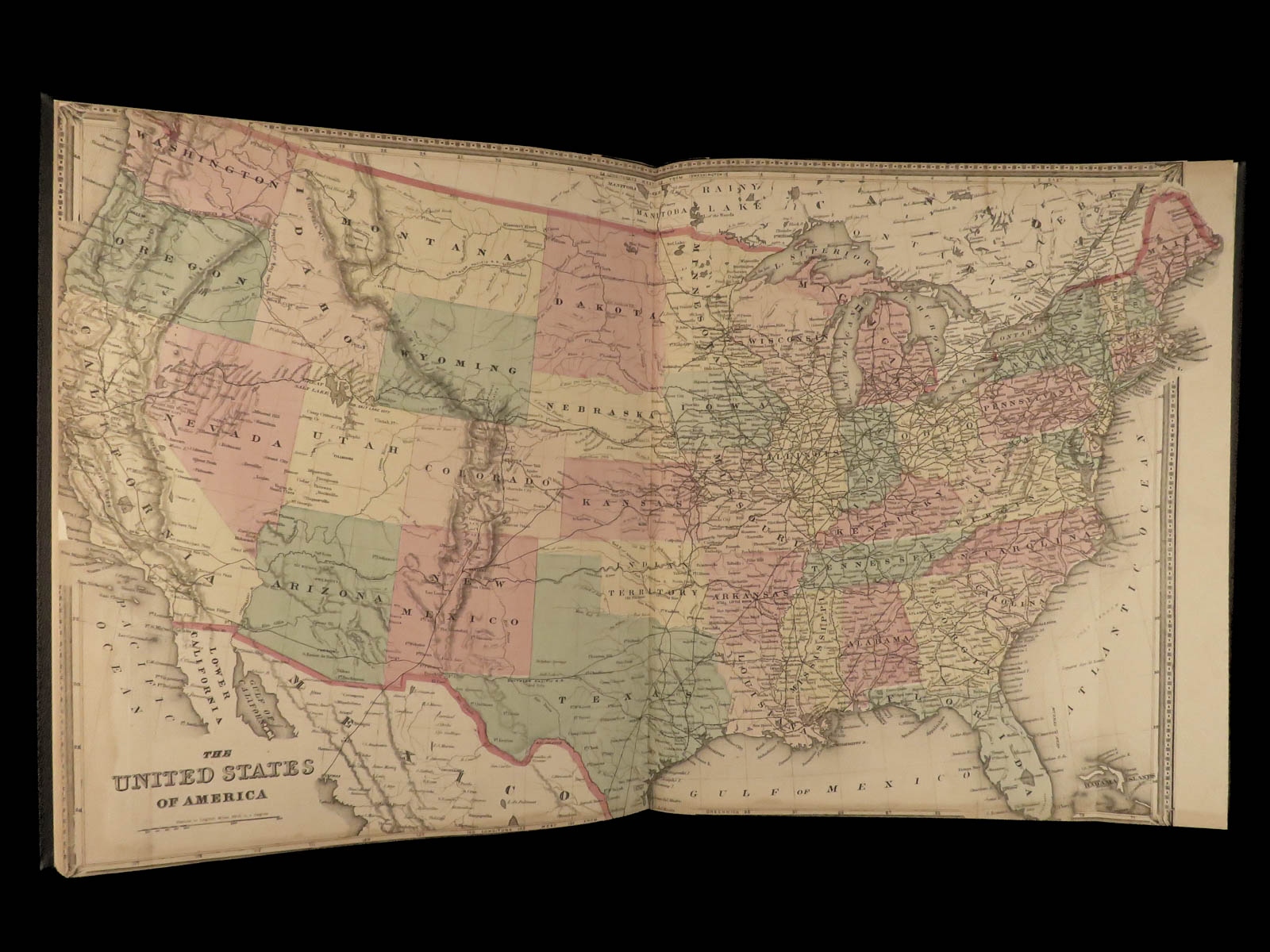
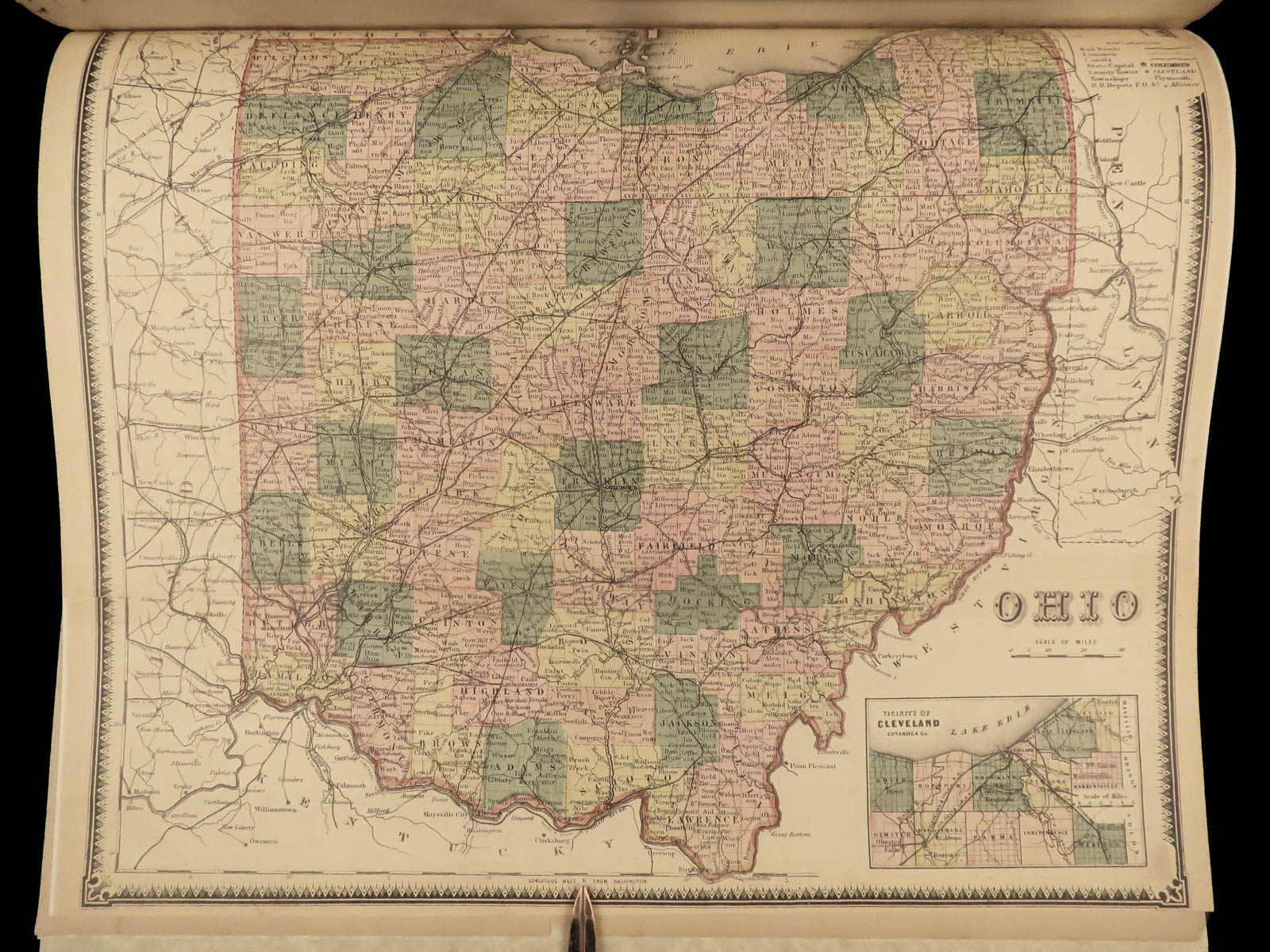
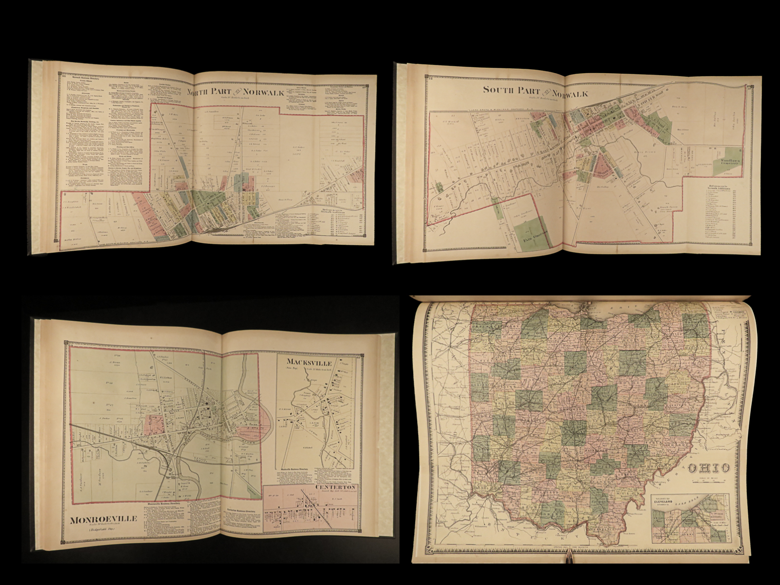
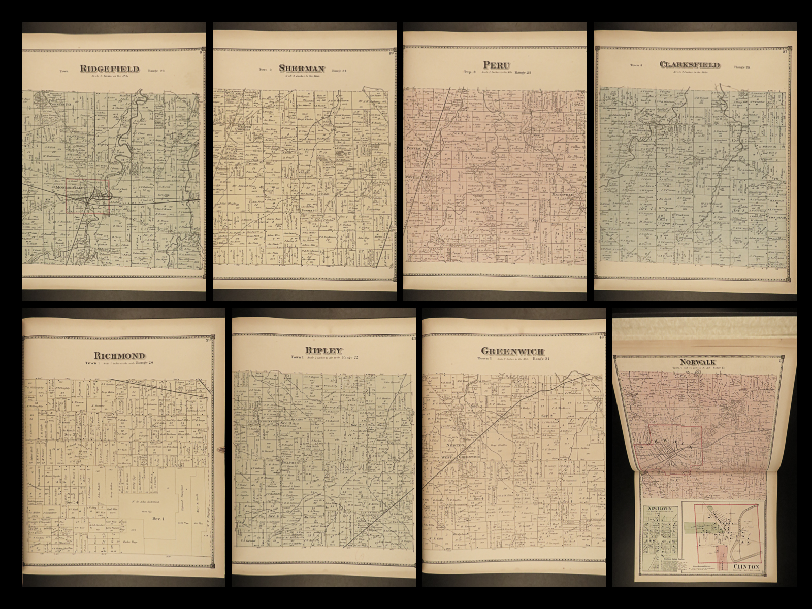
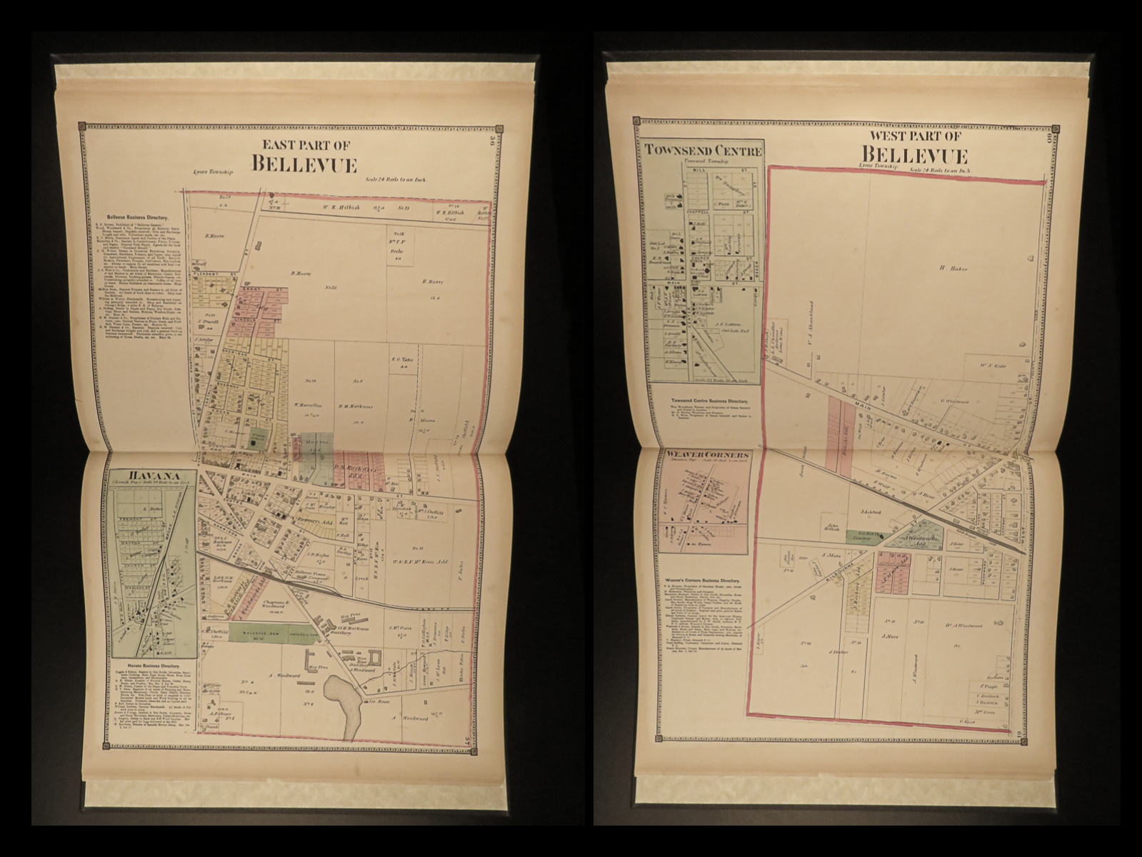
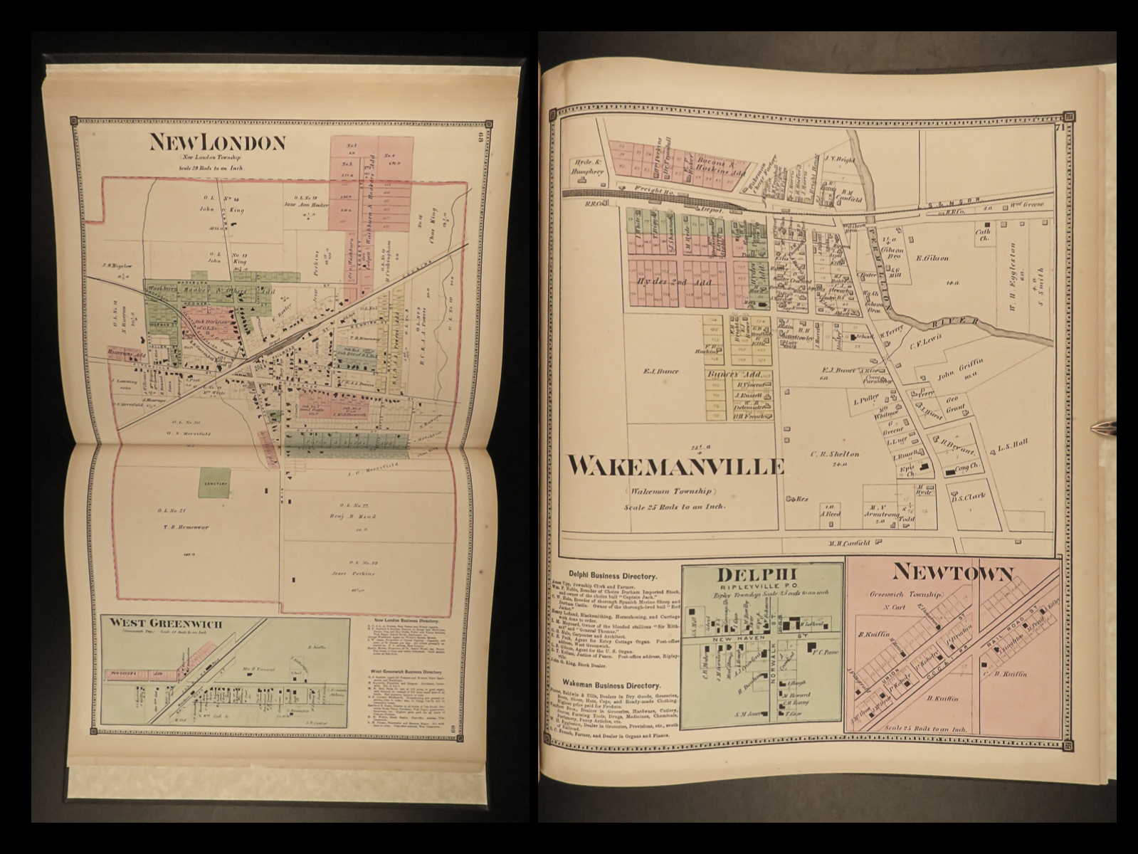
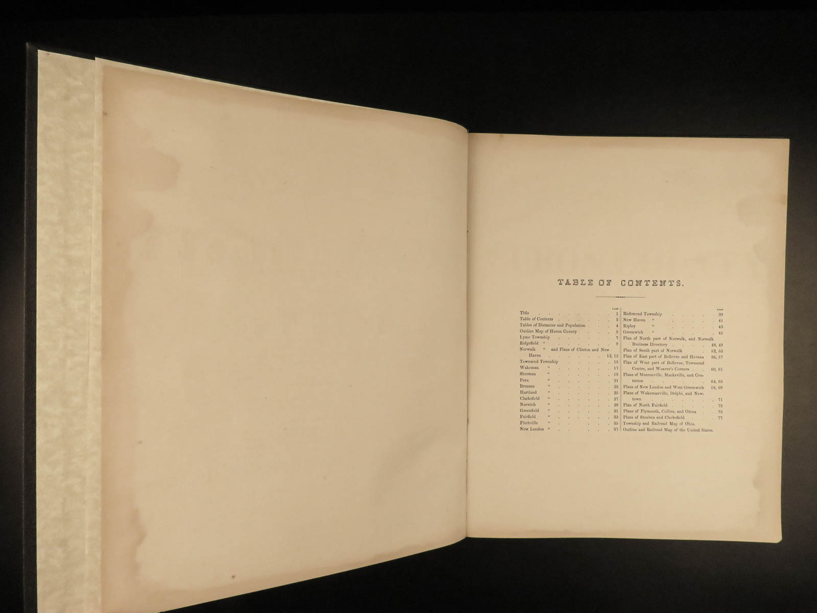
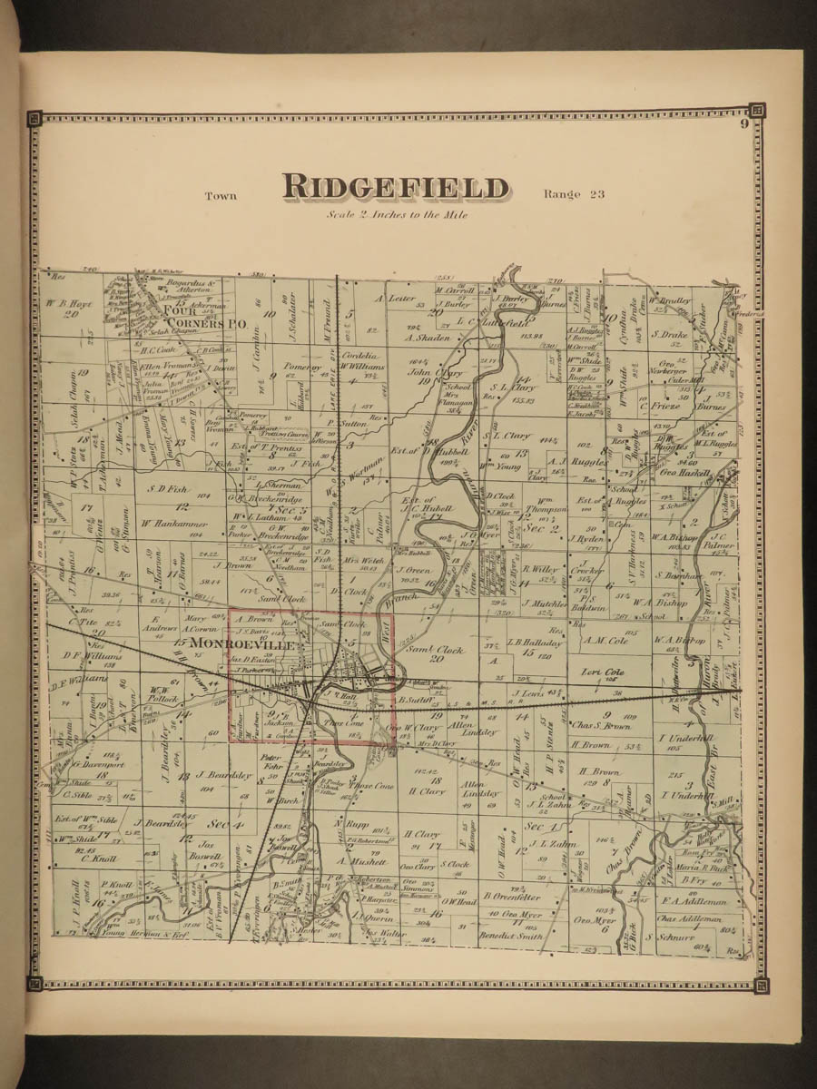
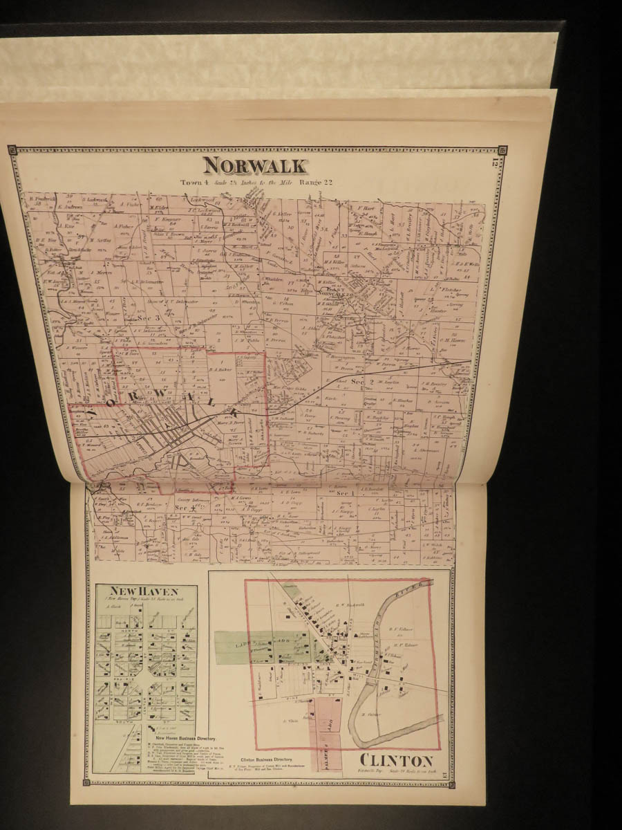
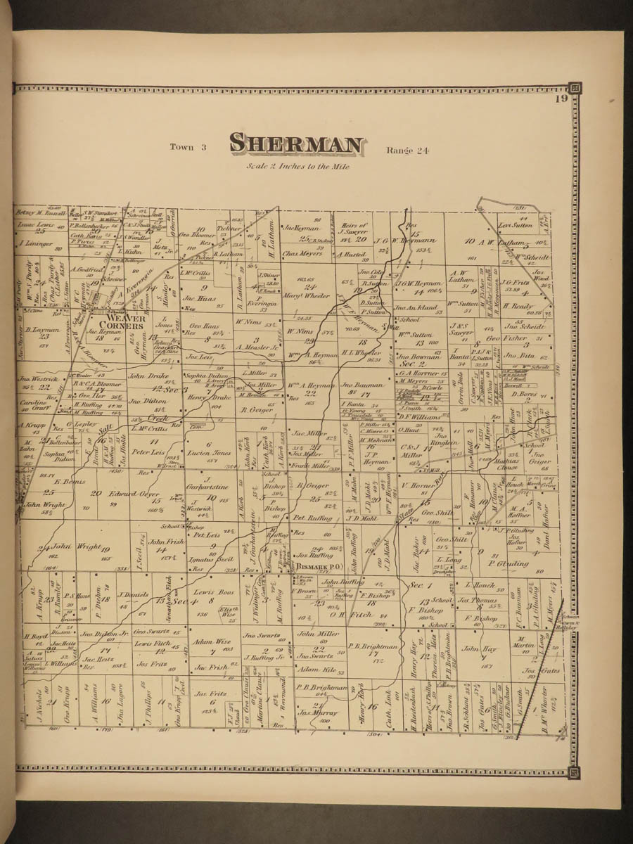
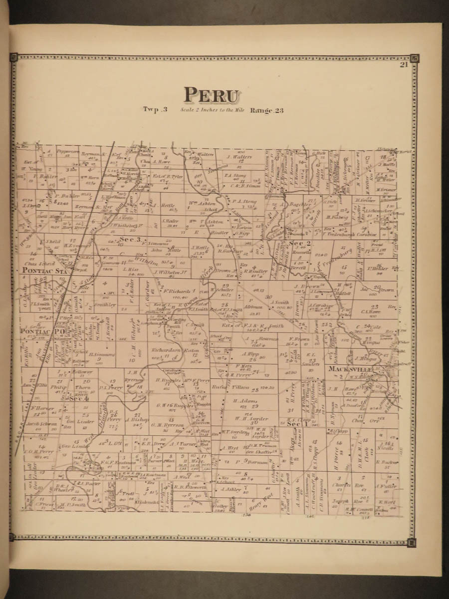
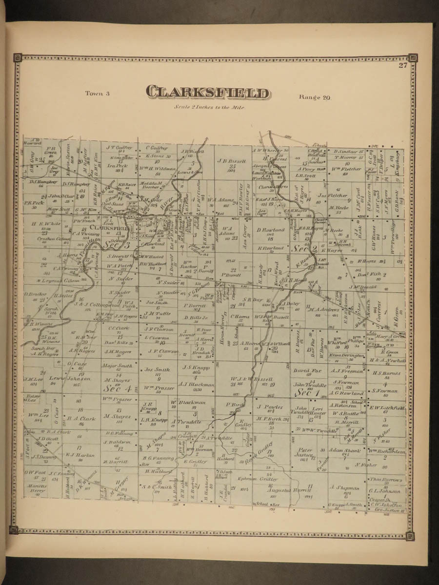
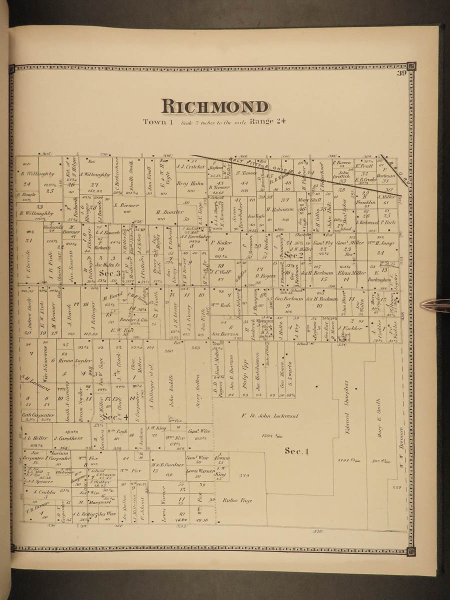
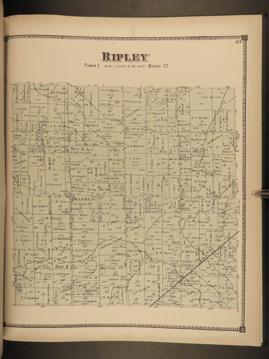
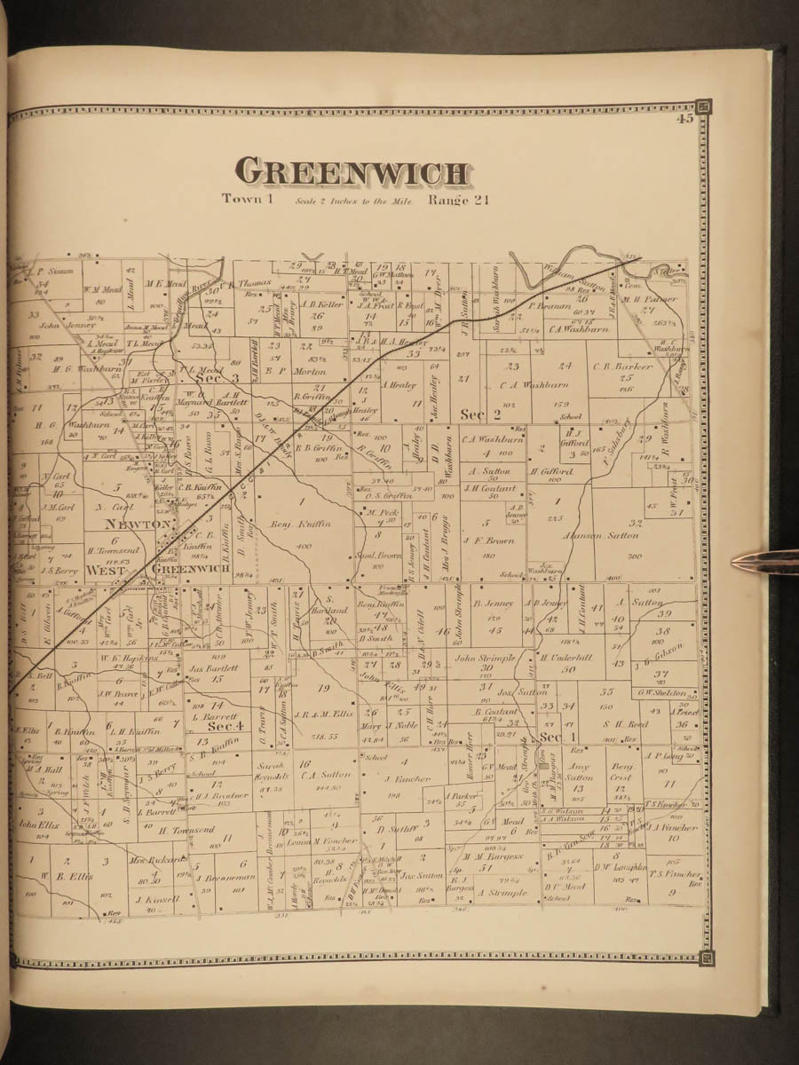
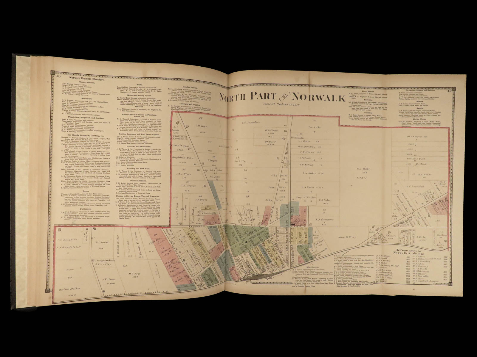
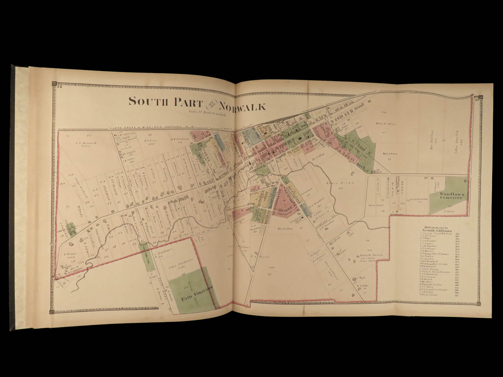
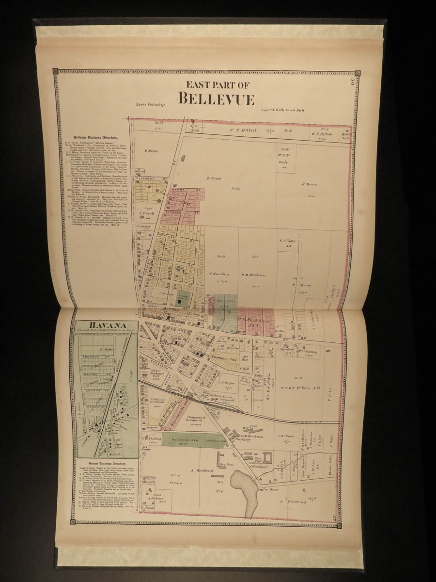
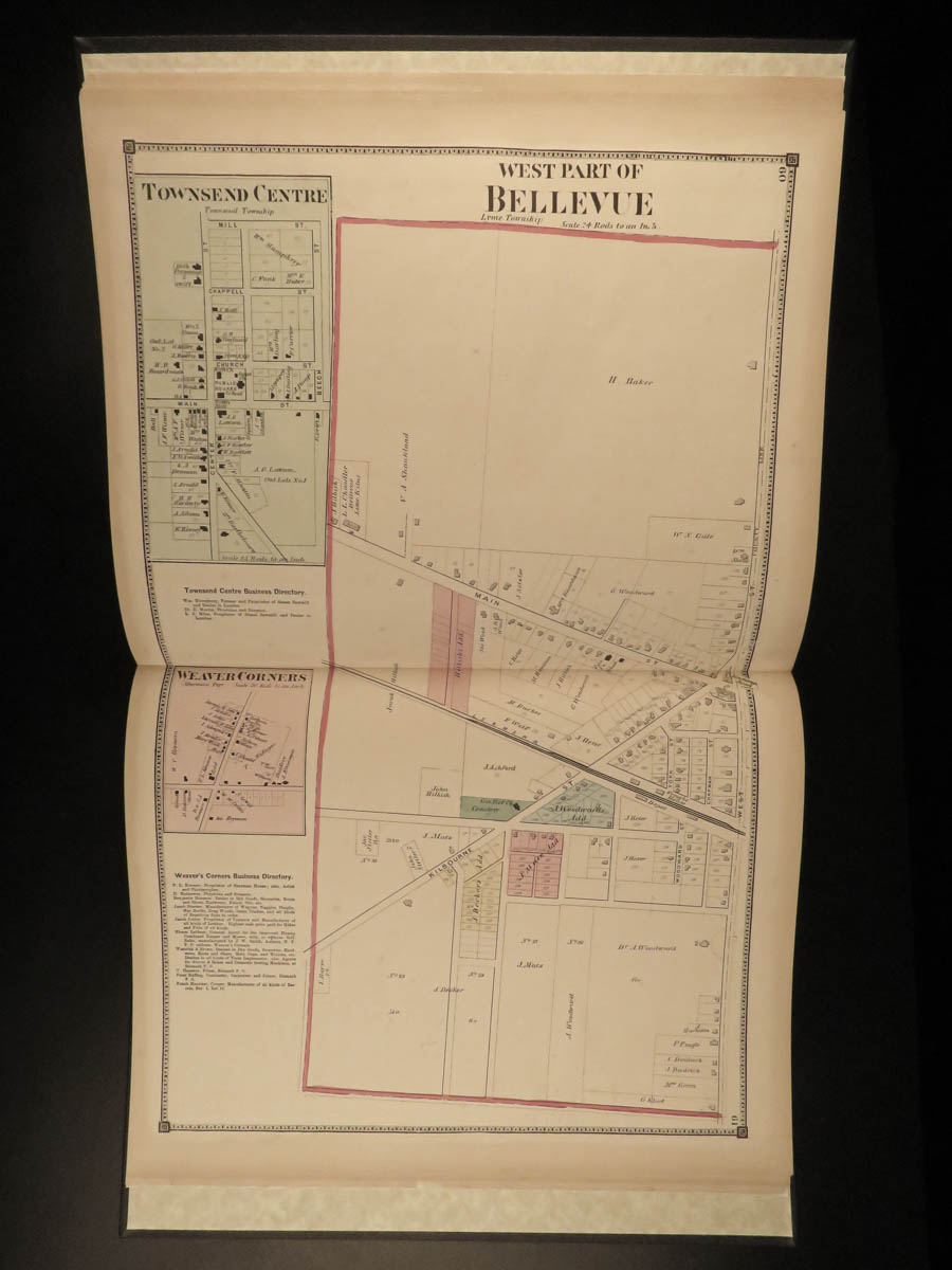
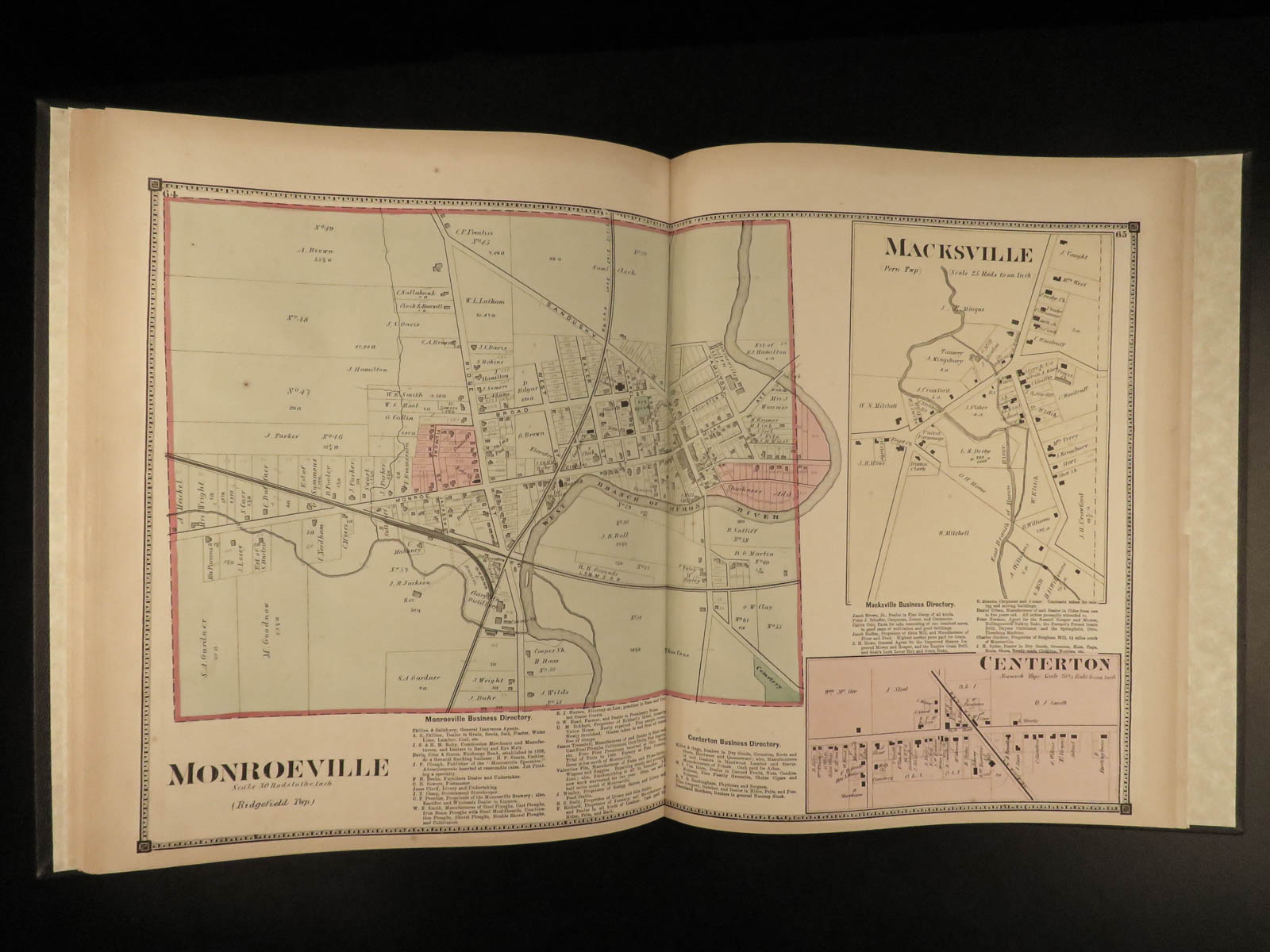
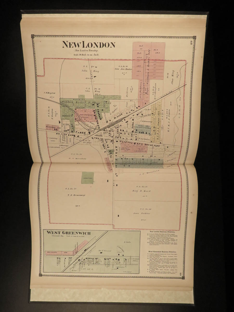
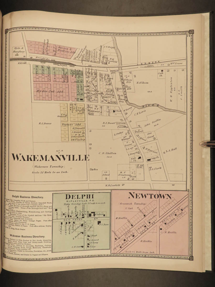
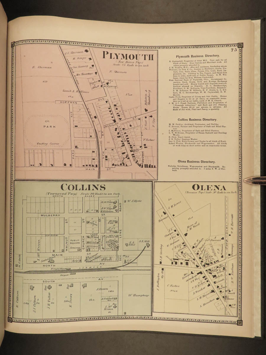
A rare, stunning 19th-century atlas of Huron County, Ohio. Published by D.J. Lake, this huge atlas contains numerous, huge double-page maps of cities throughout Huron County including Bellevue and Norwalk, as well as many other smaller townships such as Fitchville and New London. An impressive collection of huge, colored maps! Note the final map is a huge double-page map of the United States!

1873 ATLAS MAPS of Huron County OHIO Bellevue Norwalk HUGE MAPS Color USA
A rare, stunning 19th-century atlas of Huron County, Ohio. Published by D.J. Lake, this huge atlas contains numerous, huge double-page maps of cities throughout Huron County including Bellevue and Norwalk, as well as many other smaller townships such as Fitchville and New London. An impressive collection of huge, colored maps! Note the final map is a huge double-page map of the United States!
Item number: #22139
Price: $599
LAKE, D.J.
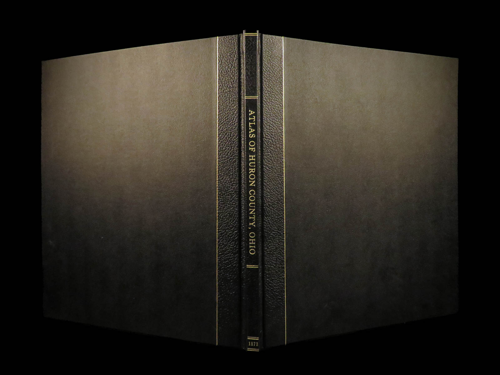
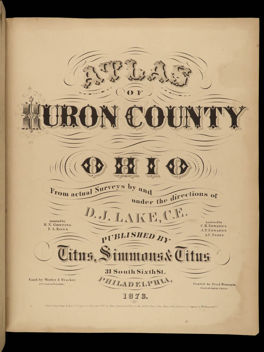
Atlas of Huron County, Ohio : from actual surveys
Philadelphia: Titus, Simmons & Titus, 1873.
Details:
- Collation:
- 77, [7]
- Wanting p. 5-6 (Outline Map of Huron County)
- 77 (Township and Railroad map of Ohio) provided in facsimile
- Language: English
- Binding: Leather; tight and secure
- Size: ~15.25in X 13in (38.5cm x 32.5cm)
Our Guarantee:
Very Fast. Very Safe. Free Shipping Worldwide.
Customer satisfaction is our priority! Notify us with 7 days of receiving, and we will offer a full refund without reservation!
22139
Category
Voyages & Exploration & Maps
Authors
LAKE, D.J.
Printing Date
19th Century
Language
English
Binding
Leather
Book Condition
Excellent
Other Books you might like...
-
Sale!
 Add to cart
1794 History of INDIA Asia MAPS Egypt Hindustan Robertson Scottish Enlightenment
Original price was: $550.00.$450.00Current price is: $450.00. -
Sale!
 Add to cart
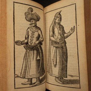
1633 1st ed PERSIA Middle East Costumes IRAN ELZEVIR Dutch West India Company
Original price was: $950.00.$750.00Current price is: $750.00. -
Sale!
 Add to cart
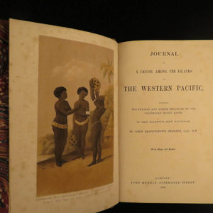
1853 1st ed Erskine Journal of Cruise Pacific Islands Tonga Fiji Polynesia MAP
Original price was: $599.00.$499.00Current price is: $499.00. -
Sale!
 Add to cart
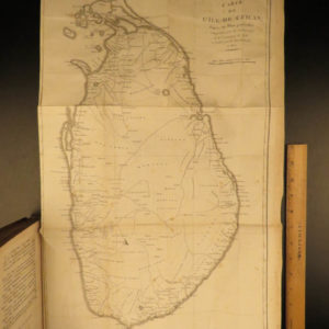
1803 1st ed Robert Percival Voyages CEYLON Dutch Torture MAPS 2v SET Sri Lanka
Original price was: $599.00.$499.00Current price is: $499.00.