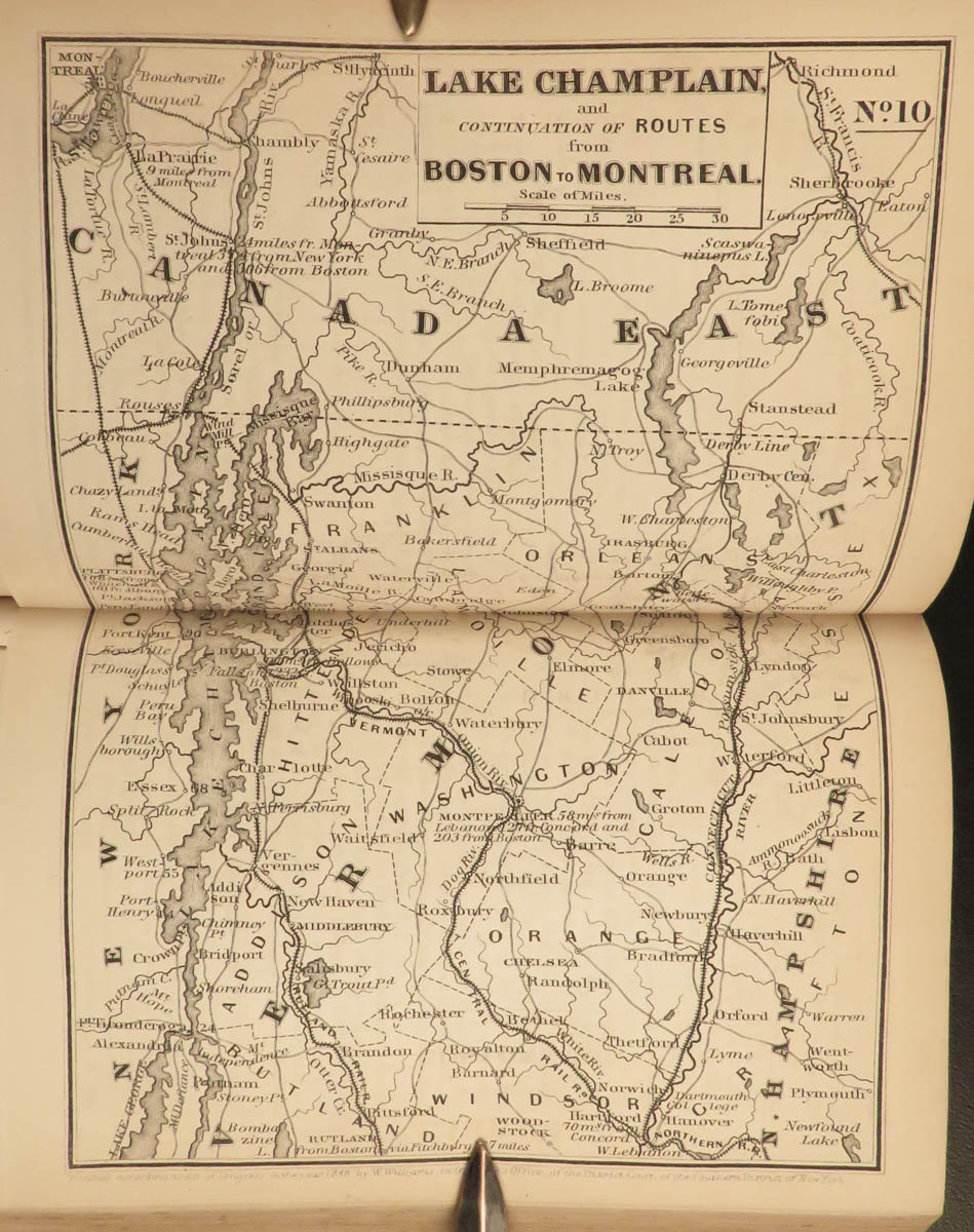
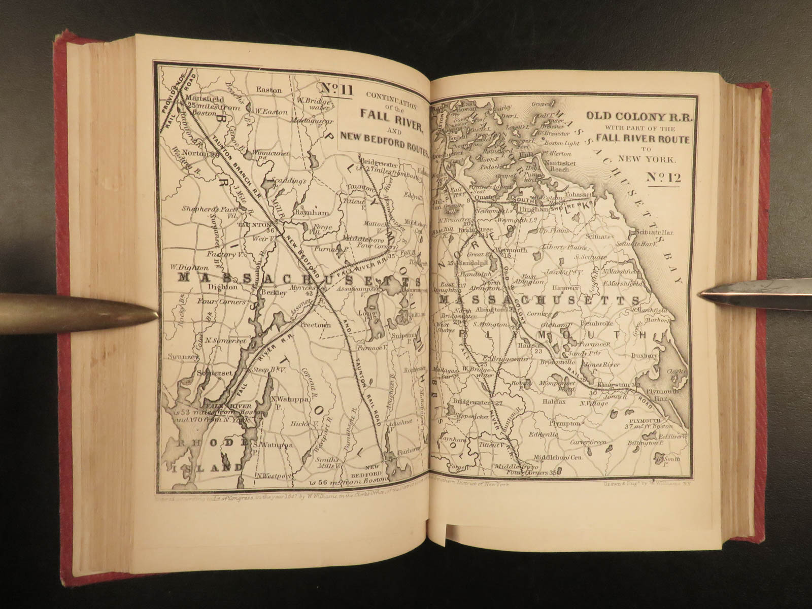
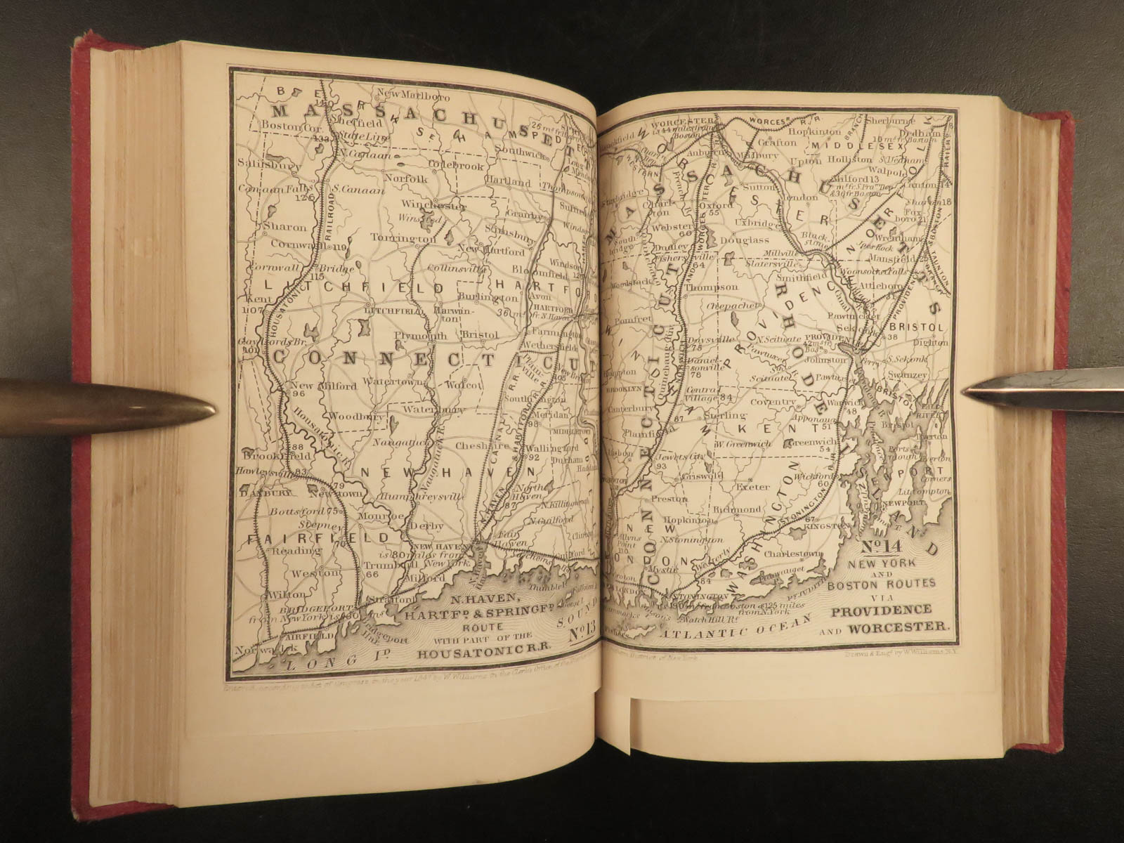
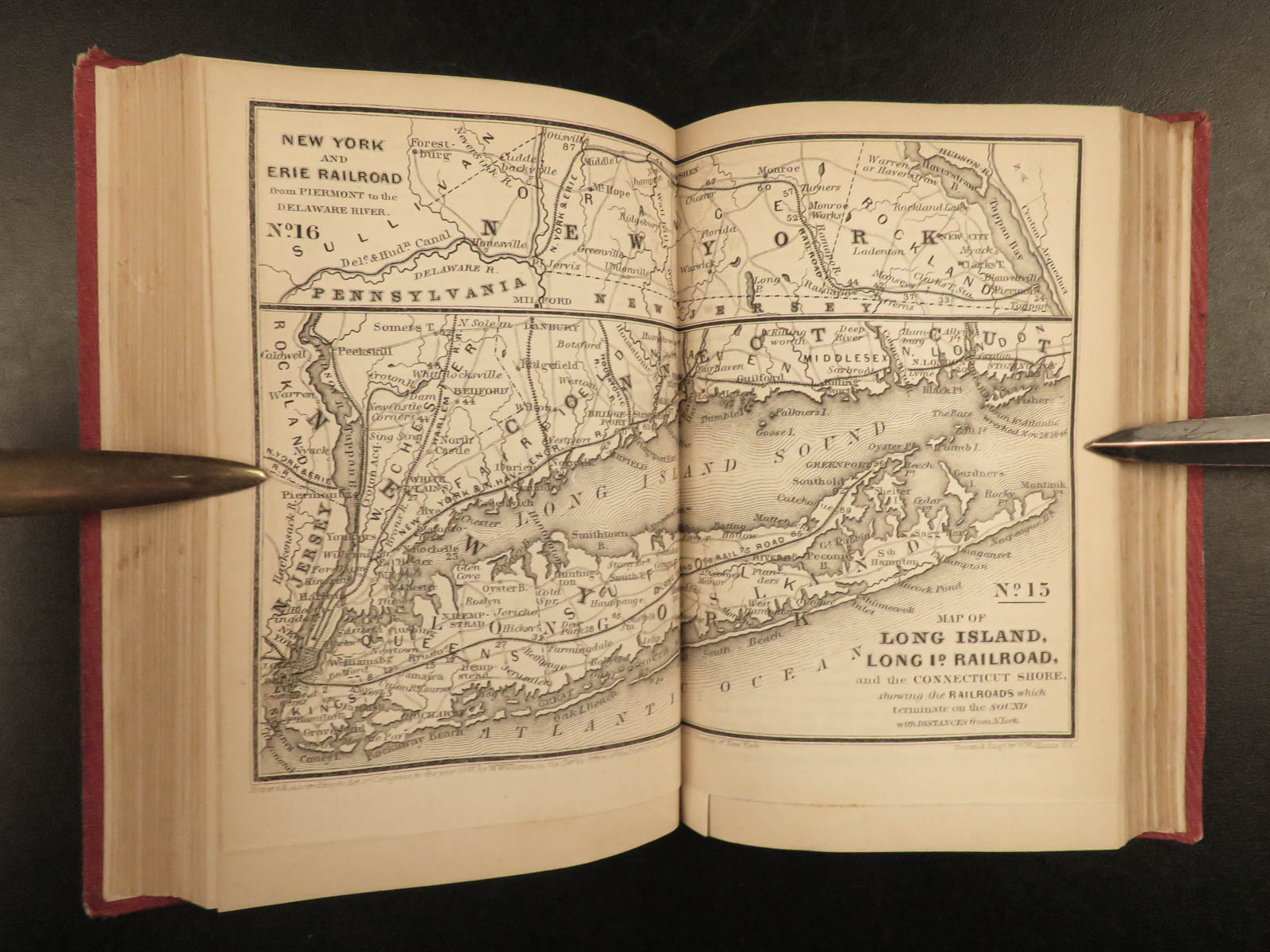
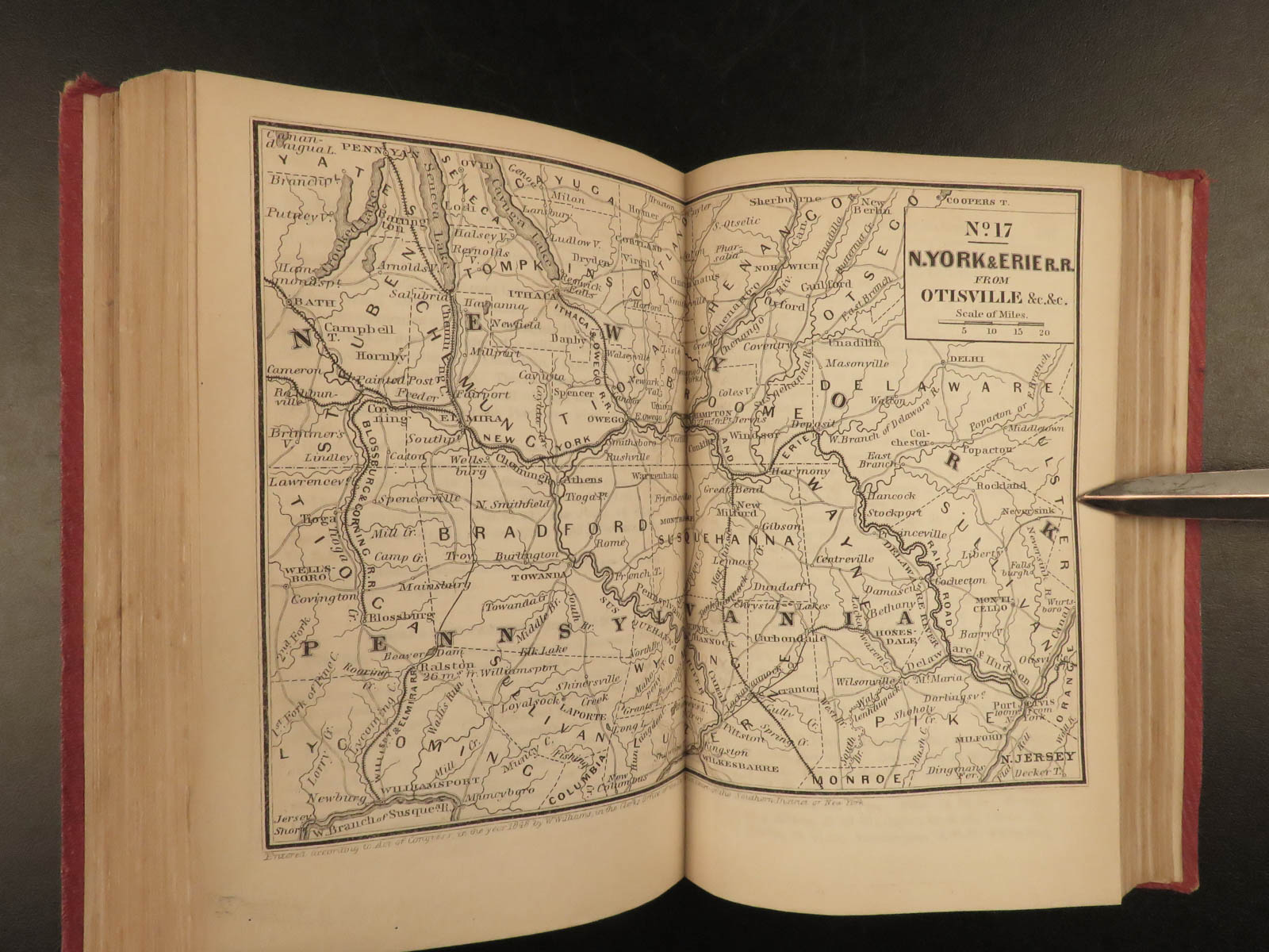
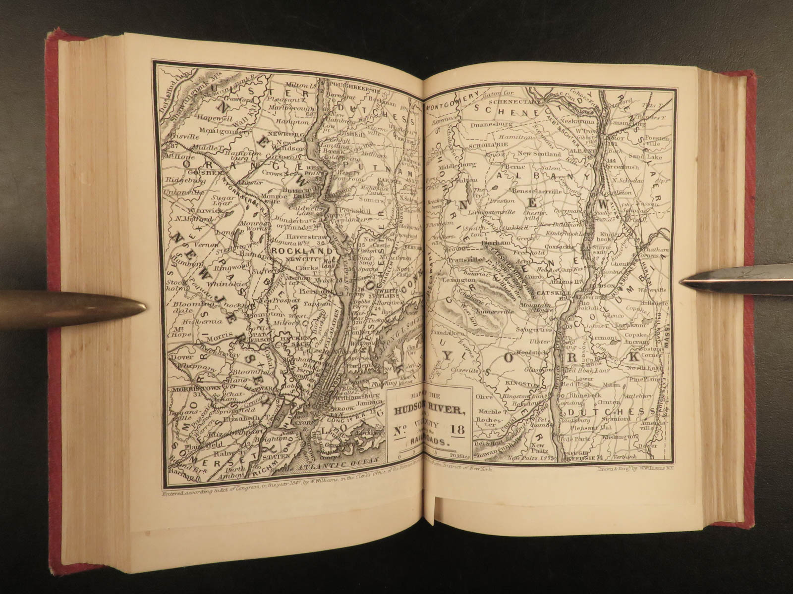
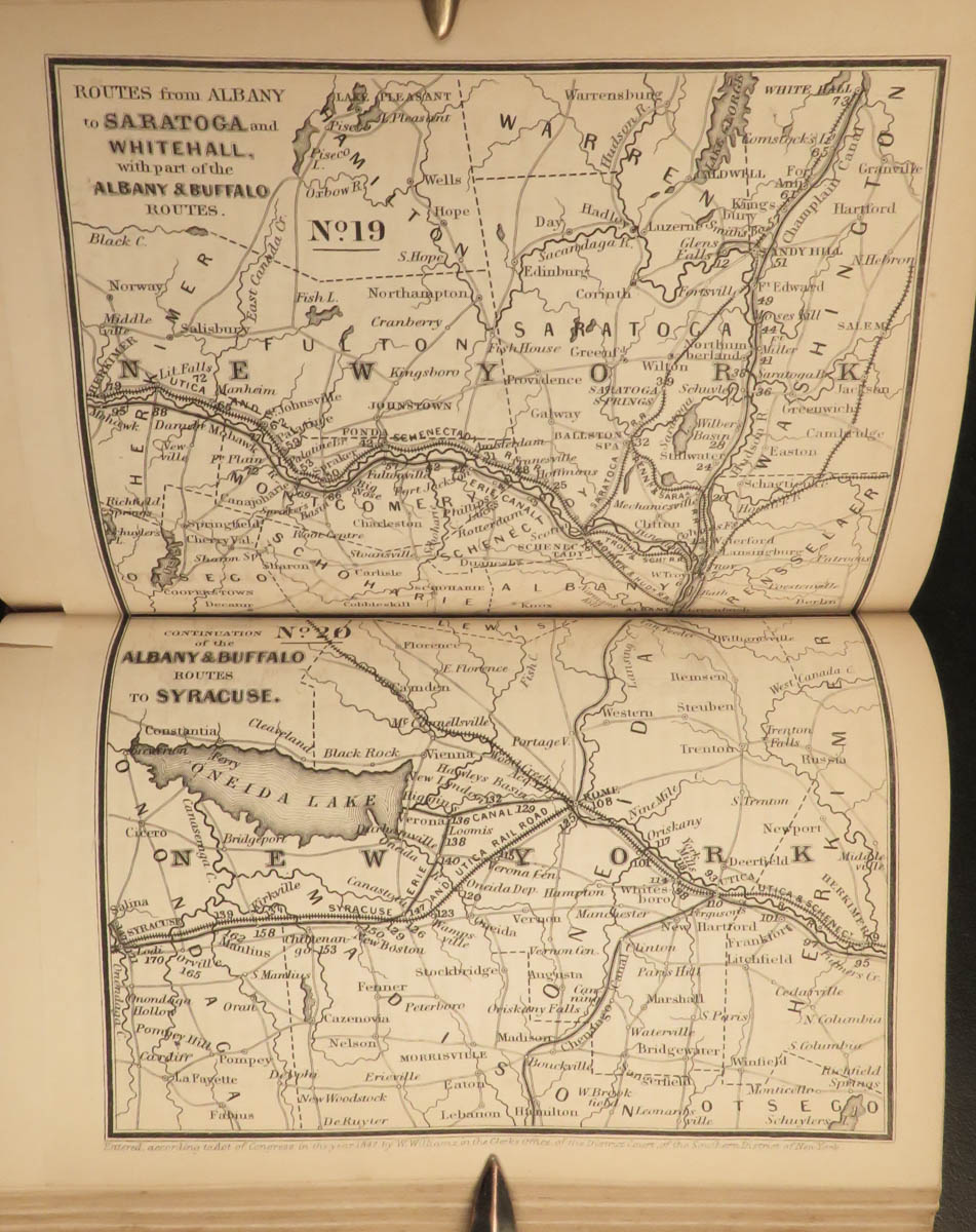
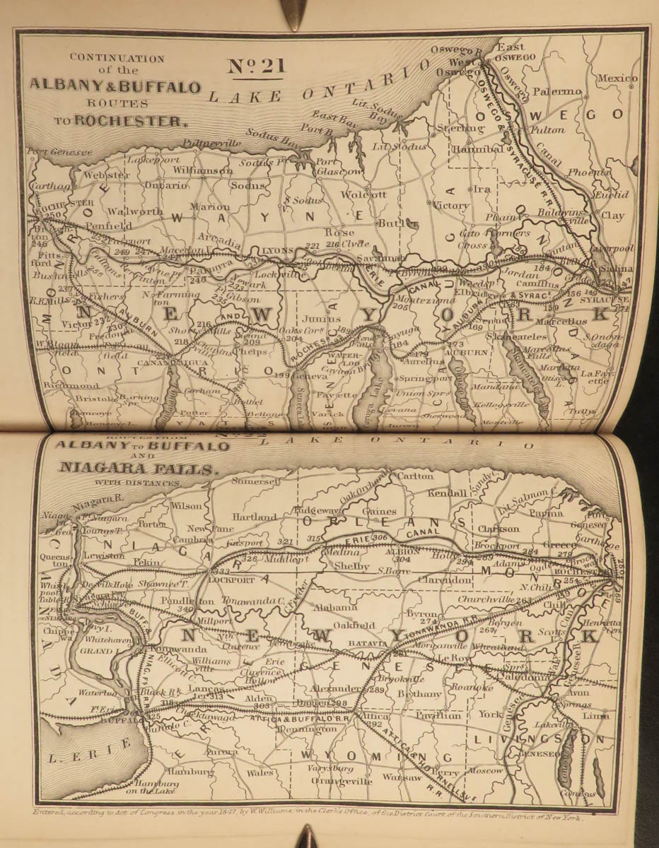
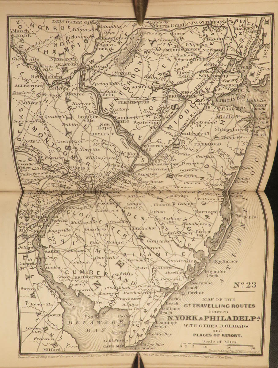
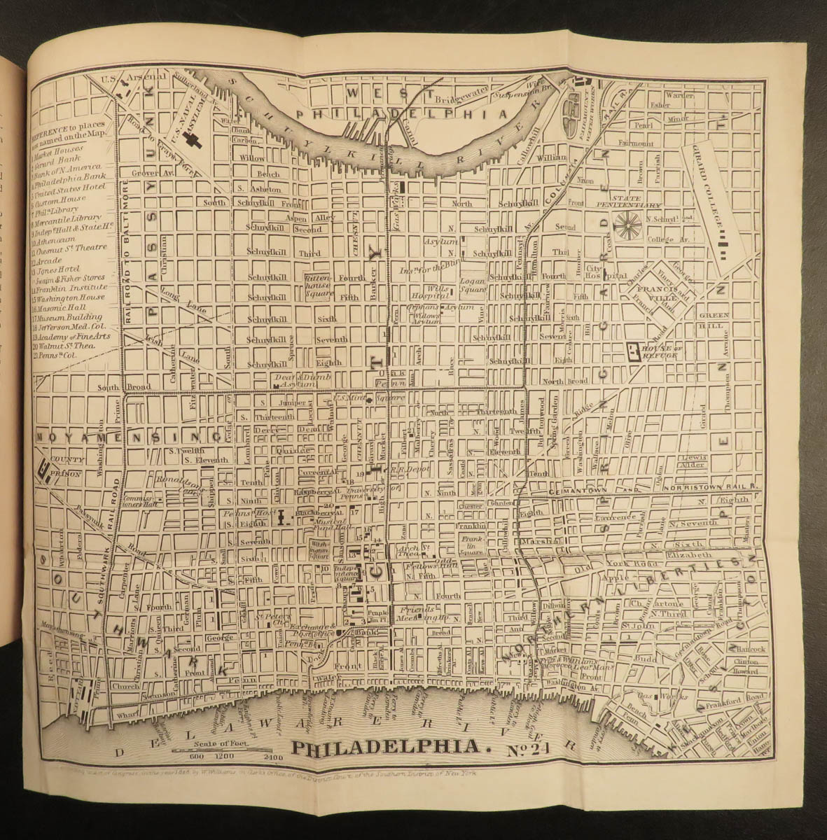
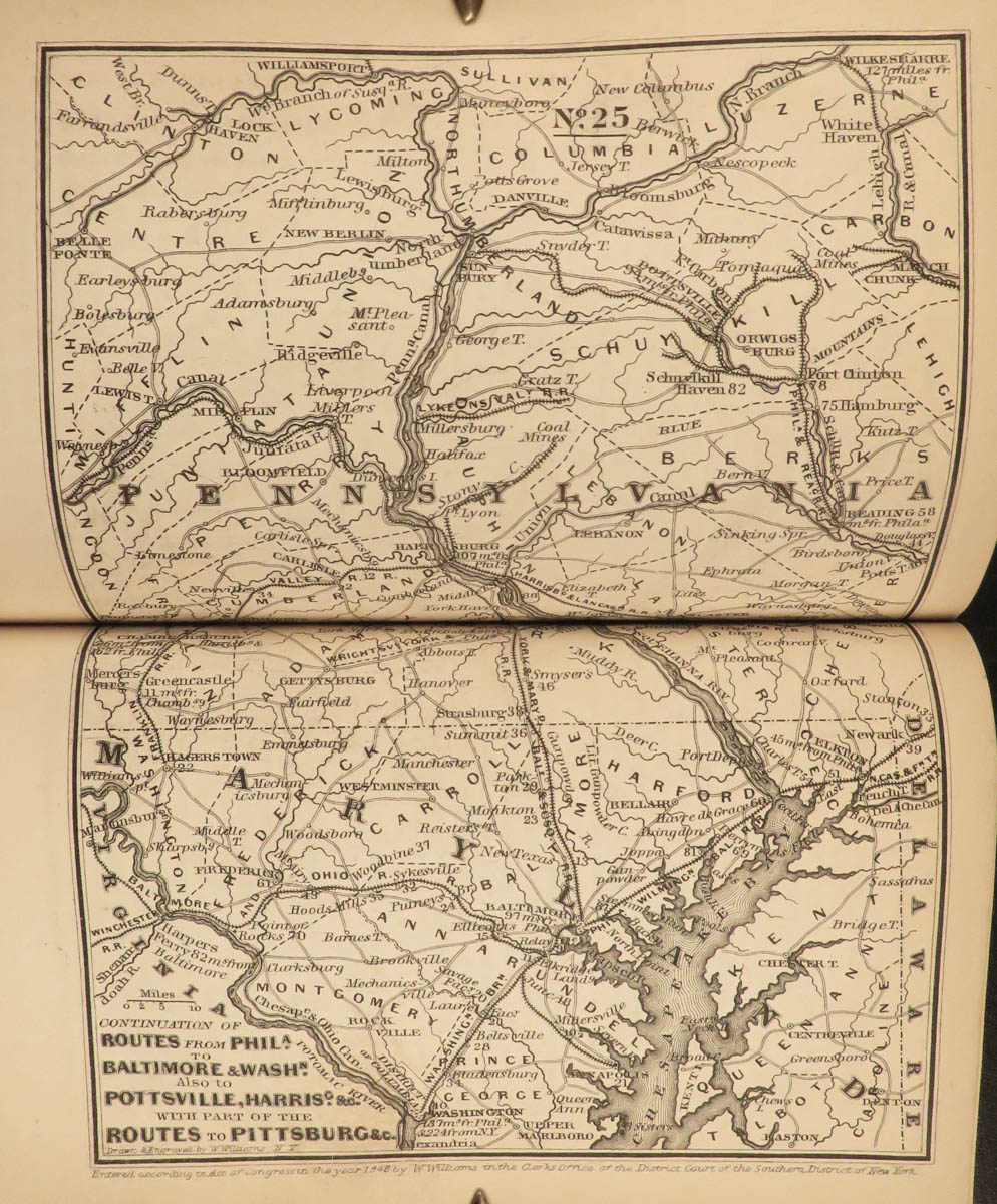
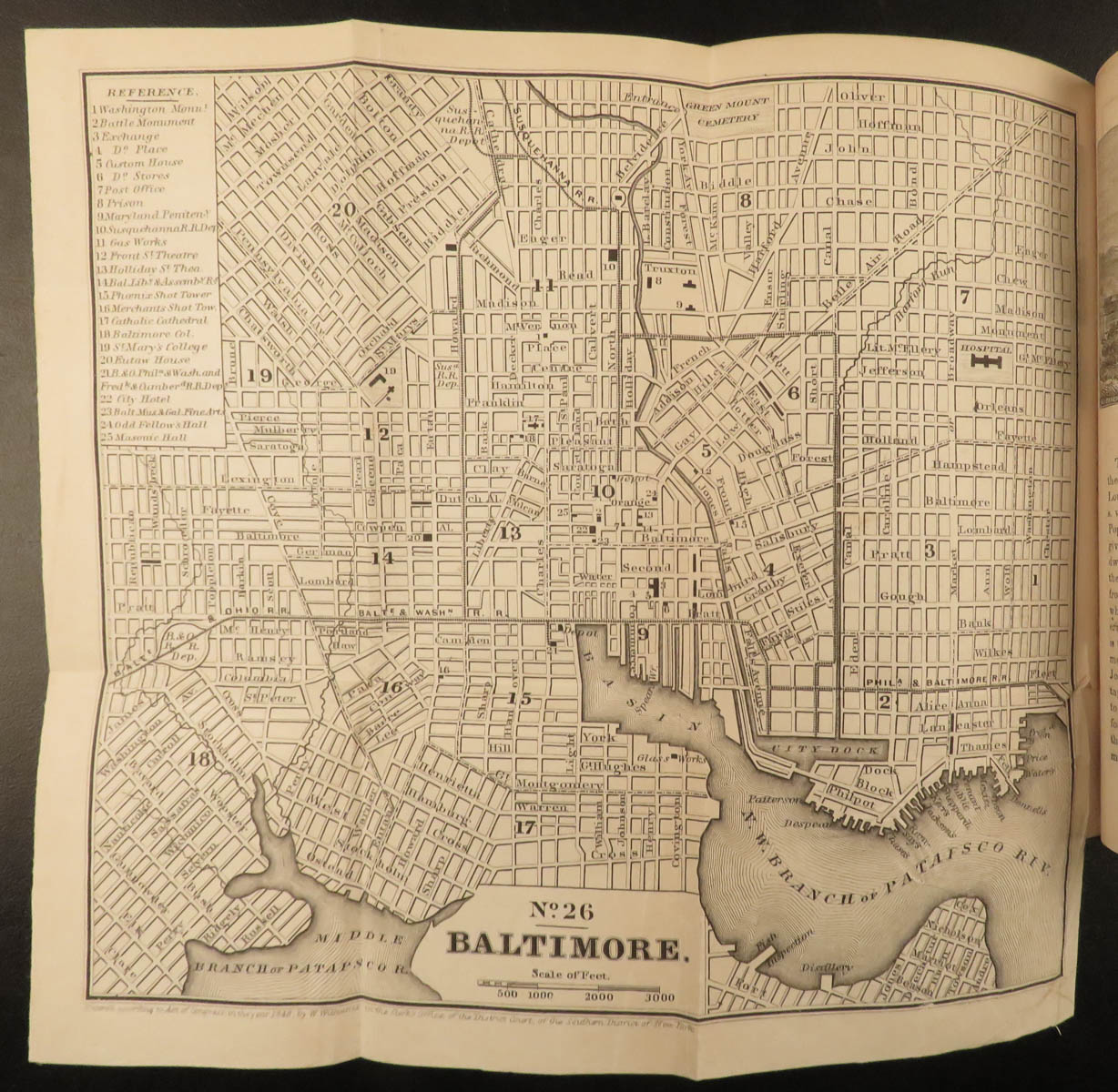
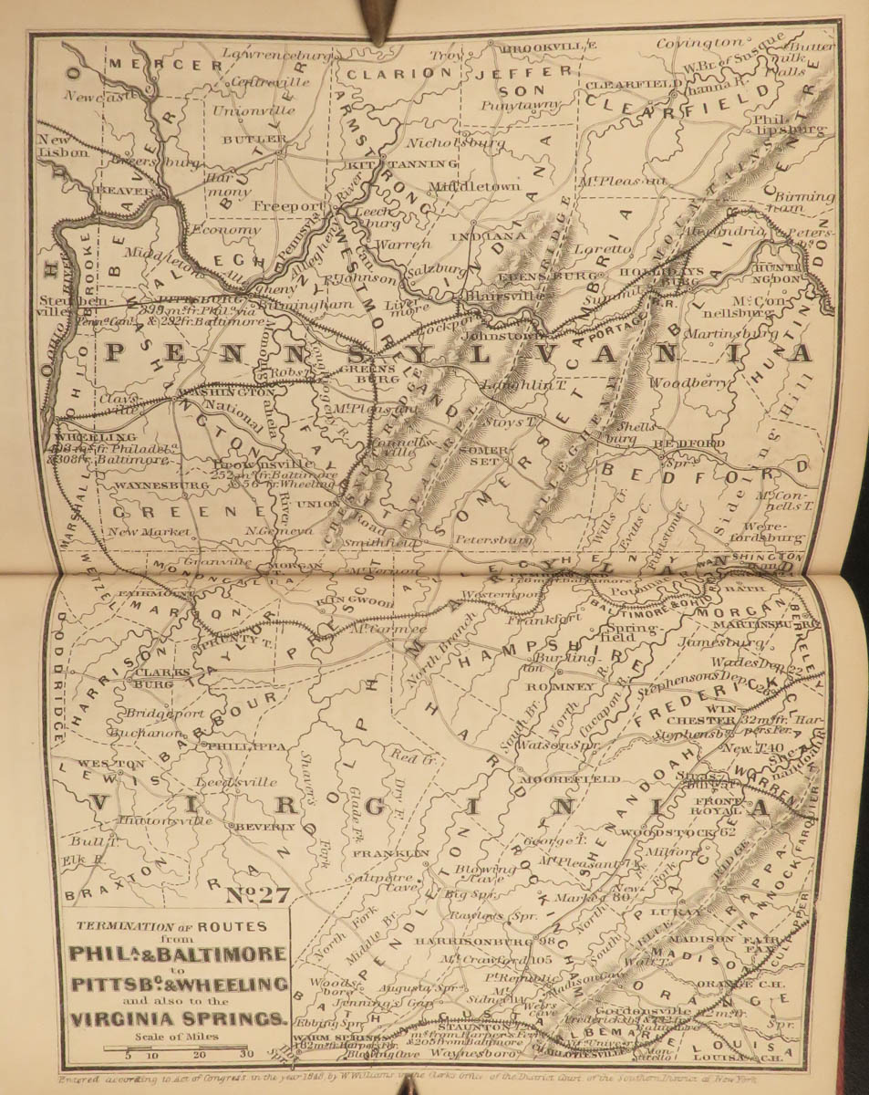
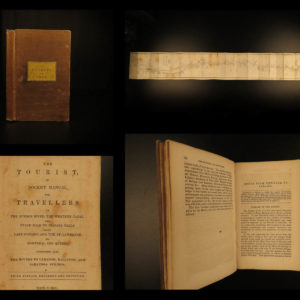
1853 Illustrated ATLAS Traveler’s Guide MAPS Niagara Railroads New York & USA

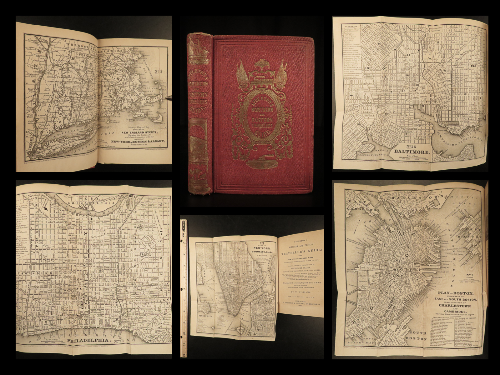
In the mid-19th-century, Appleton produced numerous travel guides for the United States, Canada, Mexico, and Europe. This guide is an interesting 1850s travel guide to the ‘middle states’ of Canada, Nova Scotia, and New Brunswick, as well as other northern and eastern sections of America. The Railroad and Steamboat companion concentrates on the Eastern United States and Canada but discusses also Southern and Mid-Western states. Interesting topics includes:
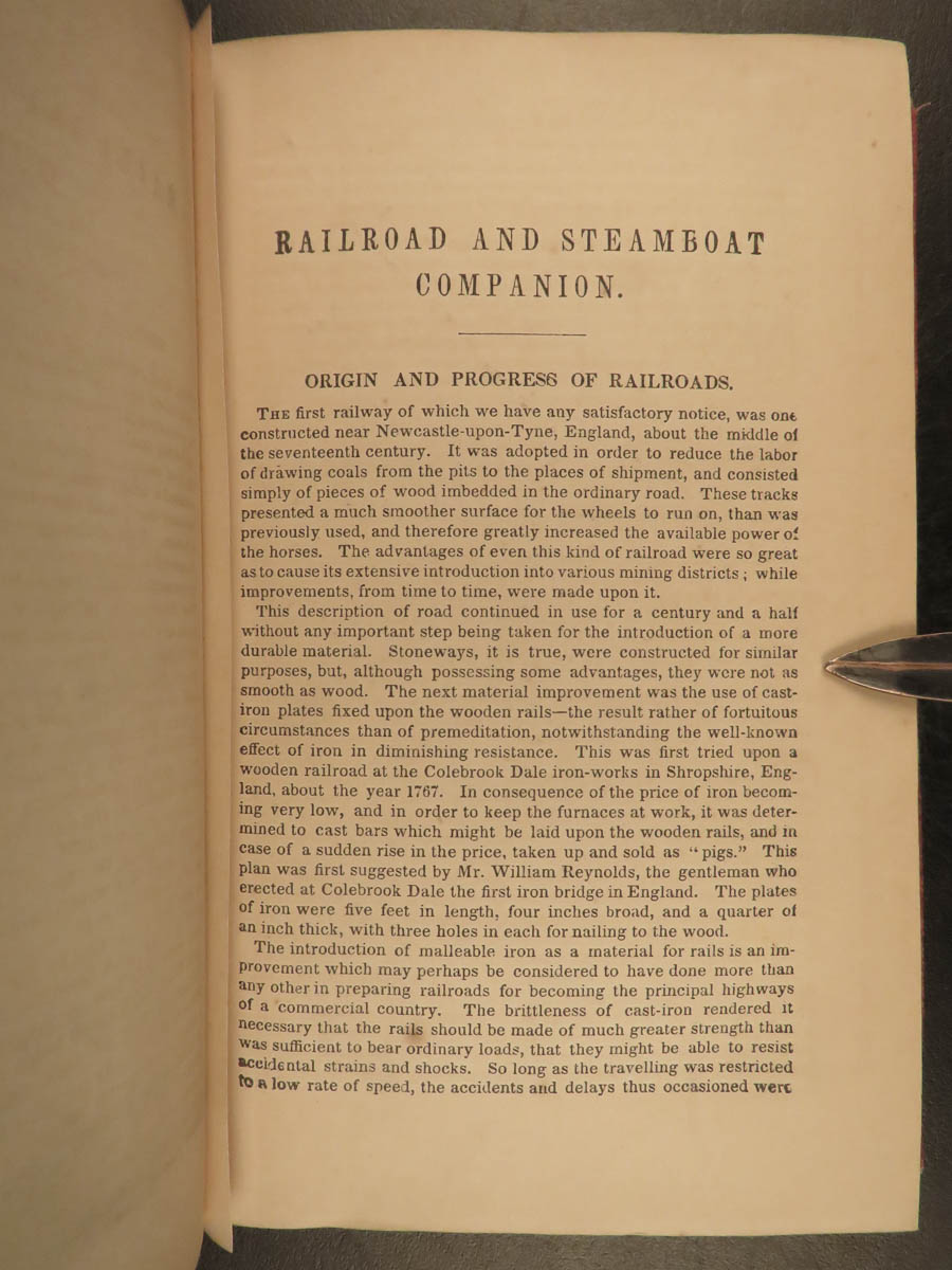
- Origins and Development of the Railroad and Steamboats
- Different Railroads
- Routes in different cities
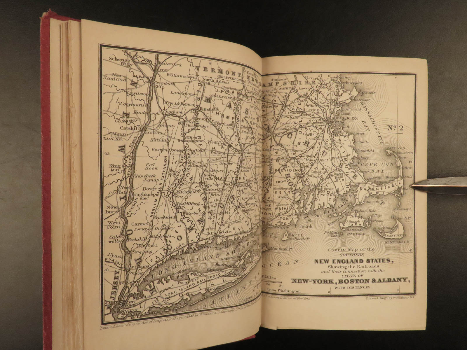
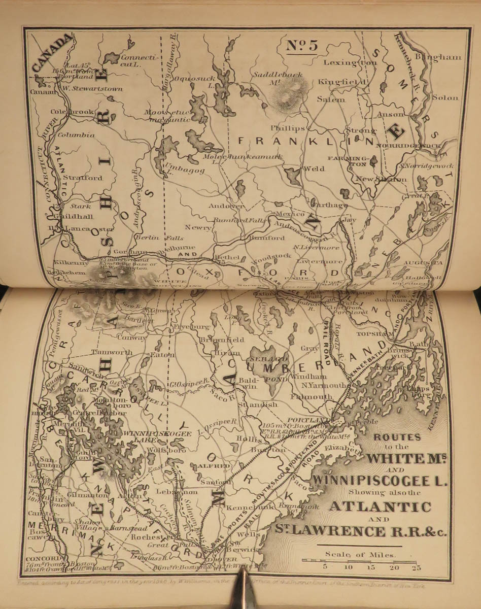
- The White Mountains
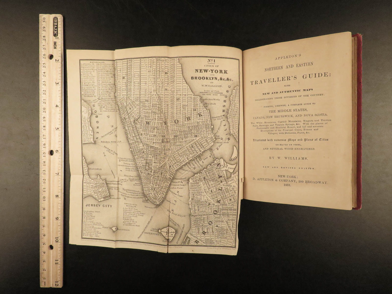
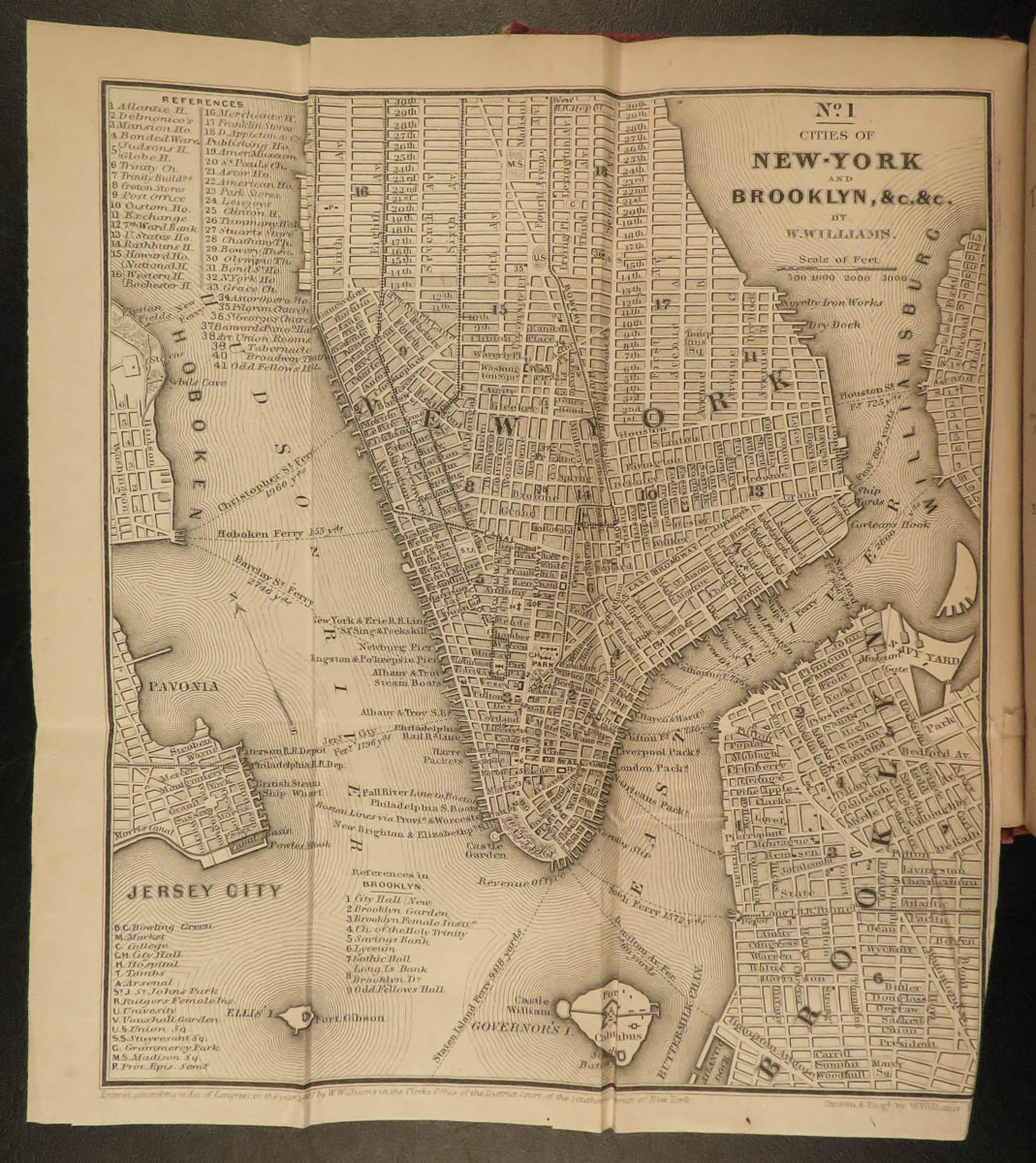
- New York
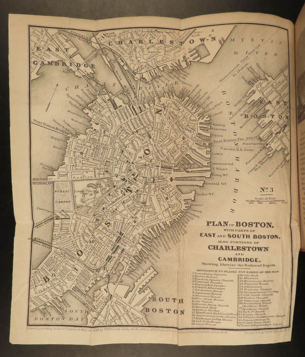
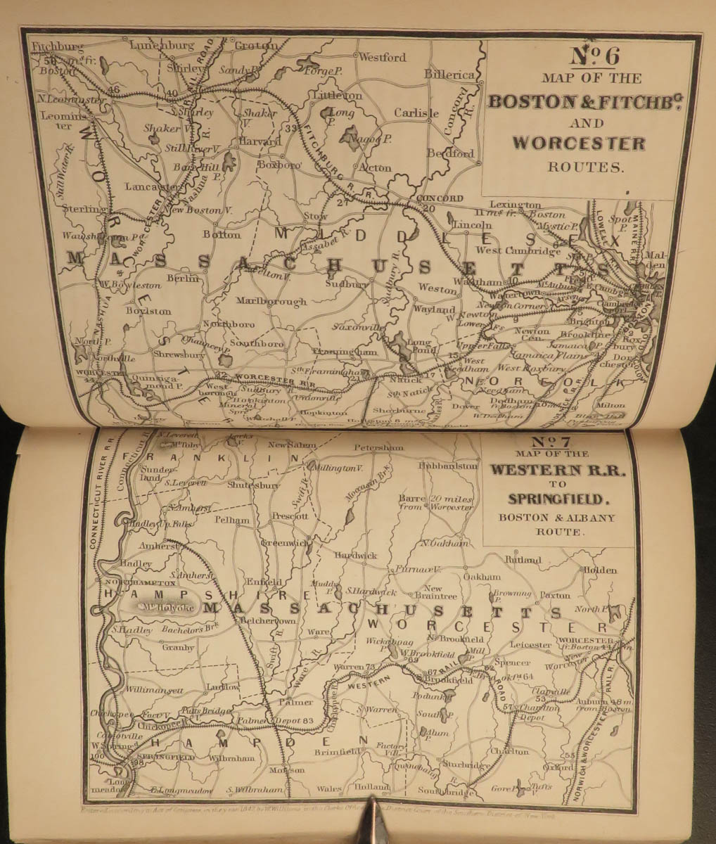
- Boston
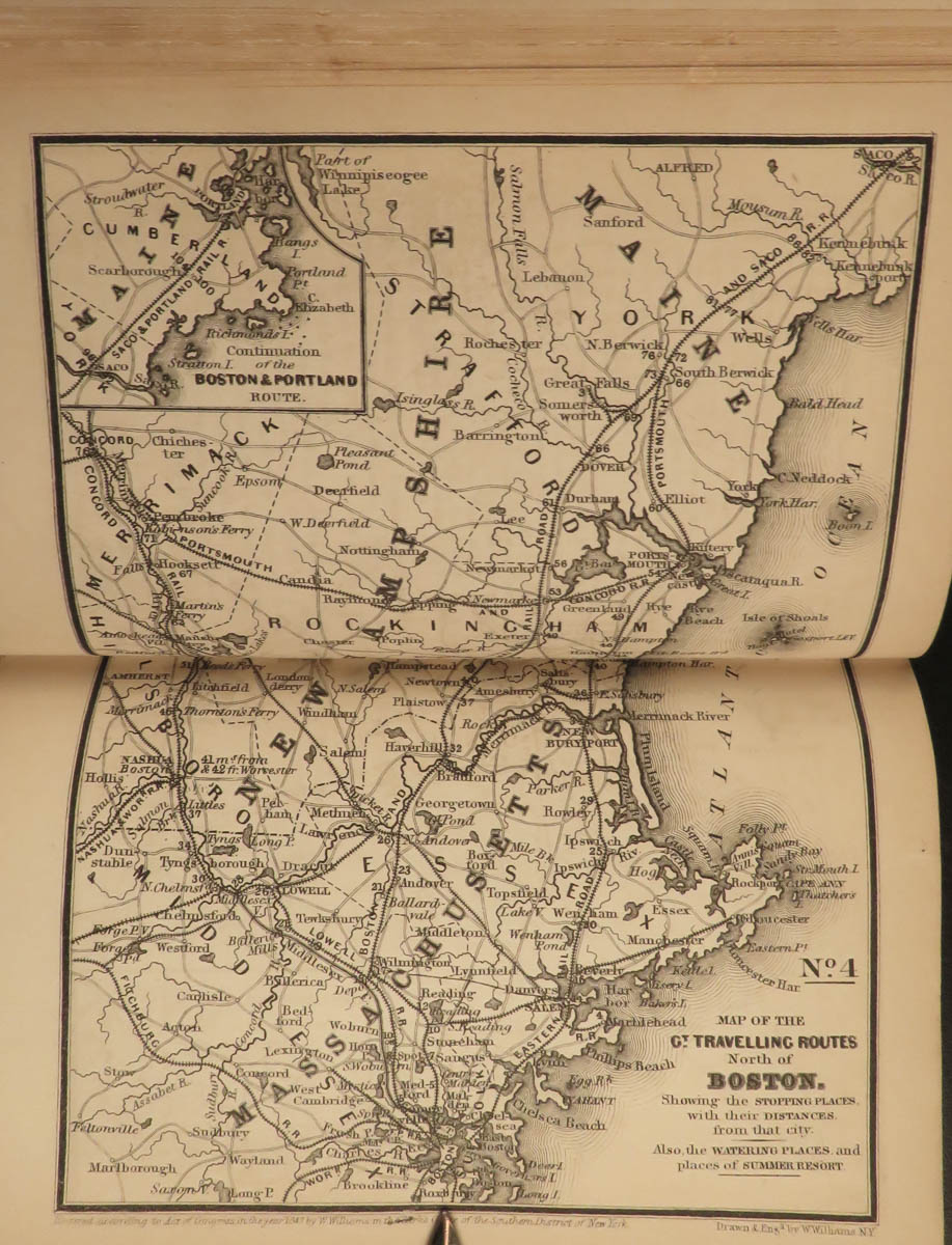
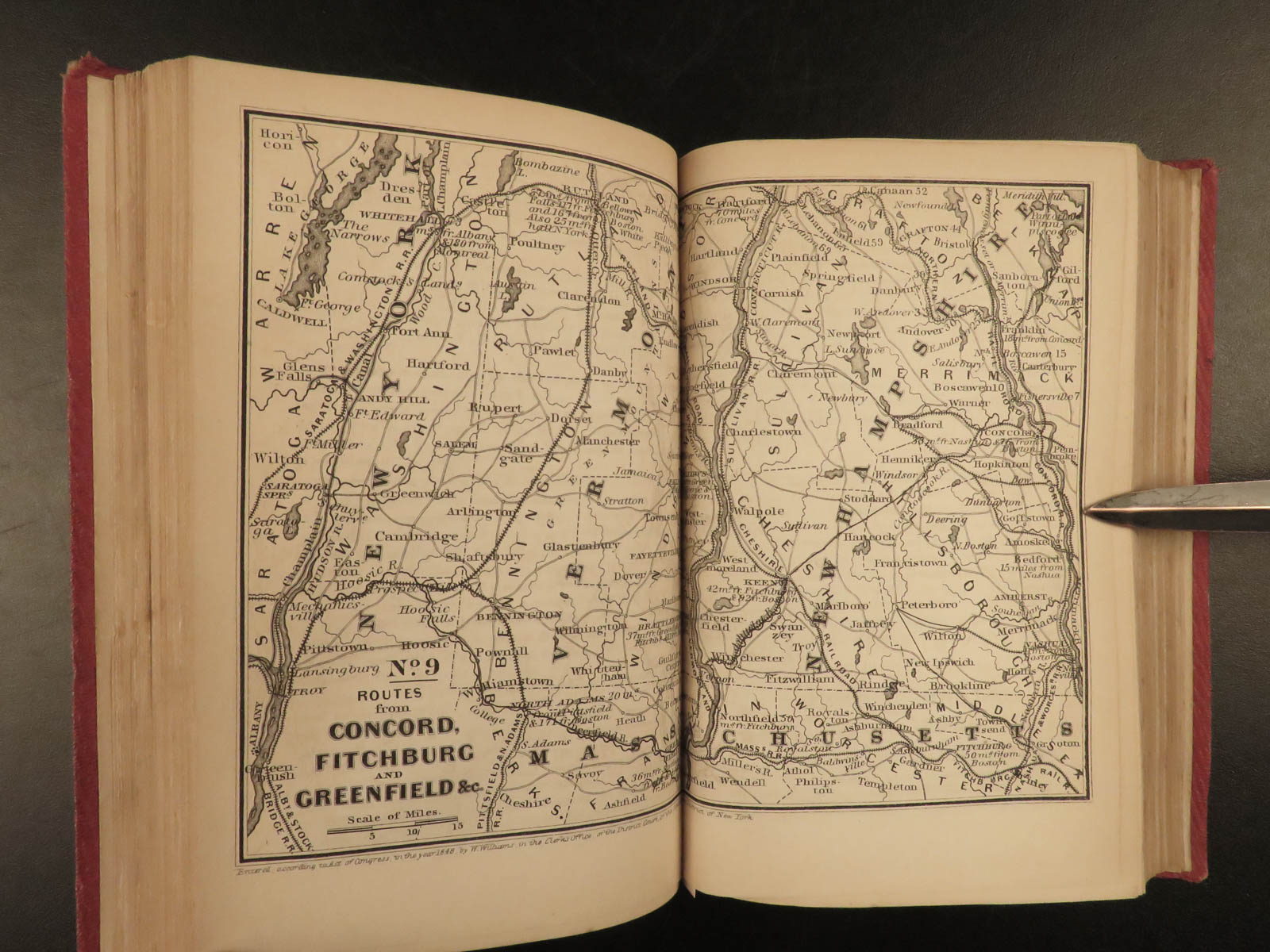
- New Hampshire
- New Brunswick
- Baltimore
- South Carolina
- Georgia
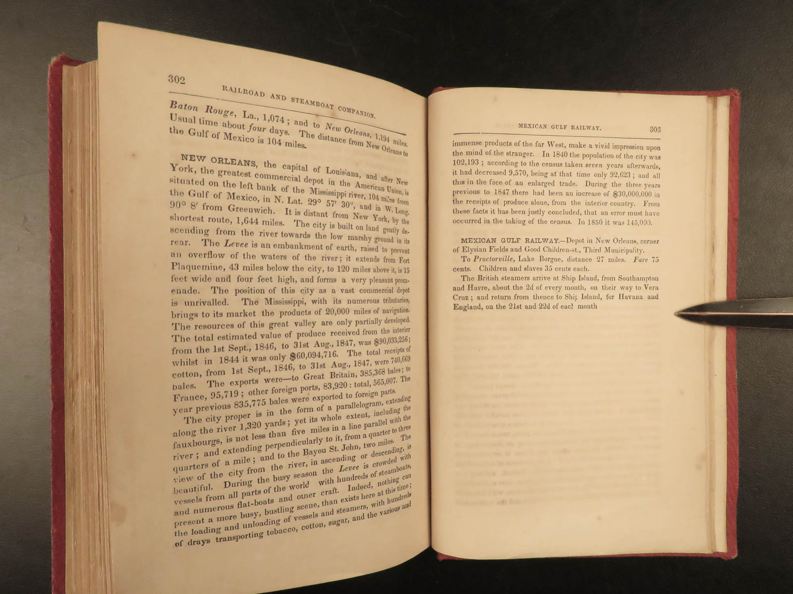
- New Orleans
- And many more!
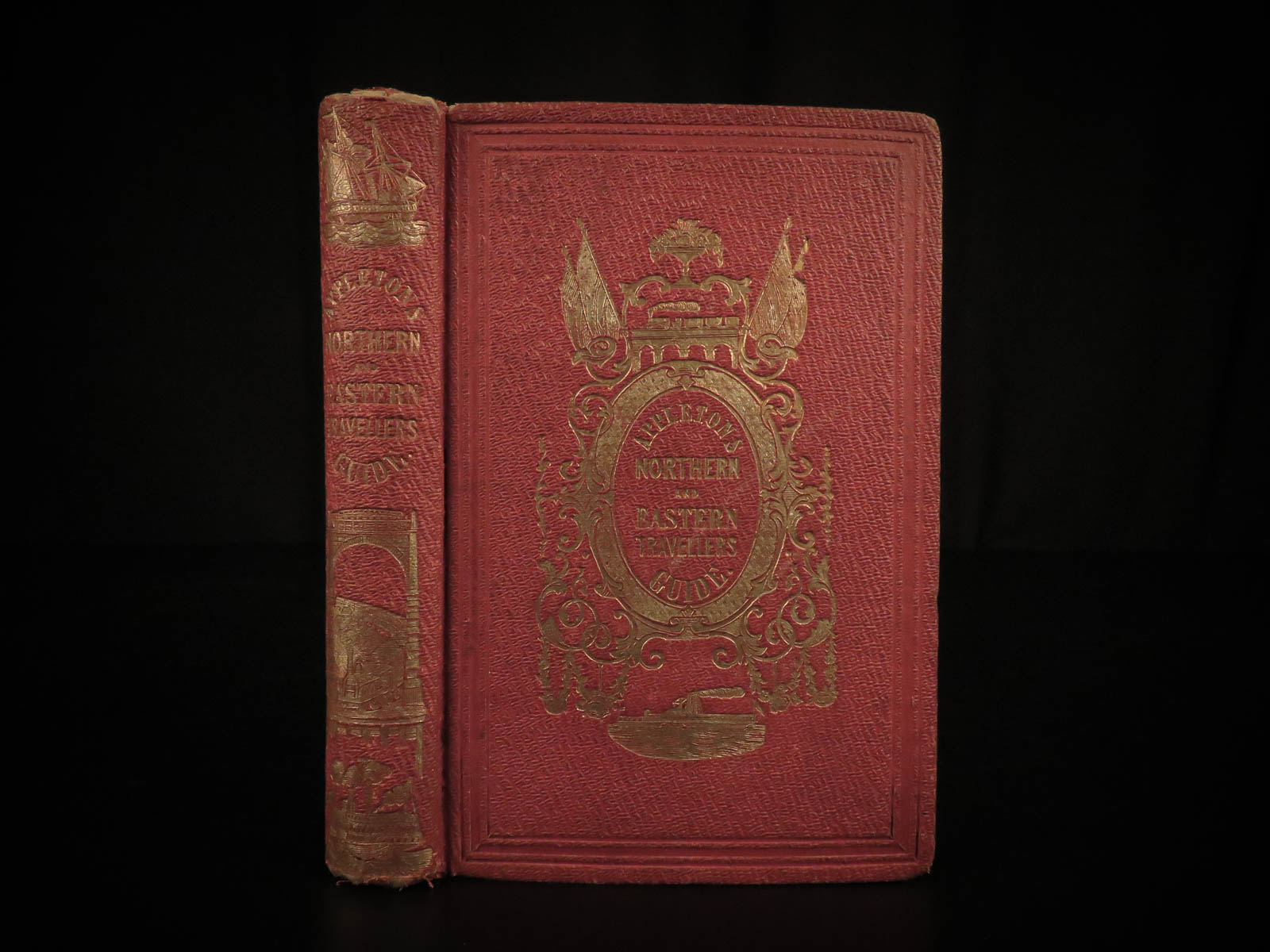
This 1853 edition by Wellington Williams is illustrated with maps and city views, as well as numerous in-text engraved vignettes, of which many plates are double page and fold out maps!

1853 Illustrated ATLAS Traveler’s Guide MAPS Niagara Railroads New York & USA
In the mid-19th-century, Appleton produced numerous travel guides for the United States, Canada, Mexico, and Europe. This guide is an interesting 1850s travel guide to the ‘middle states’ of Canada, Nova Scotia, and New Brunswick, as well as other northern and eastern sections of America. The Railroad and Steamboat companion concentrates on the Eastern United States and Canada but discusses also Southern and Mid-Western states. Interesting topics includes:
- Origins and Development of the Railroad and Steamboats
- Different Railroads
- Routes in different cities
- The White Mountains
- New York
- Boston
- New Hampshire
- New Brunswick
- Baltimore
- South Carolina
- Georgia
- New Orleans
- And many more!
This 1853 edition by Wellington Williams is illustrated with maps and city views, as well as numerous in-text engraved vignettes, of which many plates are double page and fold out maps!
Item number: #16604
Price: $750
WILLIAMS, Wellington
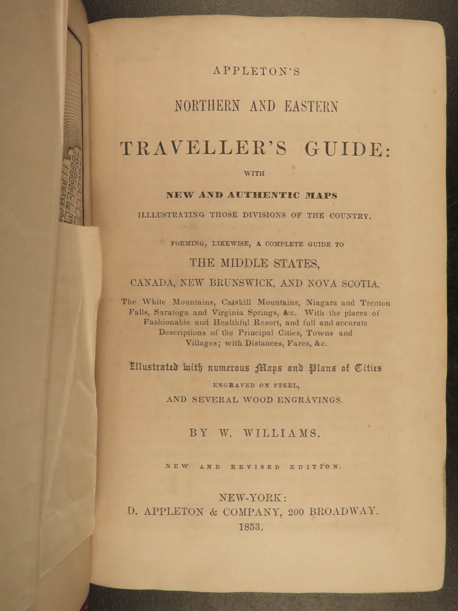
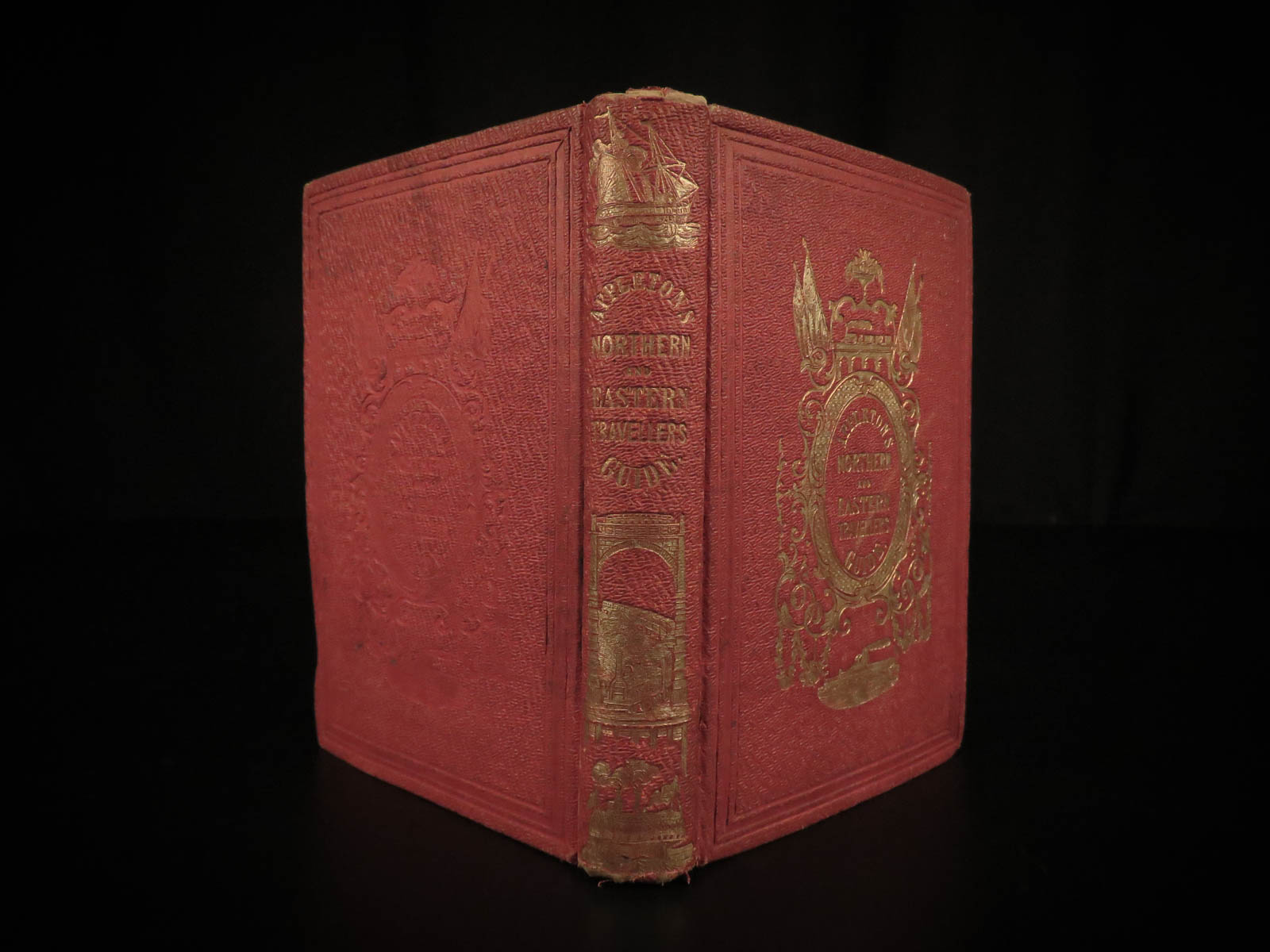
Appleton’s northern and eastern traveller’s guide: with new and authentic maps … forming, likewise a complete guide to the Middle states, Canada, New Brunswick and Nova Scotia.
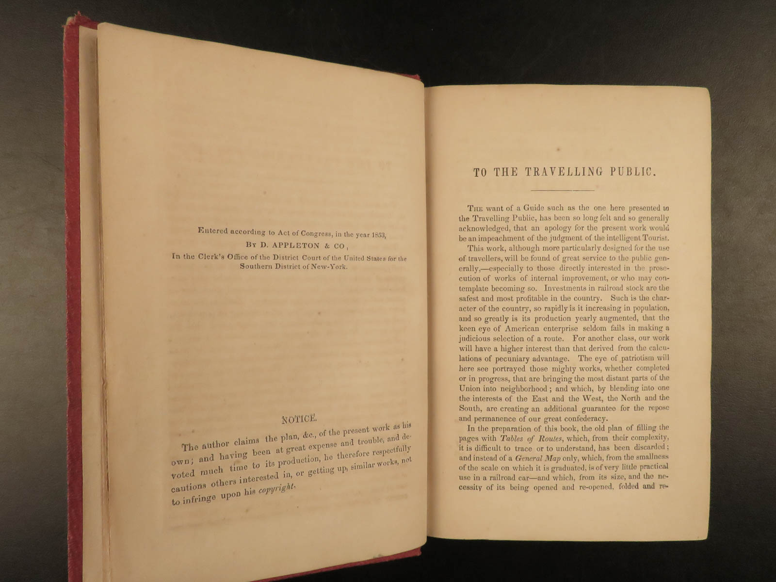
New York: D. Appleton; Philadelphia: Geo. S. Appleton, 1853.
Details:
- Collation: Complete with all pages
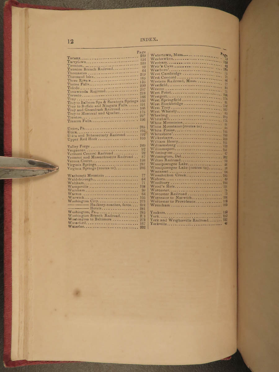
- [3], 303, [9]
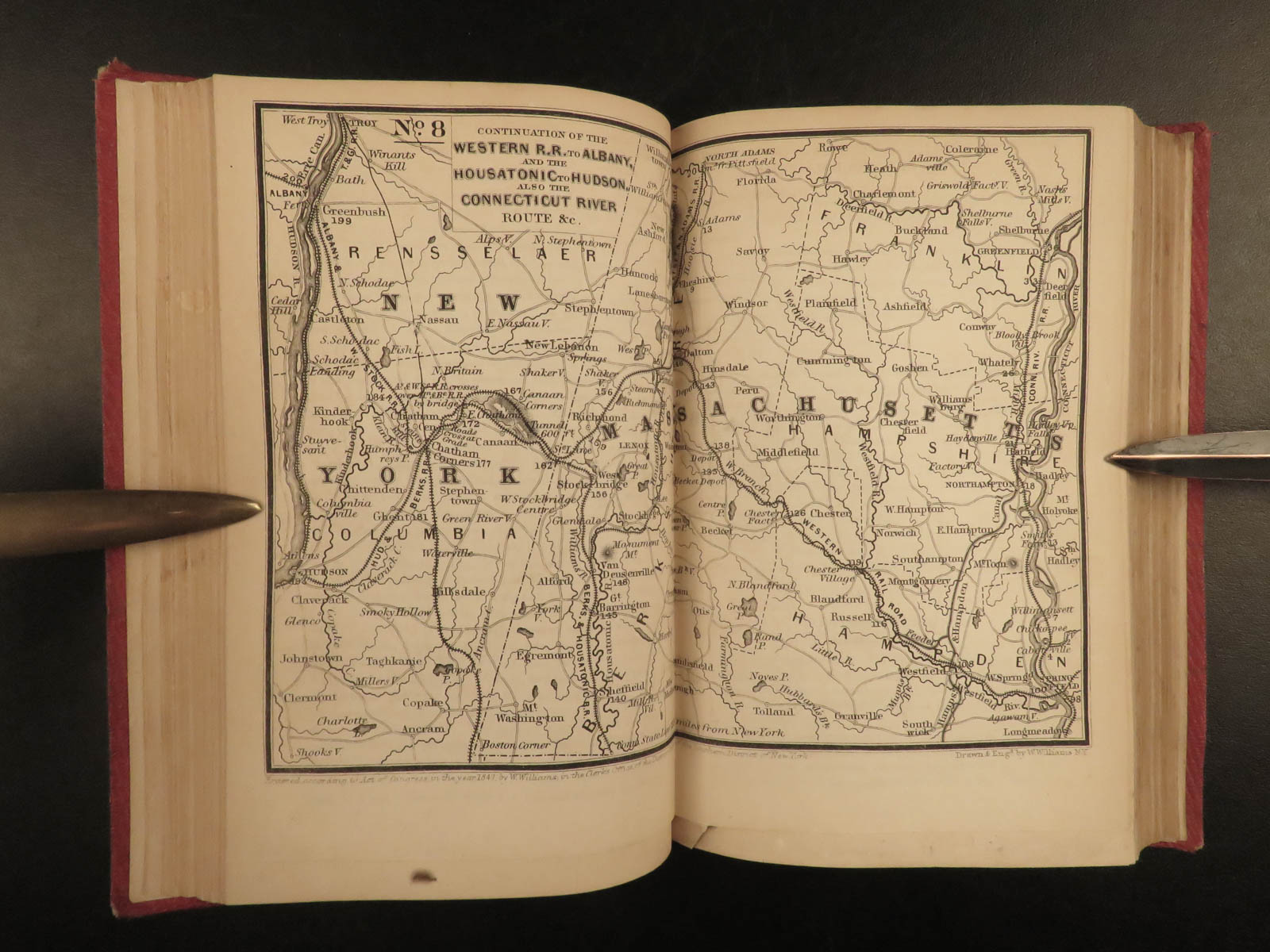
- 27 full-page and fold-out maps
- Language: English
- Binding: Hardcover; tight and secure
- Decorative red cloth
- Size: ~6.5in X 4.5in (16.5cm x 11.5cm)
Our Guarantee:
Very Fast. Very Safe. Free Shipping Worldwide.
Customer satisfaction is our priority! Notify us with 7 days of receiving, and we will offer a full refund without reservation!
16604
Category
Voyages & Exploration & Maps
Authors
WILLIAMS, Wellington
Printing Date
19th Century
Language
English
Binding
Hardcover
Book Condition
Excellent
Collation
Complete
Other Books you might like...
-
Sale!
 Add to cart
1747 English 1ed Condamine Science Voyage Equador South America Amazon Geography
Original price was: $599.00.$499.00Current price is: $499.00. -
Sale!
 Add to cart
1769 ENGLISH History of Paraguay 1ed Charlevoix Jesuit Missionary Voyages Brazil Tribes
Original price was: $599.00.$499.00Current price is: $499.00. -
Sale!
 Add to cart
1834 HUGE MAP Niagara Falls Vandewater Tourist Hudson River Travel New York
Original price was: $599.00.$499.00Current price is: $499.00. -
Sale!
 Add to cart
1687 Museum Italicum 1st ed Mabillon Italian Voyages Paleography Illustrated
Original price was: $950.00.$795.00Current price is: $795.00.