1843 EARLY AMERICA 19 MAPS Indians California PERU Brazil Oceania Illustrated 9v

An impressive collection of volumes from the 19th-century work “L’Univers”. Published by Didot, the publisher the many famed French voyages books, this work contains numerous volumes history and descriptions of people and their cultures from all over the world. This particular lot features nine volumes covering the following locations:
- South and Central America
- Brazil, Colombia & Guyana
- Chili, Paraguay, Patagonia
- Guatemala, Peru
- Antilles
- United States & Canada
- Oceania
- Polynesia
- Malasia
- Micronesia
- Europe
- Cities of the Hanseatic League
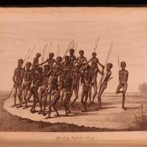
The United States volume is particularly desirable as it contains descriptions of Native American Indian tribes, early California interests, and Colonial history. Note that each volume contains impressive illustrations and even folding maps!


1843 EARLY AMERICA 19 MAPS Indians California PERU Brazil Oceania Illustrated 9v
An impressive collection of volumes from the 19th-century work “L’Univers”. Published by Didot, the publisher the many famed French voyages books, this work contains numerous volumes history and descriptions of people and their cultures from all over the world. This particular lot features nine volumes covering the following locations:
- South and Central America
- Brazil, Colombia & Guyana
- Chili, Paraguay, Patagonia
- Guatemala, Peru
- Antilles
- United States & Canada
- Oceania
- Polynesia
- Malasia
- Micronesia
- Europe
- Cities of the Hanseatic League
The United States volume is particularly desirable as it contains descriptions of Native American Indian tribes, early California interests, and Colonial history. Note that each volume contains impressive illustrations and even folding maps!
Item number: #24421
Price: $950
various
L’Univers | histoire et description de tous les peuples
Paris: Firmin Didot, 1843 1st editions
Details:
- Collation: Complete with all pages; 9 volumes
- Each volume individually paginated
- Amerique – Vols. 1-5
- Oceanie – Vols. 1-3
- Europe –
- Hundreds of illustrations throughout, including 19 folding maps
- Language: French
- Binding: Hardcover; tight and secure
- Size: ~9.75in X 6.75in (25cm x 17cm)
- Quite scarce
- Each volume individually paginated
Our Guarantee:
Very Fast. Very Safe. Free Shipping Worldwide.
Customer satisfaction is our priority! Notify us with 7 days of receiving, and we will offer a full refund without reservation!
24421
Category
Voyages & Exploration & Maps
Authors
various
Printing Date
19th Century
Language
French
Binding
Hardcover
Book Condition
Excellent
Collation
Complete
Other Books you might like...
-
Sale!
 Add to cart
1804 Account of New South Wales David Collins Australia New Zealand Illustrated
Original price was: $1,950.00.$1,750.00Current price is: $1,750.00. -
 Add to cart
1687 1st ed Travels of John Chardin in PERSIA Middle East Iraq Turkey MAPS
$950.00 -
Sale!
 Add to cart
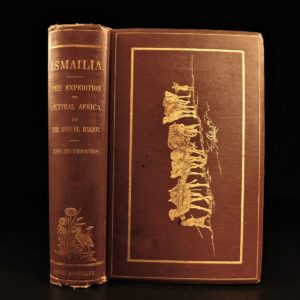
1875 1st ed ISMAILIA Central Africa Slave Trade SUDAN Egypt Illustrated Baker
Original price was: $550.00.$450.00Current price is: $450.00. -
 Add to cart
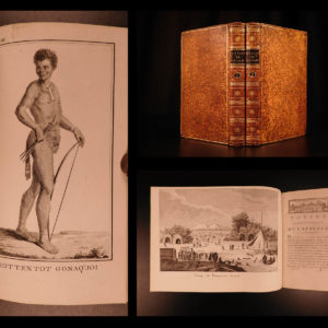
1790 1st ed Vaillant Africa Voyages Hottentot Ethnology Zoology Birds Giraffe 2v
$950.00