A Cruising Voyage Round the World – Woodes Rogers, 1712 | First Edition with Maps

1712 Cruising Voyage Woodes Rogers, first edition with three folding maps and Selkirk’s survival account. Notable early privateering and Pacific trade journal.
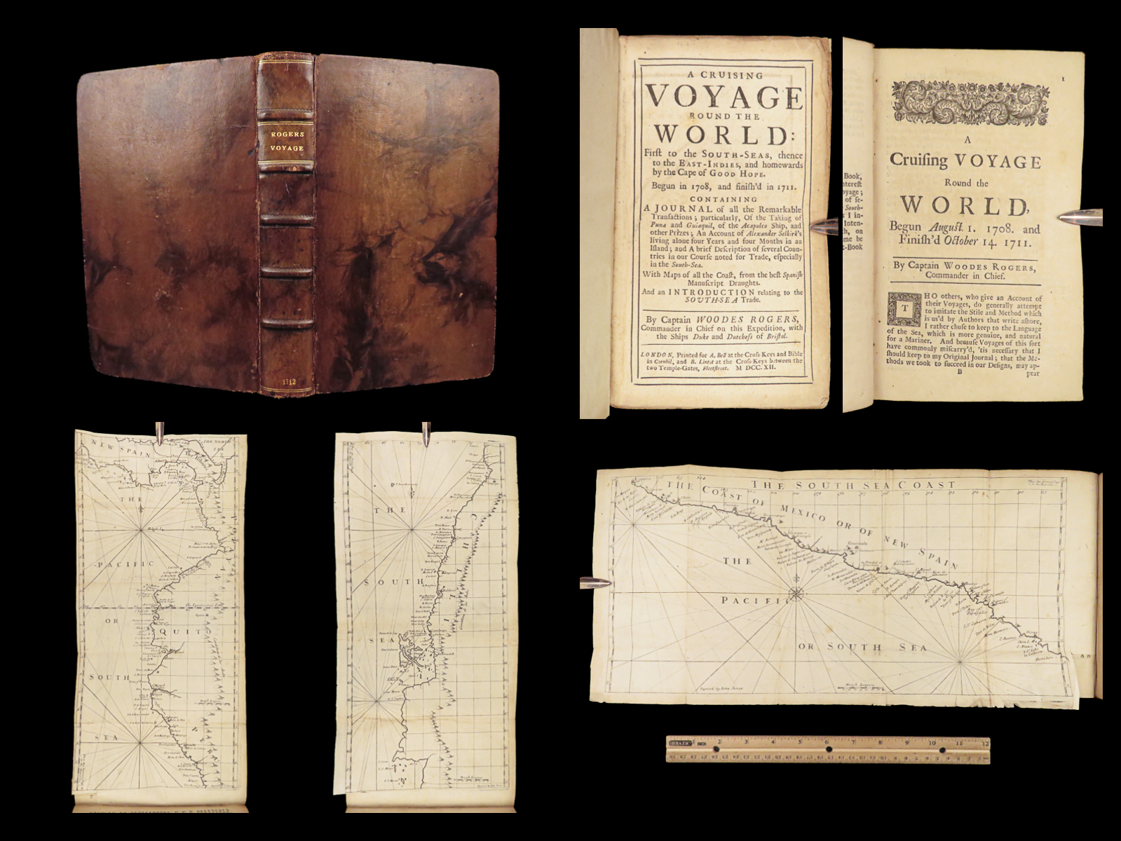
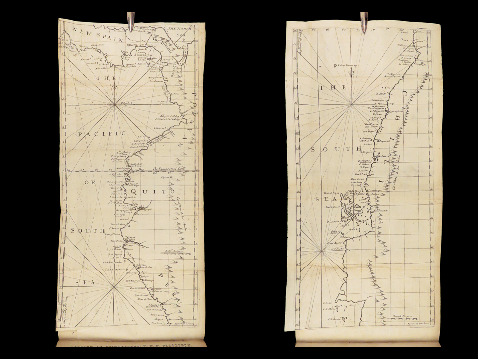


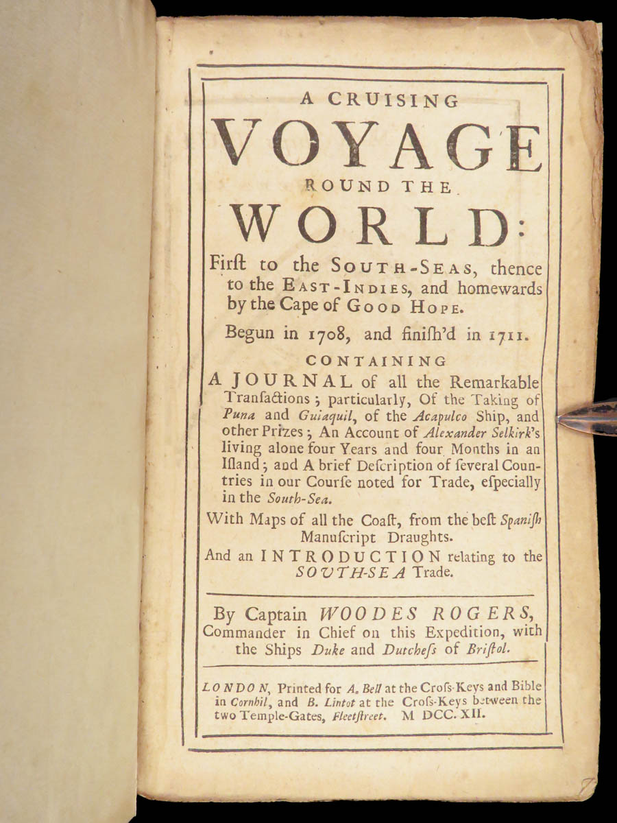

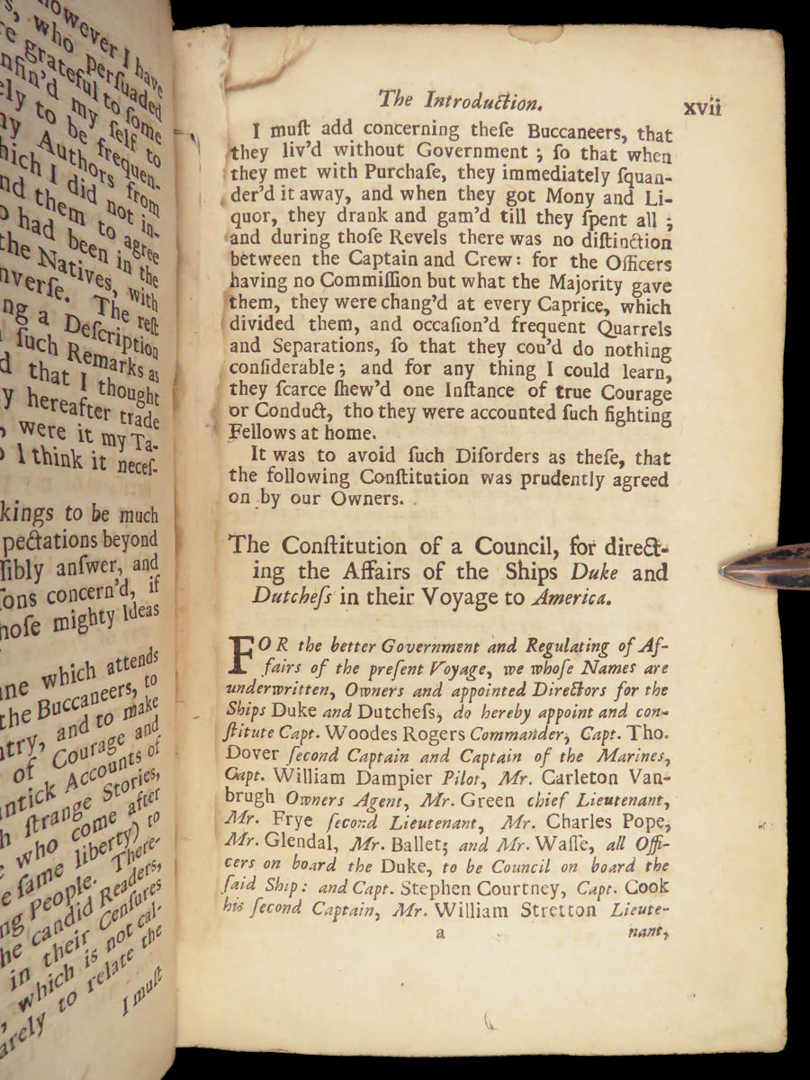
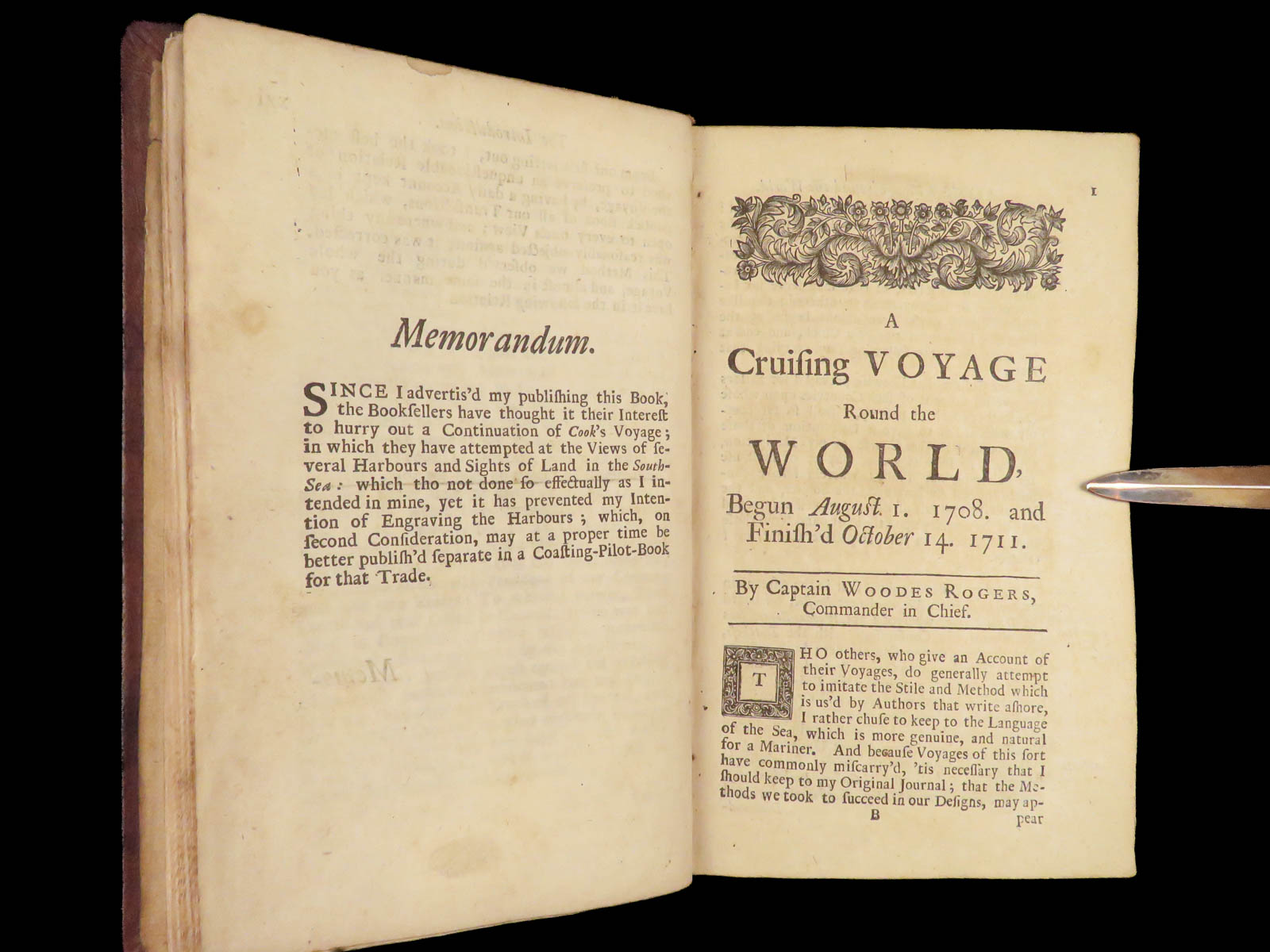


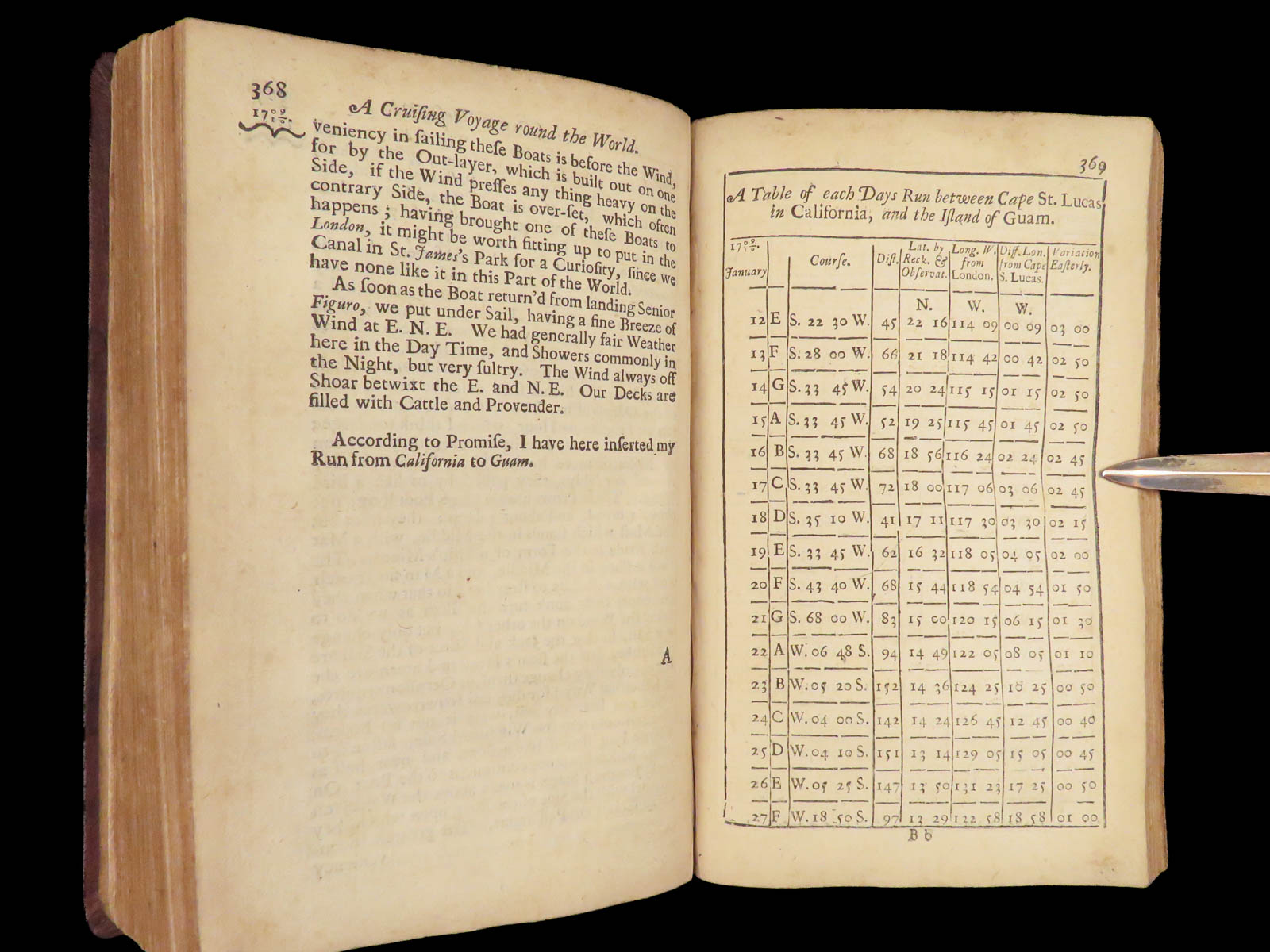
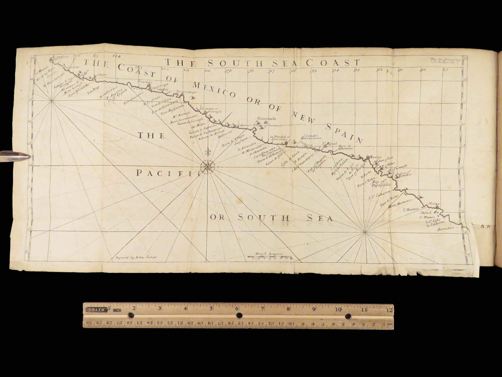
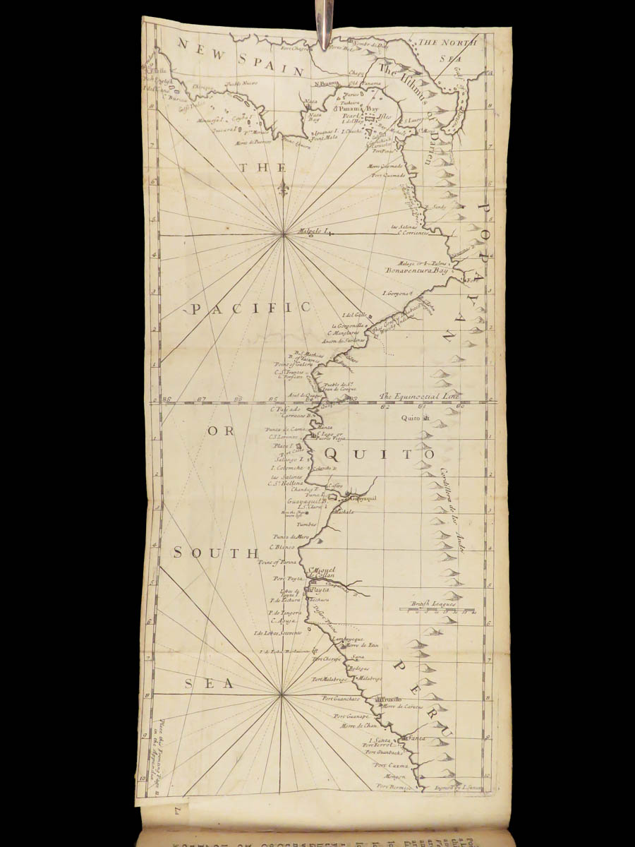
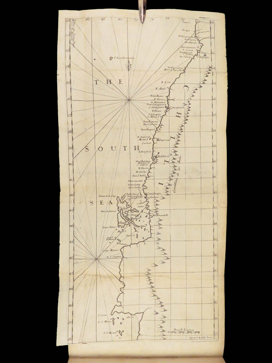


1712 Cruising Voyage Woodes Rogers is the first edition of the British privateer’s circumnavigation account. The narrative covers Rogers’ three-year voyage through the South Seas and East Indies, with detailed reporting on coastal movements along the Americas and maritime trade ports visited between 1708 and 1711. It includes the earliest published description of Alexander Selkirk’s rescue after four years of isolation on Juan Fernández Island. The volume contains three large folding maps based on seized Spanish charts, depicting coastlines of Southern Mexico, Peru, and Chile.
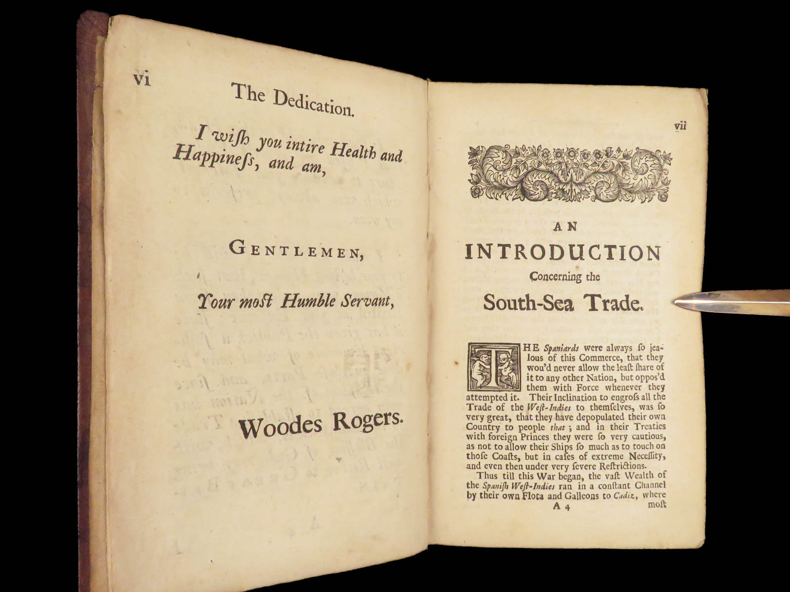
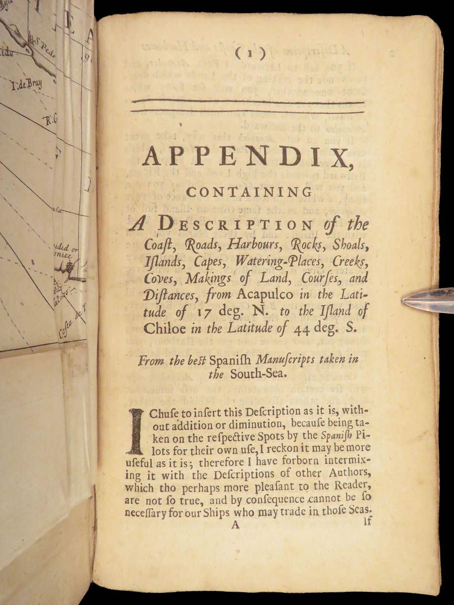
The appendix gives a sequential description of the harbors along the Pacific coast of the Americas, based on Spanish sources captured during the voyage. The main narrative outlines stops and seizures along the coasts of Peru and Chile, interactions with local populations, and descriptions of towns and fortifications. The section on Batavia includes information about provisioning and European merchant presence. Letters and mentions of William Dampier situate the voyage within a longer chain of English maritime operations.
Bibliographic Details
- Title: A Cruising Voyage Round the World: First to the South-Seas, Thence to the East-Indies, and Homewards by the Cape of Good Hope. Begun in 1708, and Finish’d in 1711…
- Author(s): Woodes Rogers
- Publisher: London, Printed for A. Bell and B. Lintot
- Edition: First Edition, 1712.
- Format: Octavo, single volume
- Binding: Full leather
- Size: ~ 8 in x 5 in (20.3 cm x 12.7 cm)
- Collation: xxi, [1], 428, 56, [14] pp
- Illustrations: 3 folding maps of Mexico and Guatemala, Peru, and Chile) (out of 5)
- Contents Include:
- Voyage narrative with South Sea engagements
- Selkirk’s solitary survival on Juan Fernández Island
- Mentions of Dampier and related letters
- Notes on Batavia, Strait of Magellan, and South American ports
- Appendix on coastal harbors and trade locations in the Spanish Pacific
- Provenance: Bookplate – C. Cruz Montt
- Carlos Cruz Montt (1879-1955), a member of the prominent Chilean Montt family, was an esteemed Chilean architect and art collector whose art collection is currently in the care of the British Museum.
- Reference(s): Sabin 72734; Hill 1479
Condition:
Bound in later full calf in 18th-century style. Gilt ruling remains clear and consistent. The maps are complete and properly folded, including coastal surveys integral to South Sea navigation. Pages show moderate foxing with some toning at the edges, but all text and plates are intact. Collation is complete. The folding maps are well-preserved with no major losses or repairs. Text block remains secure and square.
Why Collect This?
- First edition documenting Rogers’ 1708–1711 circumnavigation
- Includes earliest printed account of Selkirk, precursor to Robinson Crusoe
- Three large folding maps
- A foundational title in the history of English privateering and early Pacific trade
Categories
Americana, American History
European History
Maps
Voyages & Exploration & Maps
Authors
Woodes Rogers
Printing Date
18th Century
Language
English
Binding
Leather
Book Condition
Very Good
Other Books you might like...
-
Sale!
 Add to cart
1864 Civil War Fort Pillow Massacre Prisoner of War POW Illustrated CSA Forrest
Original price was: $550.00.$450.00Current price is: $450.00. -
Sale!
 Add to cart
1862 1st ed Officers of Union Army Navy Generals American CIVIL WAR Battles
Original price was: $499.00.$399.00Current price is: $399.00. -
Sale!
 Add to cart
1768 Colonial Americana 1ed Almanac Fletcher Massachusetts Bay Charter Plymouth
Original price was: $750.00.$599.00Current price is: $599.00. -
Sale!
 Add to cart
1864 Civil War RAILROAD Locomotive Engineer Norris Steam Engine Illustrated
Original price was: $499.00.$399.00Current price is: $399.00.