The Practical Navigator – John Hamilton Moore – 1784 | Full Calf Binding with Diagrams & Tables

1784 Practical Navigator John Hamilton Moore, London imprint in full calf, with trigonometric figures and over 200 pages of navigational tables.
CLICK THE DESCRIPTION & DETAILS TAB BELOW TO LEARN MORE.
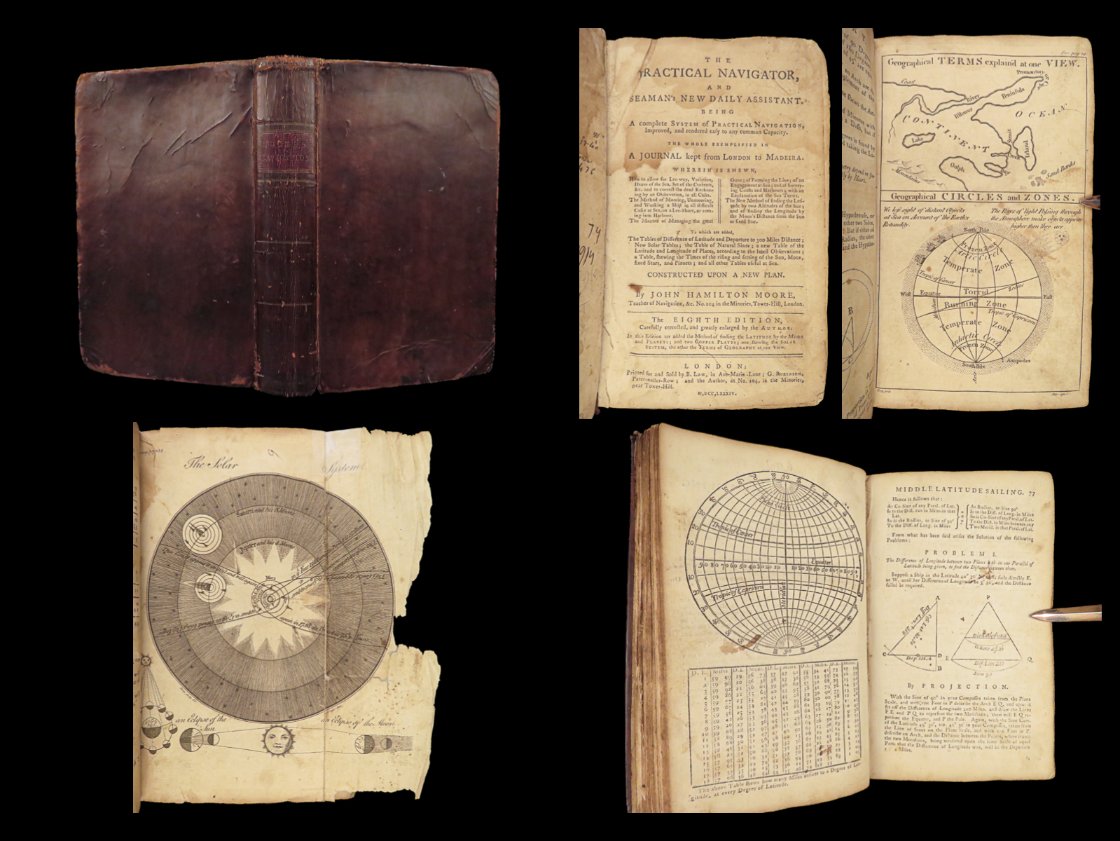

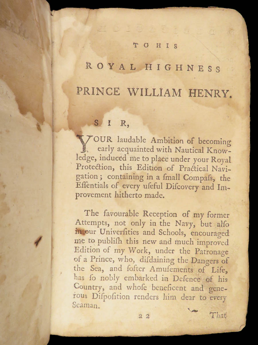
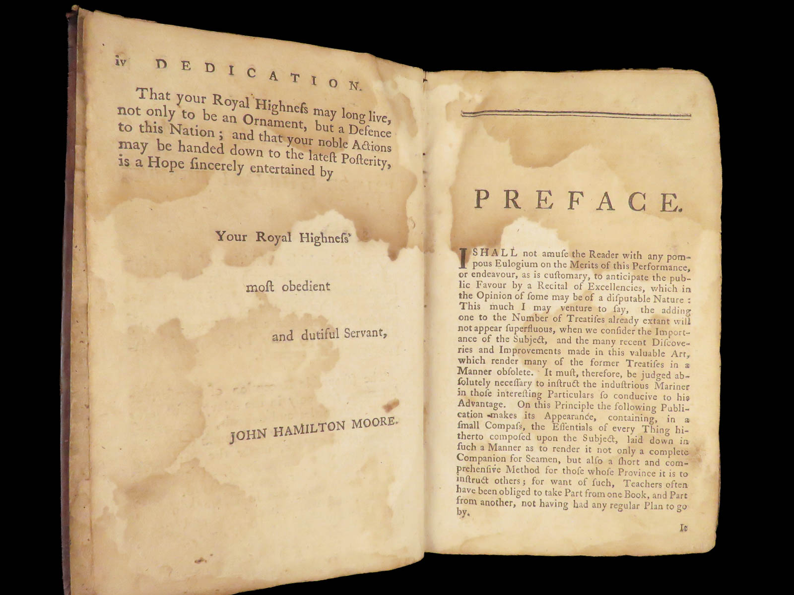
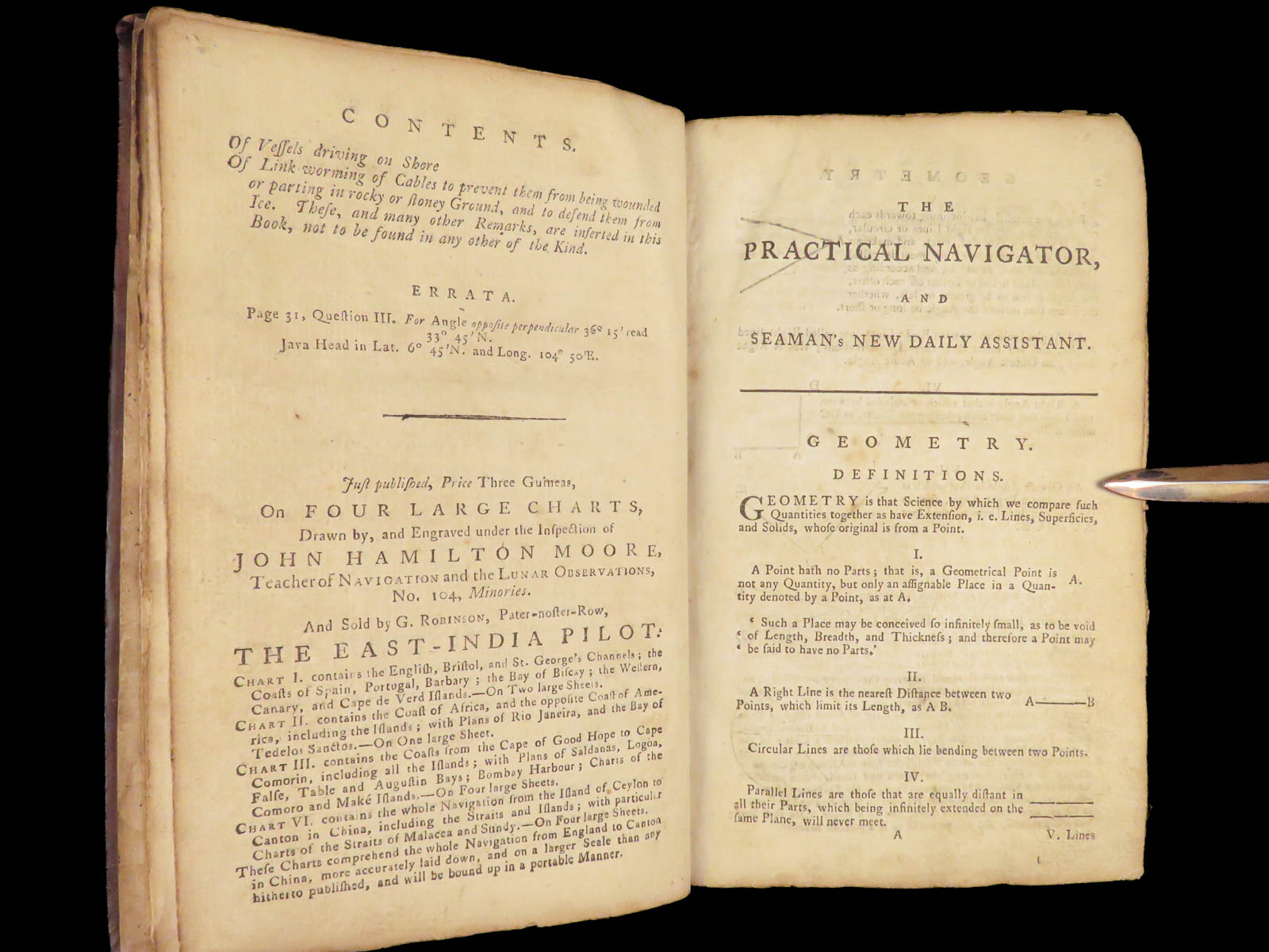
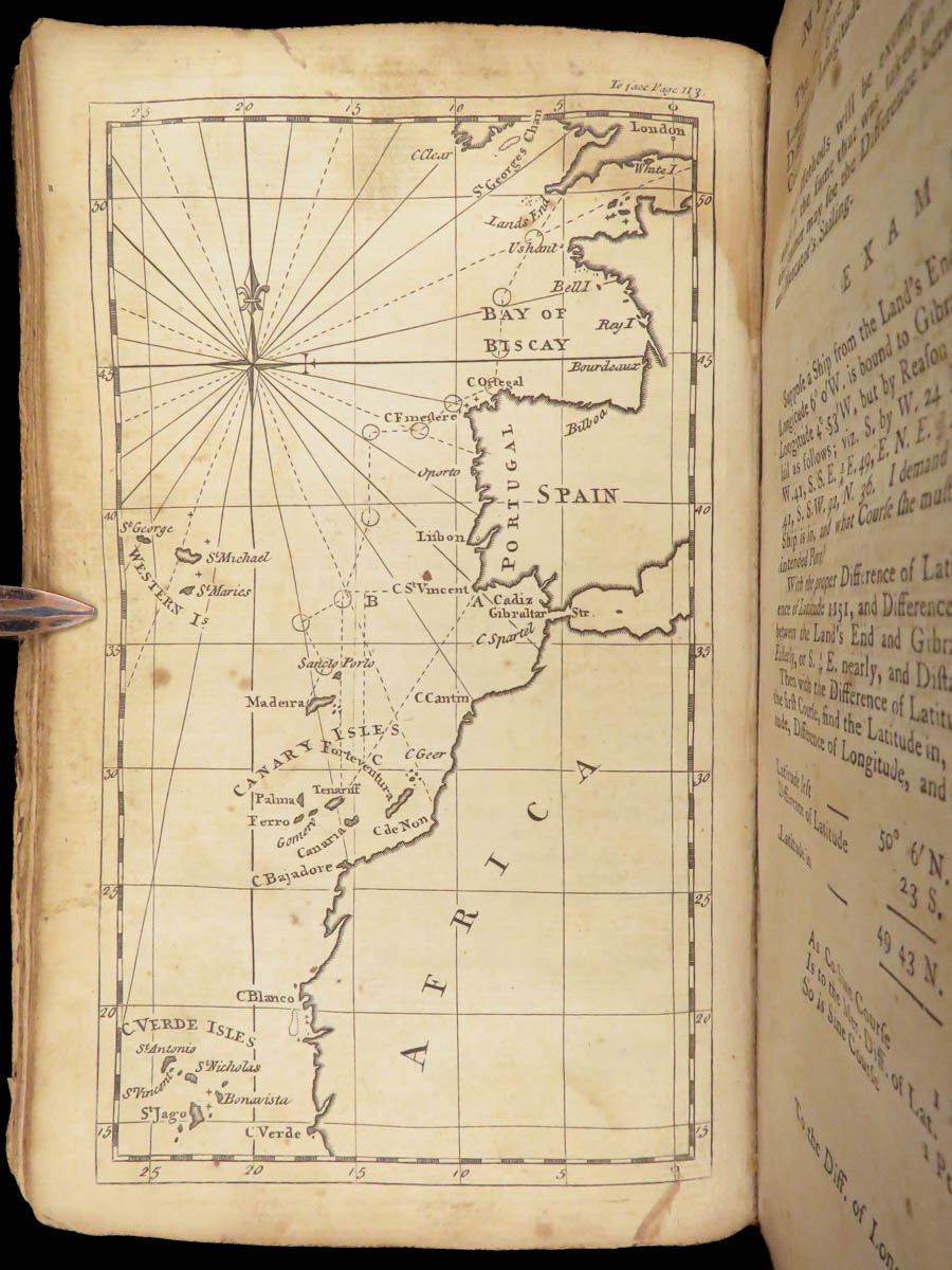
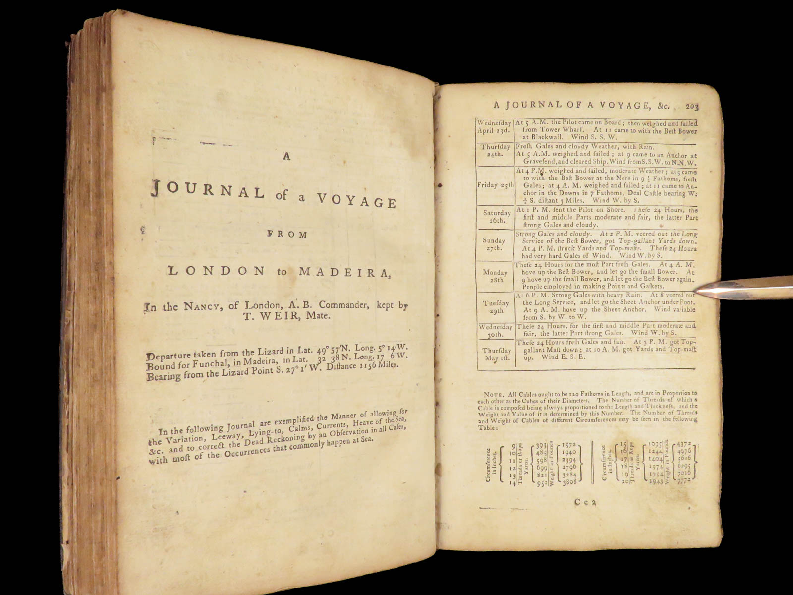
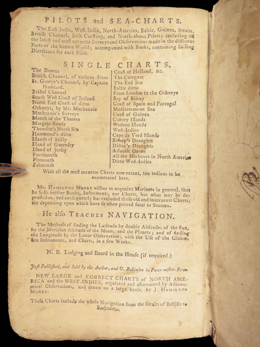
The 1784 Practical Navigator by John Hamilton Moore is a foundational maritime manual produced in London during a period of expansive British naval activity. Structured as a journal from London to Madeira, the work instructs seamen in practical navigation through observation, calculation, and applied trigonometry. Moore’s clear method is laid out in progressive form, using diagrams and detailed tables that helped make complex maritime techniques more widely teachable in the late 18th century.
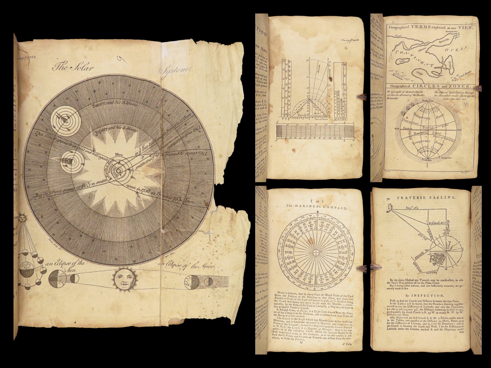
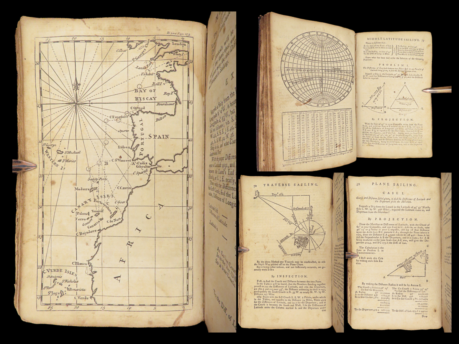
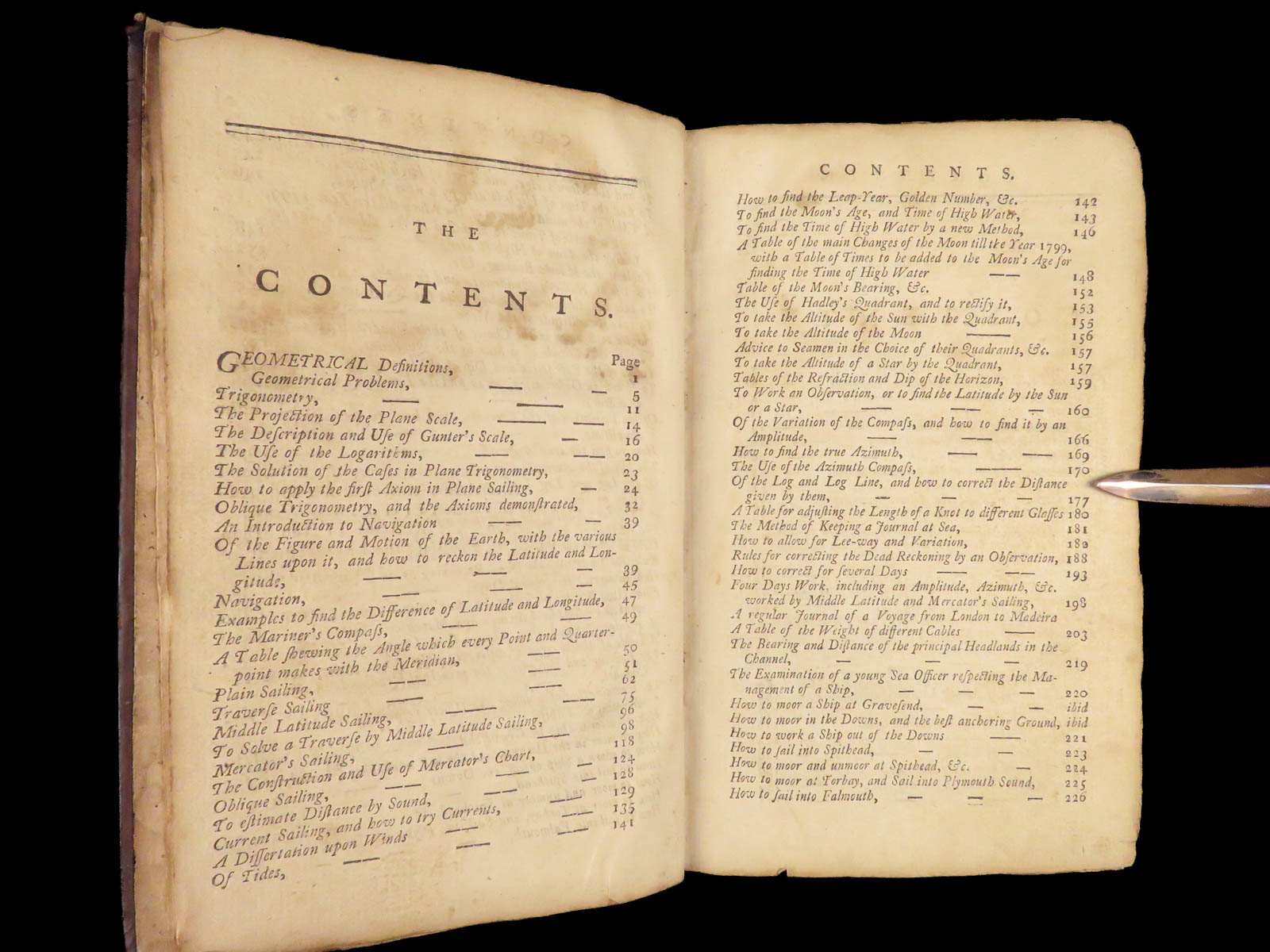
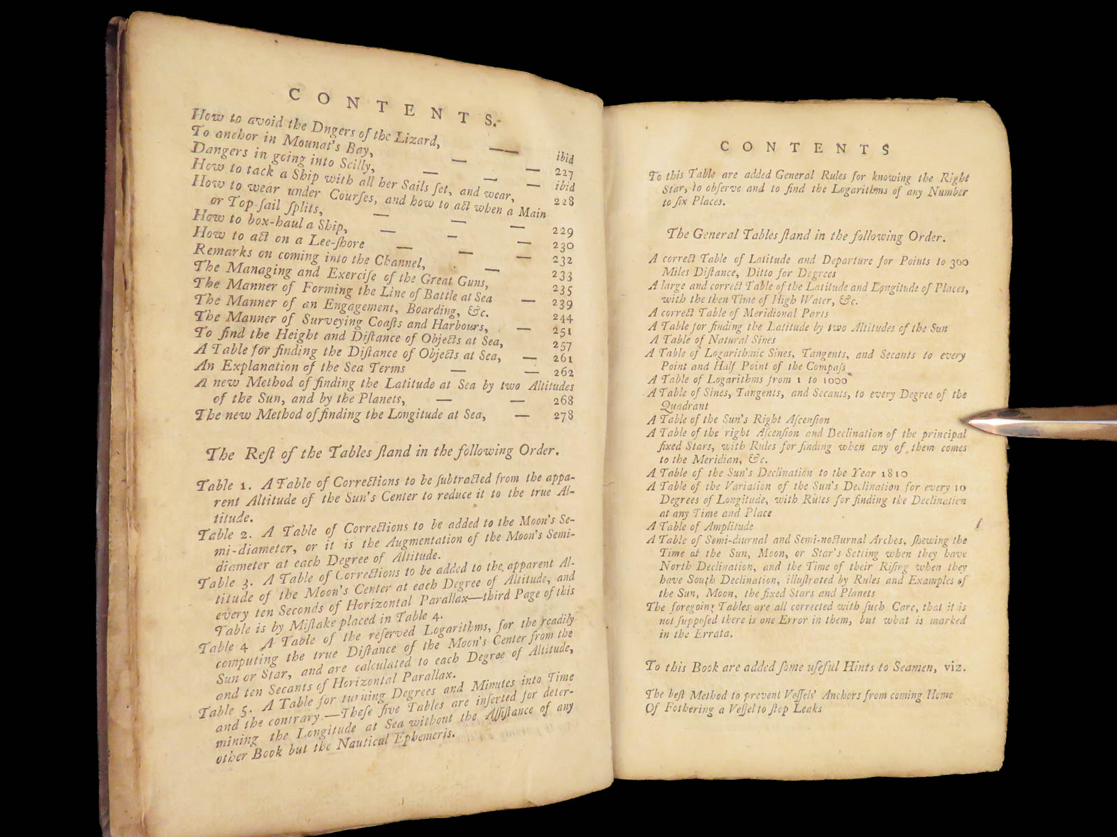
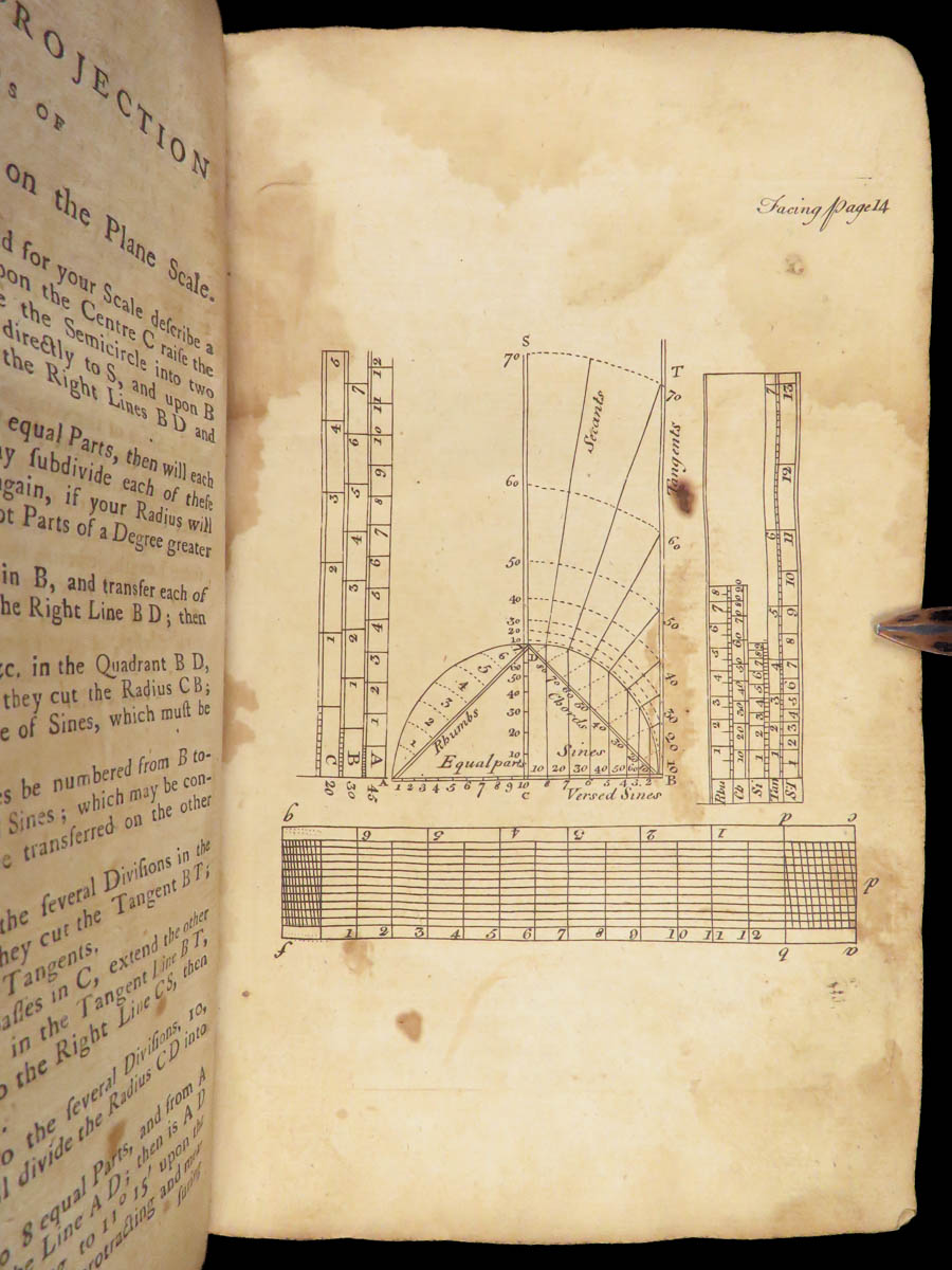
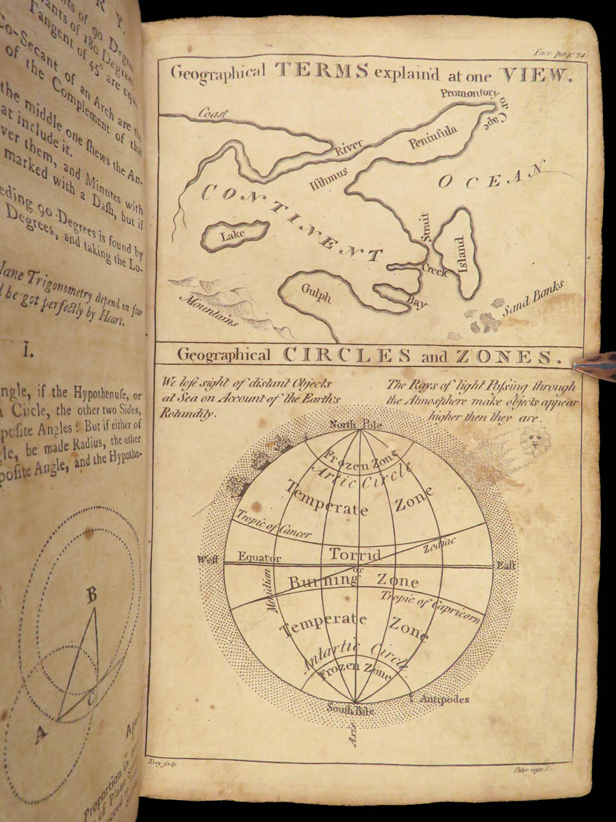
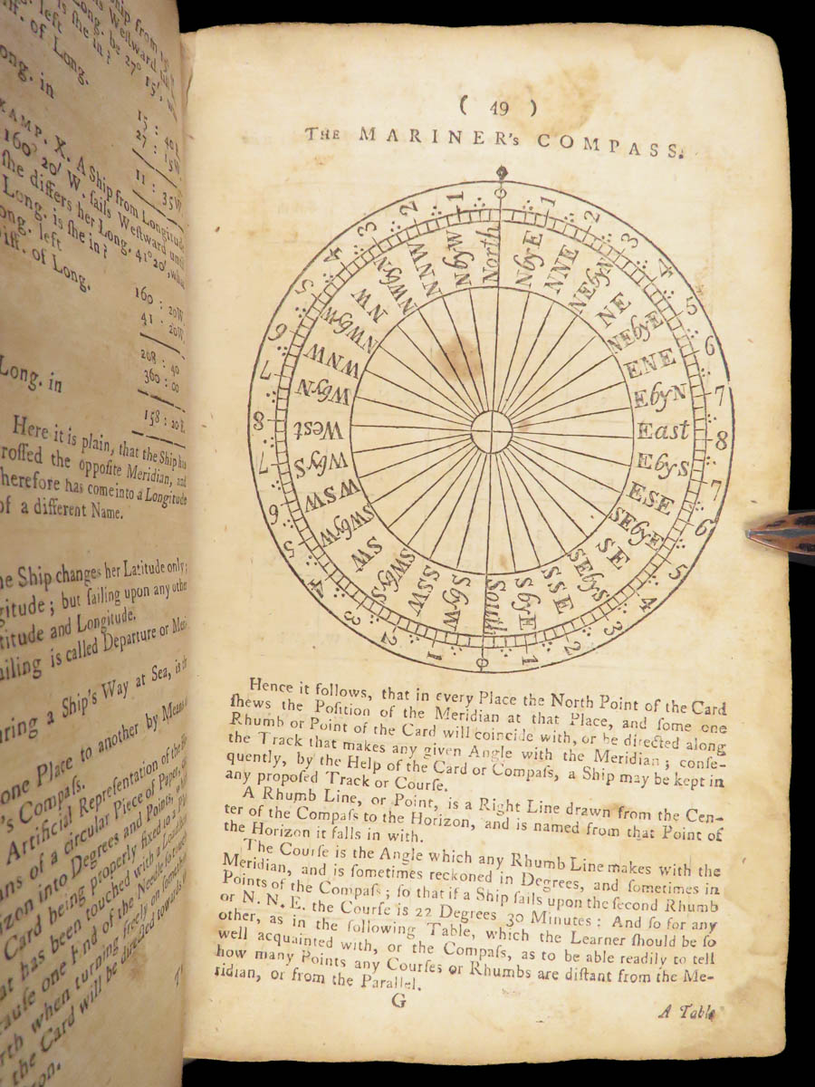
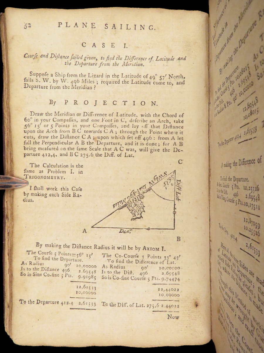
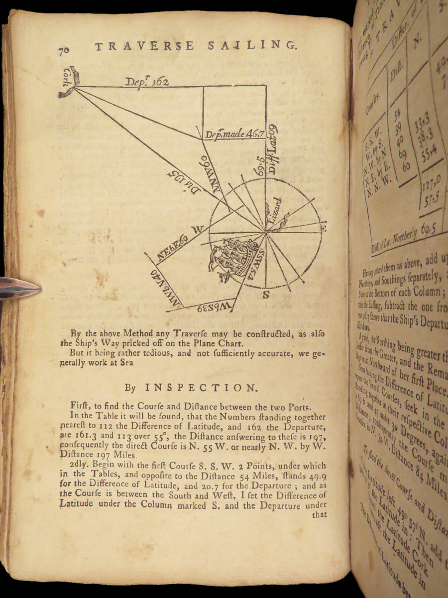
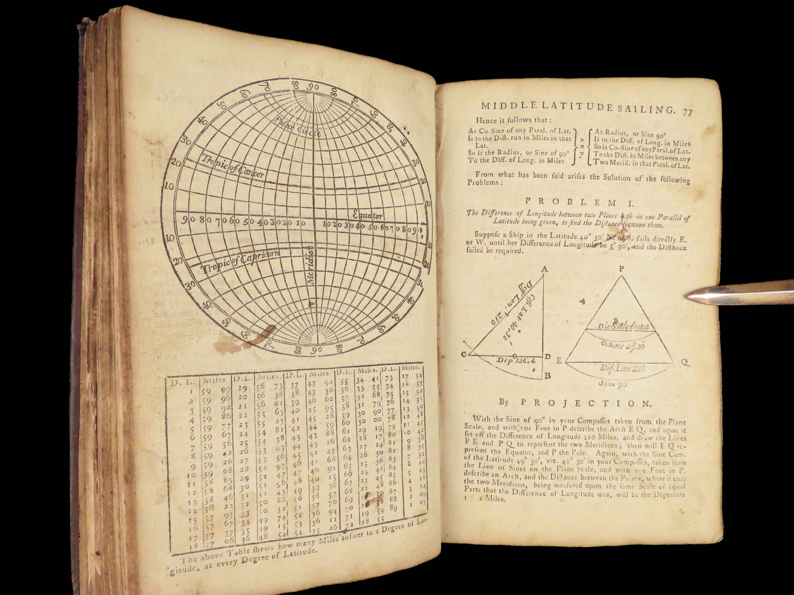
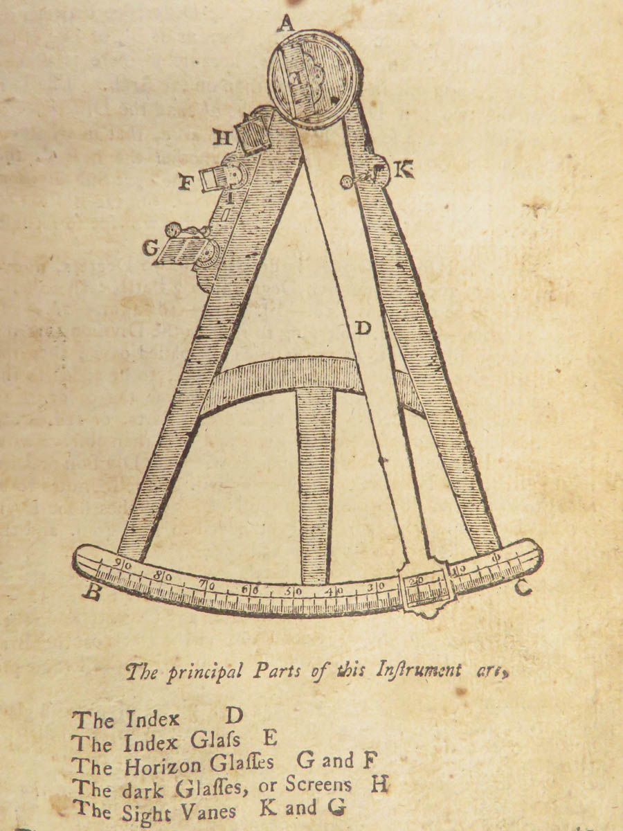
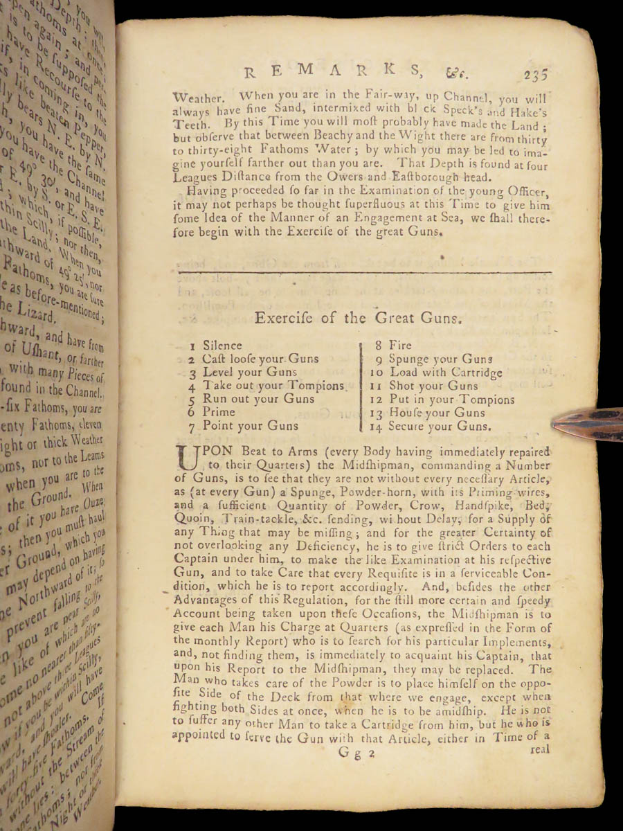
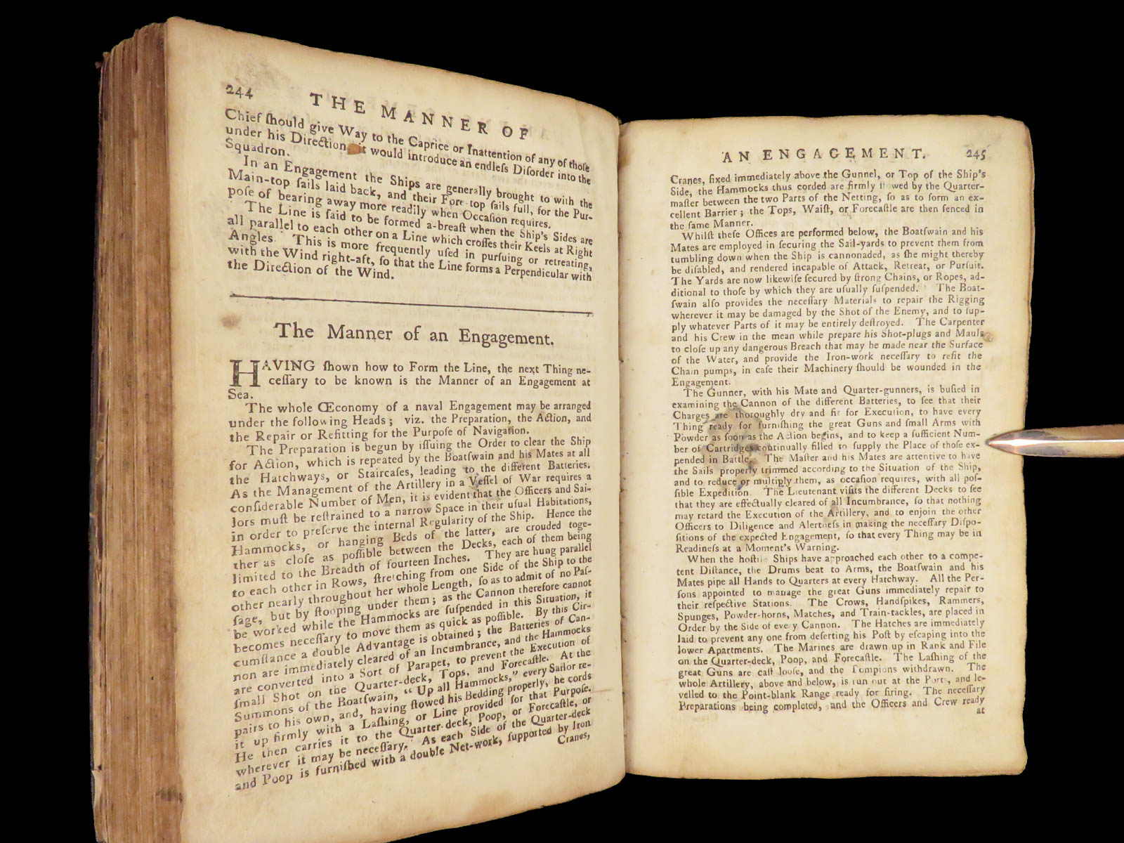
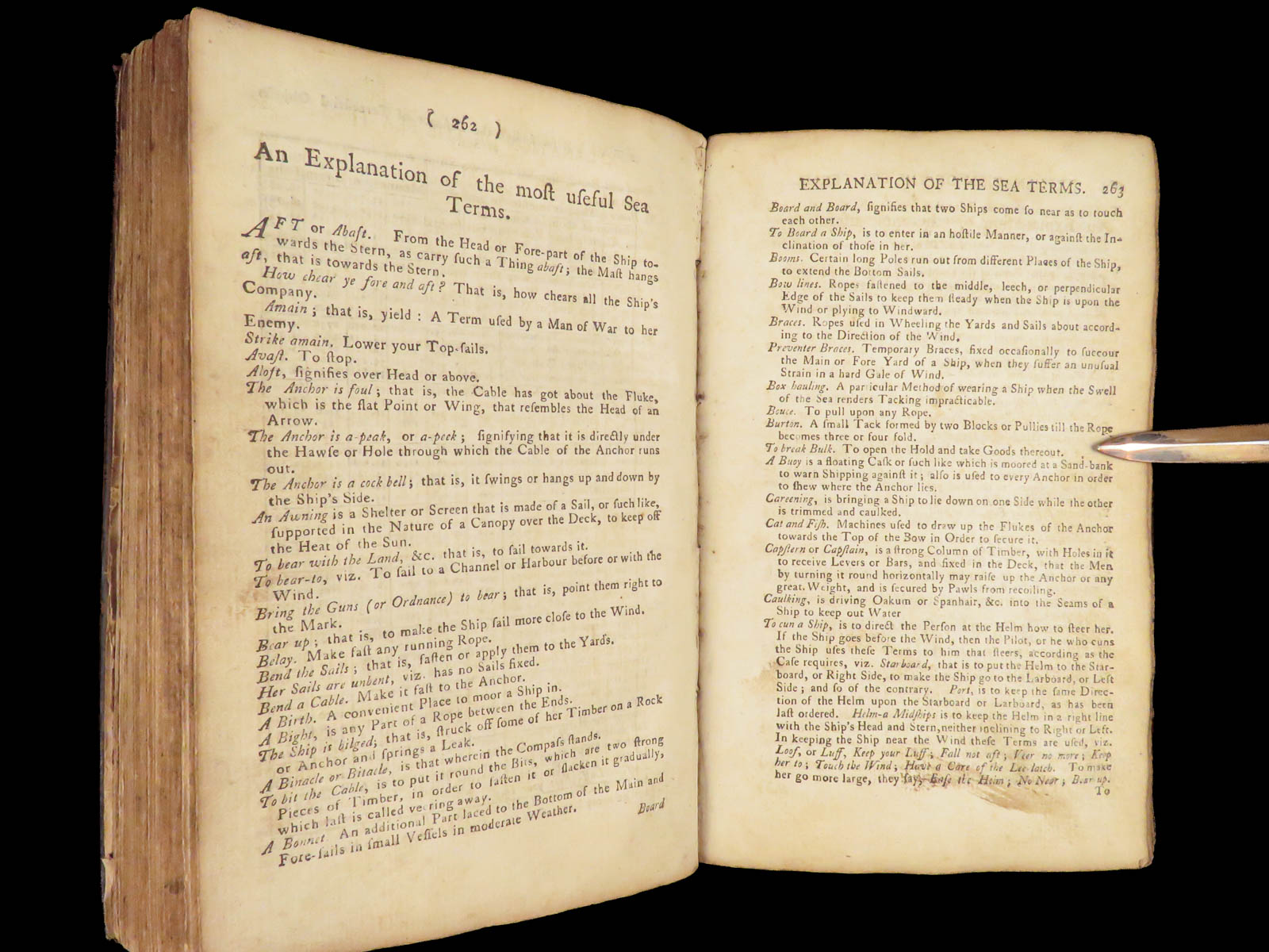
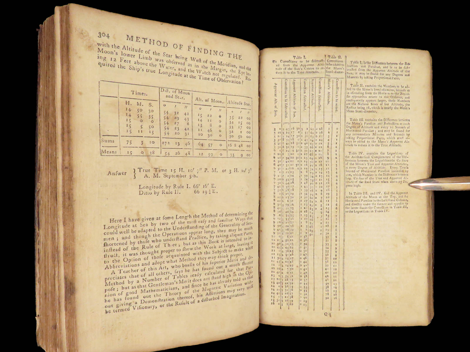
The manual opens with a navigational journal followed by systematic instruction in handling dead reckoning, correcting course by variation, calculating lunar distance, and determining position using solar and stellar methods. A full-page geometric diagram explains the basis of plane trigonometry, which supports the rest of the text. More than 200 pages of printed tables support manual calculation for distance, direction, and celestial observations, and were essential to navigation prior to the introduction of chronometric methods.
Printed in London and sold through multiple booksellers and by the author himself, this edition reflects Moore’s direct involvement in both the theory and teaching of navigation. Its technical layout and content made it a working tool aboard merchant ships and instructional academies alike.
Bibliographic Details
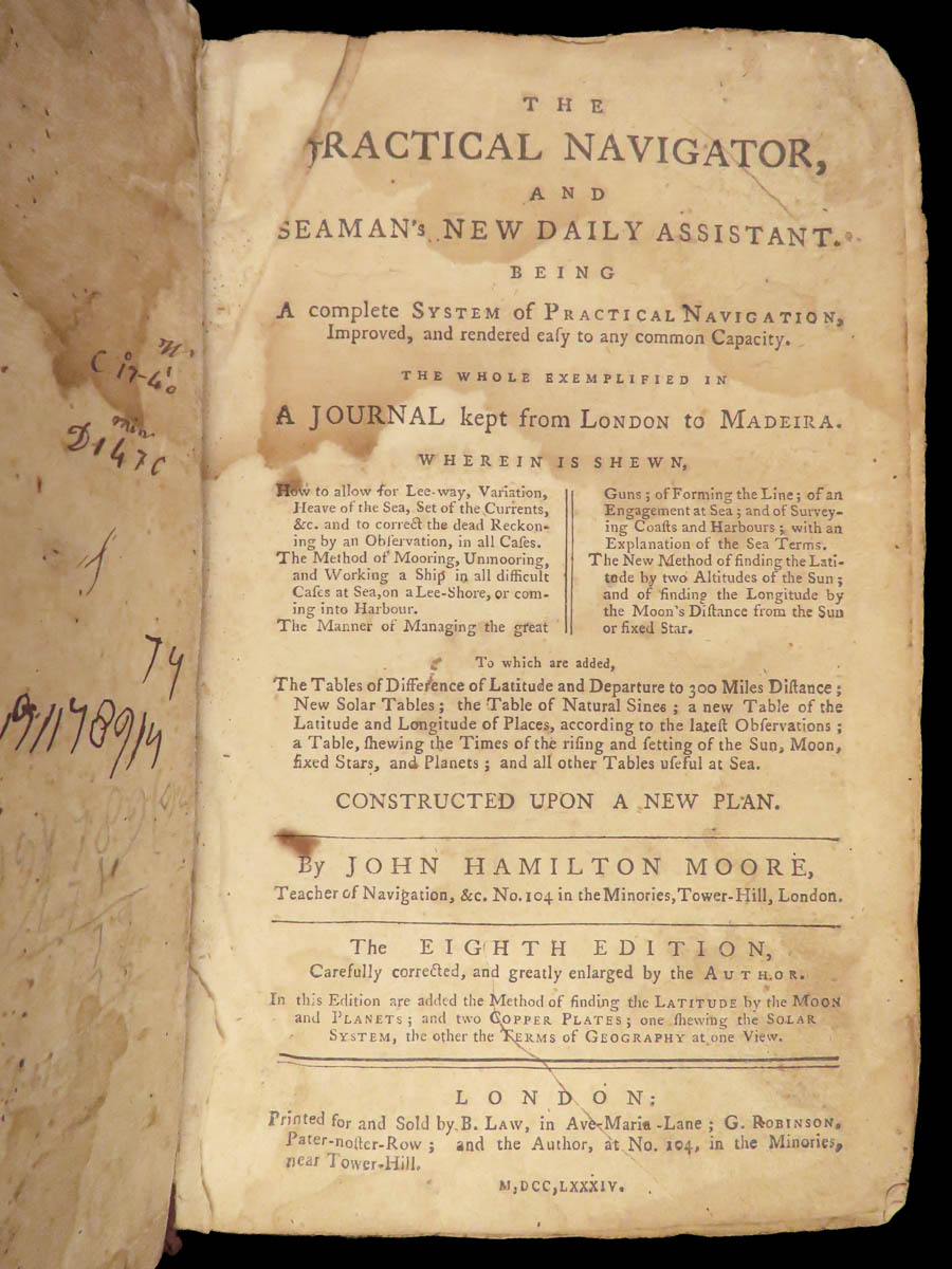
- Title: The Practical Navigator, and Seaman’s New Daily Assistant: Being a Complete System of Practical Navigation…
- Author(s): John Hamilton Moore
- Publisher: London, Printed for and Sold by B. Law, G. Robinson, and the Author
- Edition: 8th edition, 1784.
- Format: Octavo, single volume
- Binding: Full calf, red morocco label
- Size: 8.5 in x 5.5 in (21.5 cm x 14 cm)
- Collation: xi, [5], 304, [204] pp
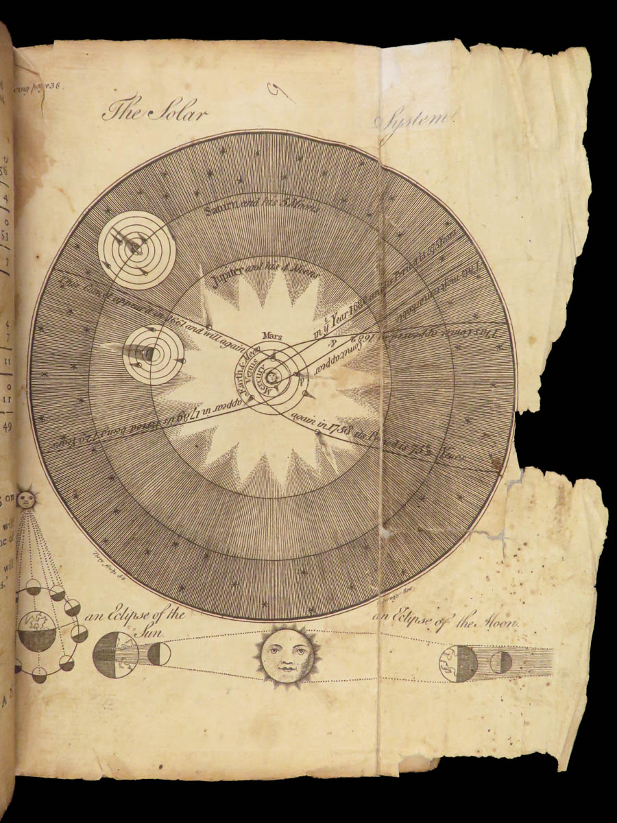
- Illustrations: Numerous in-text diagrams and tables; 4 copper-plate engraved plates (1 folding)
- Contents Include:
- Journal from London to Madeira
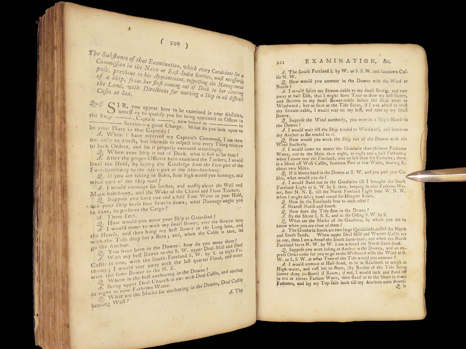
- Rules for Determining Latitude by Observation
- Plane Trigonometry Section with Definitions and Figures
- Extensive Artificial Sine and Secant Tables
- Solar and Lunar Tables with Practical Application
Condition:
Bound in full period calf, this copy shows age-consistent wear, with rubbing to boards, softened corners, and a darkened red morocco title label on the spine. Raised bands remain visible. The text block is secure. Internally complete, the leaves exhibit foxing, dampstains at the prelims and endmatter, and some general toning, especially near the fore-edge. Engraved diagrams and printed tables are cleanly impressed and legible throughout, with repairs done to folding engraving of the solar system.
Why Collect This?
- London-printed maritime manual from the Age of Sail
- Full calf binding with contemporary red label
- Includes technical illustrations and over 200 pages of reference tables
- Represents Moore’s direct teaching method and real voyage application
- Valuable to collectors of navigation, astronomy, and early scientific education
INVENTORY NUMBER (SKU): #28664
Categories
European History
Medicine & Science
Voyages & Exploration & Maps
Authors
John Hamilton Moore
Printing Date
18th Century
Language
English
Binding
Leather
Book Condition
Good
Collation
Complete
Other Books you might like...
-
Sale!
 Add to cart
1804 CAPTAIN COOK 3rd Voyage Polynesian Islands Northwest Passage Exploration 3v
Original price was: $750.00.$650.00Current price is: $650.00. -
Sale!
 Add to cart
1827 1st ed Imprisonment INQUISITION Juan Van Halen TORTURE Voyages Caucasus
Original price was: $750.00.$599.00Current price is: $599.00. -
Sale!
 Add to cart
1673 Dutch Hazart Church History JESUIT Missions TORTURE Martyrs America Africa
Original price was: $599.00.$499.00Current price is: $499.00. -
Sale!
 Add to cart
1825 1ed Wanderings South America Natural History Darwin & Wallace Inspiration
Original price was: $550.00.$450.00Current price is: $450.00.