The Mariner’s Compass Rectified – Andrew Wakeley – 1763 | William Mountaine, Nautical Navigation

1763 edition of The Mariner’s Compass Rectified, revised by William Mountaine from Andrew Wakeley’s original navigation tables. Includes Gregorian calendar adjustments, four engraved instrument diagrams, with practical solar and stellar data for sea navigation.
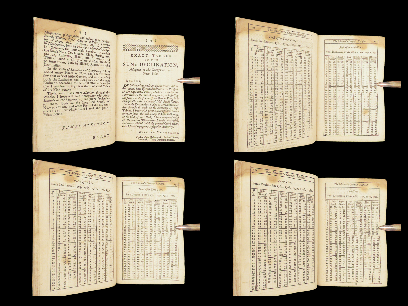
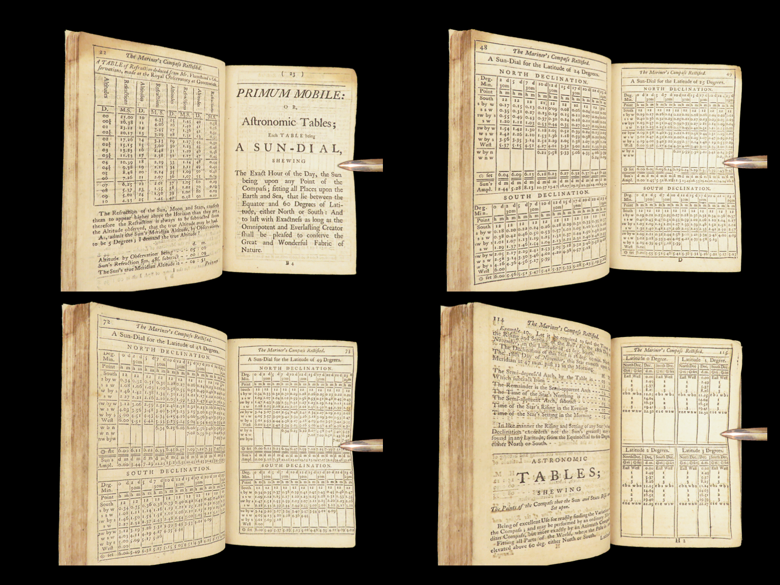

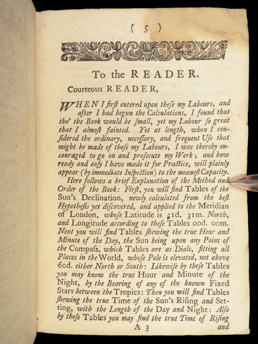
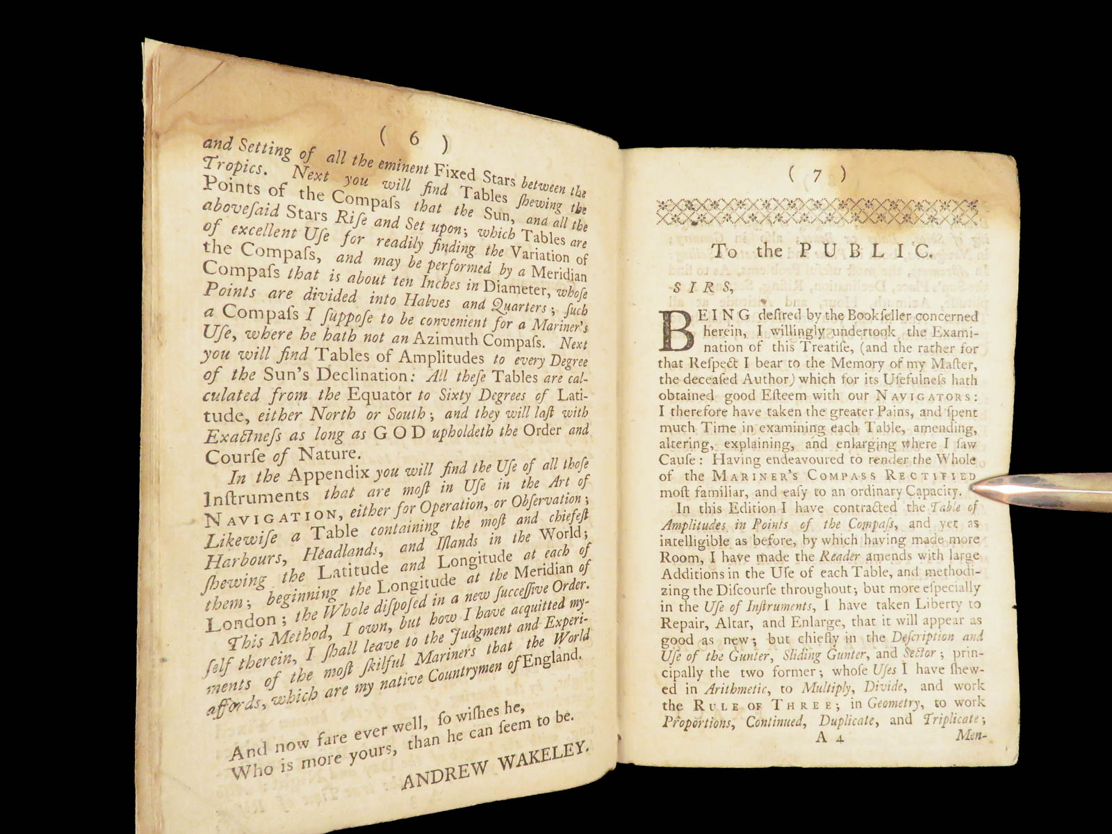
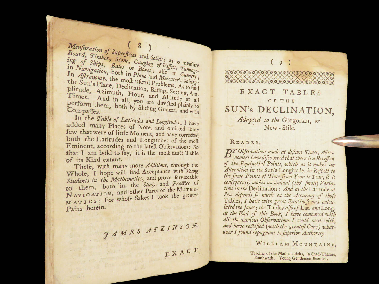
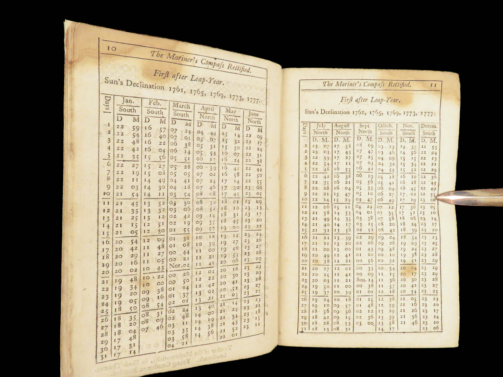
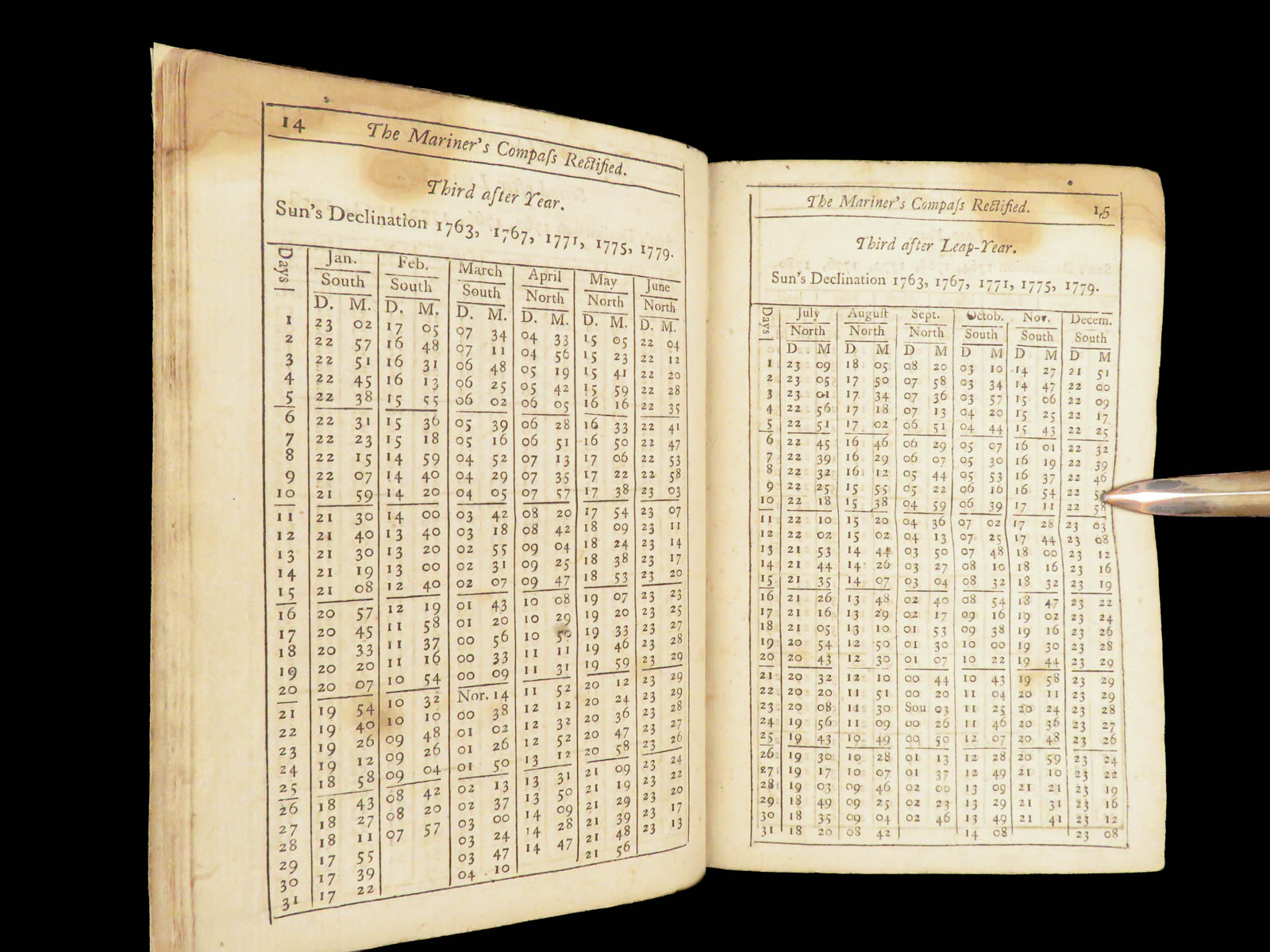
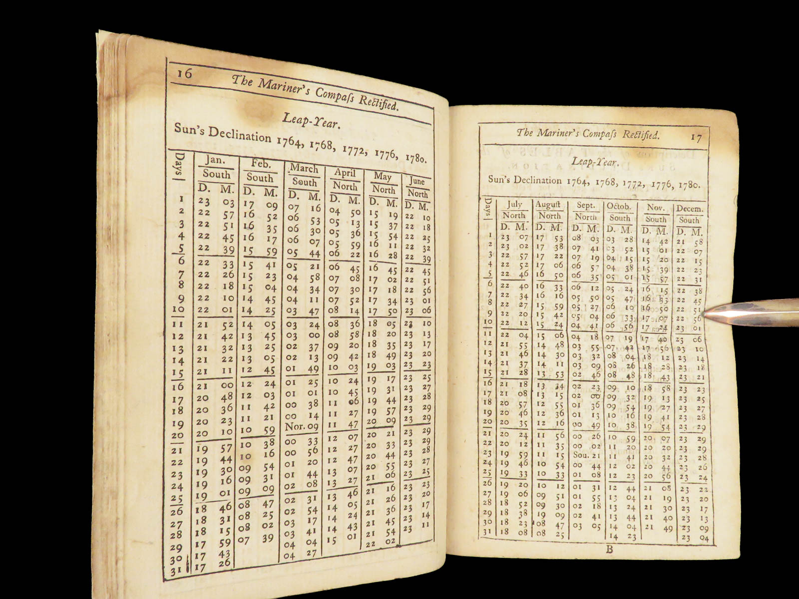
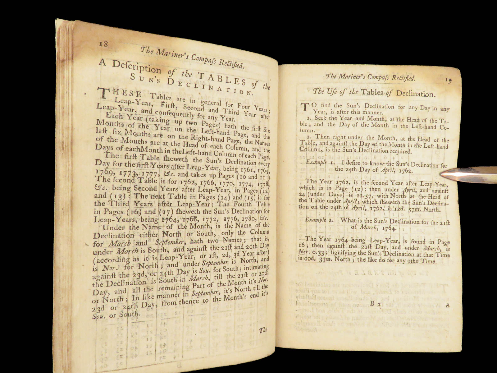
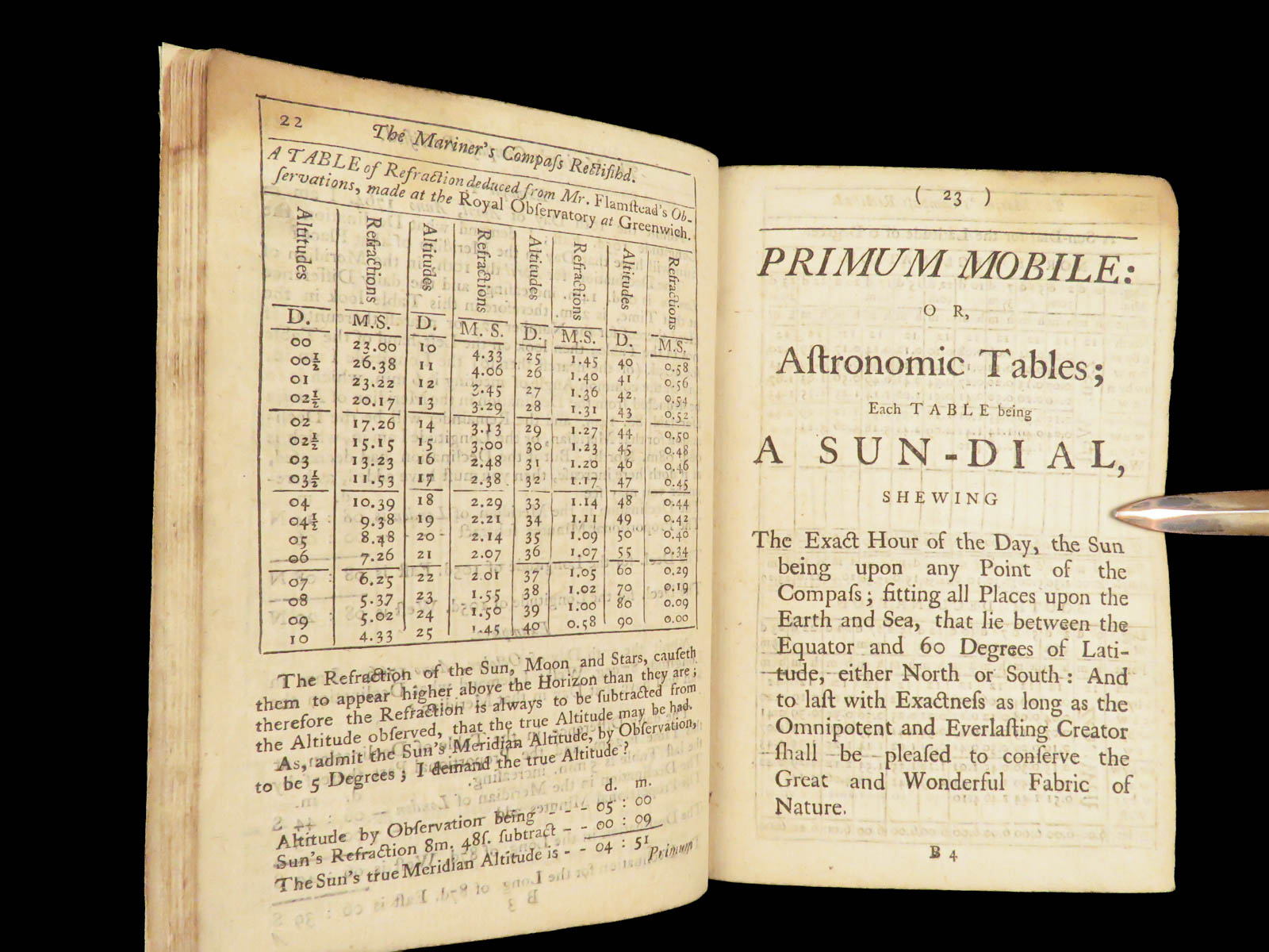

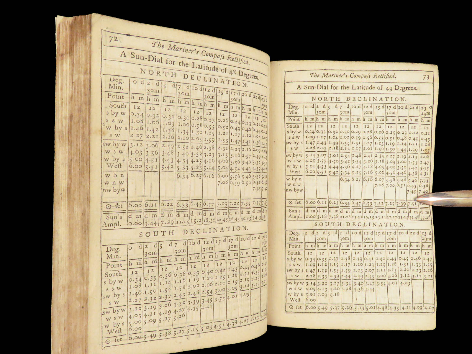
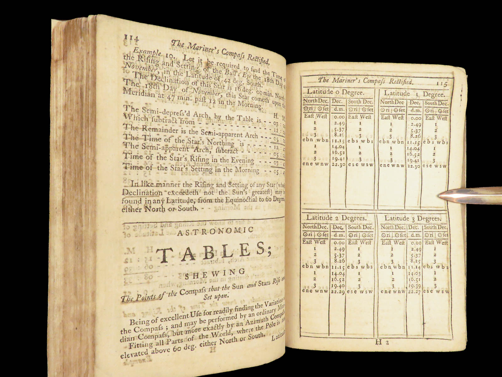

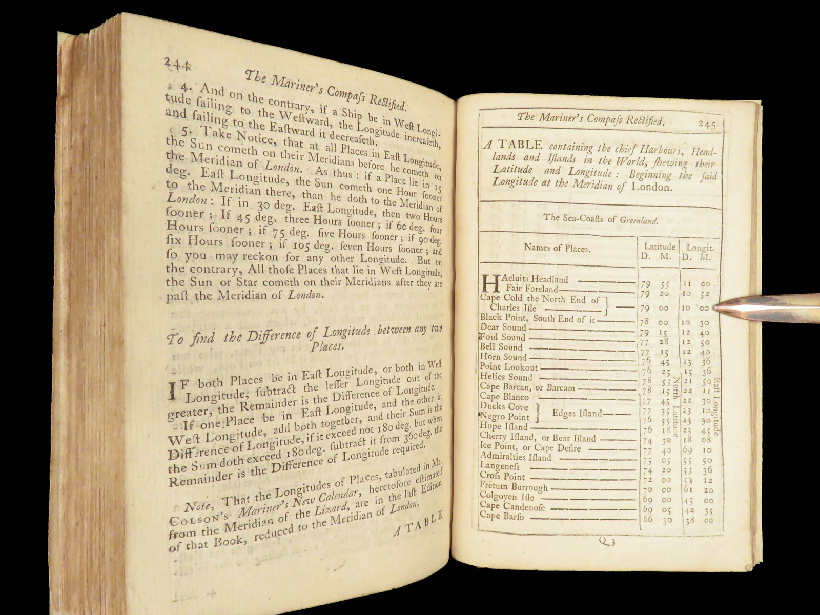
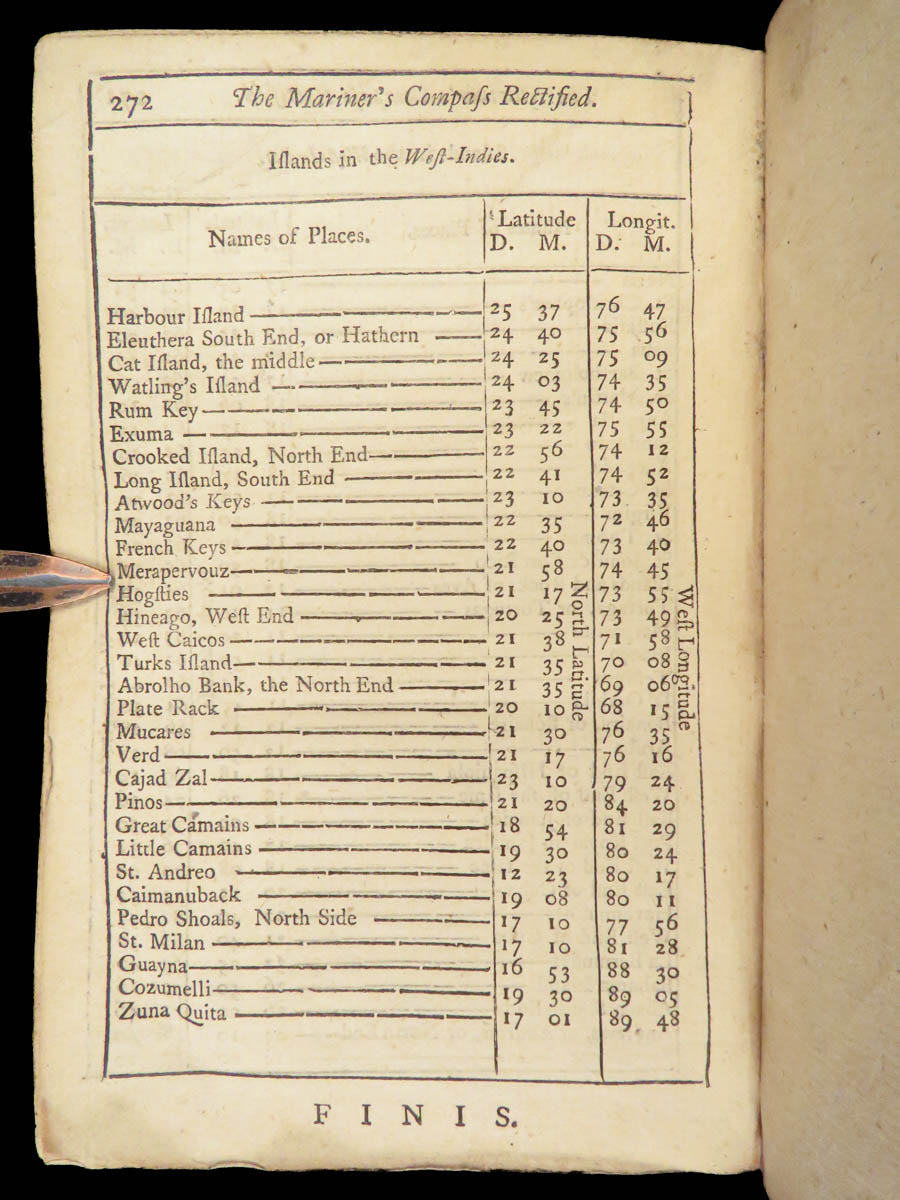
This 1763 edition of The Mariner’s Compass Rectified, originally composed by Andrew Wakeley and expanded by William Mountaine, contains essential nautical calculations for navigation by sun and star. Mountaine revised the solar tables to reflect the Gregorian calendar, accounting for observed changes in declination values. The volume brings together directional tables, sunrise and sunset data, and amplitude figures relevant to navigation across latitudes up to 60 degrees. It was printed by London’s primary sea-book publishers at Tower Hill and the instructional and practical methods used by mariners in mid-18th century Britain.
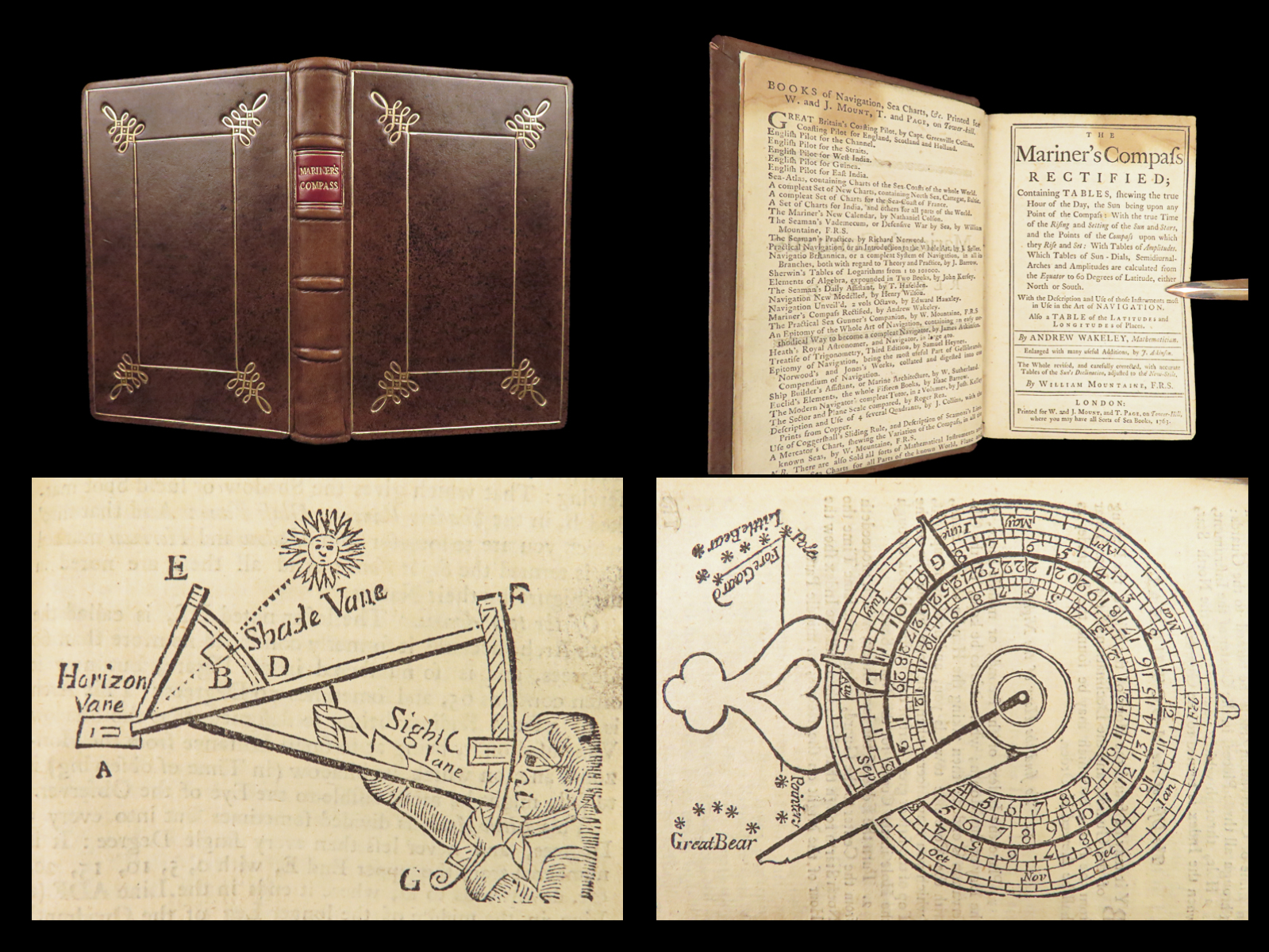
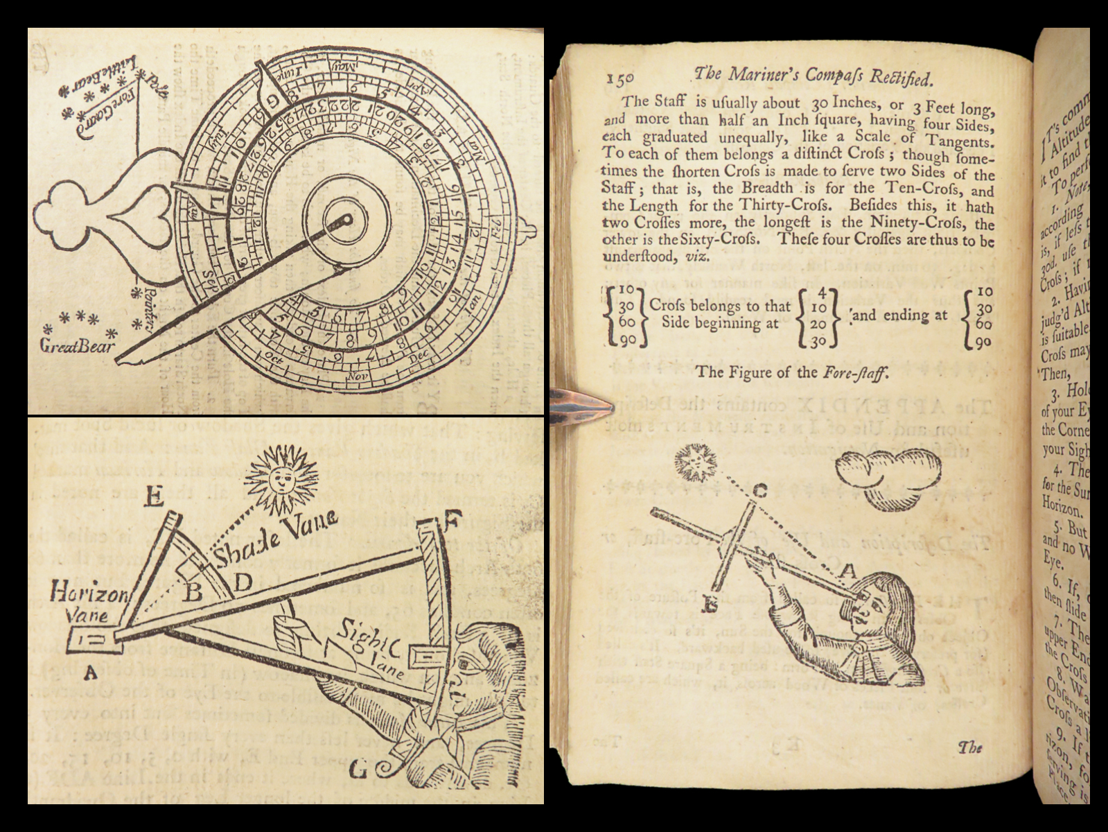
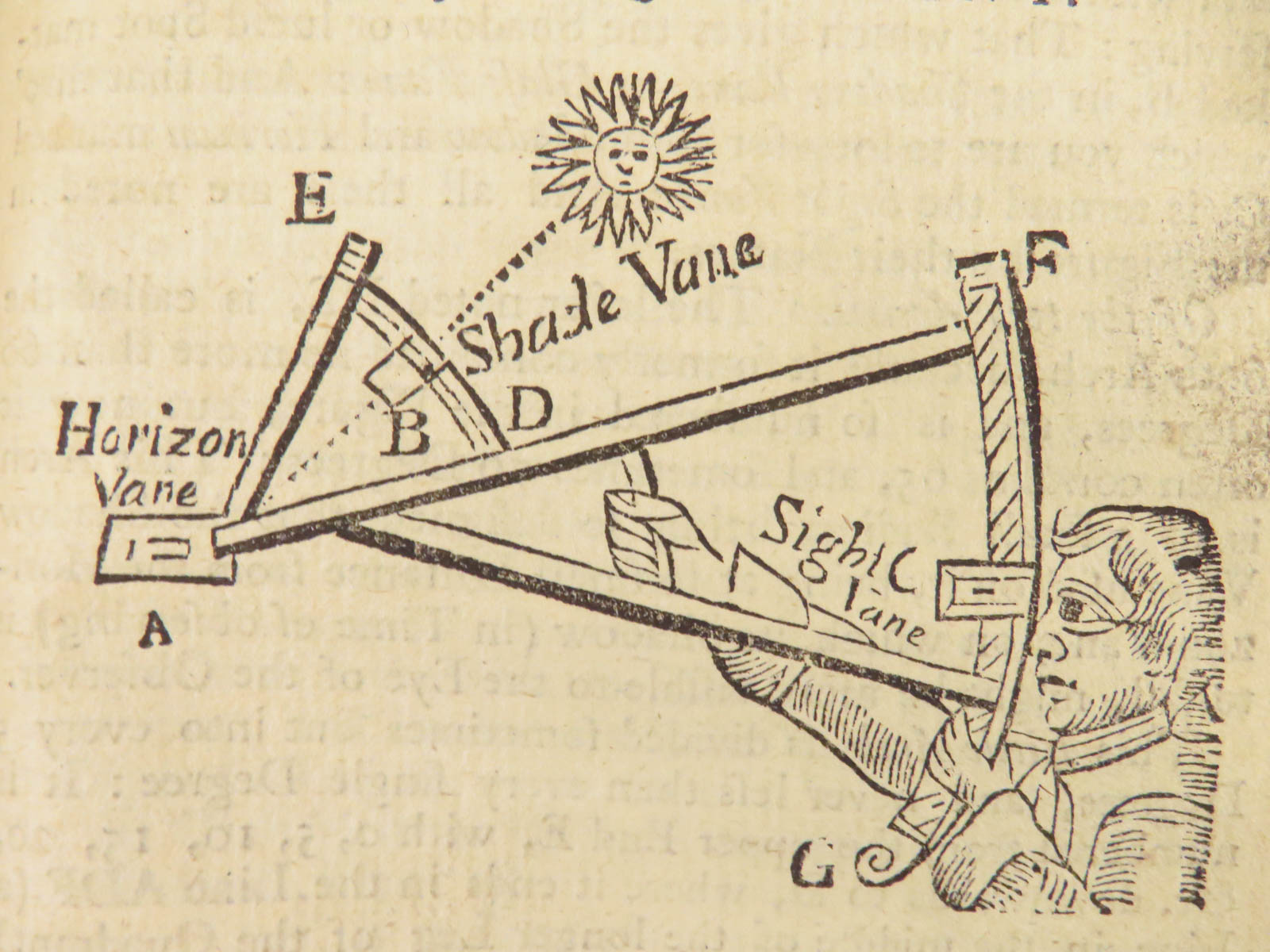
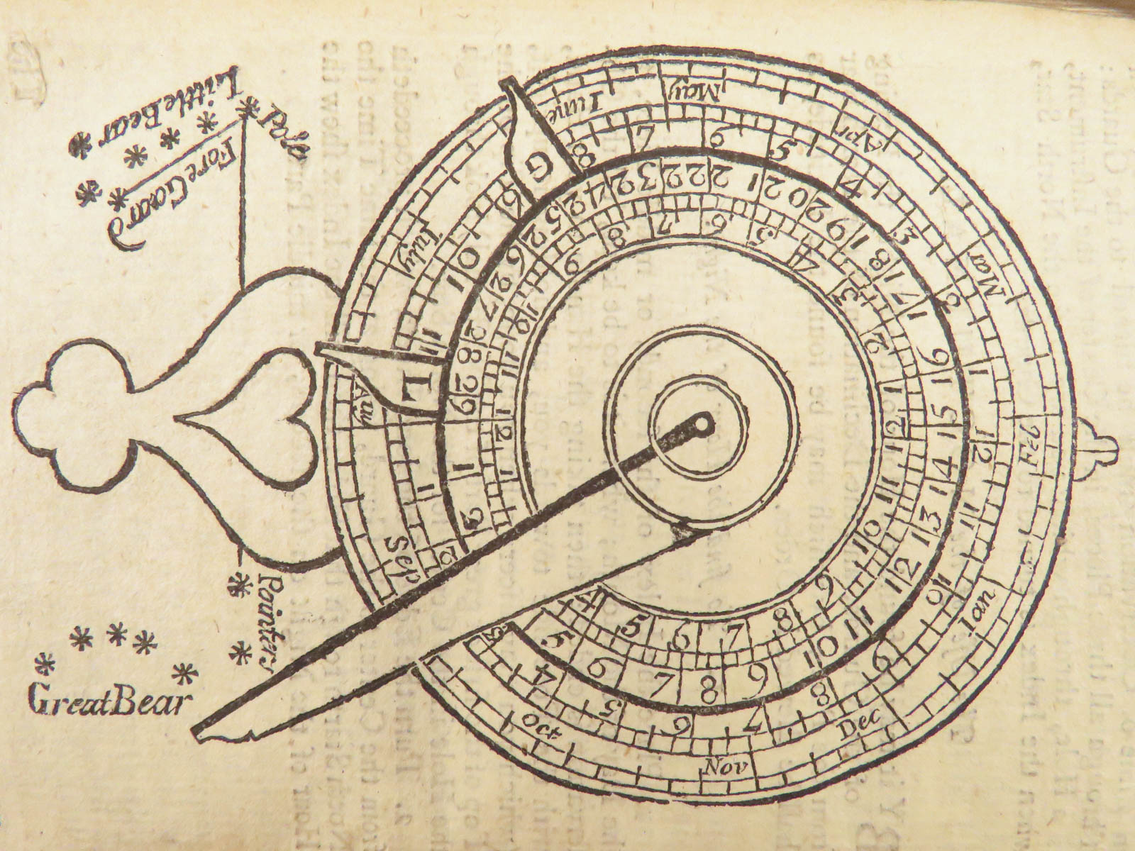
Included in this volume are four engraved illustrations: a Compass Rose (page 95) diagramming cardinal directions and their subdivisions; a Fore-staff (page 150) used to measure solar altitude; a Quadrant (page 159) attributed to Davis for calculating meridional height; and a Nocturnal (page 170), designed to determine nighttime hours using star positions. The detailed trigonometric and astronomical tables along with these visual aids were intended to be directly referenced during training or voyage.
Bibliographic Details
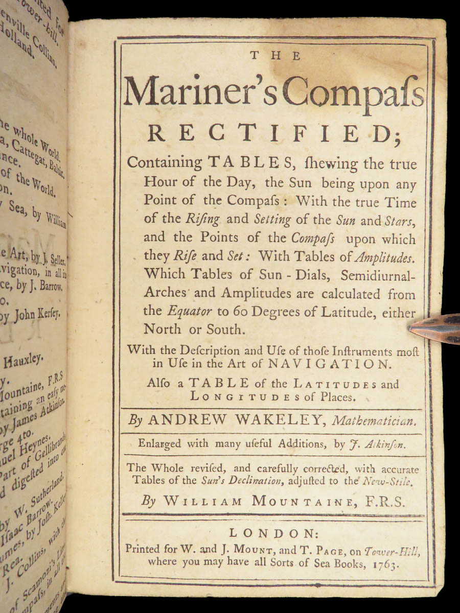
- Title: The Mariner’s Compass Rectified; Containing Tables, shewing the true Hour of the Day, the Sun being upon any Point of the Compass. With the true Time of the Rising and Setting of the Sun and Stars, and the Points of the Compass upon which they Rise and Set. With Tables of Amplitudes, Sun-Dials, Semidiurnal Arches, and a Table of the Latitudes and Longitudes of Places.
- Author(s): Andrew Wakeley
- Contributor(s): J. Atkinson; William Mountaine
- Publisher: W. and J. Mount, and T. Page, Tower-Hill, London
- Edition: Revised and Corrected Edition, 1763
- Format: Duodecimo (12mo), single volume
- Binding: Full calf, paneled in gilt, raised bands
- Size: ~ 6.75 in × 4.75 in (17 cm × 11.5 cm)
- Collation: 272 pp.
- Illustrations: Four engraved diagrams (Compass Rose, Fore-staff, Quadrant, Nocturnal); hundreds of numerical and solar tables
- Contents Include:
- Exact solar declination tables adjusted to the New Style (Gregorian)
- Amplitude and time tables based on solar motion and compass points
- Rising and setting tables for sun and stars across latitudes
- Instrumental diagrams with usage instructions for the quadrant, fore-staff, and nocturnal
- Latitude and longitude listings for key locations
- Reference(s): This edition not in ESTC
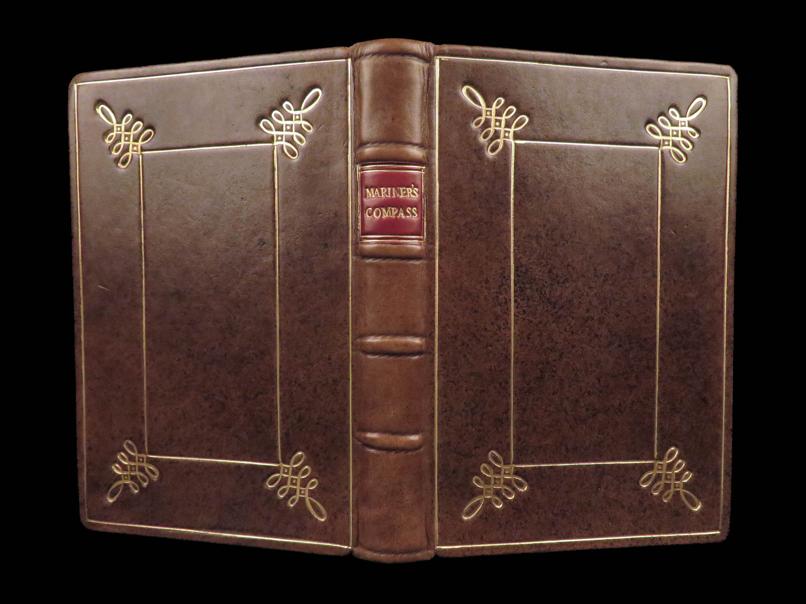
Condition:
Bound in modern full speckled calf, with gilt-paneled covers and decorative corner flourishes. The spine is divided by raised bands and title label in gilt. Internally, textblock lightly toned, but complete. This copy has been carefully conserved and rebound to professional standards.
Why Collect This?
- Access to historic 18th-century solar and stellar tables.
- Fascinating depiction of engraved instrument diagrams not always present in earlier issues
- Finely rebound in decorative full calf using period-appropriate materials
- Issued by Tower Hill publishers known for supplying British naval and merchant ships
- Appealing to collectors of early maritime navigation, practical astronomy, and instrument history
Categories
European History
Maps
Medicine & Science
Voyages & Exploration & Maps
Authors
Andrew Wakeley William Mountaine J. Atkinson
Printing Date
18th Century
Language
English
Binding
Leather
Book Condition
Very Good
Collation
Complete
Other Books you might like...
-
Sale!
 Add to cart
1794 History of INDIA Asia MAPS Egypt Hindustan Robertson Scottish Enlightenment
Original price was: $550.00.$450.00Current price is: $450.00. -
Sale!
 Add to cart
1854 1ed Journey to Central Africa EGYPT Sudan Ethiopia MAP Nile Bayard Taylor
Original price was: $499.00.$450.00Current price is: $450.00. -
Sale!
 Add to cart
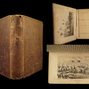
1862 Slave Trade Africa & American Flag Foote Voyages Civil War Slavery Plates
Original price was: $499.00.$450.00Current price is: $450.00. -
Sale!
 Add to cart
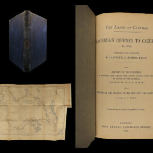
1873 1ed Richard Burton Lands Cazembe Africa Exploration MAP Royal Geographical
Original price was: $499.00.$399.00Current price is: $399.00.