1807 – American Practical Navigator | United States Sailing Instruction | Maps

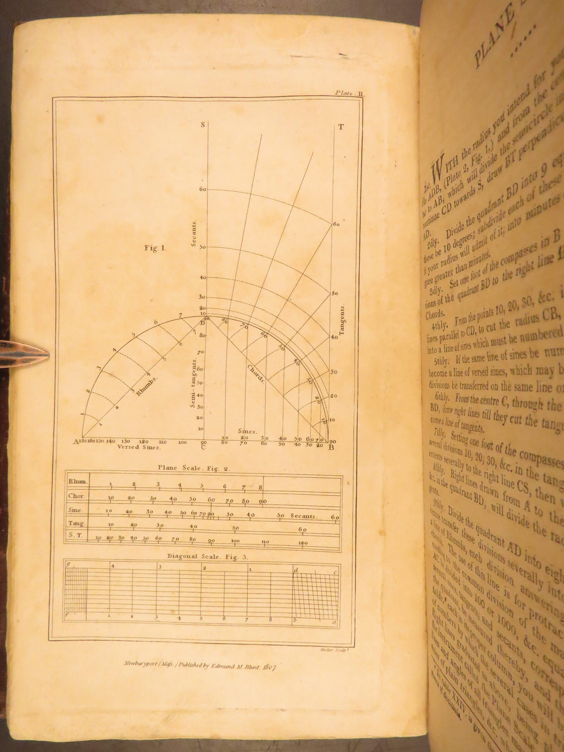
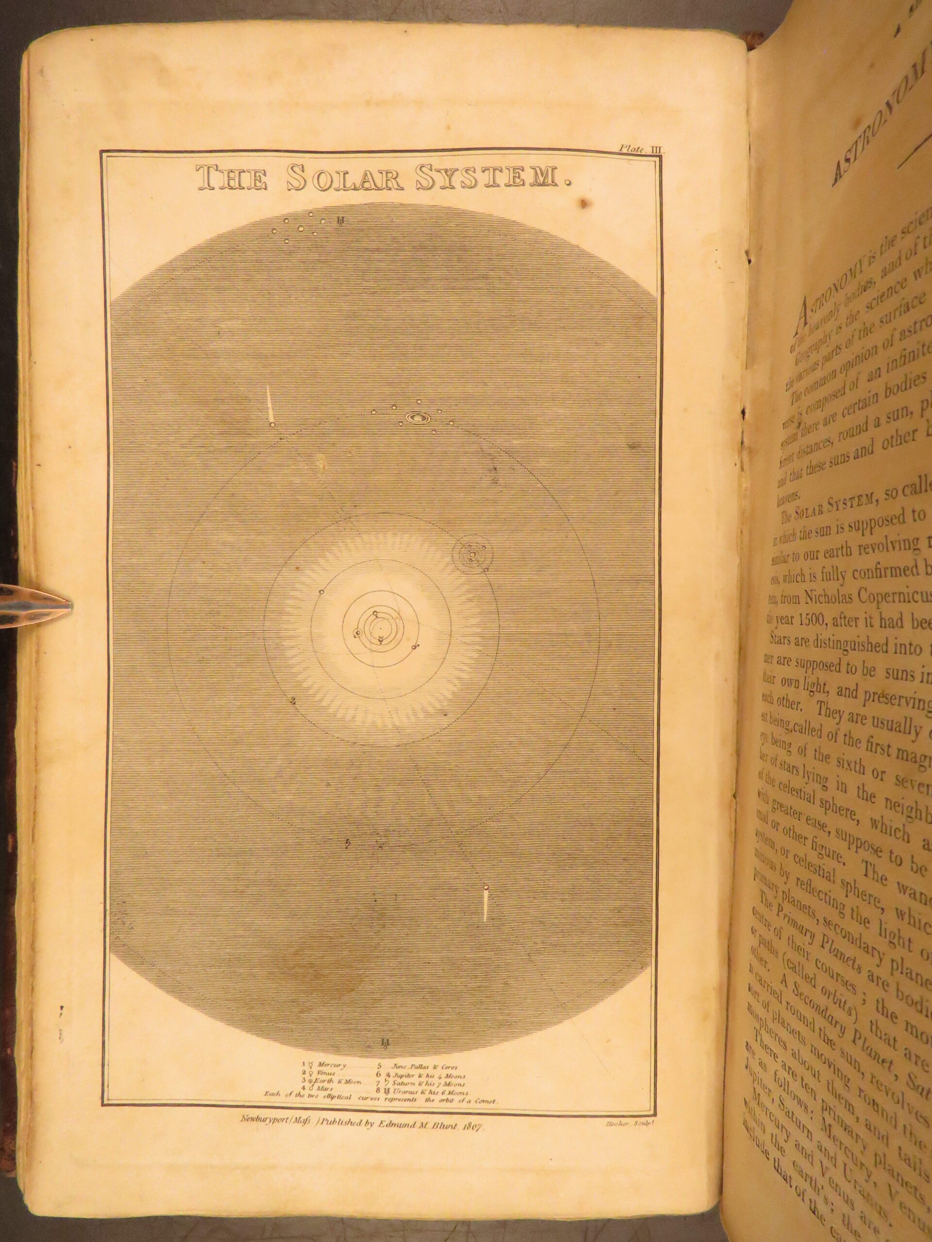
Bowditch’s 1807 printing of The New American Practical Navigator redefined American maritime standards, featuring navigational tables, maps, and terminology with 11 engravings.
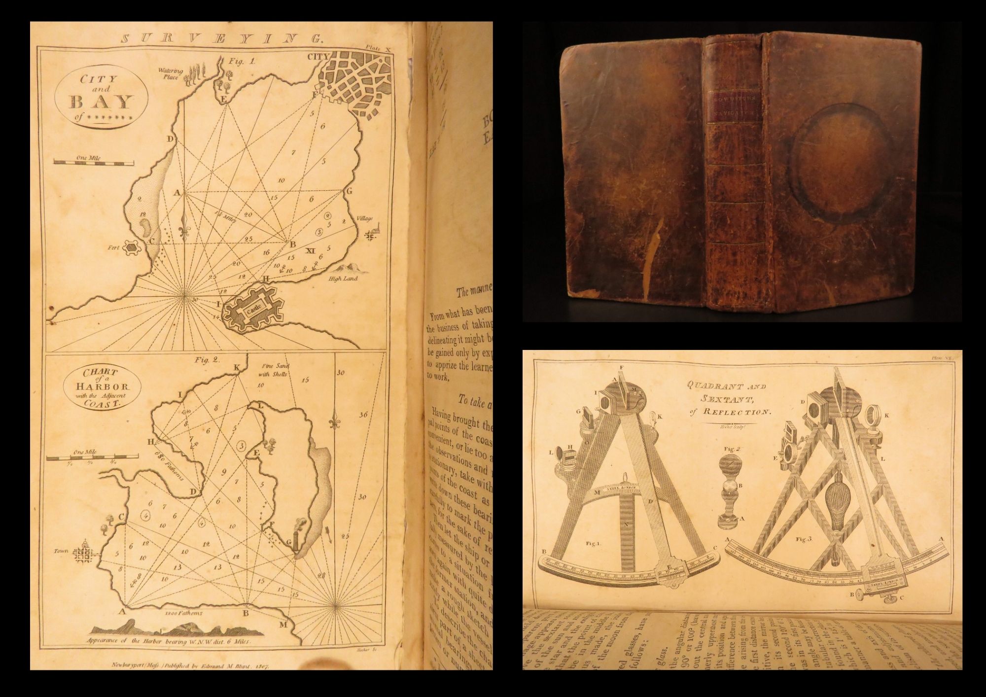
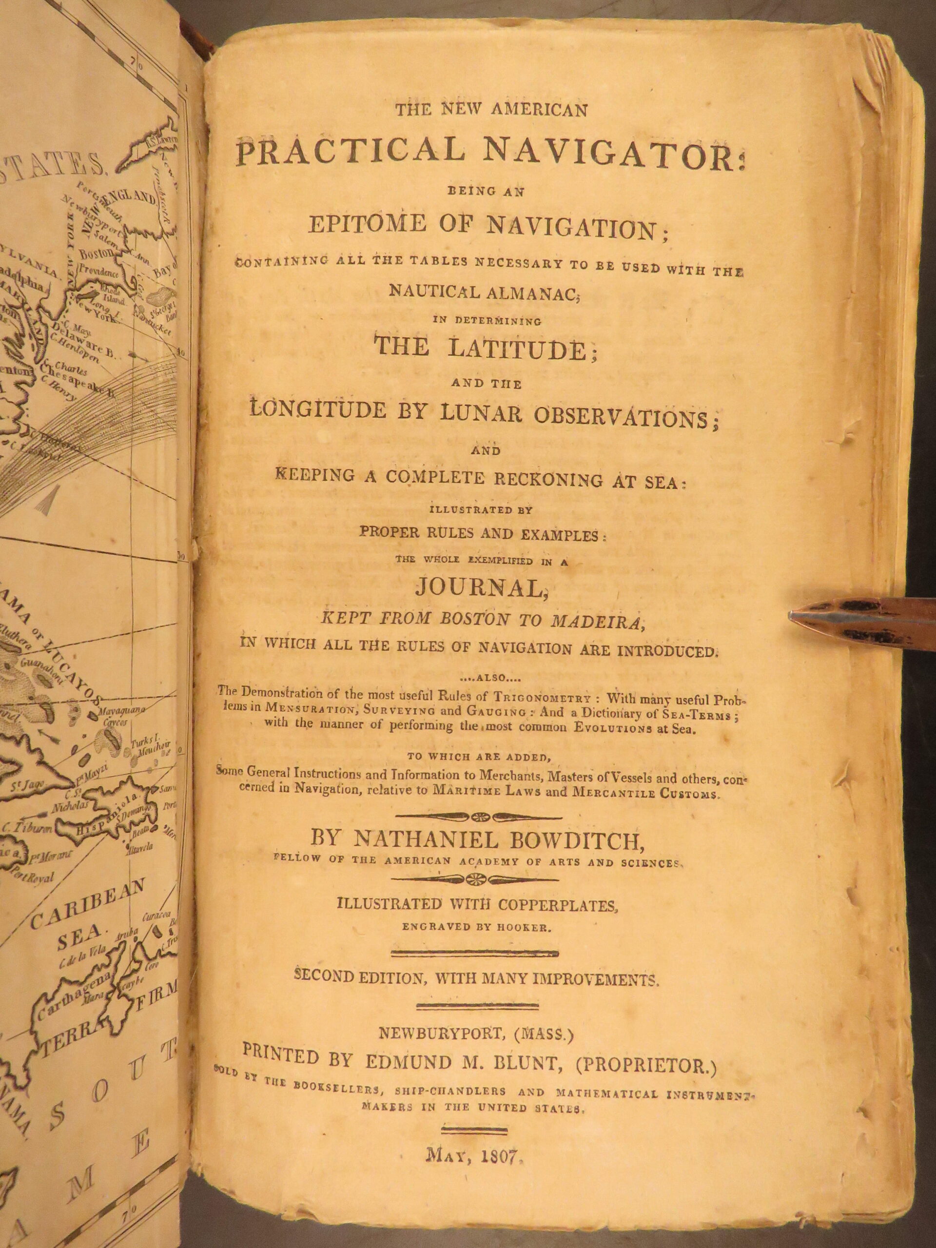
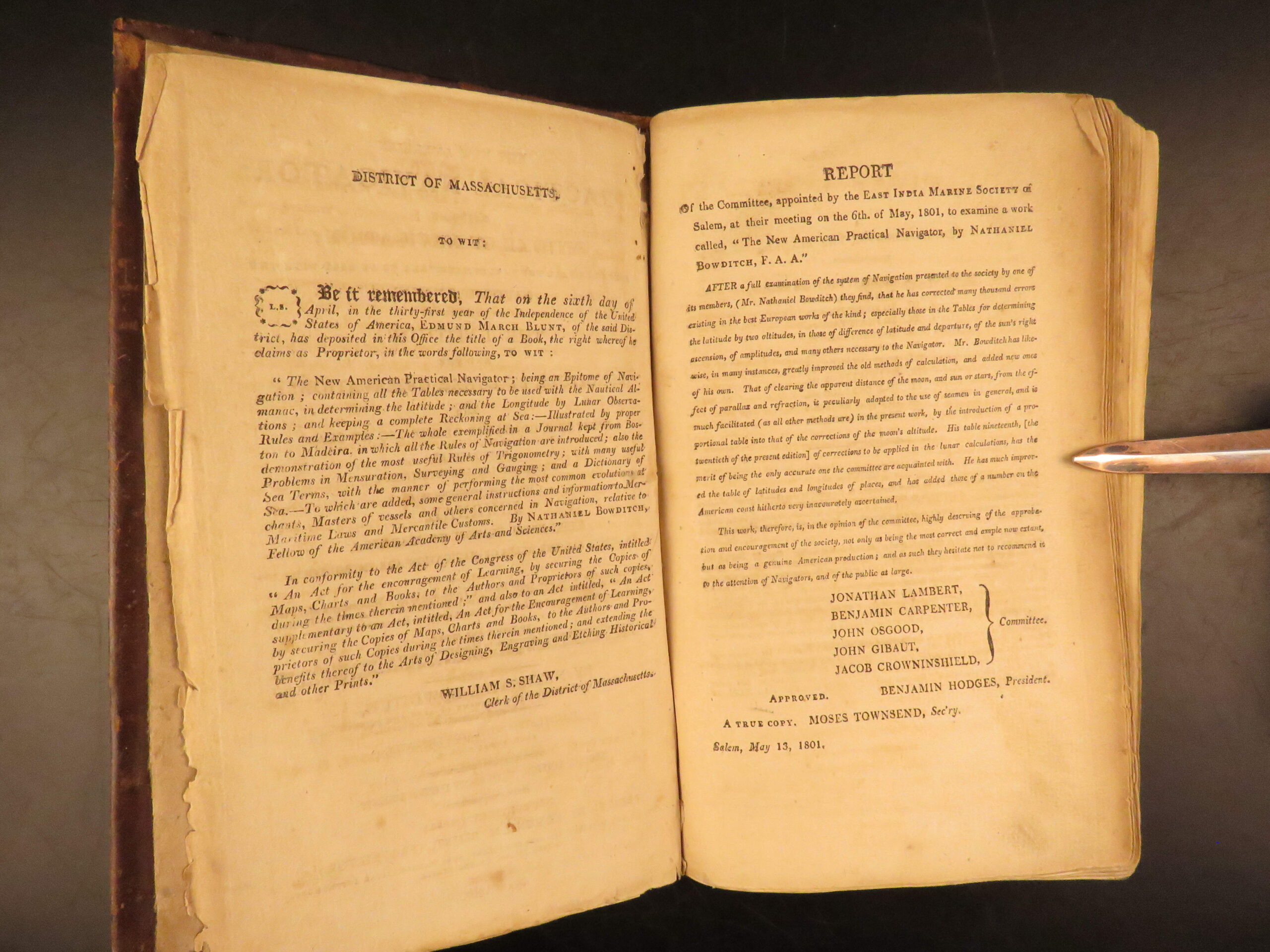
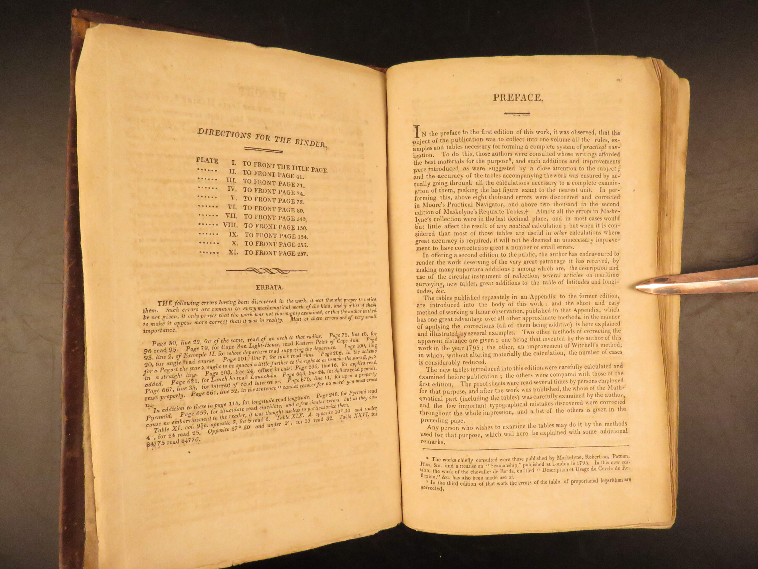
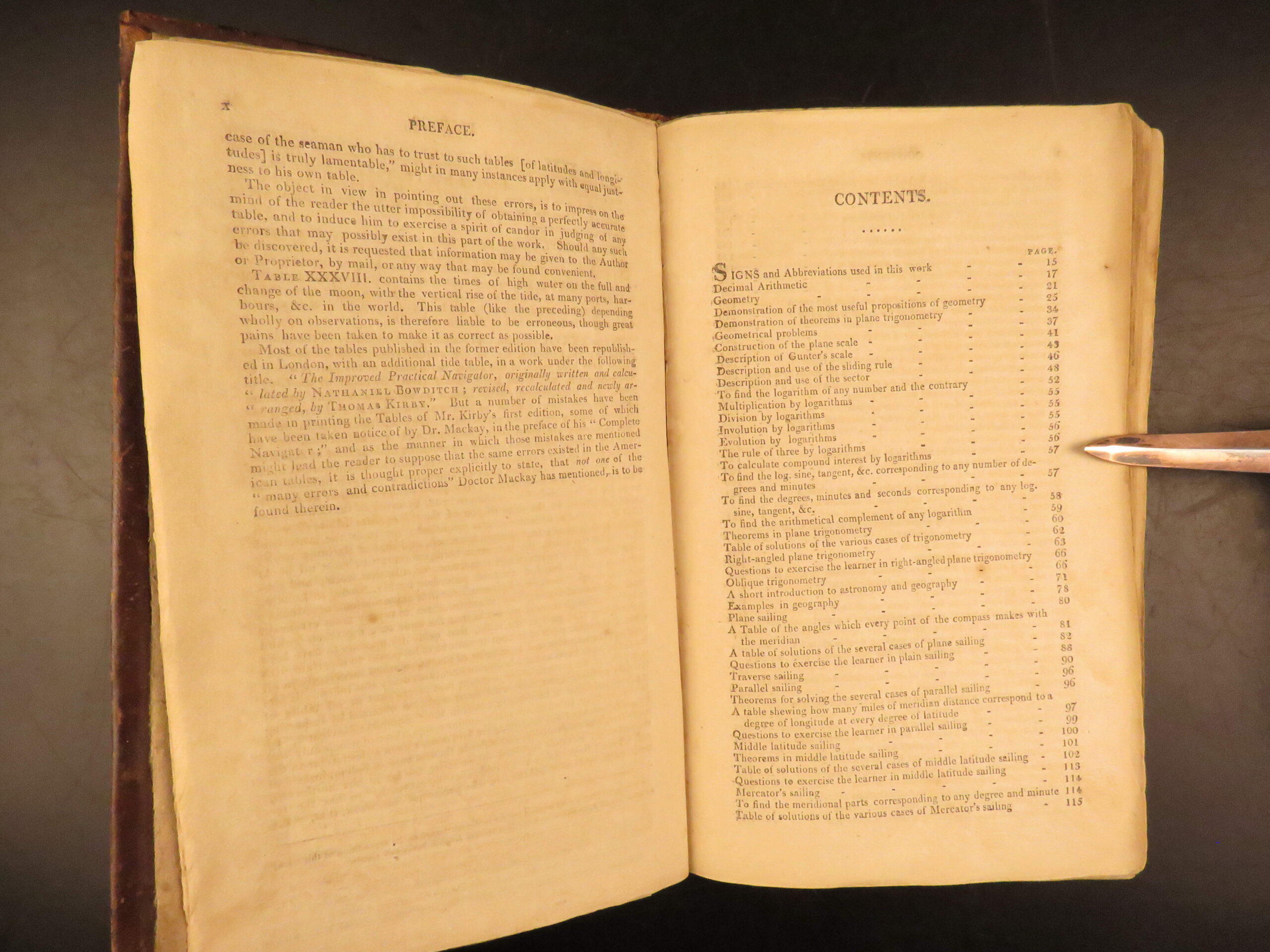
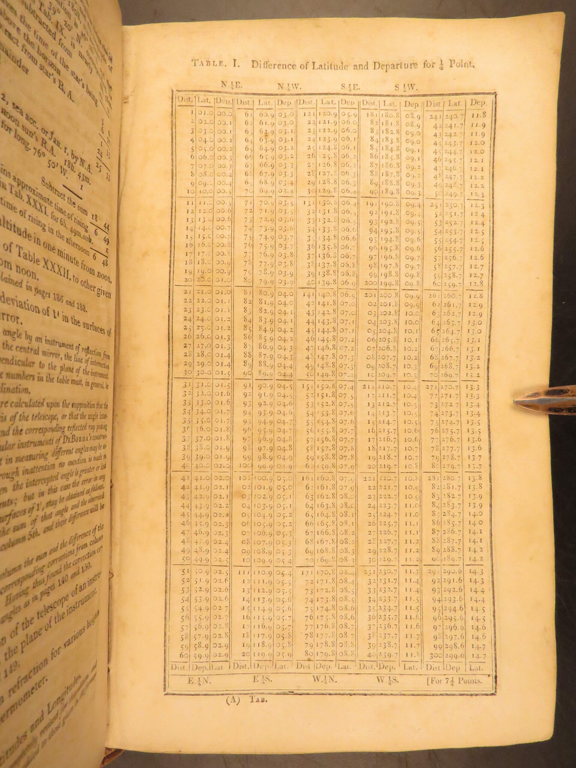
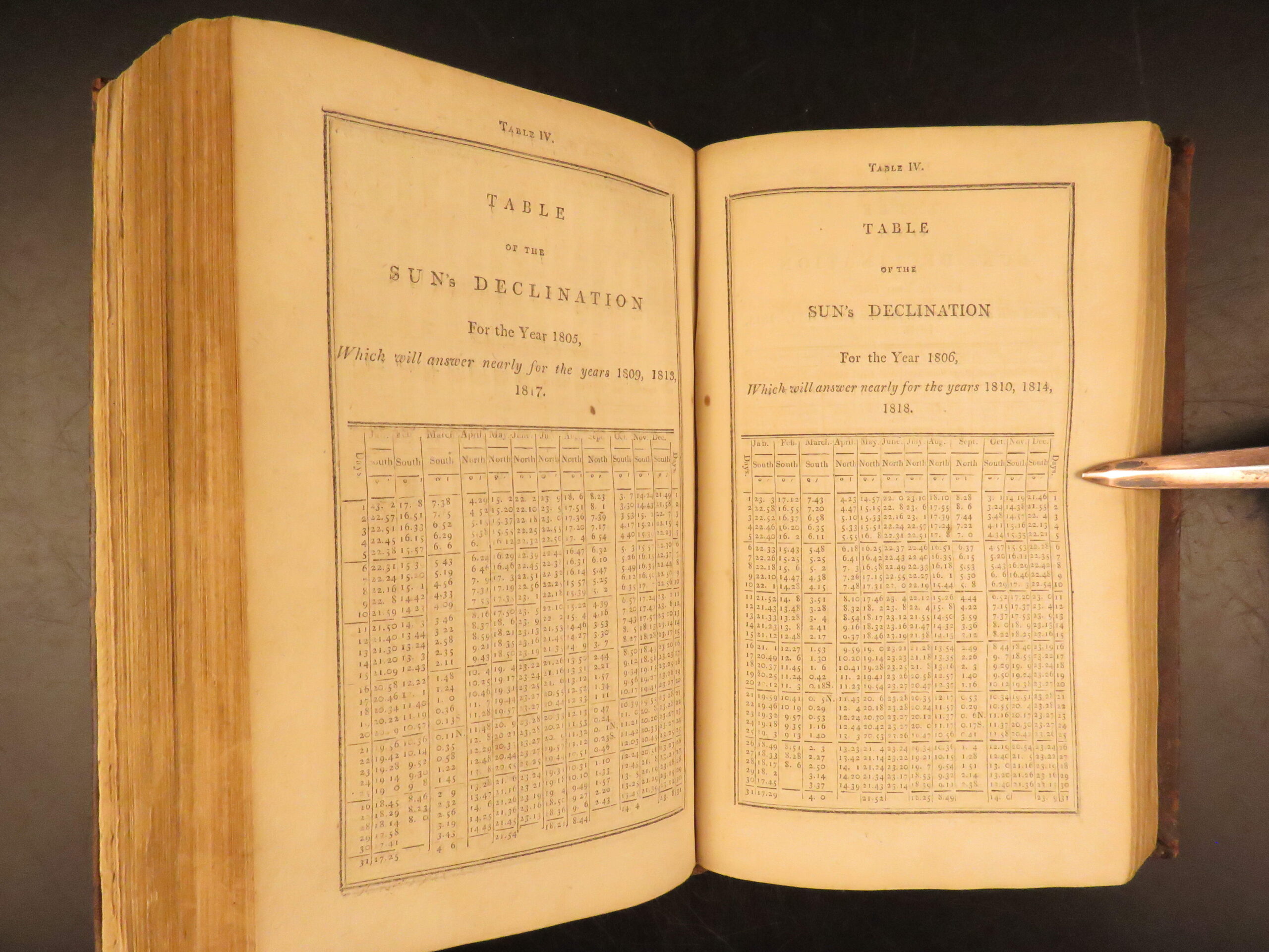
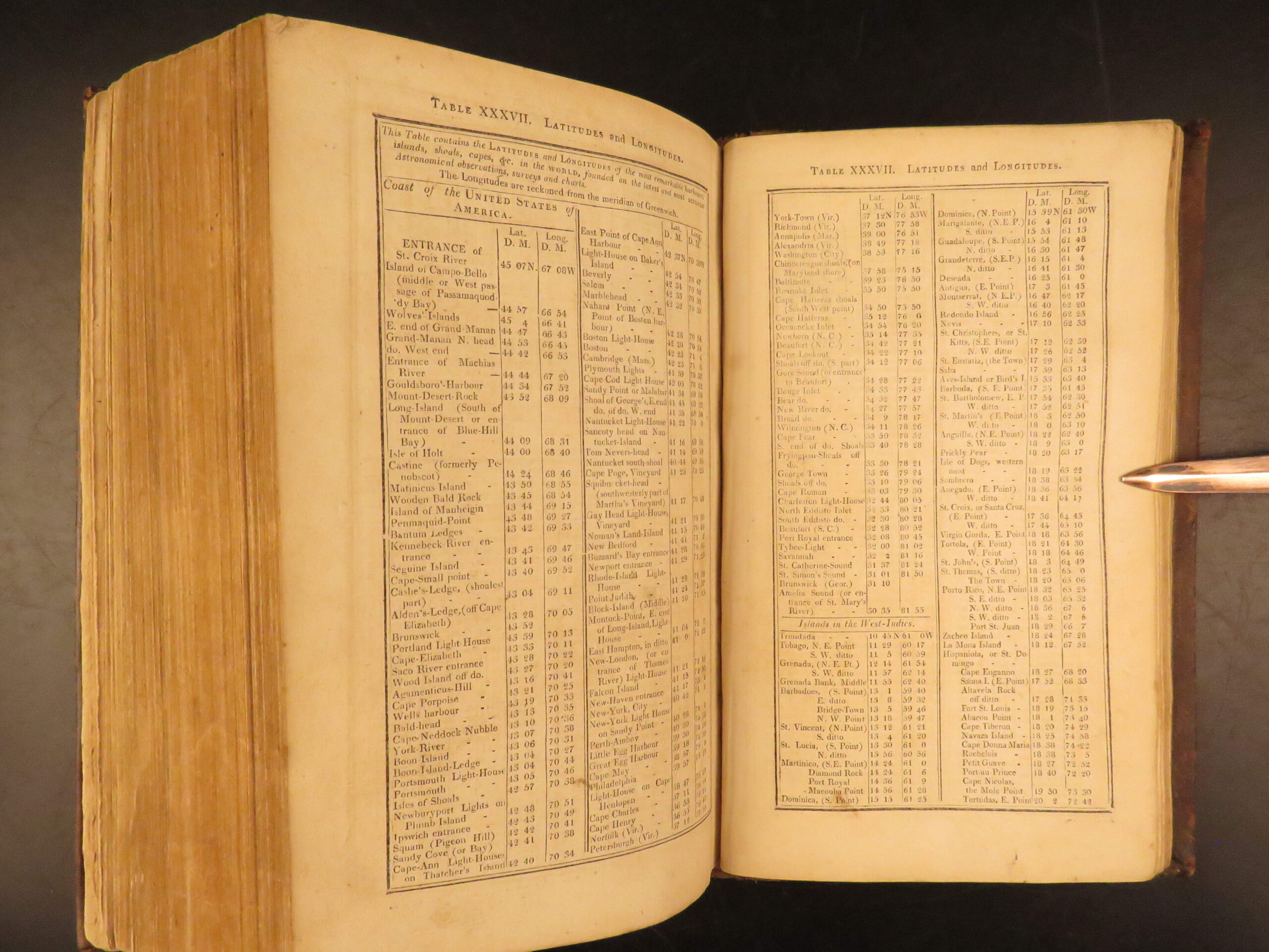
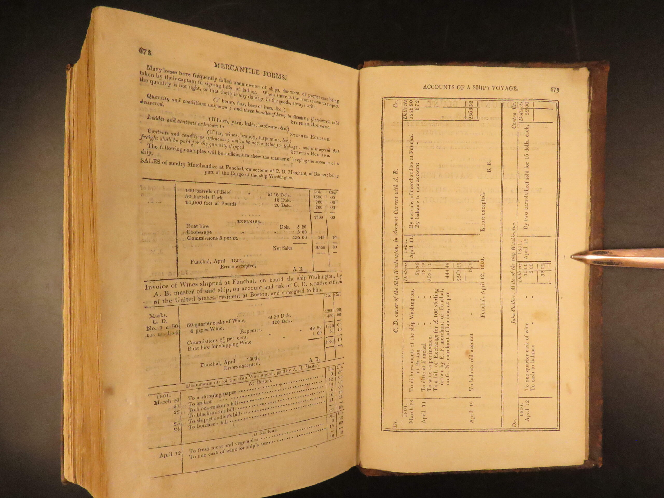
Nathaniel Bowditch shipped out in 1795 on the first of five voyages to the East Indies. He spent his time pouring over the standard navigational tables prepared by John Hamilton Moore of England. After finding over 8,000 errors in Morris’s work on navigation he produced his own title on the subject New American Practical Navigator. Howes calls this the “First accurate navigator’s guide.” This volume also includes information on navigational law, measurement, and terminology serving as an encyclopedia of navigation becoming a handbook on oceanography and meteorology and containing useful tables and a maritime glossary.
“The first complete epitome of practical navigation for the common man” -Grolier American.
Bibliographic Details
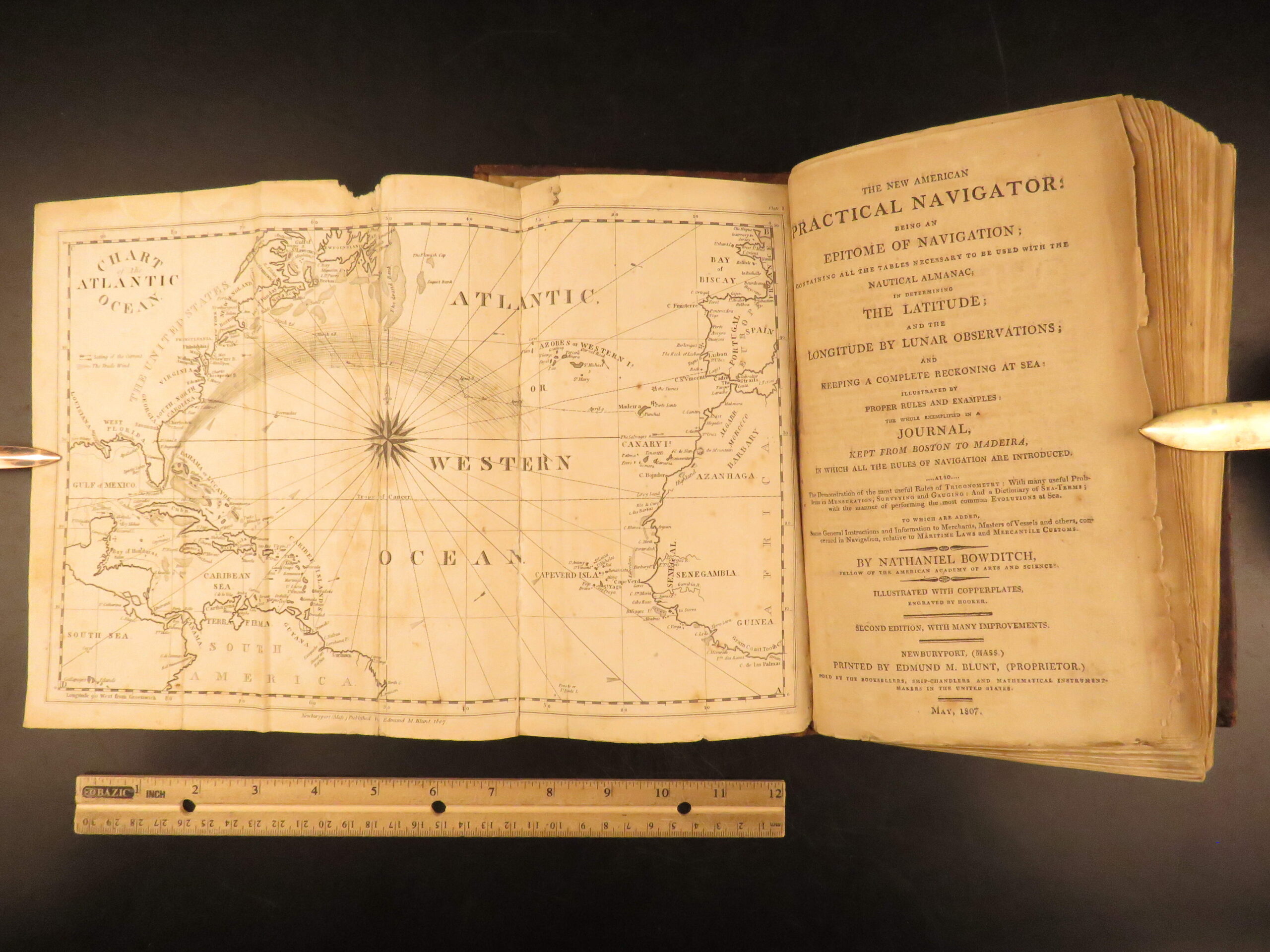
- Title: The New American Practical Navigator: Being an Epitome of Navigation; Containing All the Tables Necessary to be Used with the Nautical Almanac, in Determining the Latitude, and the Longitude by Lunar Observations
- Author(s): Nathaniel Bowditch
- Publisher: Newburyport: Printed by Edmund M. Blunt
- Edition: 2nd Edition. 1807.
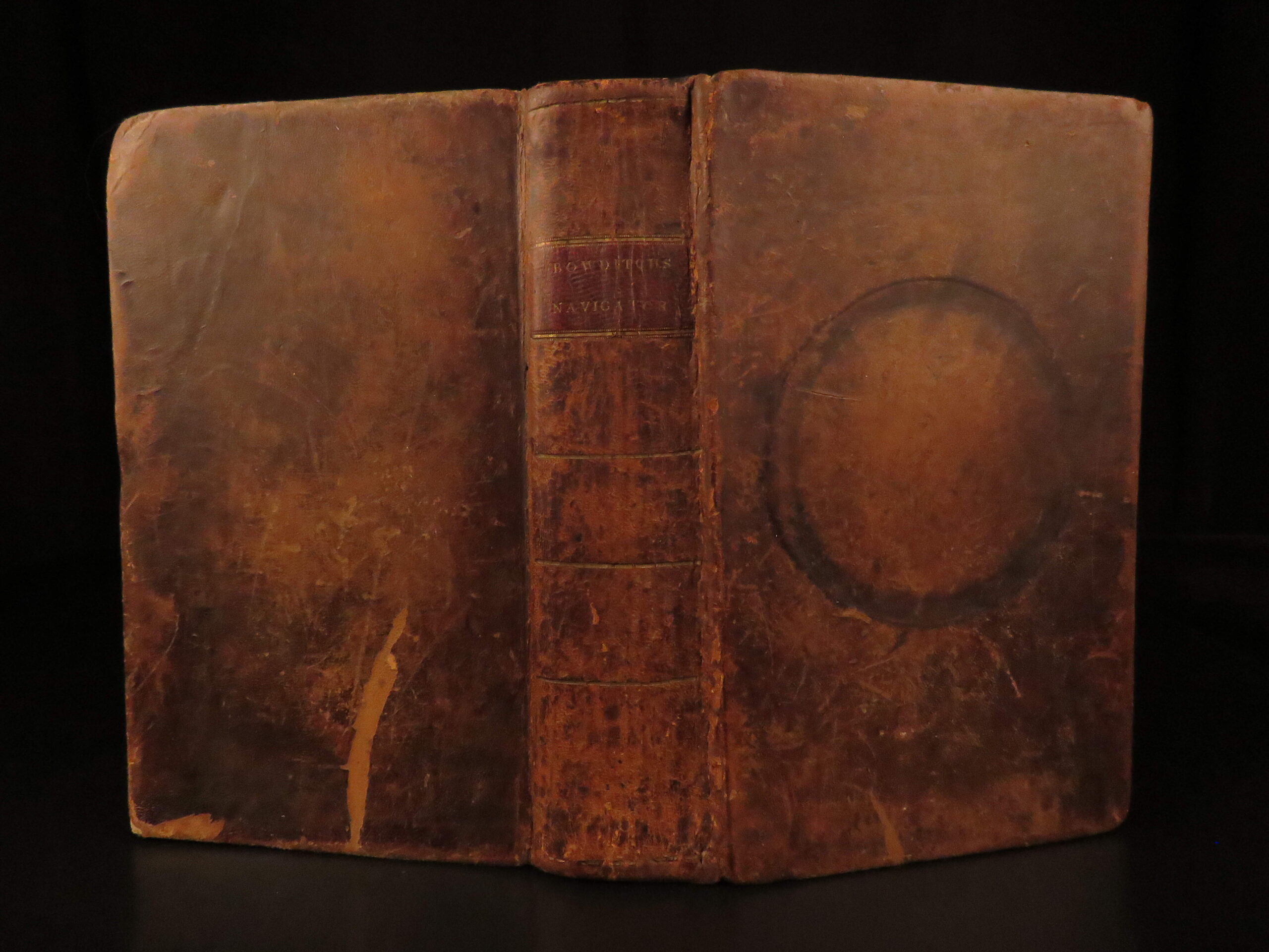
- Binding: Full leather
- Format: (8vo), single volume
- Size: 9.25 in × 5.5 in
- Collation: [i–v], vi–xiv, 15–679 pp
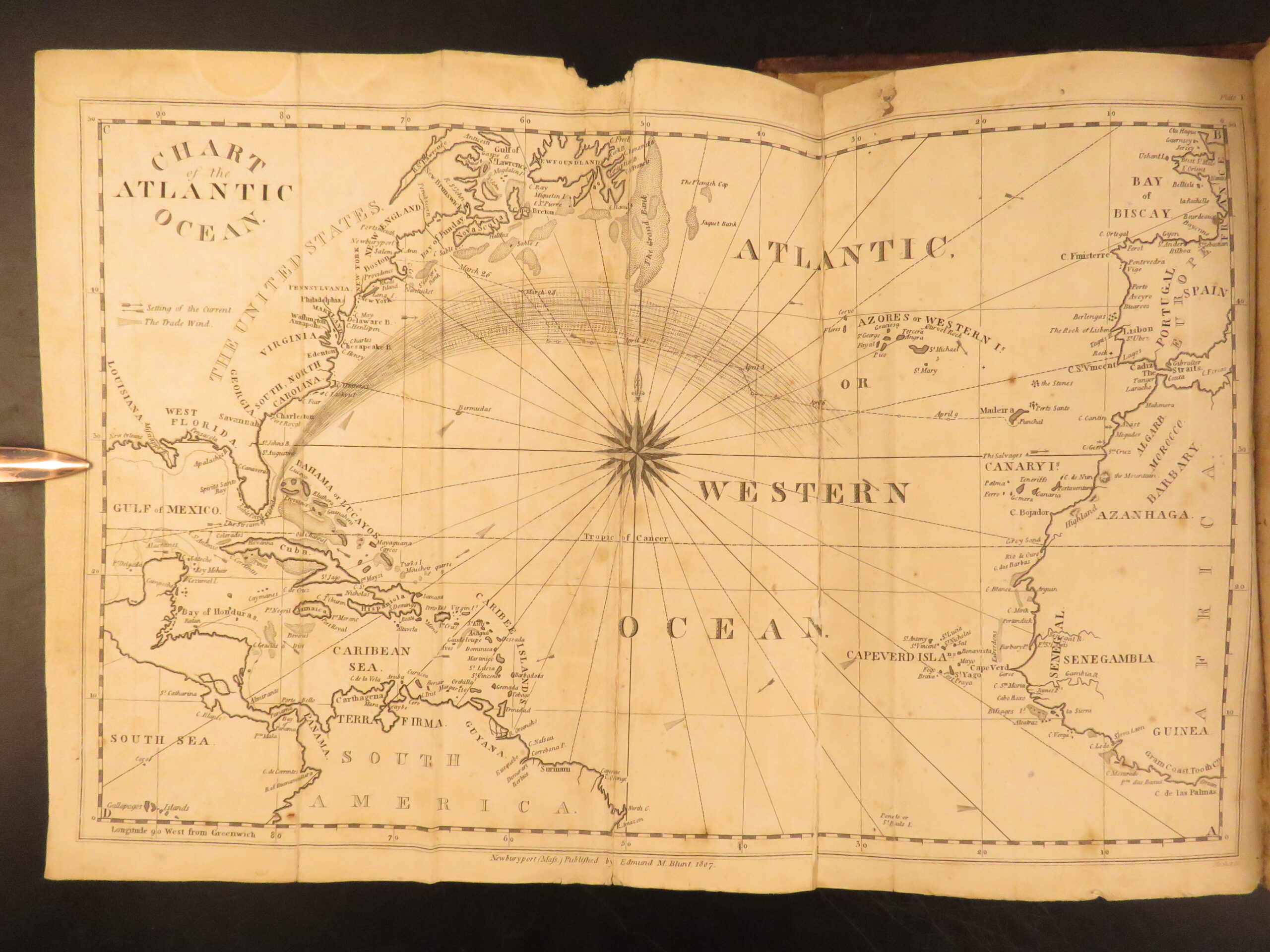
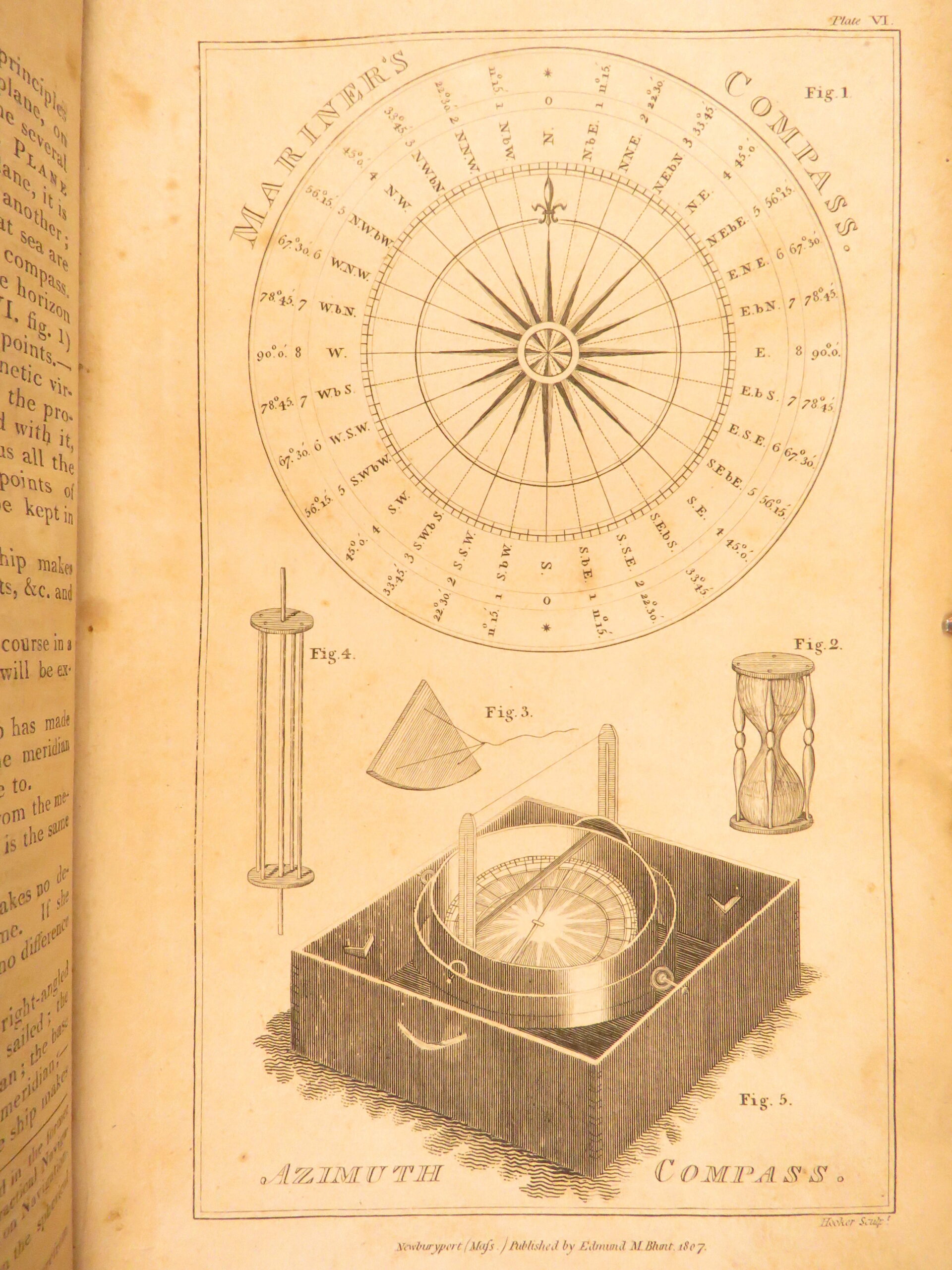
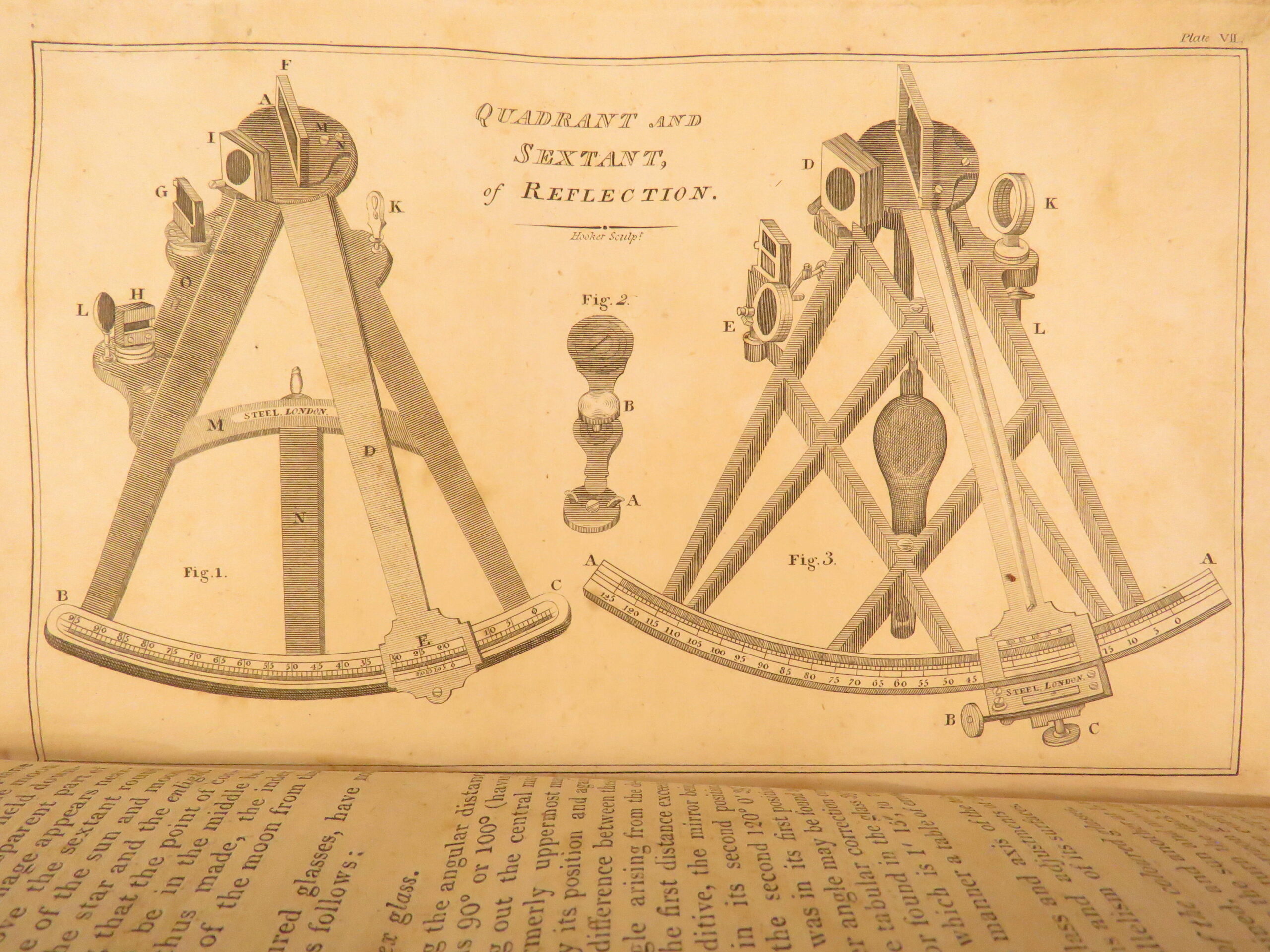
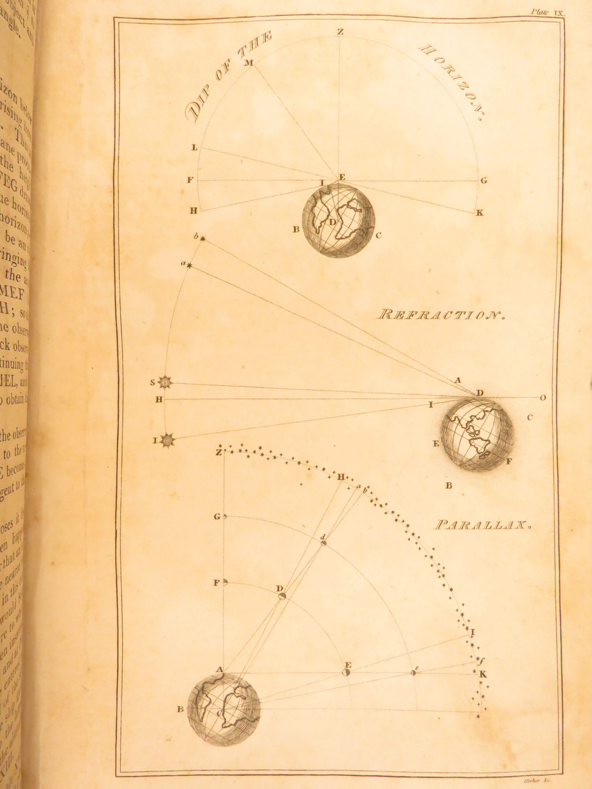
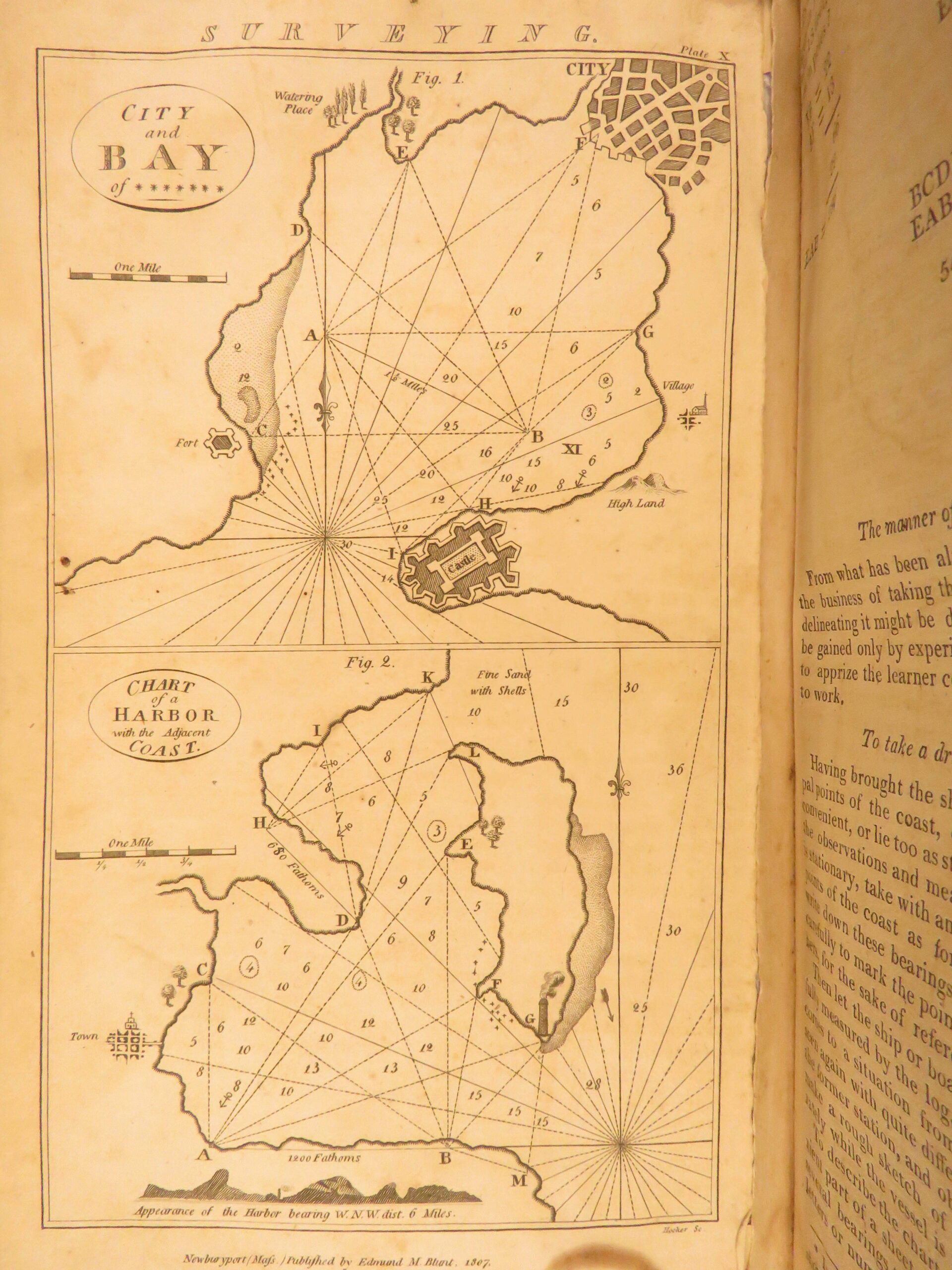
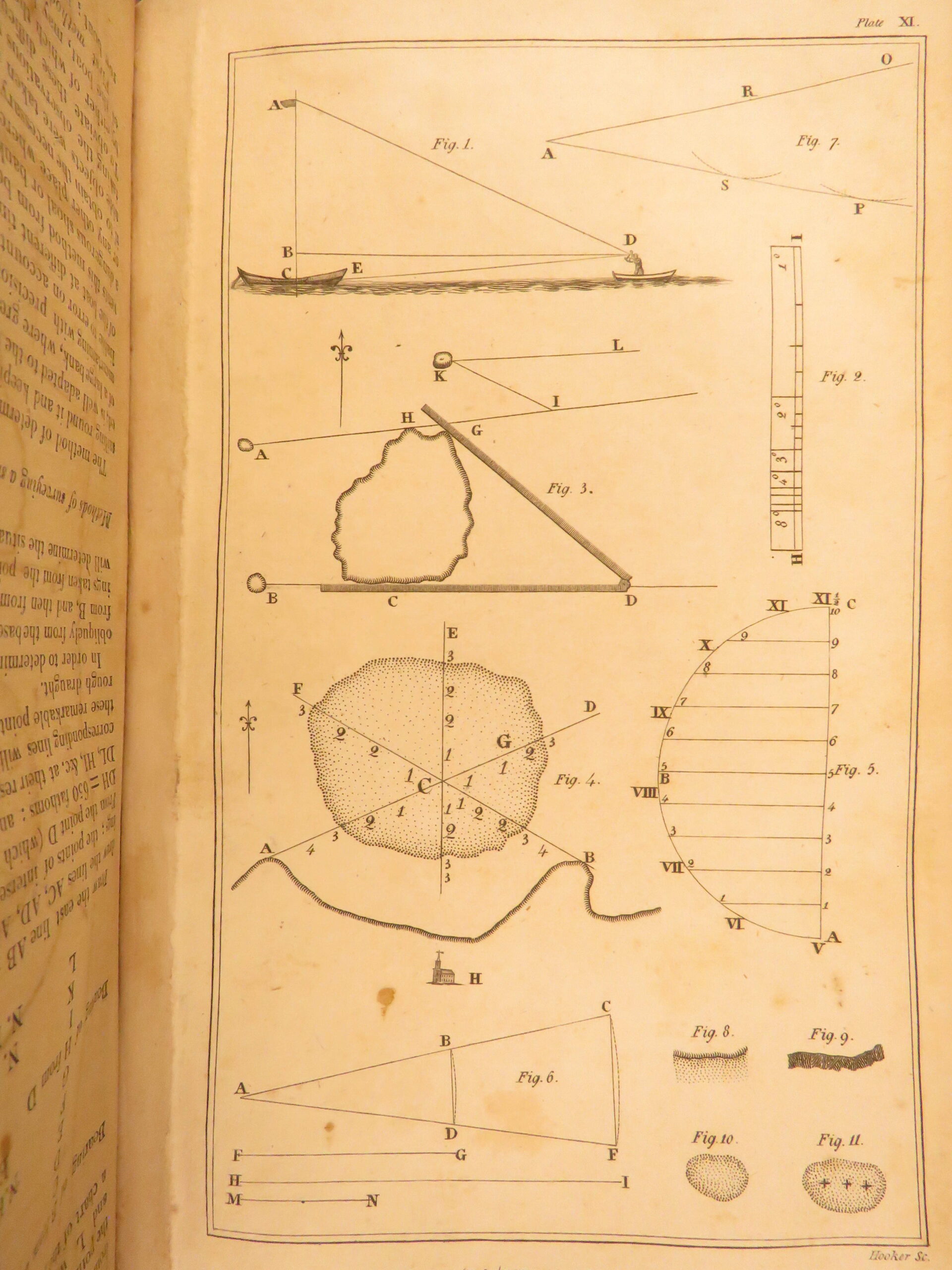
- Illustrations: 11 engravings, including 2 maps
- Contents Include:
- Lunar distance calculations
- Tables for determining latitude and longitude
- Nautical and legal definitions
- Glossary and navigation law references
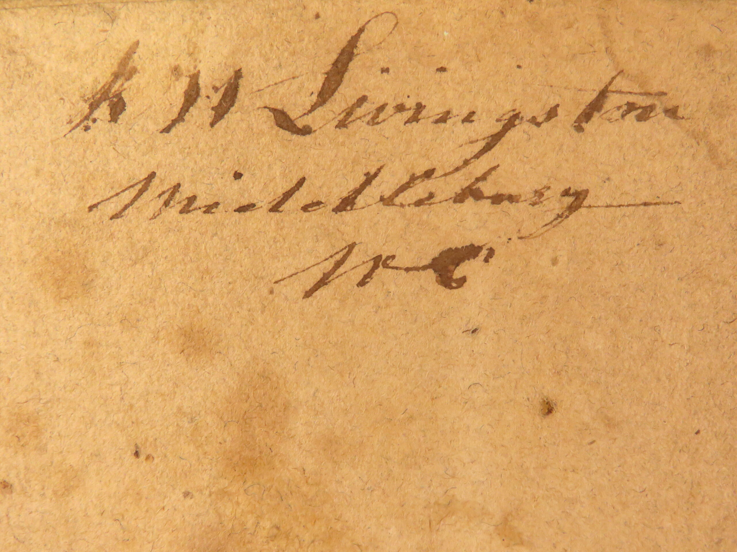
- Provenance: Handwritten signature of [K.] W. Livingston, Middleburg, NC
- Reference(s): Howes B 657
Condition:
Very Good. Bound in full leather with visible water ring to the front cover. Binding tight and text block secure. Moderate age wear to corners and edges. Internally clean with all engravings and maps present.
Why Collect This?
- Early edition foundational to American navigational practice
- Engraved plates including two navigational maps
- Important for collectors of early American science, oceanography, and naval history
Item Number: #29969
Categories
Americana, American History
Law & Government
Mathematics & Physics
Voyages & Exploration & Maps
Authors
Nathaniel Bowditch
Printing Date
19th Century
Language
English
Binding
Leather
Book Condition
Very Good
Collation
Complete
Other Books you might like...
-
 Add to cart
1680 Netherlands History English William Temple Government War France Amsterdam
$499.00 -
Sale!
 Add to cart
1819 Memoires of Duke of Sully France Henry IV Huguenot Utopian Europe 5v SET
Original price was: $550.00.$499.00Current price is: $499.00. -
Sale!
 Add to cart
1631 Principatibus Italiae Italian Politics Elzevier Italy Laet Segetho Galileo
Original price was: $550.00.$450.00Current price is: $450.00. -
Sale!
 Add to cart
1673 Sanderson Episcopacy LAW Catholic vs Protestant England Wenceslaus Hollar
Original price was: $499.00.$399.00Current price is: $399.00.