Geological Report – George Featherstonhaugh – 1835 | Folding Map, Fossils

First edition of George William Featherstonhaugh’s 1835 geological report surveying Missouri, Arkansas, and Indian Territory with analysis of strata, fossils, coal, iron, and novaculite, including one large folding map.


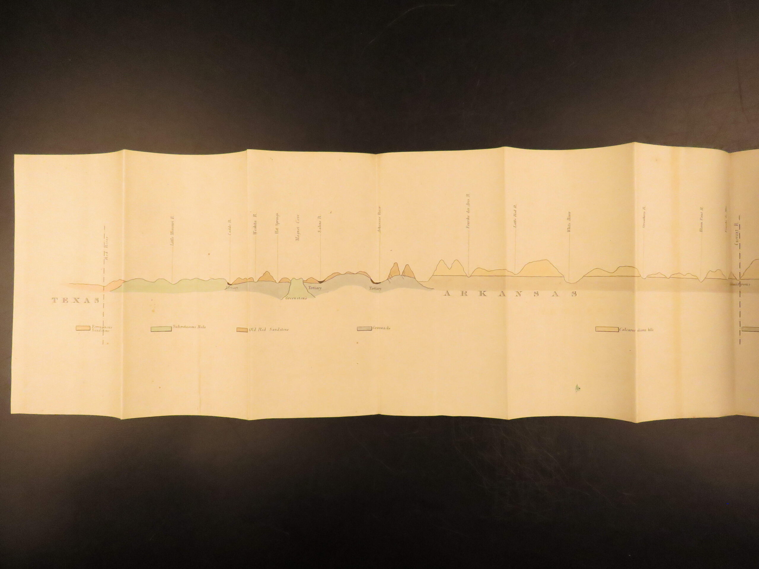
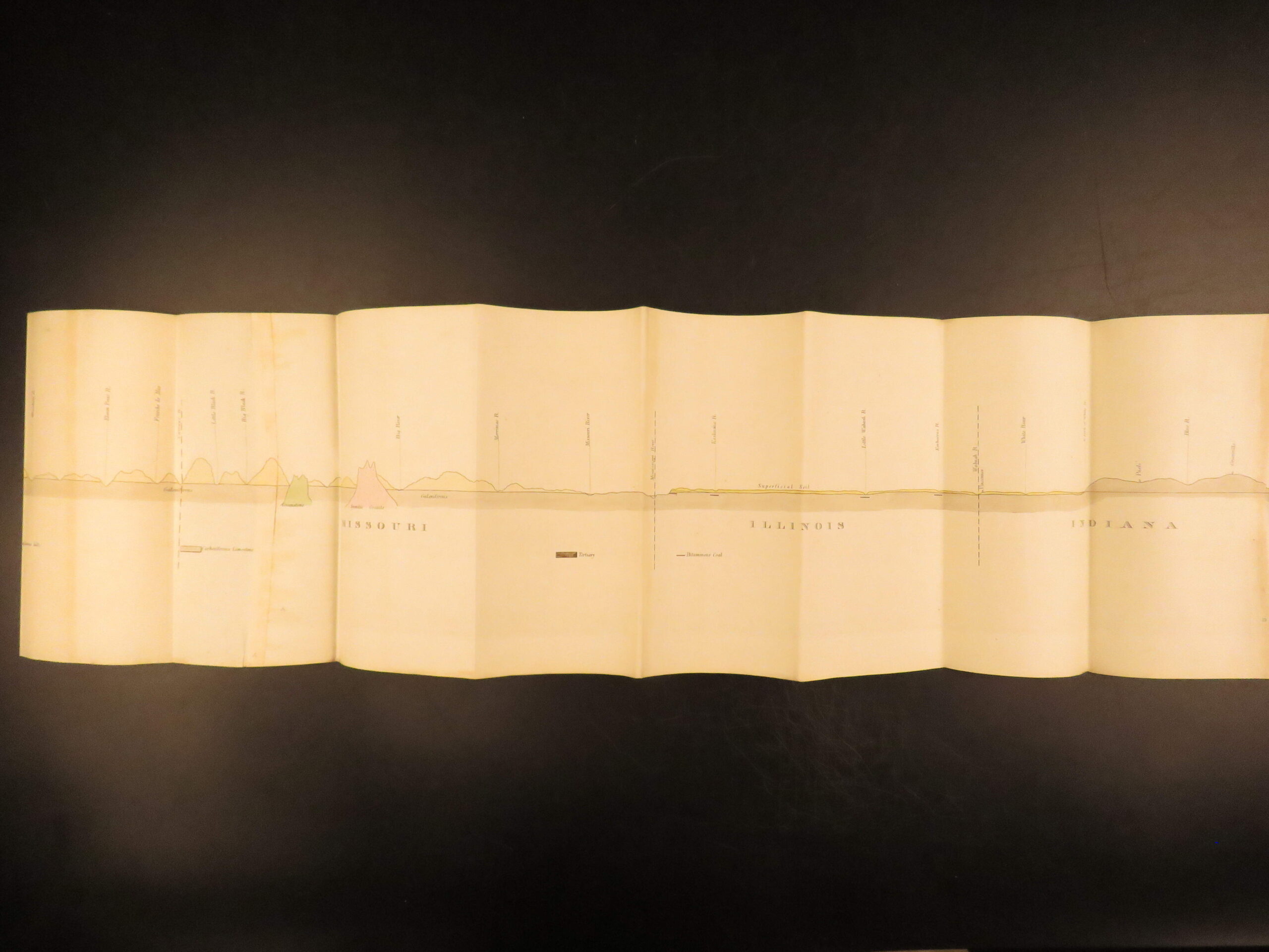
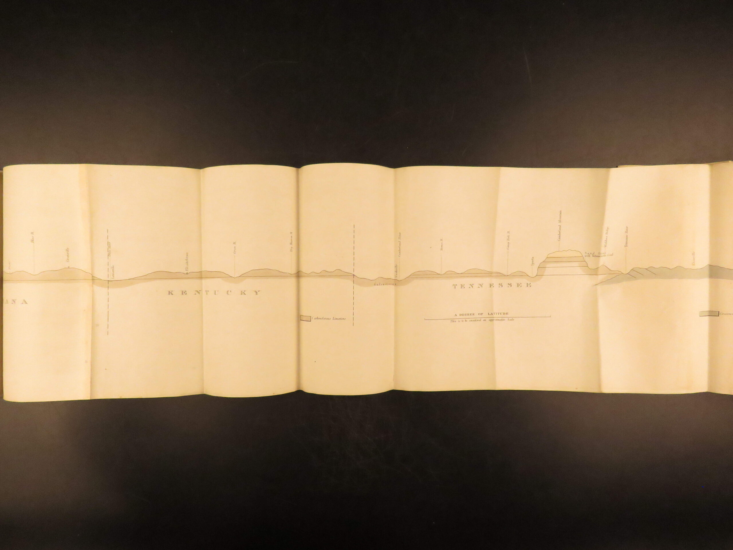
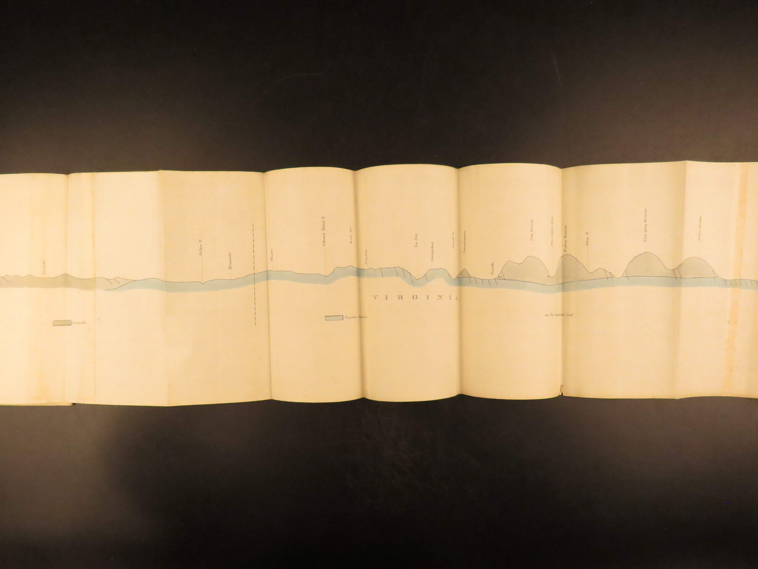
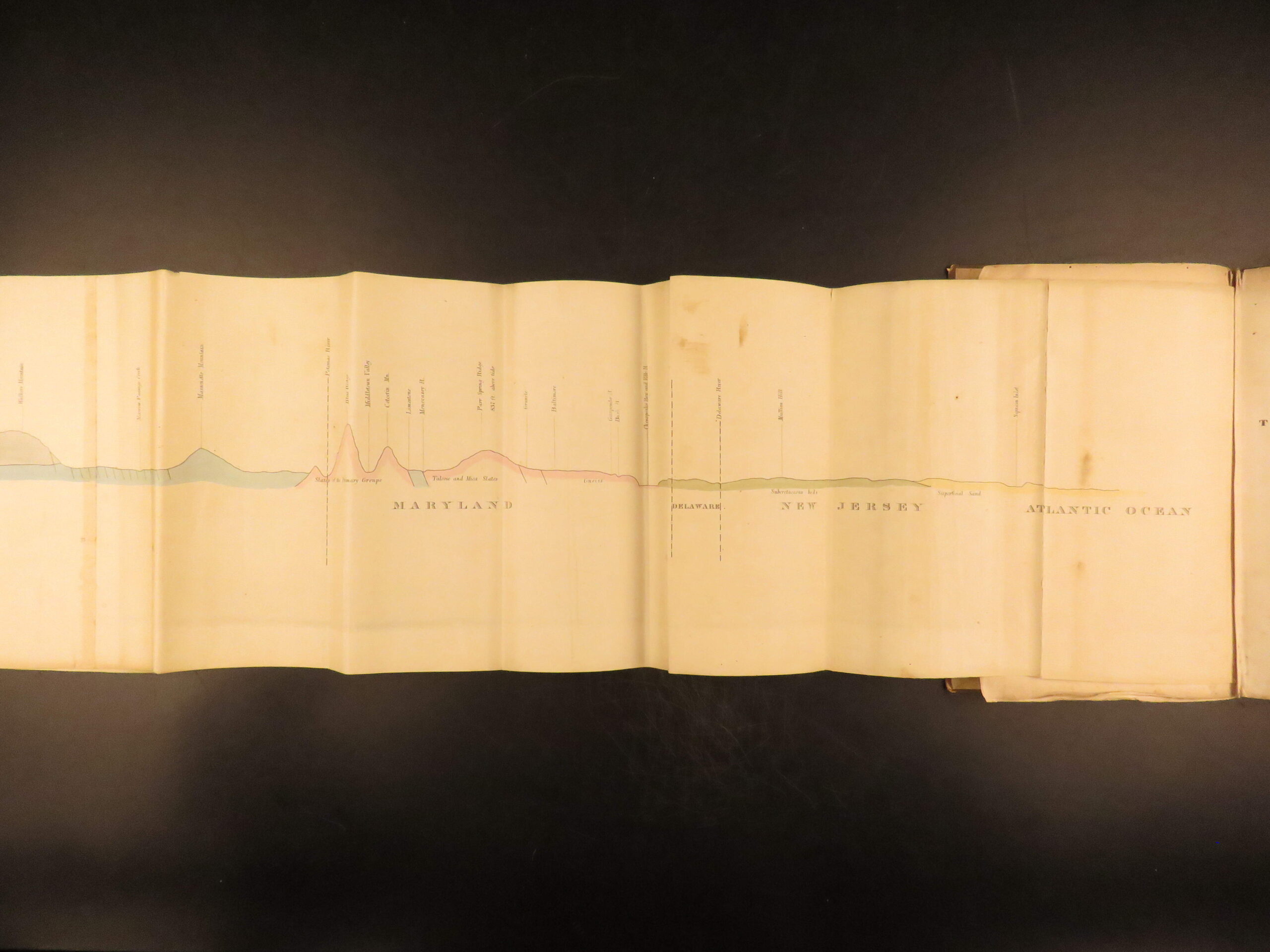

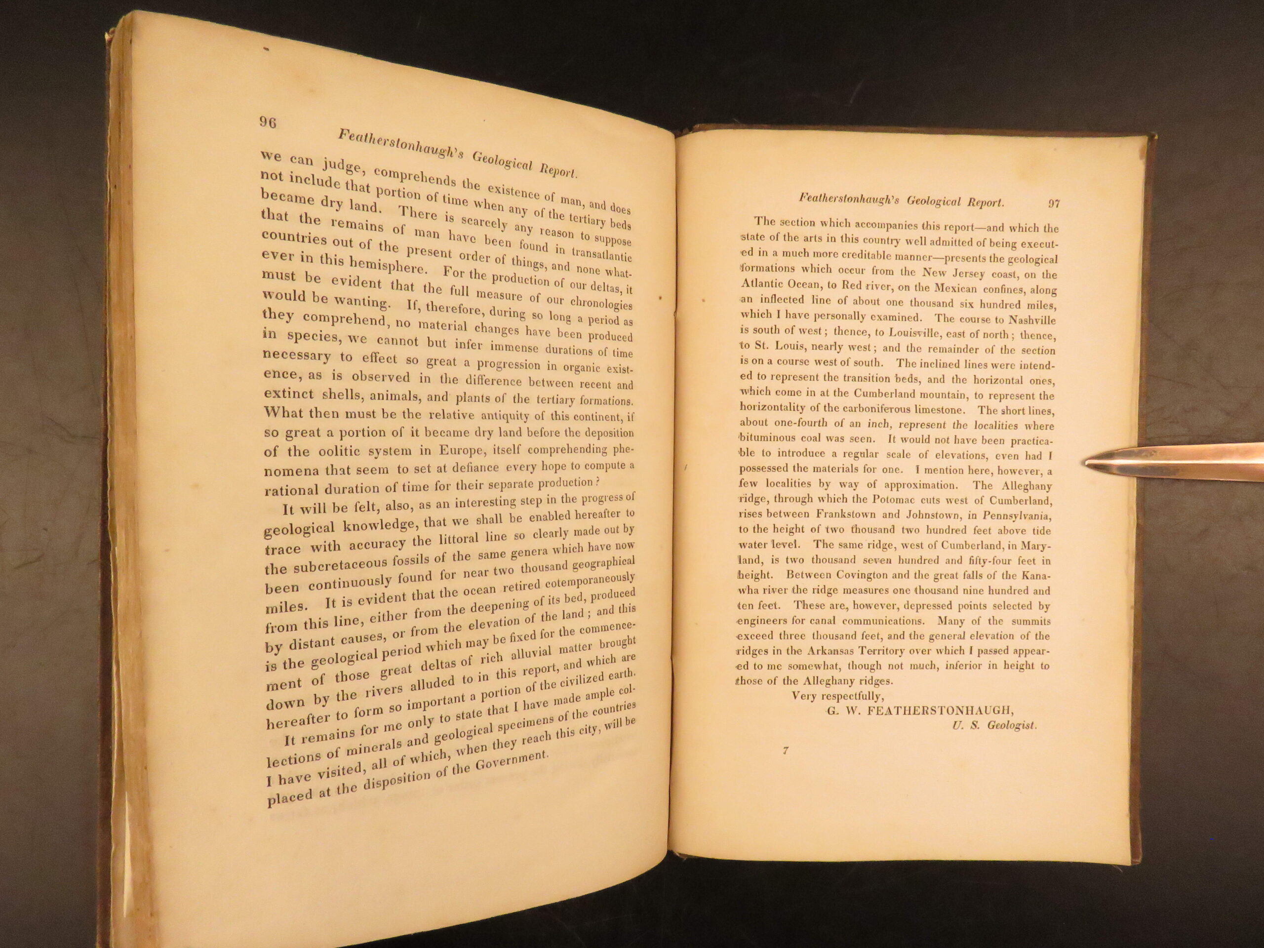
Geological Report of an Examination Made in 1834 of the Elevated Country between the Missouri and Red Rivers by George William Featherstonhaugh is a rare 1834 first edition account of geological exploration west of the Mississippi. This work is notable for its enormous folding map and its observations of geological structures in Arkansas, southern Missouri, and Oklahoma. Featherstonhaugh, recognized as the first U.S. government geologist, documents strata of limestone, coal beds, sandstone, and novaculite, with attention to iron deposits and coal seams. He also describes fossils and organic remains discovered during his journey, providing a critical early record of the mineral and fossil resources of the trans-Mississippi frontier.
Bibliographic Details
- Title: Geological Report of an Examination Made in 1834 of the Elevated Country between the Missouri and Red Rivers
- Author(s): George William Featherstonhaugh
- Publisher: Washington, Gales and Seaton
- Edition: First edition, 1835
- Format: (8vo), single volume
- Binding: Original cloth, front board professionally restored
- Size: 8.75 in x 5.75 in (22.2 cm x 14.6 cm)
- Collation: 97 pp
- Illustrations: One large folding map
- Contents Include:
- Survey of northern Arkansas, southern Missouri, and Indian Territory
- Discussion of limestone, coal beds, sandstone, and novaculite formations
- Descriptions of fossils and organic remains
- Evaluation of potential mineral resources, including iron and coal
- Observations on riverbanks, drainage, bluffs, and elevational profiles
- Reference(s): Howes F 80; Sabin 23949
Condition:
Bound in original cloth with the front board professionally restored. Binding remains secure, with light wear consistent with age. The folding map is intact. Pages are clean with moderate age toning. Overall, a sound copy in Very Good condition.
Why Collect This?
- Early U.S. government geological survey of the trans-Mississippi West
- Contains an intact large folding map
- One of the first official printed works by the United States’ inaugural geologist
- Primary source for early mineral exploration of Arkansas and Missouri
Item Number: #29360
Categories
Americana, American History
Natural History
Maps
Medicine & Science
Voyages & Exploration & Maps
Authors
George William Featherstonhaugh
Printing Date
19th Century
Language
English
Binding
Hardcover
Book Condition
Very Good
Collation
Complete
Other Books you might like...
-
Sale!
 Add to cart
1834 BIRDS Jardine Naturalist Game Ornithology Partridge Quail Grouse Illustrated
Original price was: $499.00.$399.00Current price is: $399.00. -
Sale!
 Add to cart
1836 Jardine Naturalist Natural History Mammals Africa Buffalo Oxen Illustrated
Original price was: $550.00.$450.00Current price is: $450.00. -
Sale!
 Add to cart
1880 1ed Dairy Farming by Sheldon Agriculture Cattle Color Illustrated Milk Cows
Original price was: $499.00.$450.00Current price is: $450.00. -
Sale!
 Add to cart
1836 Buffalo Bison Cows Goat Sheep Buffalo Antelope Illustrated Jardine Mammalia
Original price was: $499.00.$399.00Current price is: $399.00.