1879 1ed Arctic Expedition Hall Nourse Franklin Voyage Eskimo Illustrated MAP
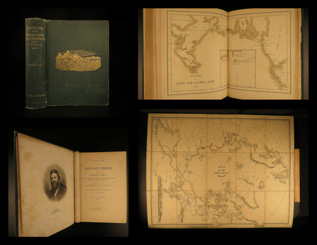
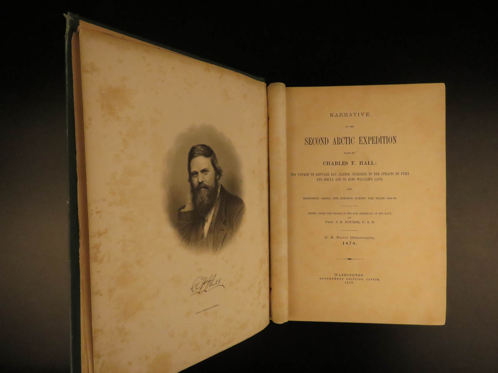
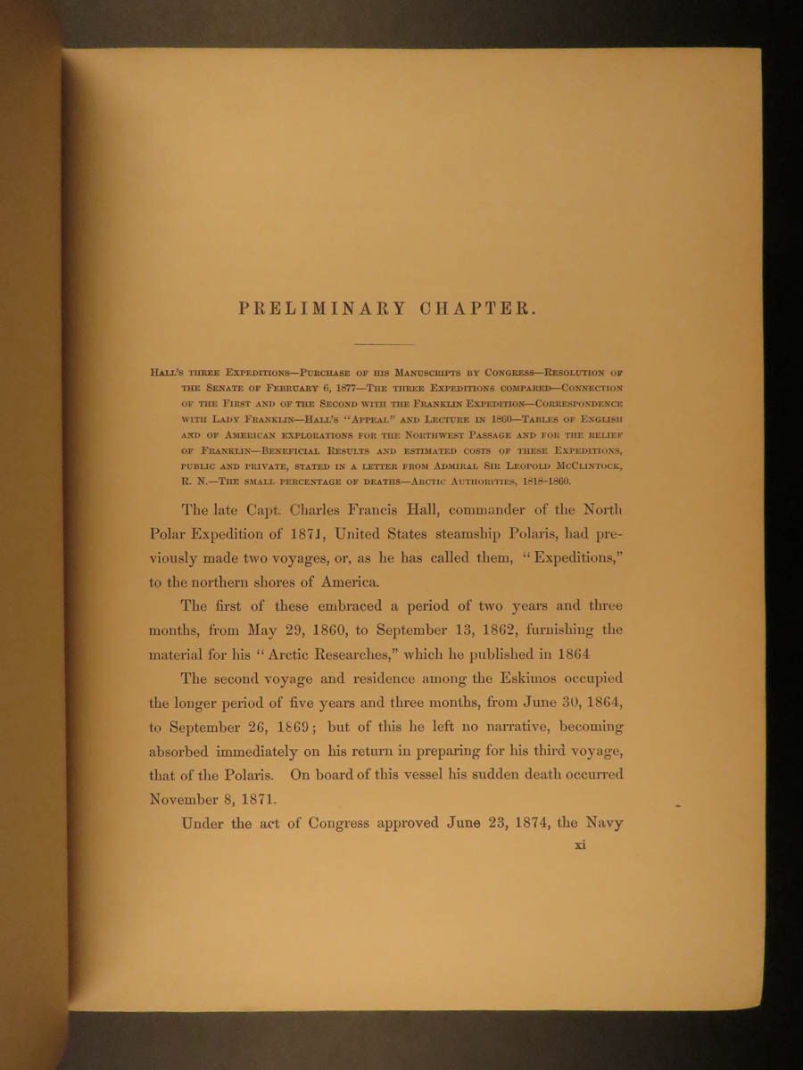
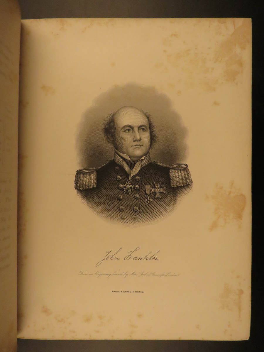
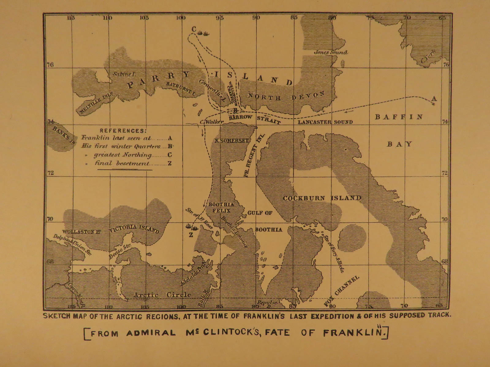
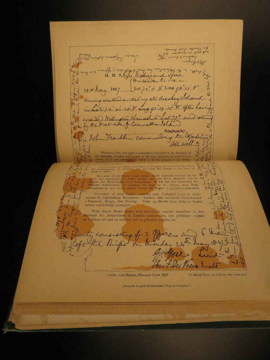
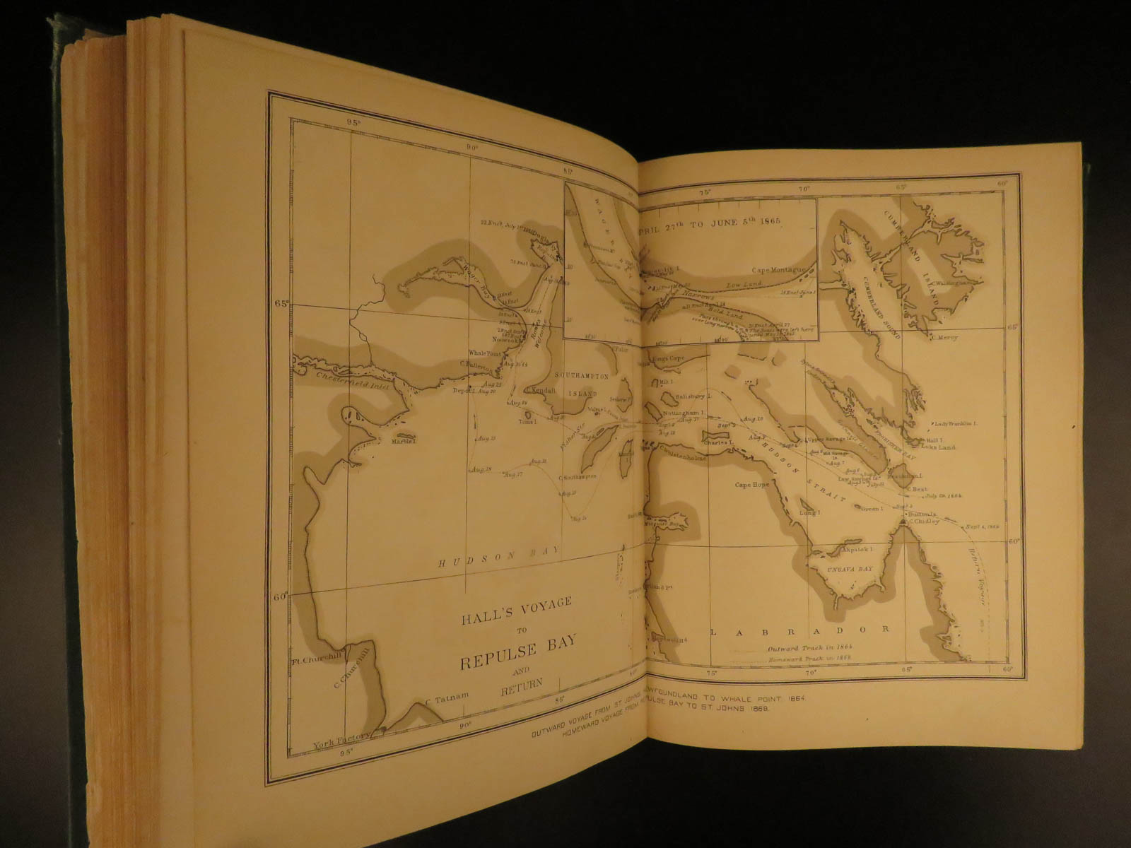
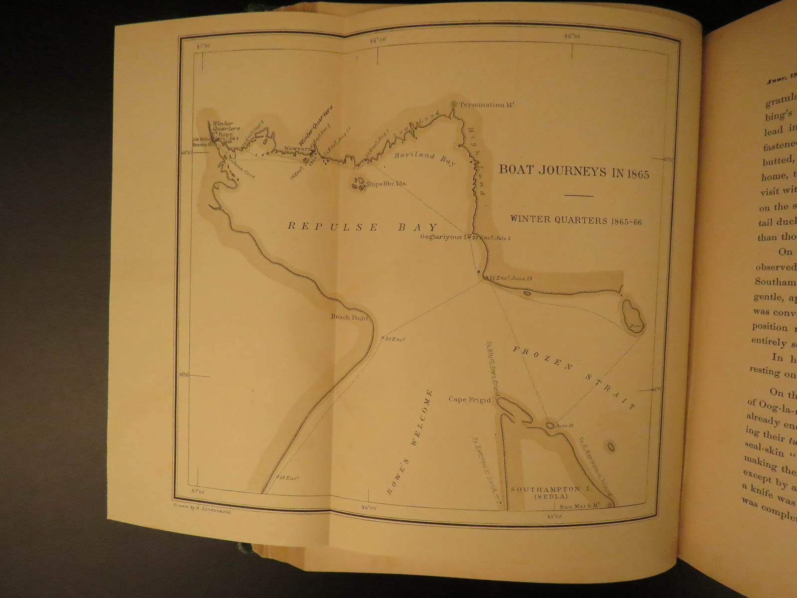
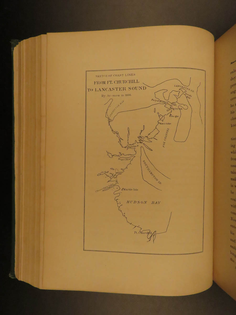
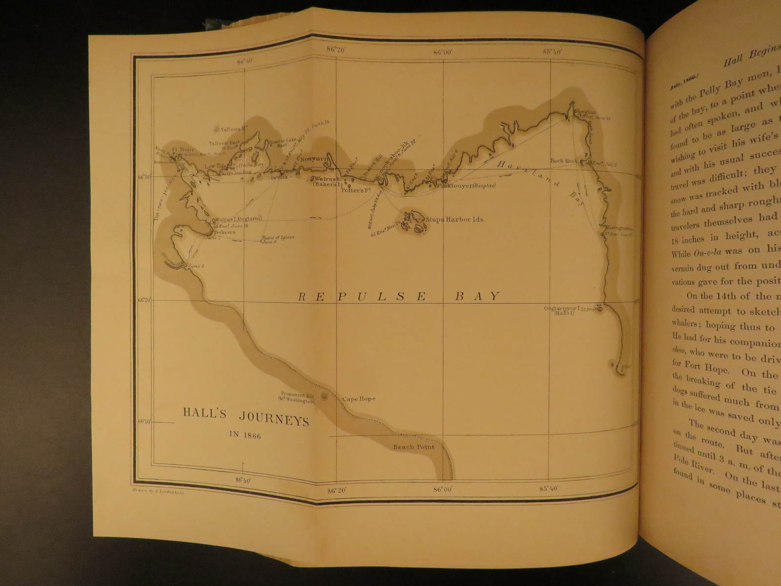
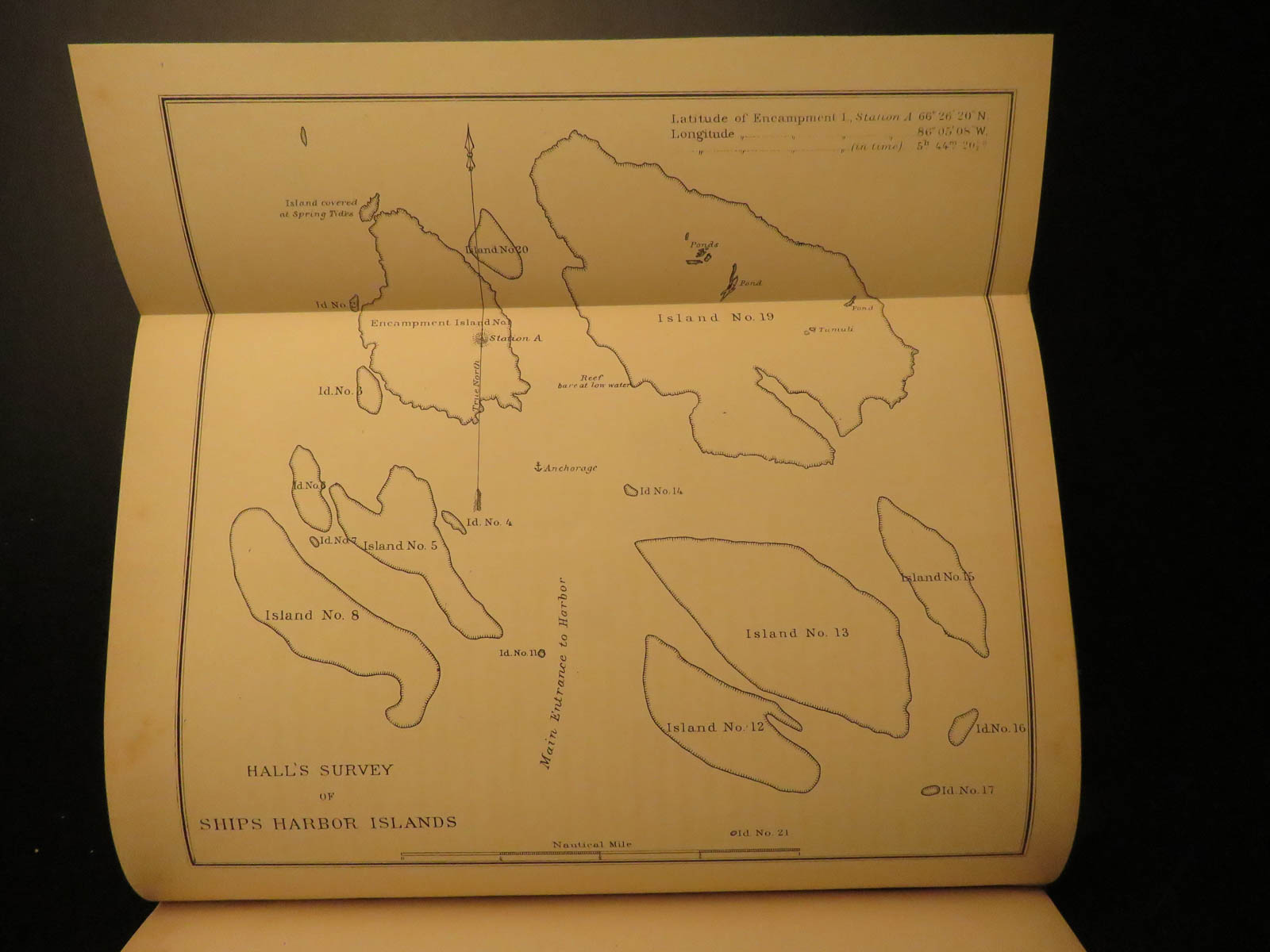
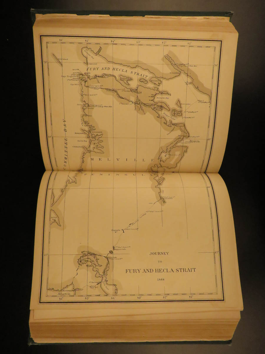
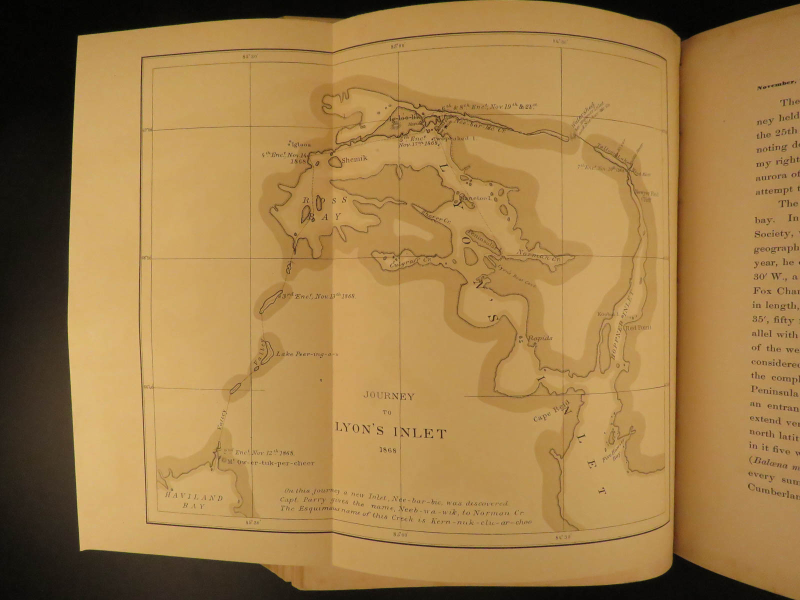
‘Narrative of the Second Arctic Expedition made by Charles F. Hall’ is a detailed and valuable account of his life among the Eskimos in the Arctic during his second expedition, when Hall explored the northern coast from the Melville Peninsula to King William Island, gathering information about John Franklin’s men and relics of the expedition. The book includes accounts of the sledge journeys to Igloolik, along the east side of Melville Peninsula to Fury and Hecla Strait, around and across Repulse Bay, two journeys to King William Island, information on flora and fauna, and much more.
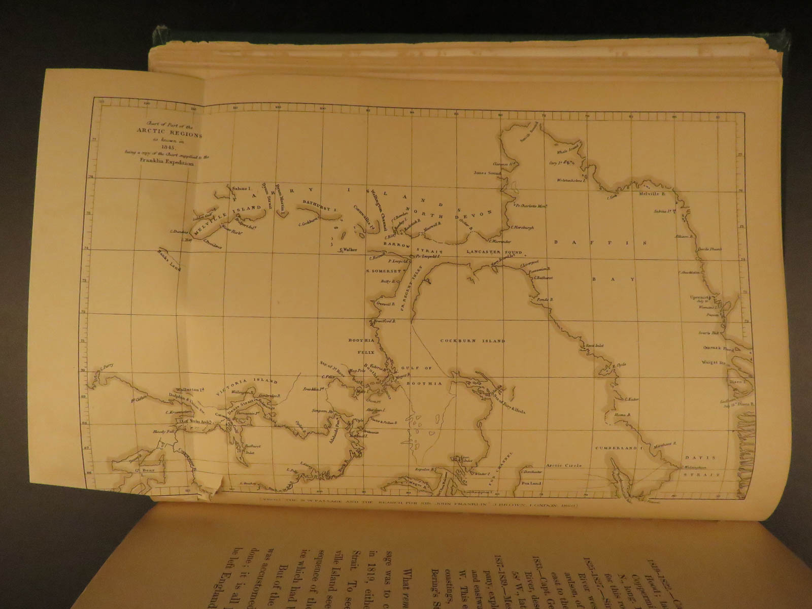
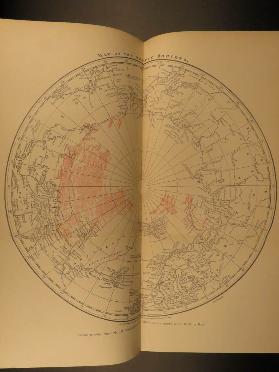
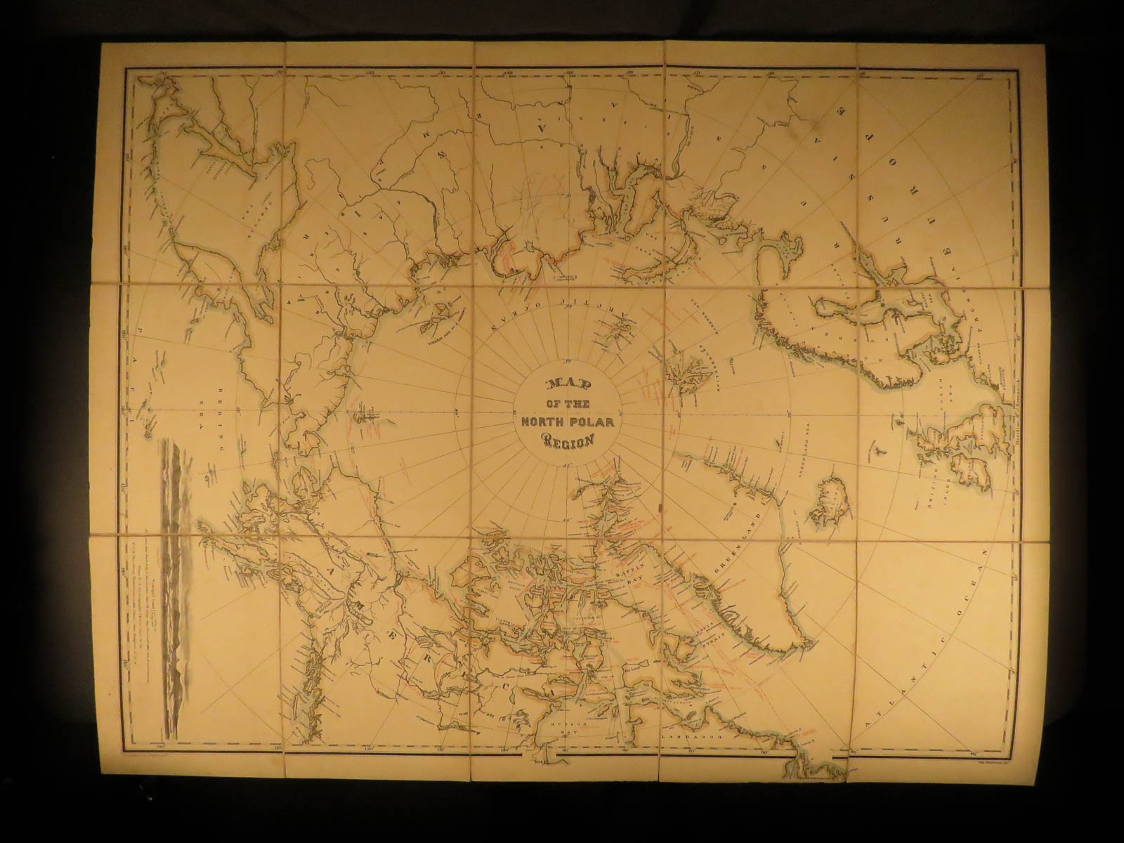
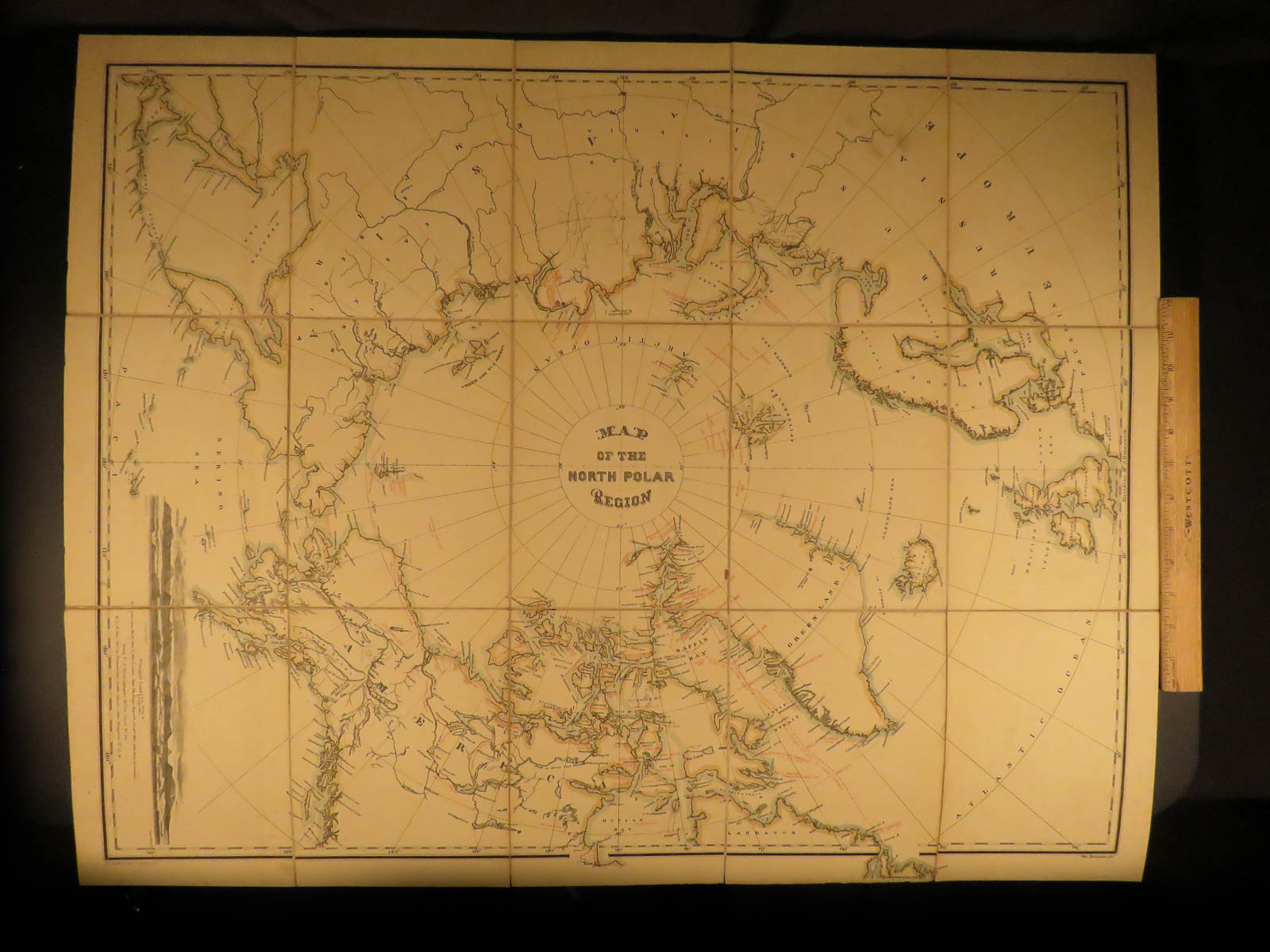
Included are 96 fascinating engravings throughout, one of which is a massive folding map of the North Pole Region (~33in X 26in).


1879 1ed Arctic Expedition Hall Nourse Franklin Voyage Eskimo Illustrated MAP
‘Narrative of the Second Arctic Expedition made by Charles F. Hall’ is a detailed and valuable account of his life among the Eskimos in the Arctic during his second expedition, when Hall explored the northern coast from the Melville Peninsula to King William Island, gathering information about John Franklin’s men and relics of the expedition. The book includes accounts of the sledge journeys to Igloolik, along the east side of Melville Peninsula to Fury and Hecla Strait, around and across Repulse Bay, two journeys to King William Island, information on flora and fauna, and much more.
Included are 96 fascinating engravings throughout, one of which is a massive folding map of the North Pole Region (~33in X 26in).
Item number: #9835
Price: $550
NOURSE, Joseph Everett
Narrative of the second Arctic expedition made by Charles F. Hall: his voyage to Repulse Bay, sledge journeys to the Straits of Fury and Hecla and to King William’s land, and residence among the Eskimos, during the years 1864-’69
Washington: Government Printing Office, 1879. First Edition.
Details:
- Collation: Complete with all pages
- [10], xlviii, 644
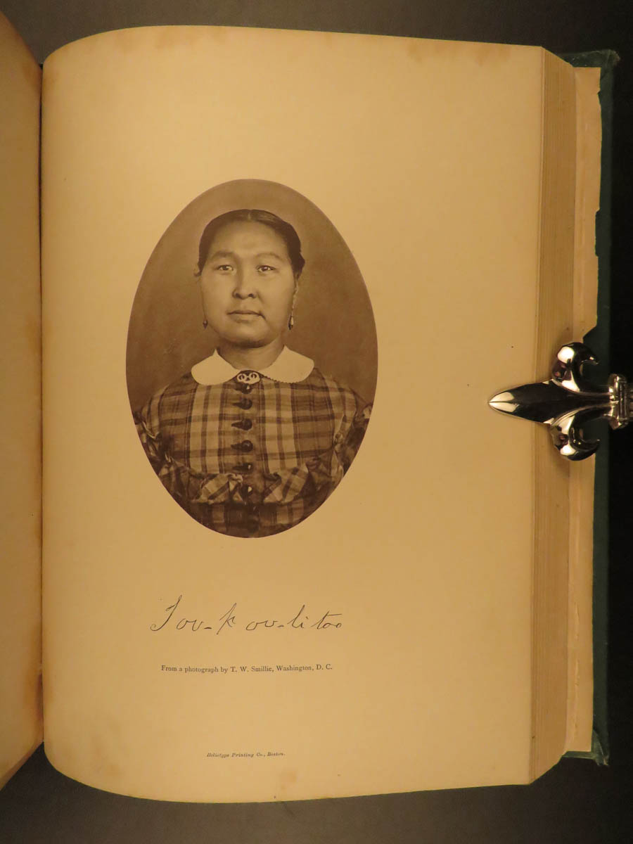
- 96 illustrations throughout
- 2 steel engravings
- 73 woodcut, photo, and heliotype engravings
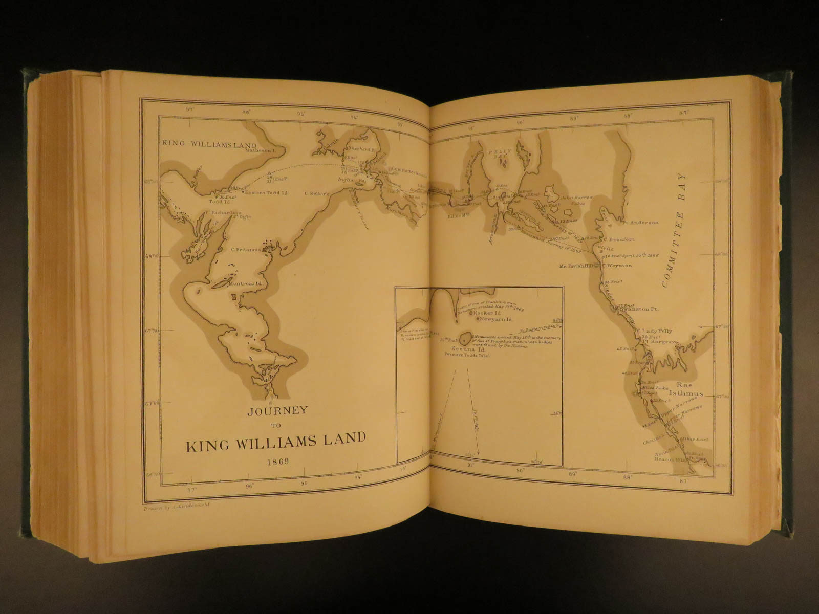
- 13 maps
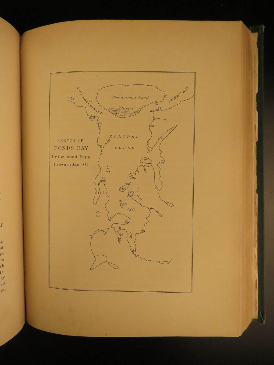
- 8 sketches of coastline, drawn by Innuits
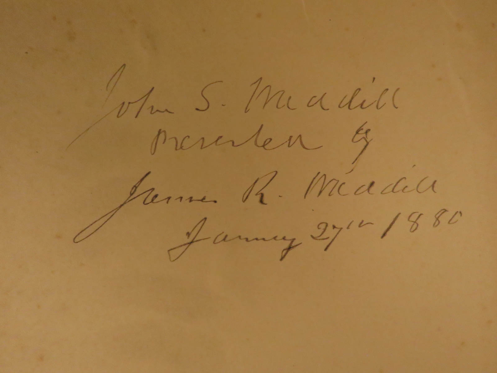
- Provenance: Handwritten
- John S. Mcadill
- J[eane] Mcadill
- Language: English
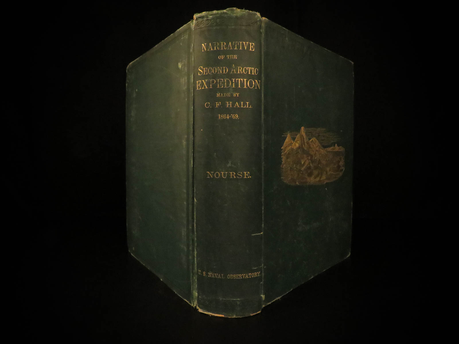
- Binding: Hardcover; tight & secure
- Size: ~10.5in X 8.25in (26.5cm x 21cm)
Our Guarantee:
Very Fast. Very Safe. Free Shipping Worldwide.
Customer satisfaction is our priority! Notify us with 7 days of receiving, and we will offer a full refund without reservation!
9835
Category
Voyages & Exploration & Maps
Authors
NOURSE, Joseph Everett
Printing Date
19th Century
Language
English
Binding
Hardcover
Book Condition
Excellent
Collation
Complete
Other Books you might like...
-
Sale!
 Add to cart
1818 Capt Paddock Shipwreck of OSWEGO Africa Slave Trade Slavery Arab Pirates
$450.00 -
 Add to cart
1794 EARLY American Biography Belknap Columbus Soto Cortez Magellan Puritans 2v
$950.00 -
Sale!
 Add to cart
1867 AFRICA Ashango-Land Apingi Kingdom Du Chaillu Sahara Gorillas Pygmy Voyages
$650.00 -
 Add to cart
1798 1ed La Perouse Voyage Pacific Islands Japan New Zealand Shipwreck English
$950.00