1854 Illustrated ATLAS Traveler’s Guide MAPS Midwest Railroads New Orleans Texas
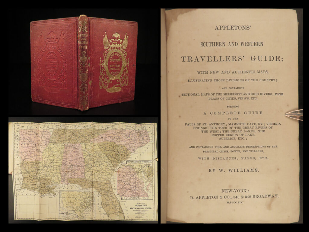
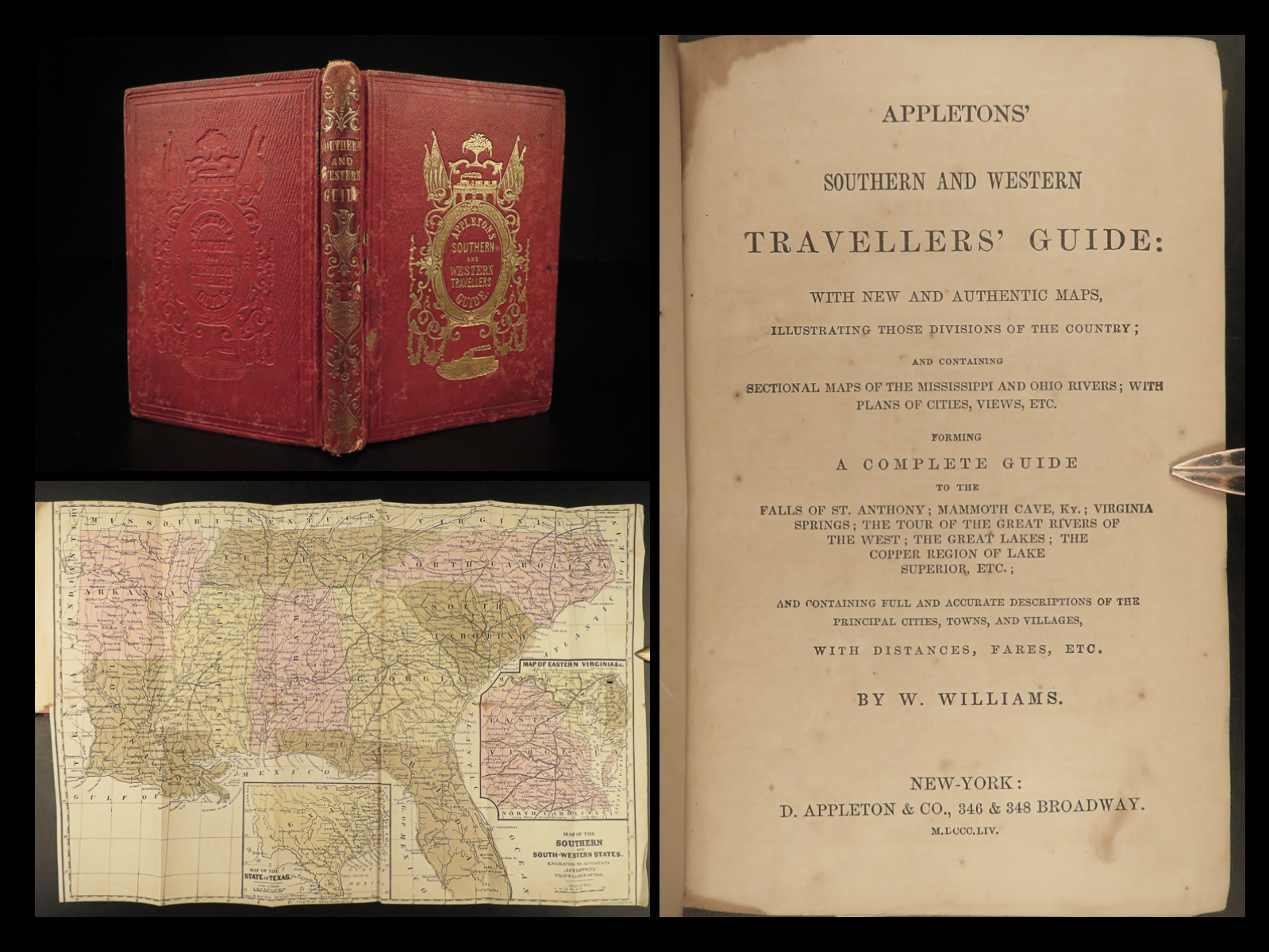
In the mid-19th-century, Appleton produced numerous travel guides for the United States, Canada, Mexico, and Europe. This guide is an interesting 1850s travel guide to the ‘Southern and Western’ states. The Railroad and Steamboat companion concentrates on the American Southeast as well as the mid-west and central states including:
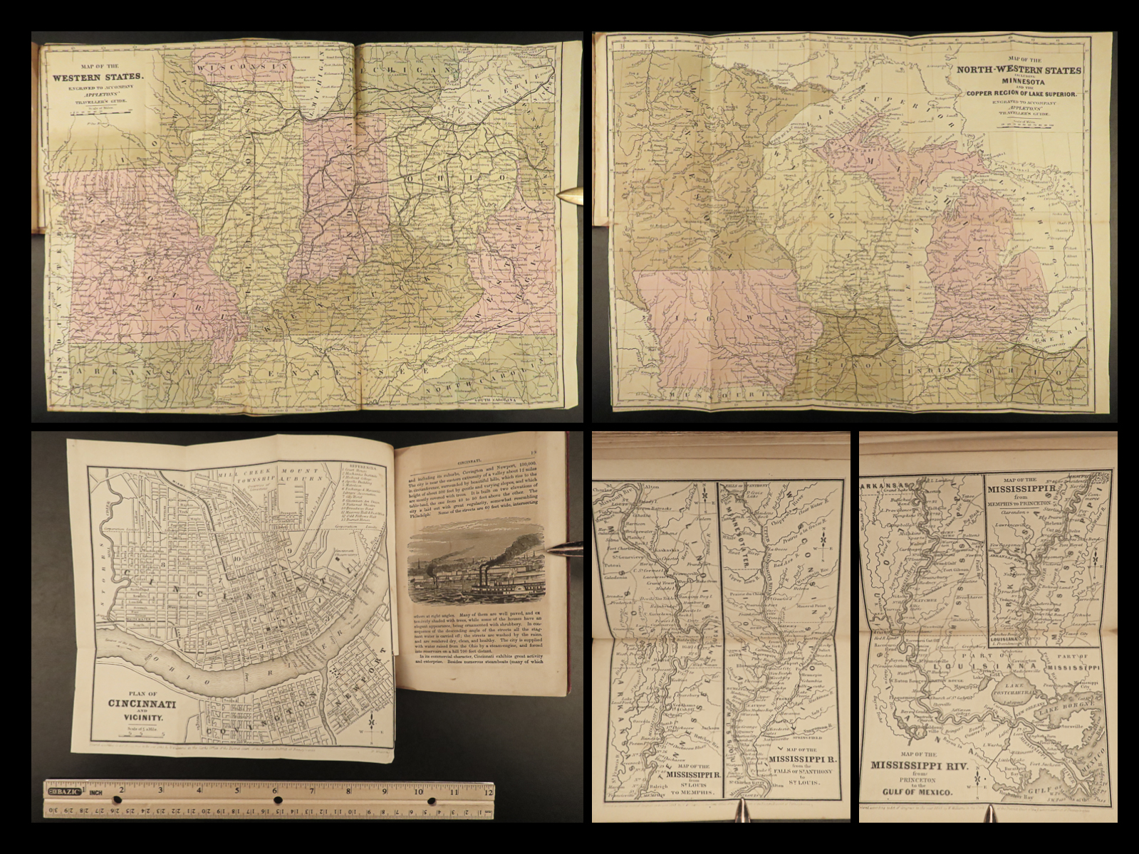
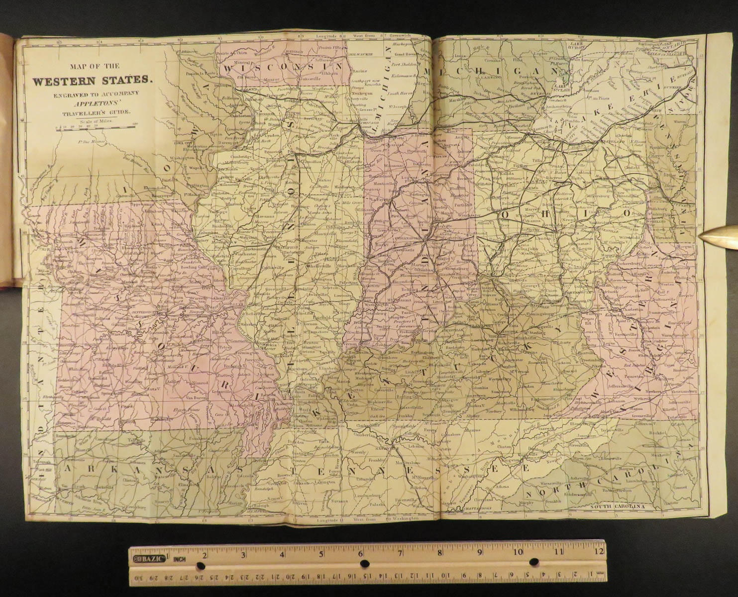
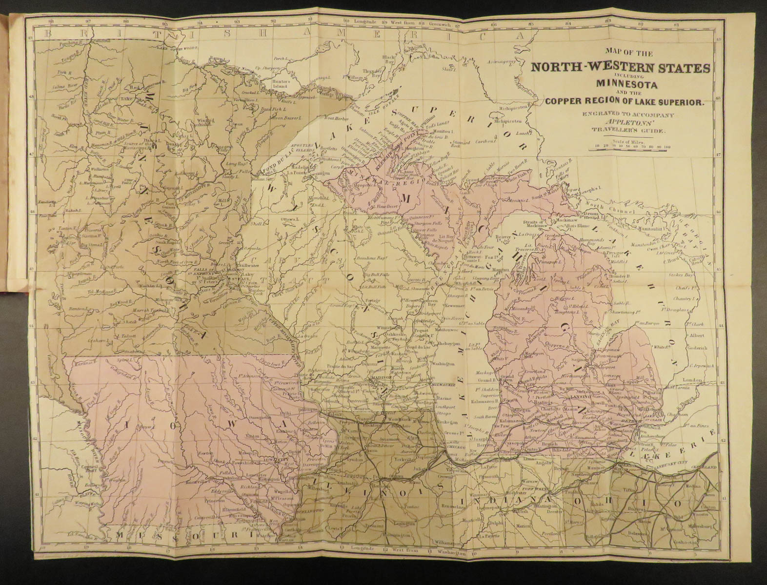
- Railroad routes throughout the Midwest
- Missouri, Illinois, Indiana
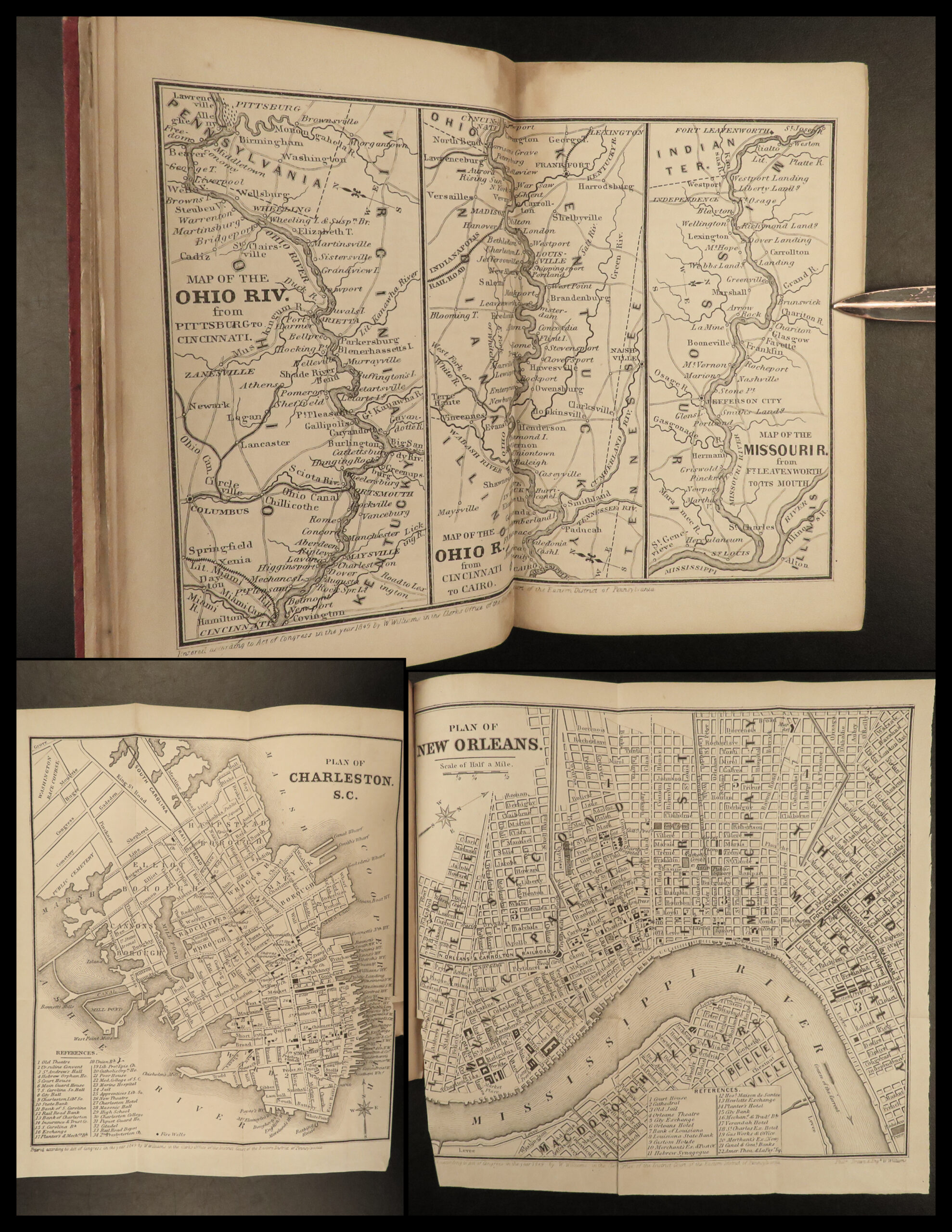
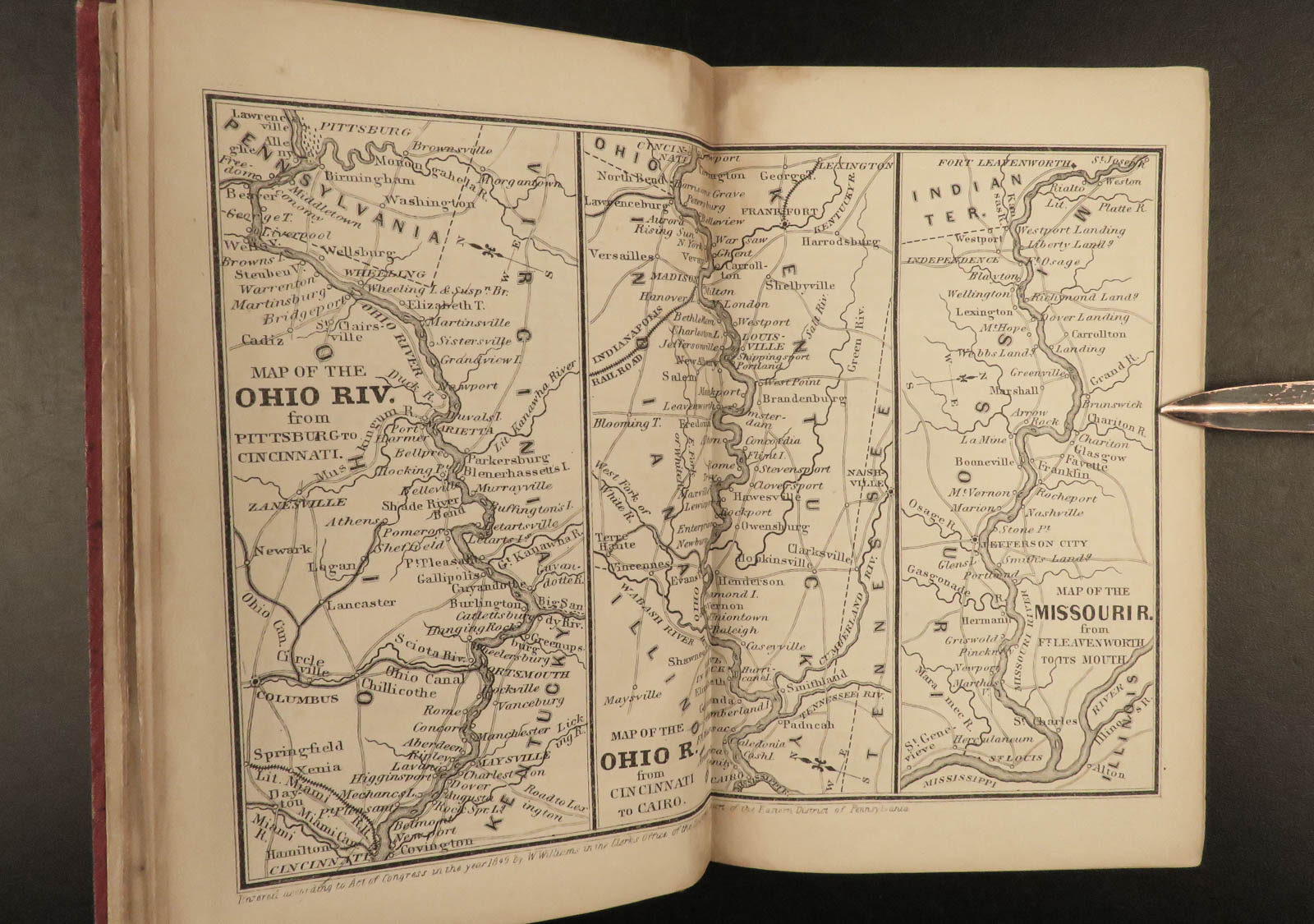
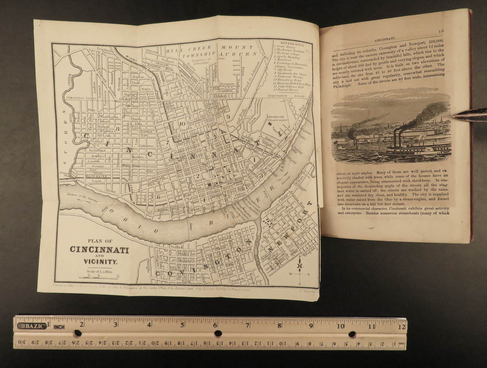
- Ohio, map of Cincinnati
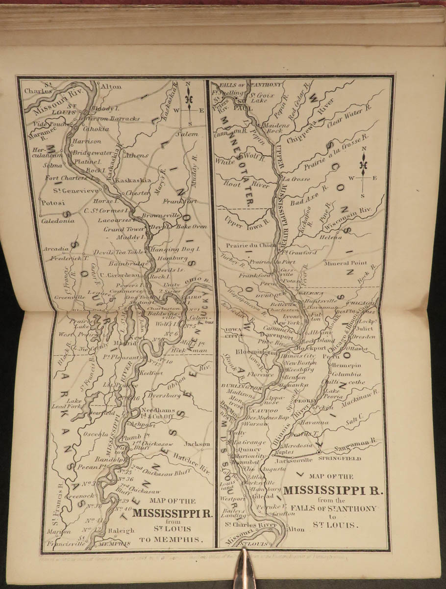
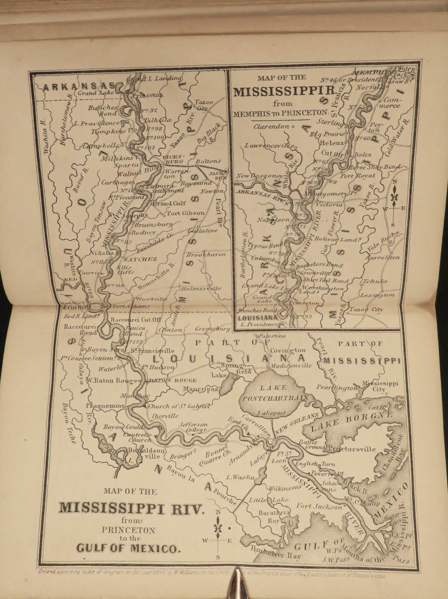
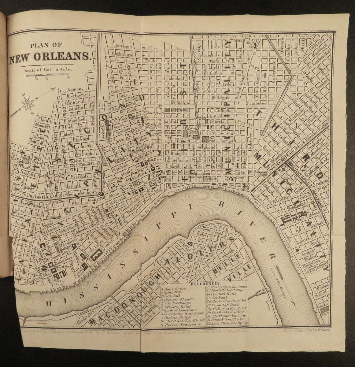
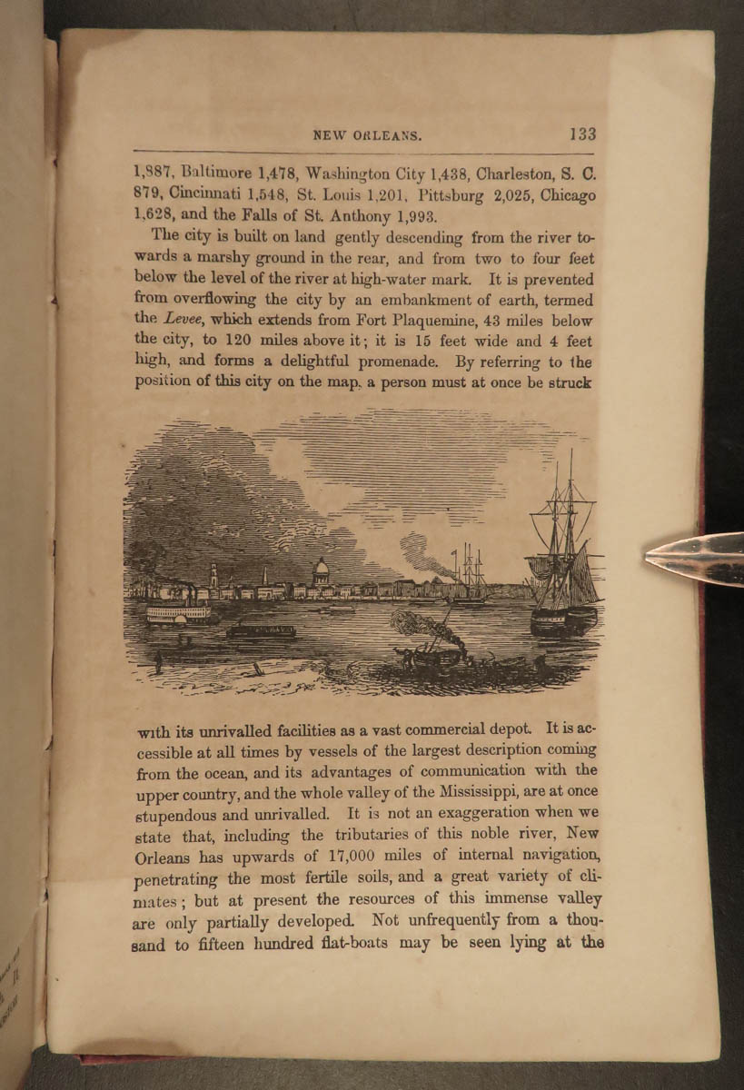
- Louisiana, map of New Orleans
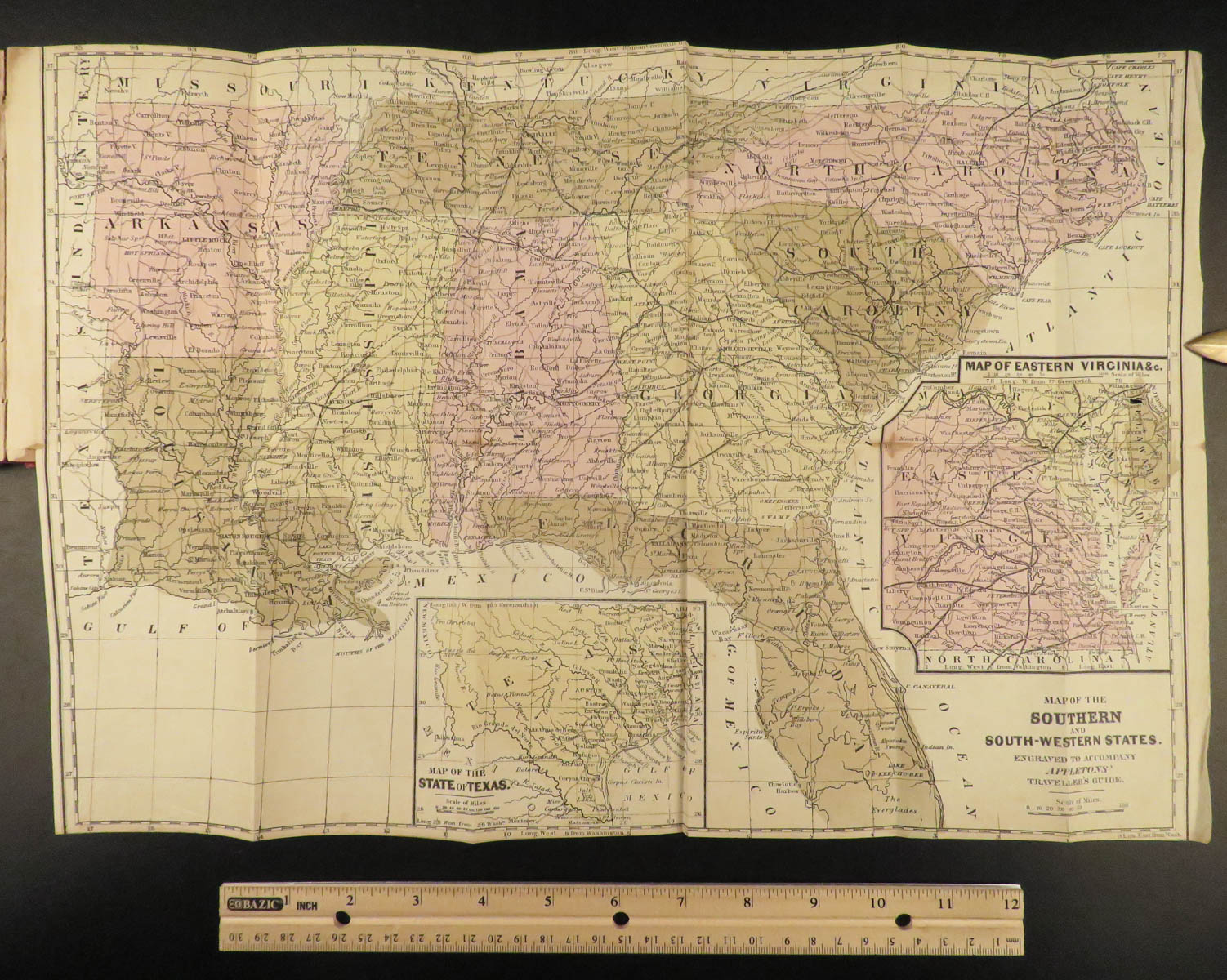
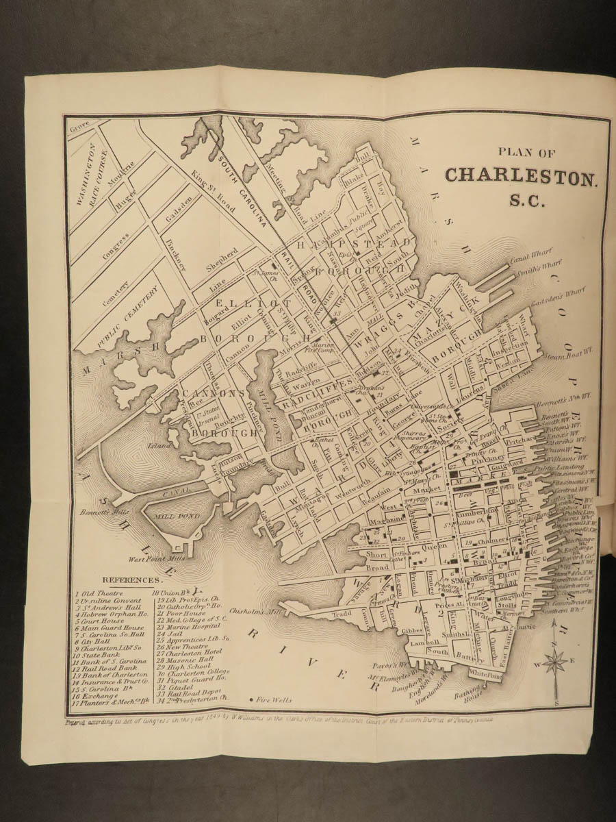
- Southeast states – South Carolina, map of Charleston
- Virginia, Maryland
- Texas
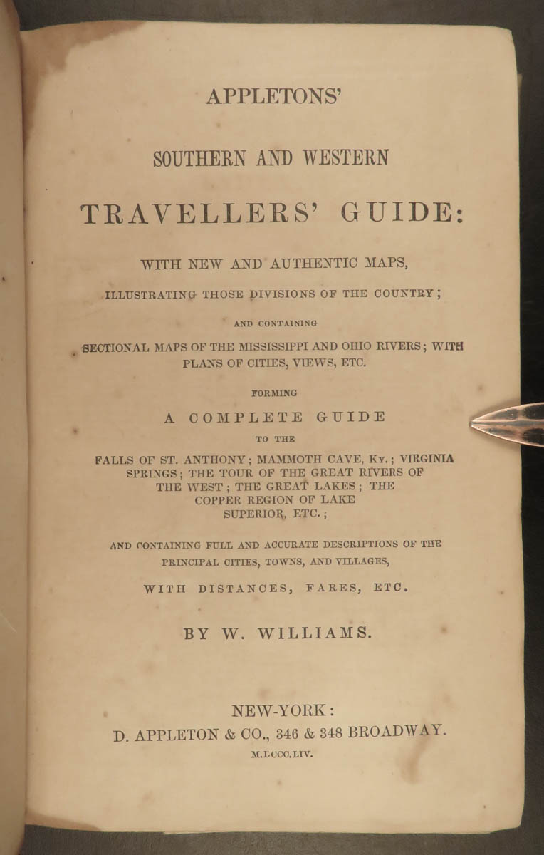
This 1854 edition by Wellington Williams is illustrated with maps and city views, as well as numerous in-text engraved vignettes, of which many plates are double page and fold out maps!
1854 Illustrated ATLAS Traveler’s Guide MAPS Midwest Railroads New Orleans Texas
In the mid-19th-century, Appleton produced numerous travel guides for the United States, Canada, Mexico, and Europe. This guide is an interesting 1850s travel guide to the ‘Southern and Western’ states. The Railroad and Steamboat companion concentrates on the American Southeast as well as the mid-west and central states including:
- Railroad routes throughout the Midwest
- Missouri, Illinois, Indiana
- Ohio, map of Cincinnati
- Louisiana, map of New Orleans
- Southeast states – South Carolina, map of Charleston
- Virginia, Maryland
- Texas
This 1854 edition by Wellington Williams is illustrated with maps and city views, as well as numerous in-text engraved vignettes, of which many plates are double page and fold out maps!
Item number: #21132
Price: $750
WILLIAMS, Wellington
Appletons’ southern and western travellers’ guide : with new and authentic maps, illustrating those divisions of the country ; and containing sectional maps of the Mississippi and Ohio rivers ; with plans of cities, views, etc
New York: D. Appleton; Philadelphia: Geo. S. Appleton, 1854.
Details:
- Collation: Complete with all pages
- 140, [6]
- 9 full-page and fold-out maps
- Language: English
- Binding: Hardcover; tight and secure
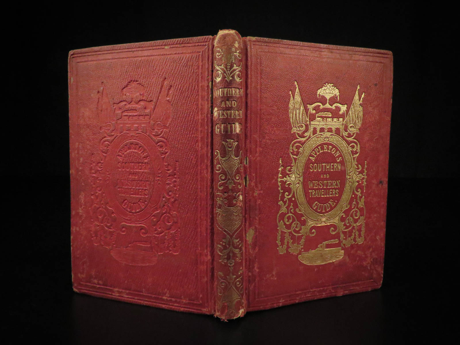
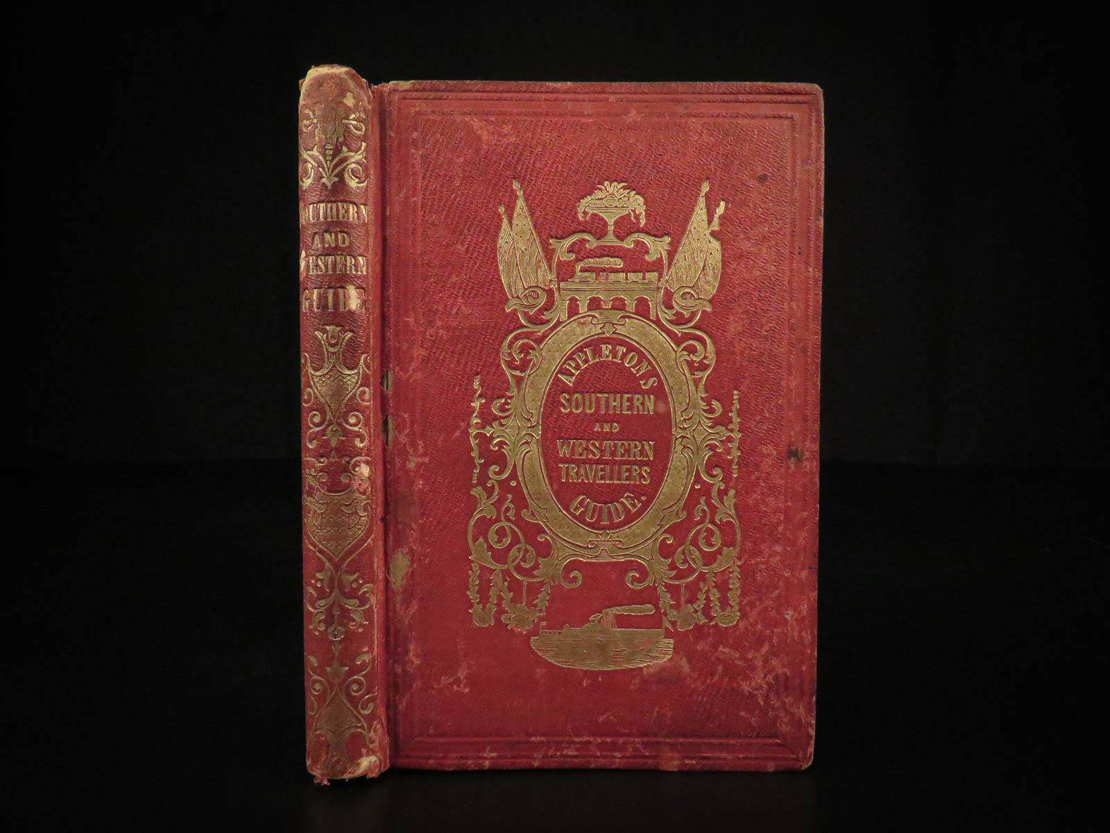
- Decorative red cloth
- Size: ~6.25in X 4.25in (16cm x 10.5cm)
Our Guarantee:
Very Fast. Very Safe. Free Shipping Worldwide.
Customer satisfaction is our priority! Notify us with 7 days of receiving, and we will offer a full refund without reservation!
21132
Category
Voyages & Exploration & Maps
Authors
WILLIAMS, Wellington
Printing Date
19th Century
Language
English
Binding
Hardcover
Book Condition
Excellent
Collation
Complete
Other Books you might like...
-
 Add to cart
1790 1st ed Vaillant Africa Voyages Hottentot Ethnology Zoology Birds Giraffe 2v
$950.00 -
 Add to cart
1687 1st ed Travels of John Chardin in PERSIA Middle East Iraq Turkey MAPS
$950.00 -
Sale!
 Add to cart
1775 1ed North Pole Voyage Arctic Exploration Illustrated John Phipps Polar Maps
Original price was: $1,500.00.$1,250.00Current price is: $1,250.00. -
Sale!
 Add to cart
1818 Capt Paddock Shipwreck of OSWEGO Africa Slave Trade Slavery Arab Pirates
Original price was: $499.00.$450.00Current price is: $450.00.