1792 Guthrie ATLAS & Geography 21 MAPS Illustrated Navigation America Asia India
William Guthrie was well known during the mid-18th-century for his many contributions to world history, especially through his extensive and thorough books. As a Scottish historian, he published one of the world’s best and most popular geography texts of the 18th-century.
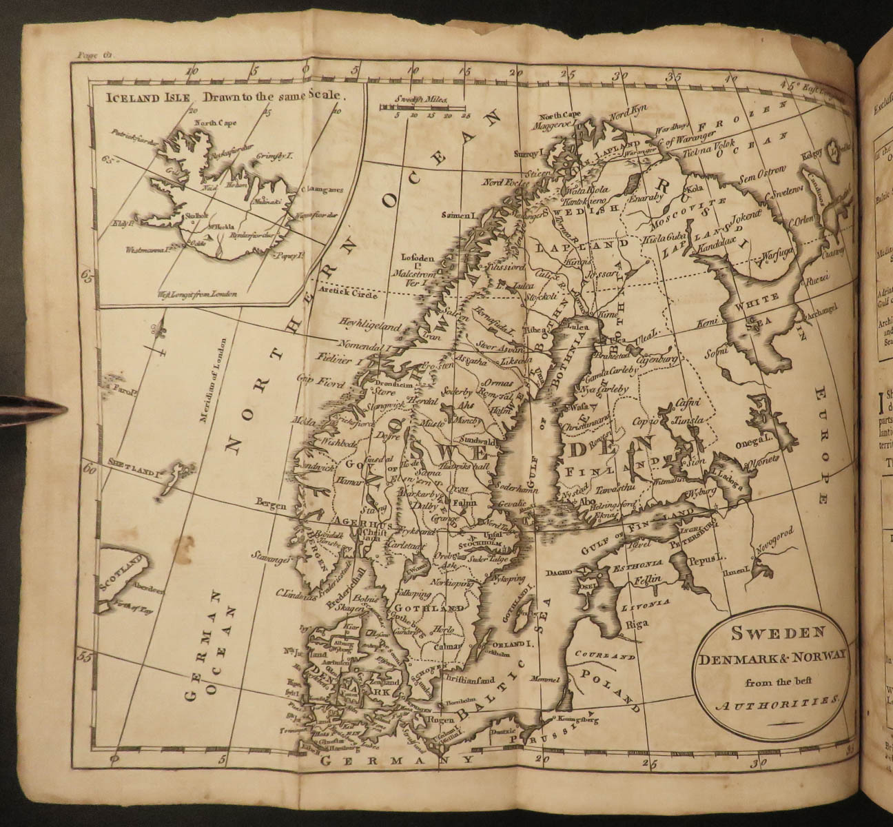
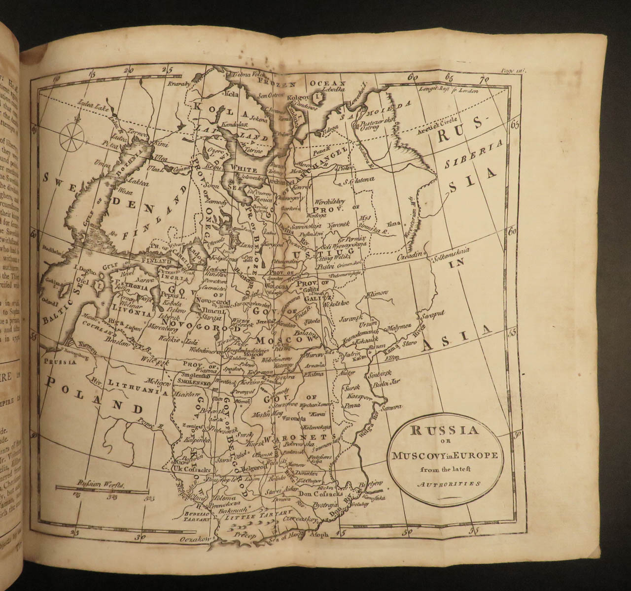
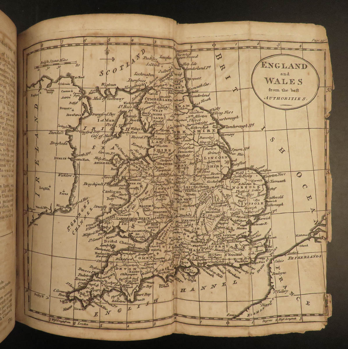
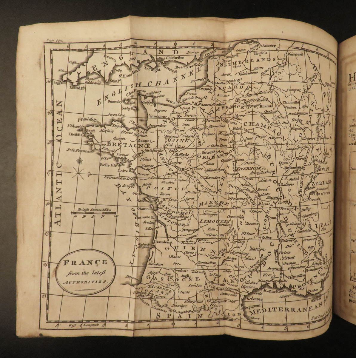
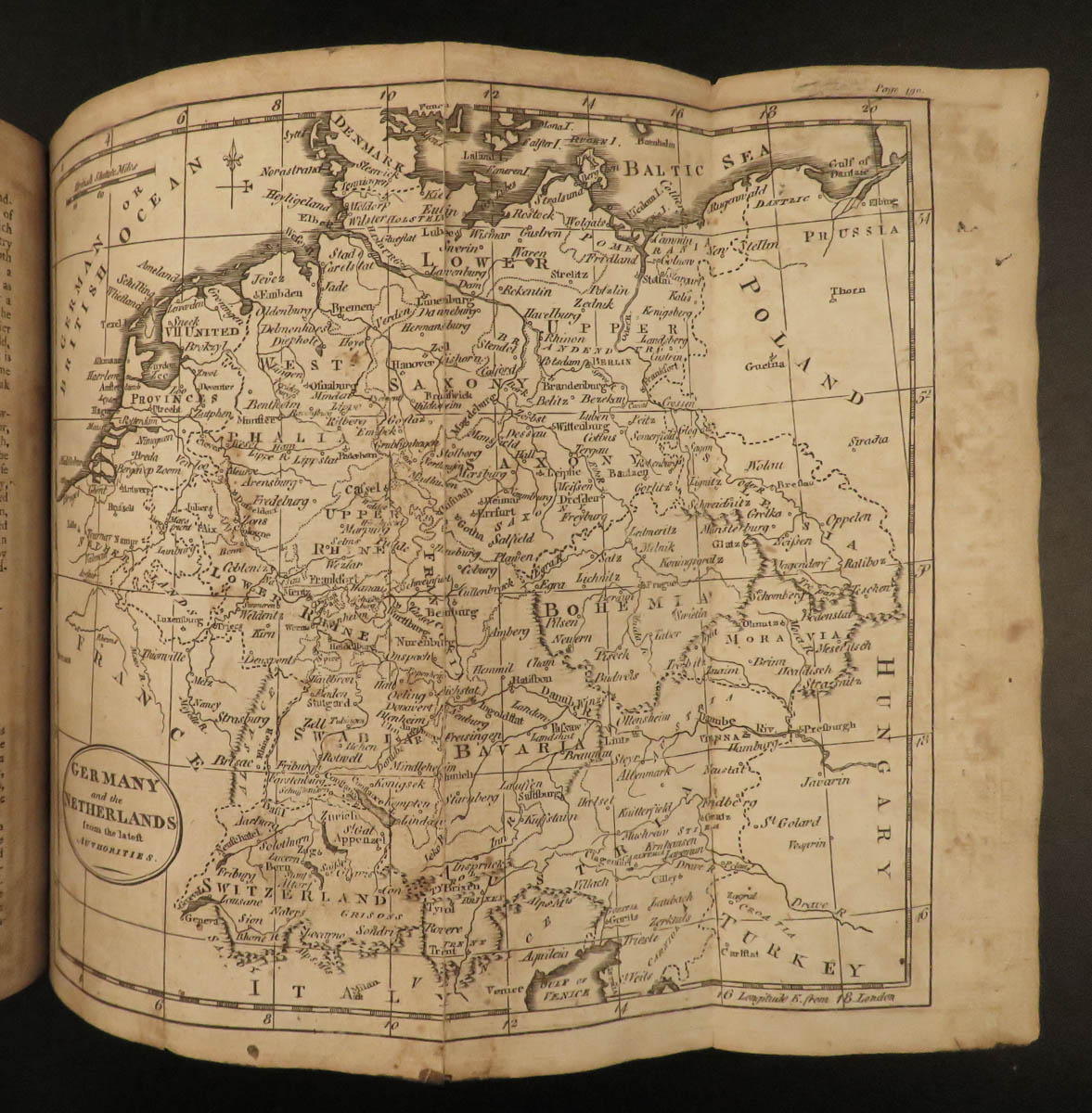
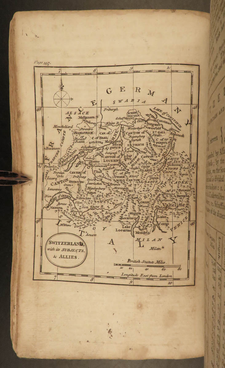
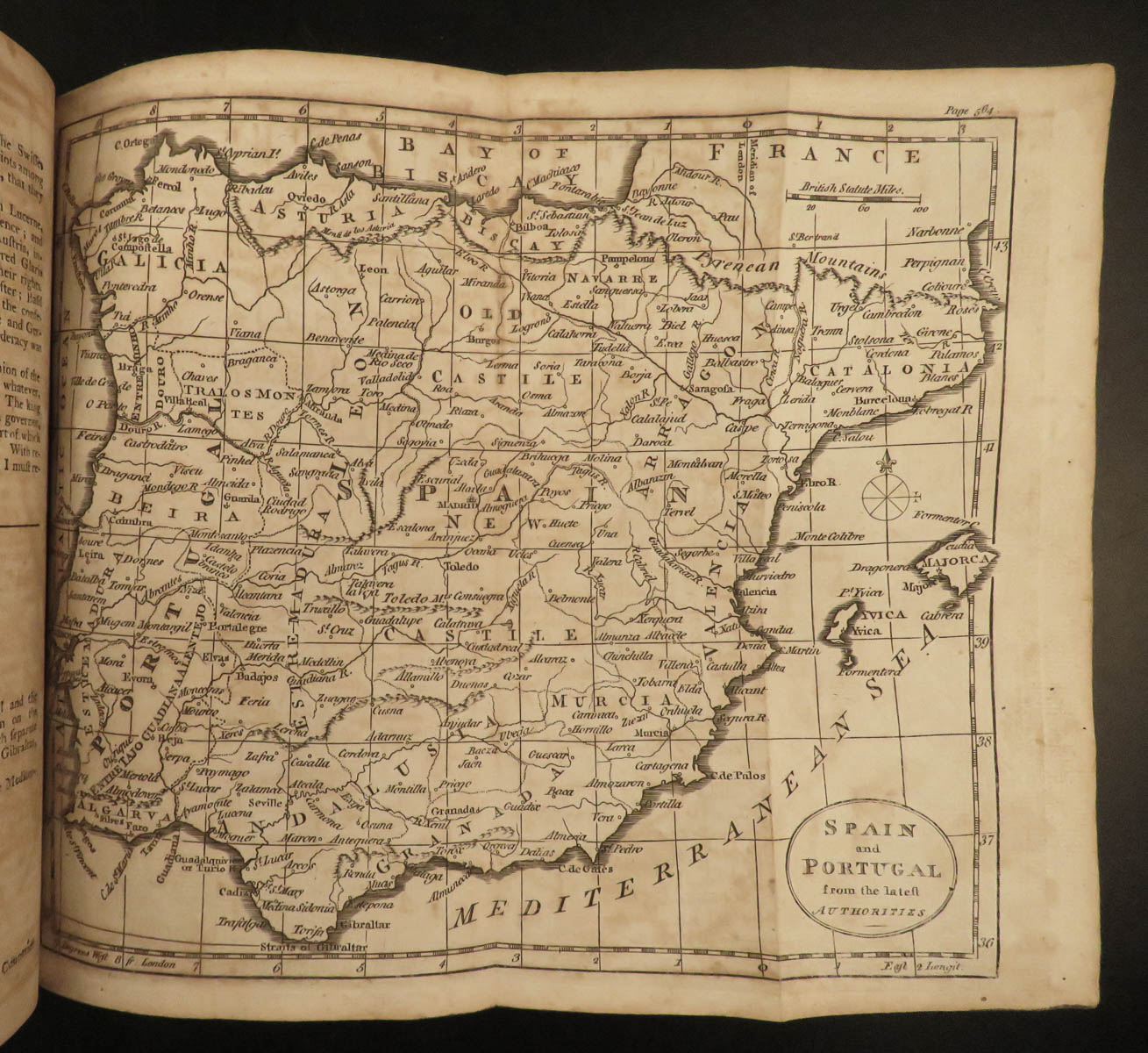
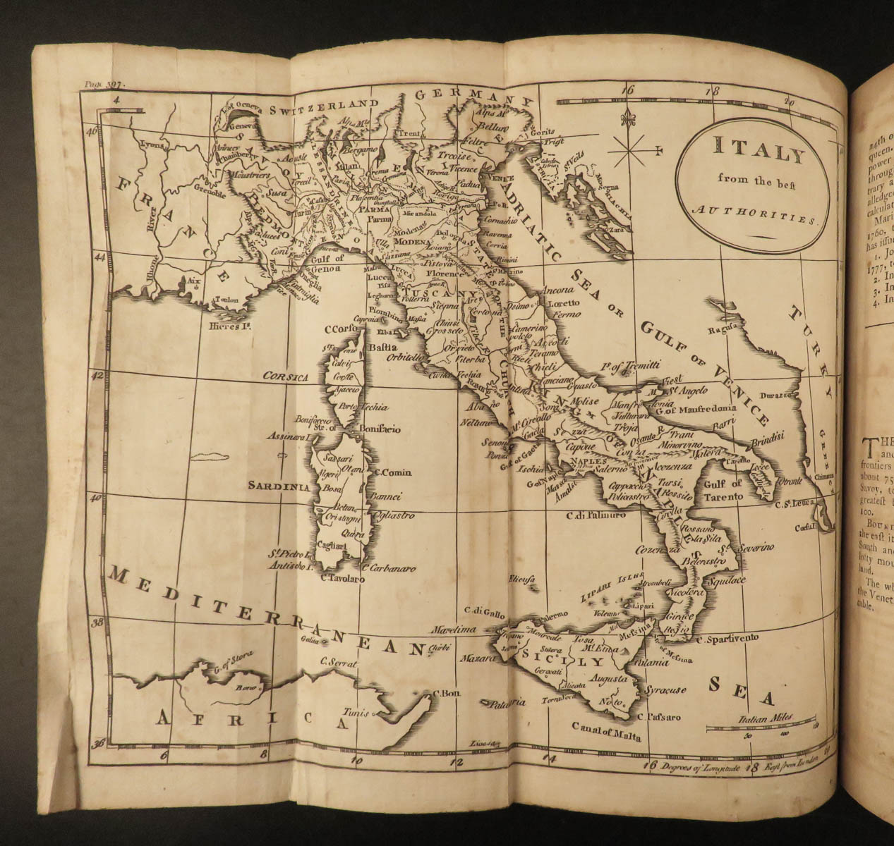
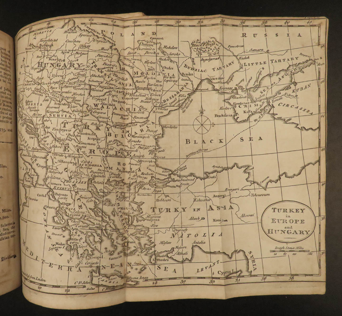
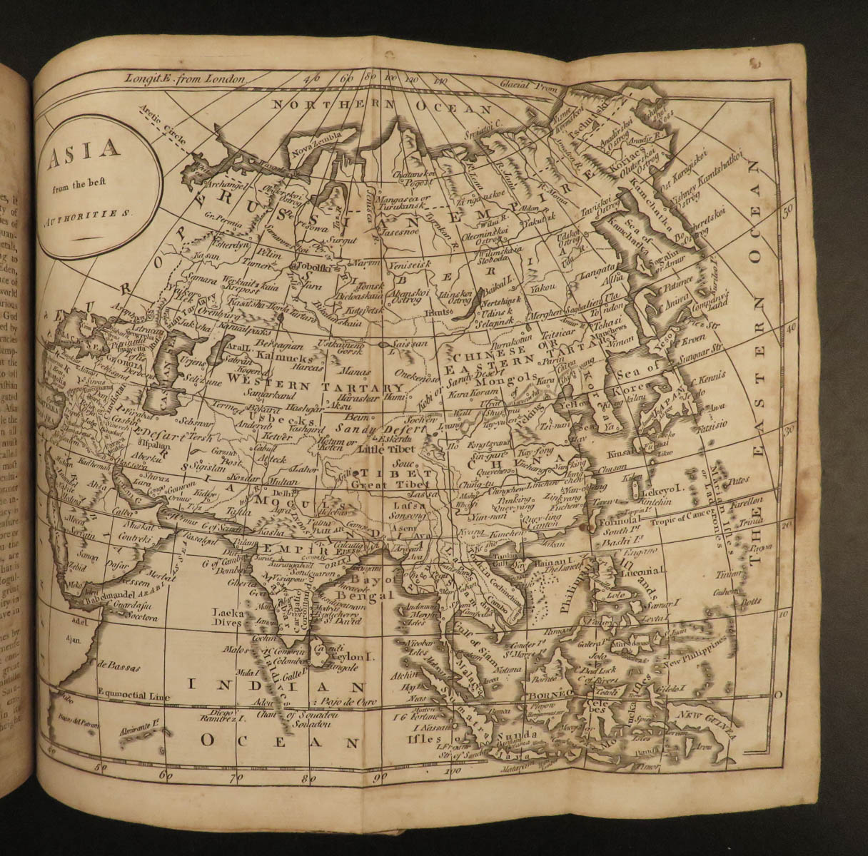
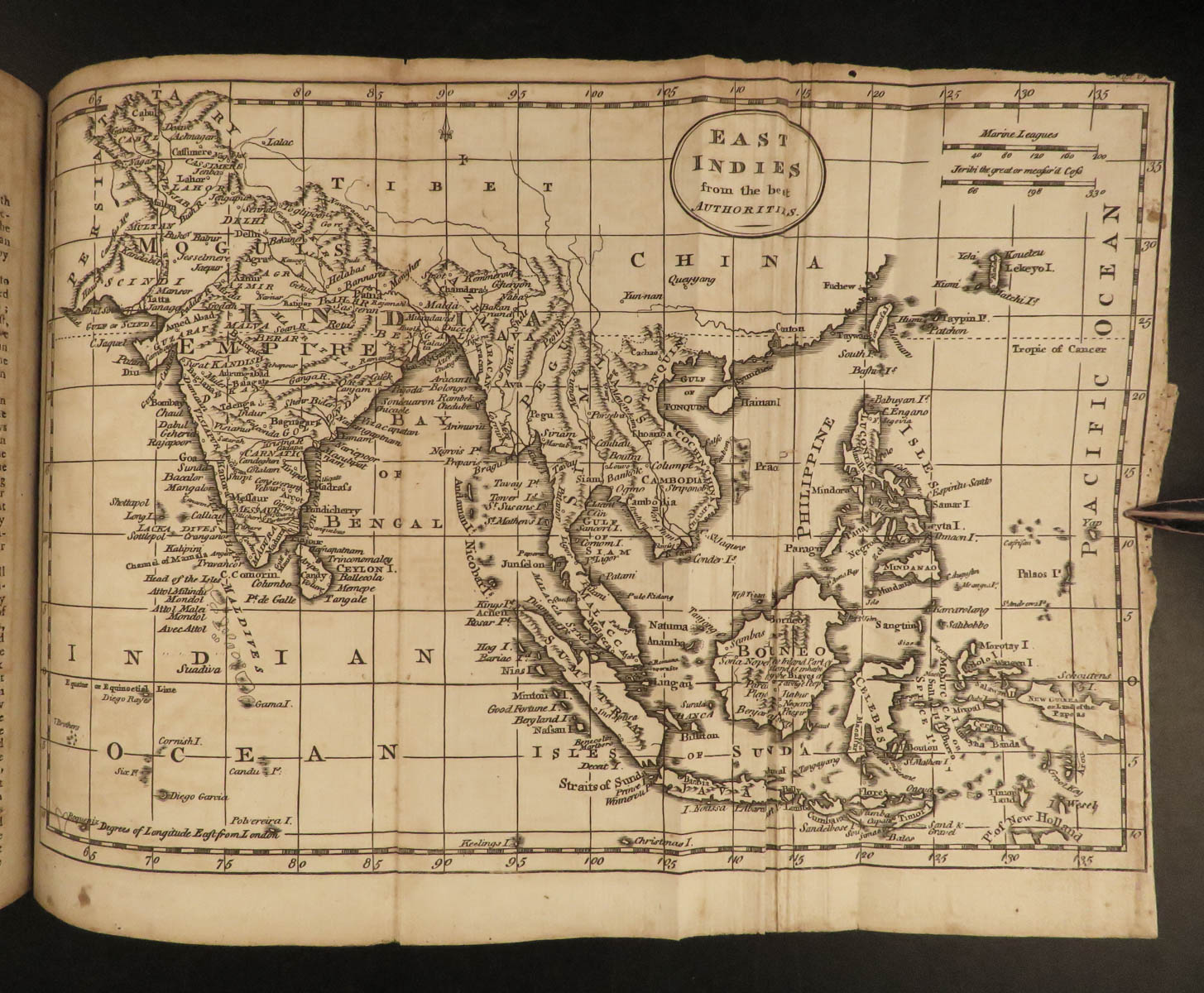
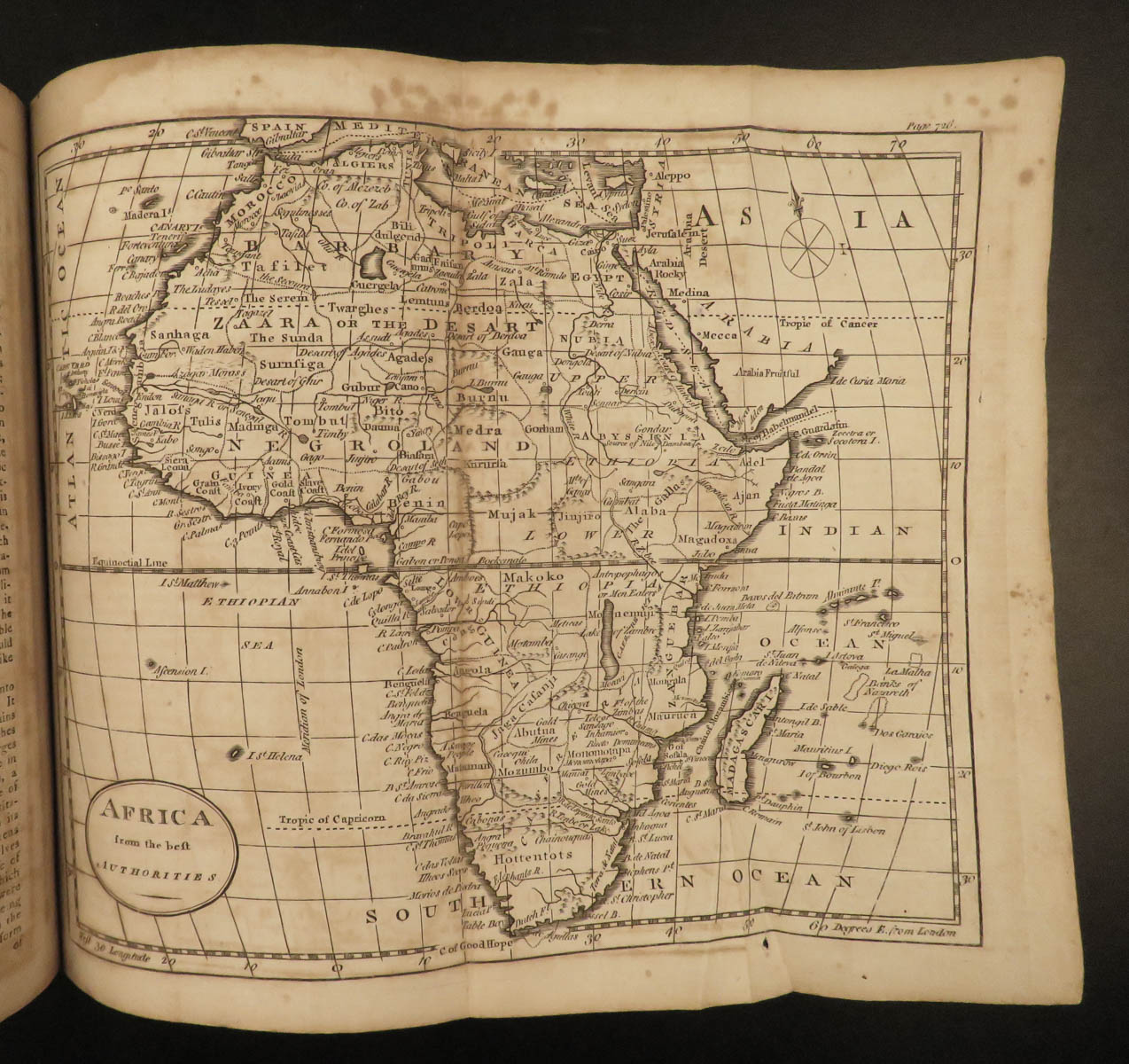
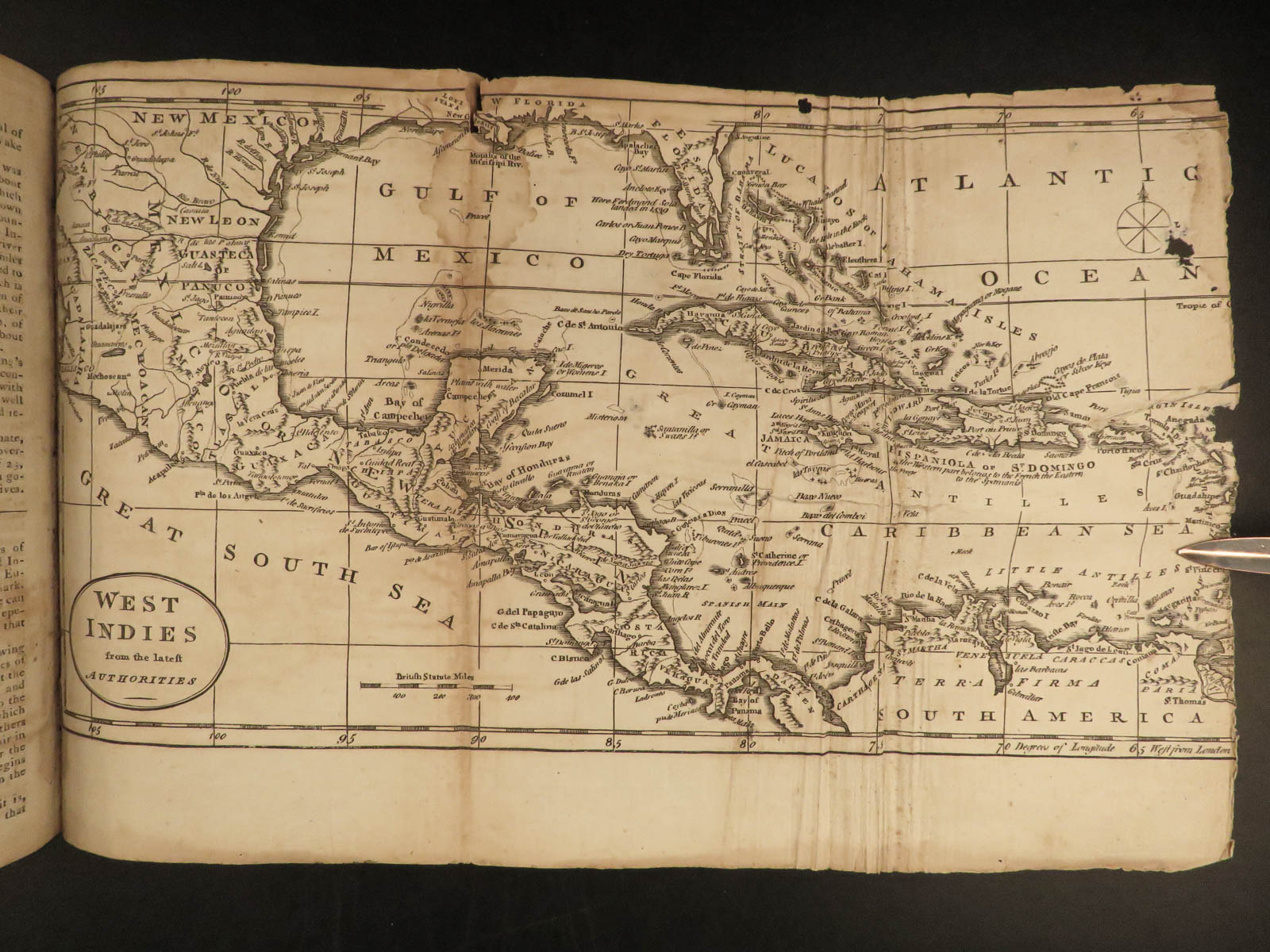
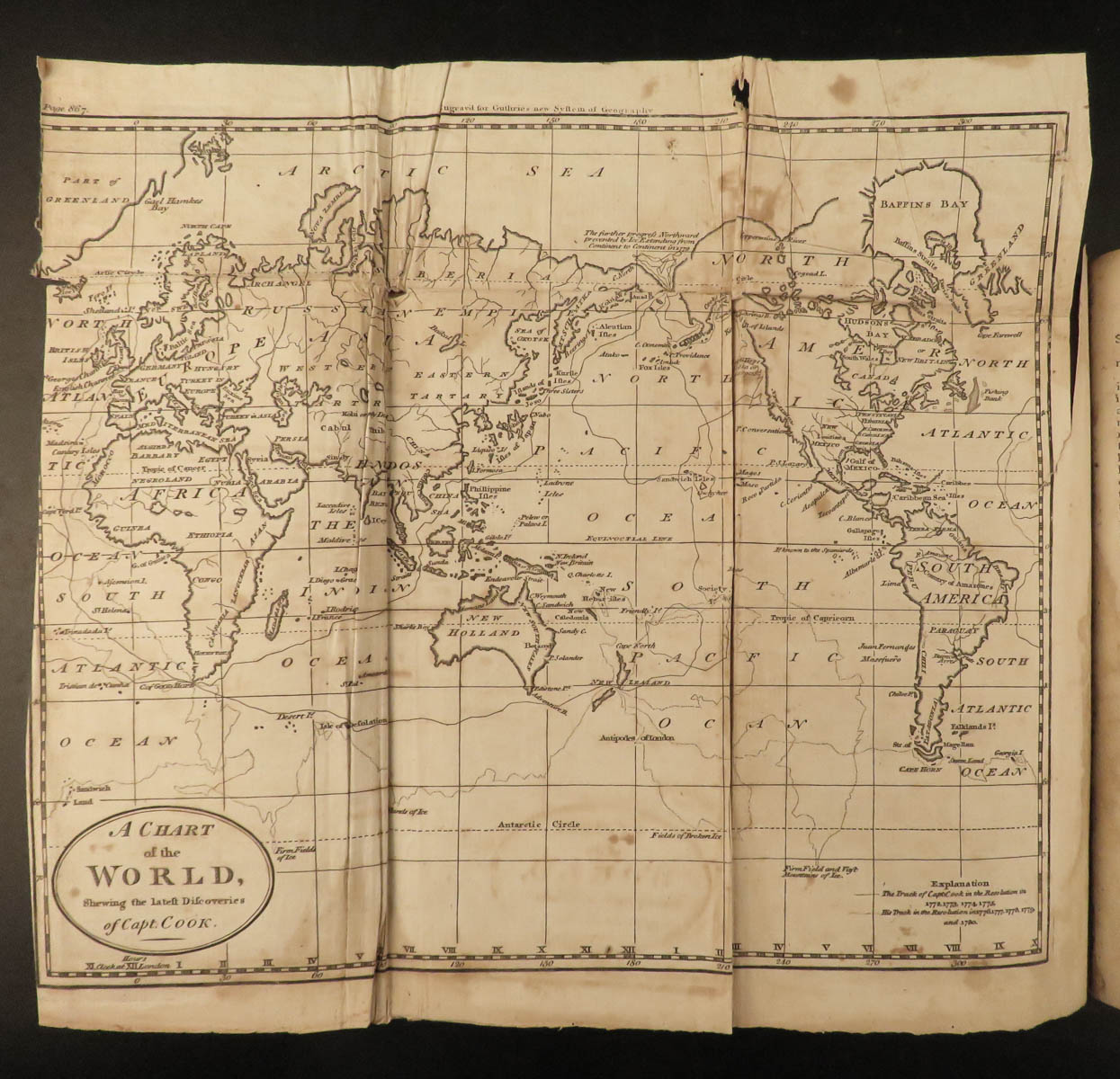
This truly impressive 1792 single-volume edition is illustrated with 21 maps! Other interesting inclusions of note:
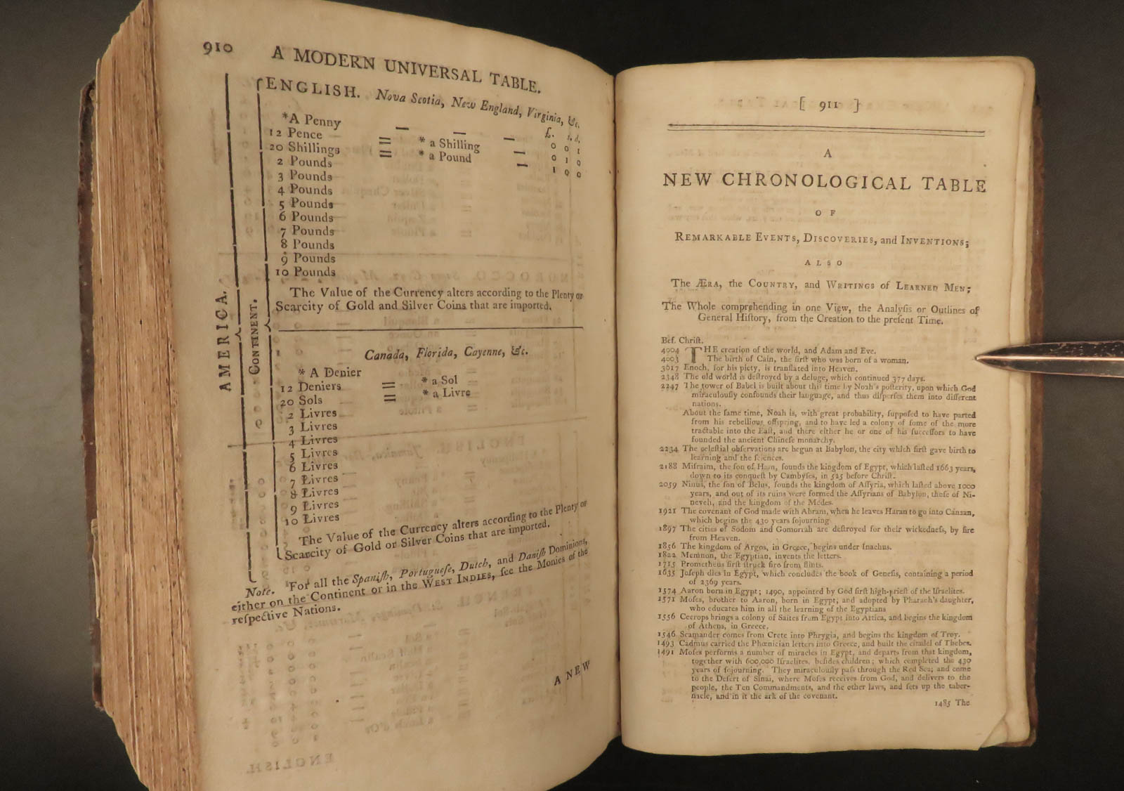
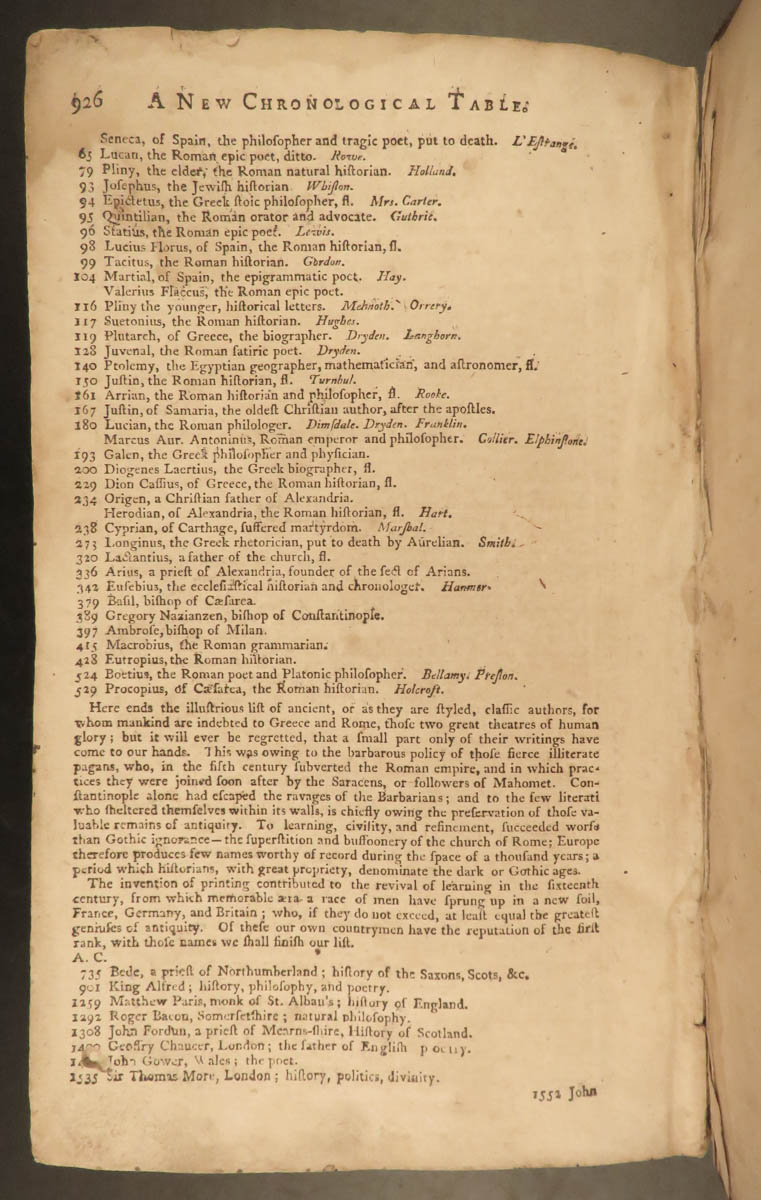
- Chronological table/list of world events
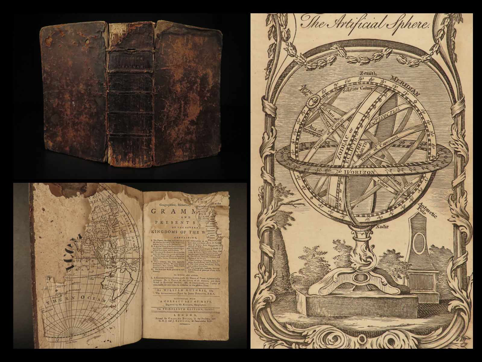
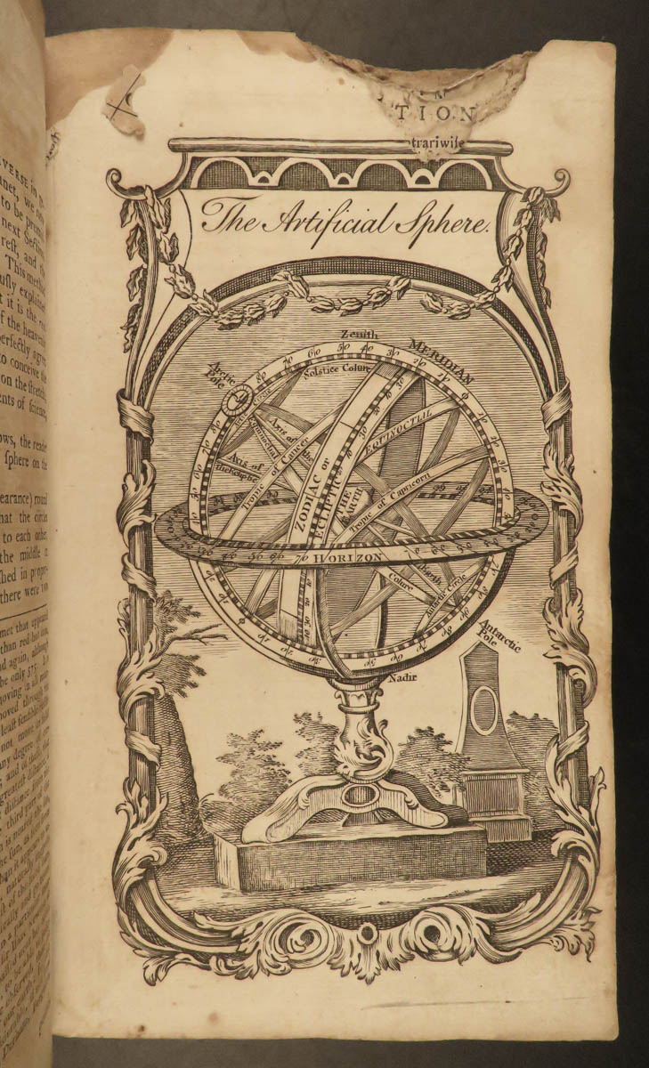
- An illustration of an armillary sphere
- Coin equivalency tables
- An early, important description of the discovery of America – though, according to Evans, much of Guthrie’s section on America is attributed to Jedidiah Morse (Evans 27077, 28782). Sabin even notes that this work includes “much matter relating to America”).


1792 Guthrie ATLAS & Geography 21 MAPS Illustrated Navigation America Asia India
William Guthrie was well known during the mid-18th-century for his many contributions to world history, especially through his extensive and thorough books. As a Scottish historian, he published one of the world’s best and most popular geography texts of the 18th-century.
This truly impressive 1792 single-volume edition is illustrated with 21 maps! Other interesting inclusions of note:
- Chronological table/list of world events
- An illustration of an armillary sphere
- Coin equivalency tables
- An early, important description of the discovery of America – though, according to Evans, much of Guthrie’s section on America is attributed to Jedidiah Morse (Evans 27077, 28782). Sabin even notes that this work includes “much matter relating to America”).
Item number: #21076
Price: $750
GUTHRIE, William
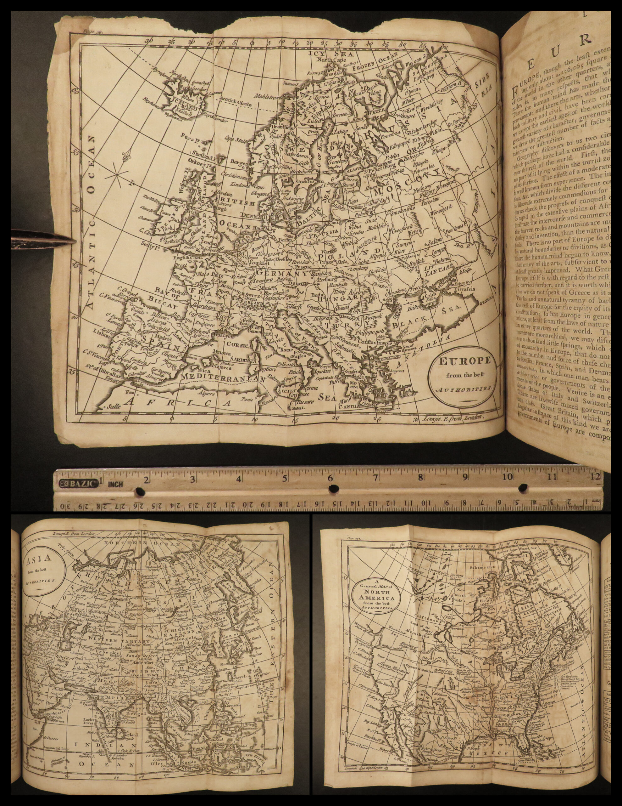
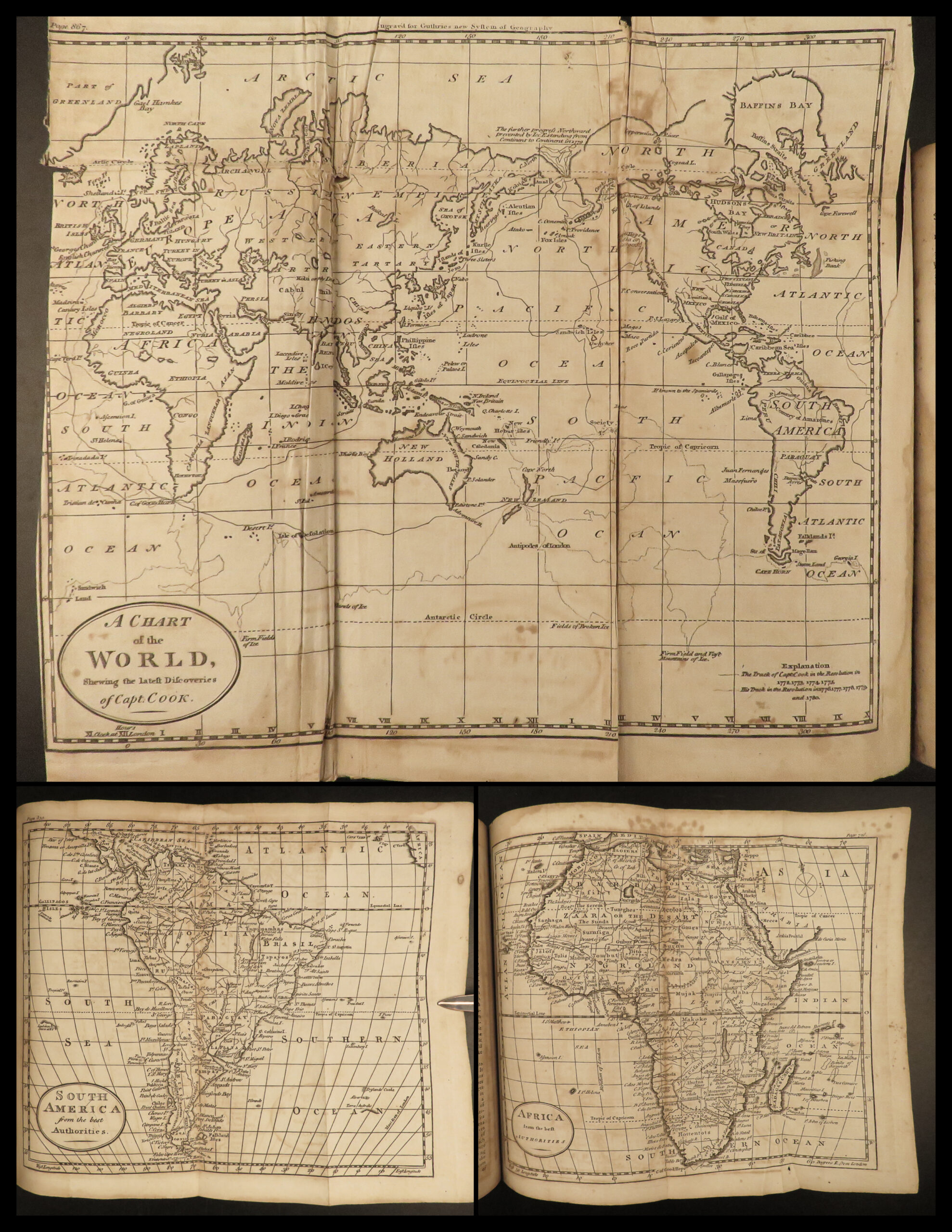
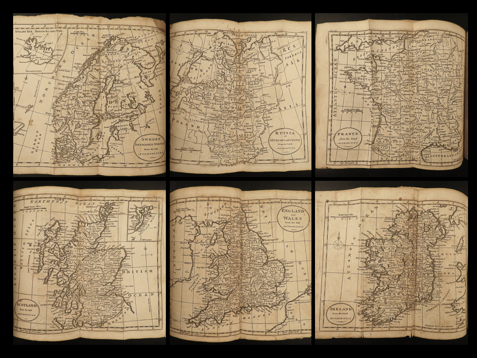
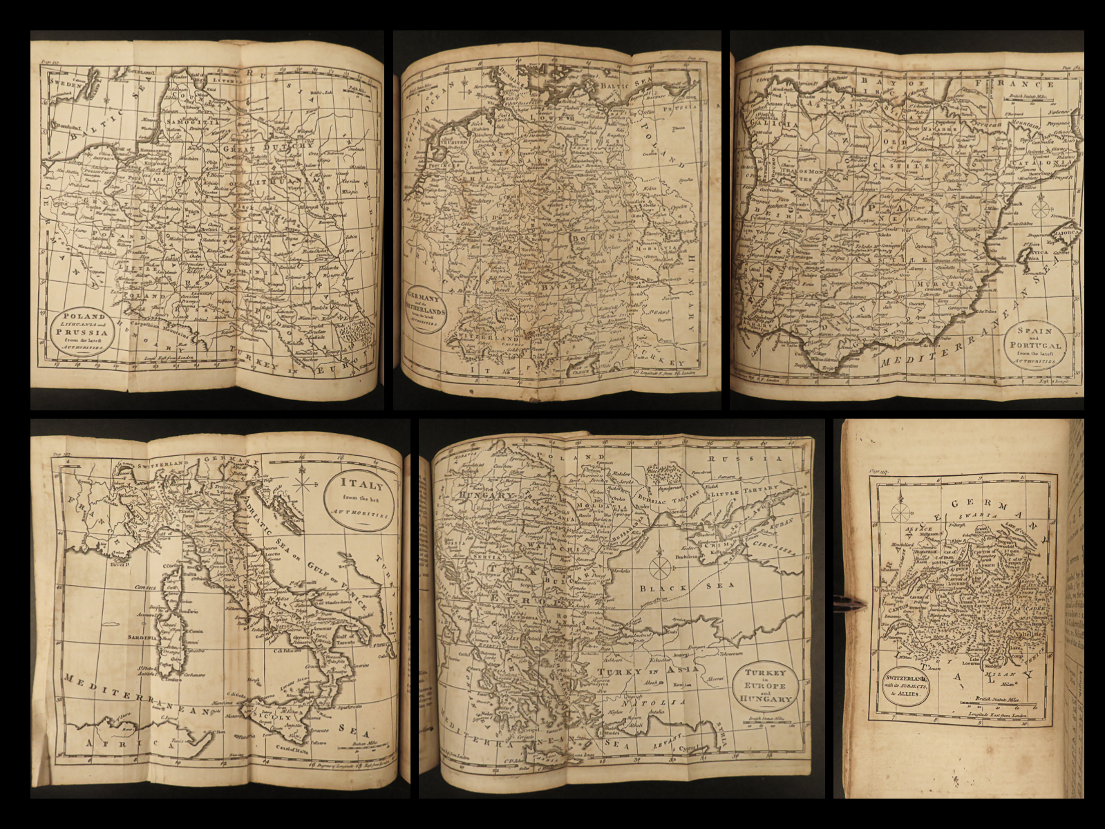
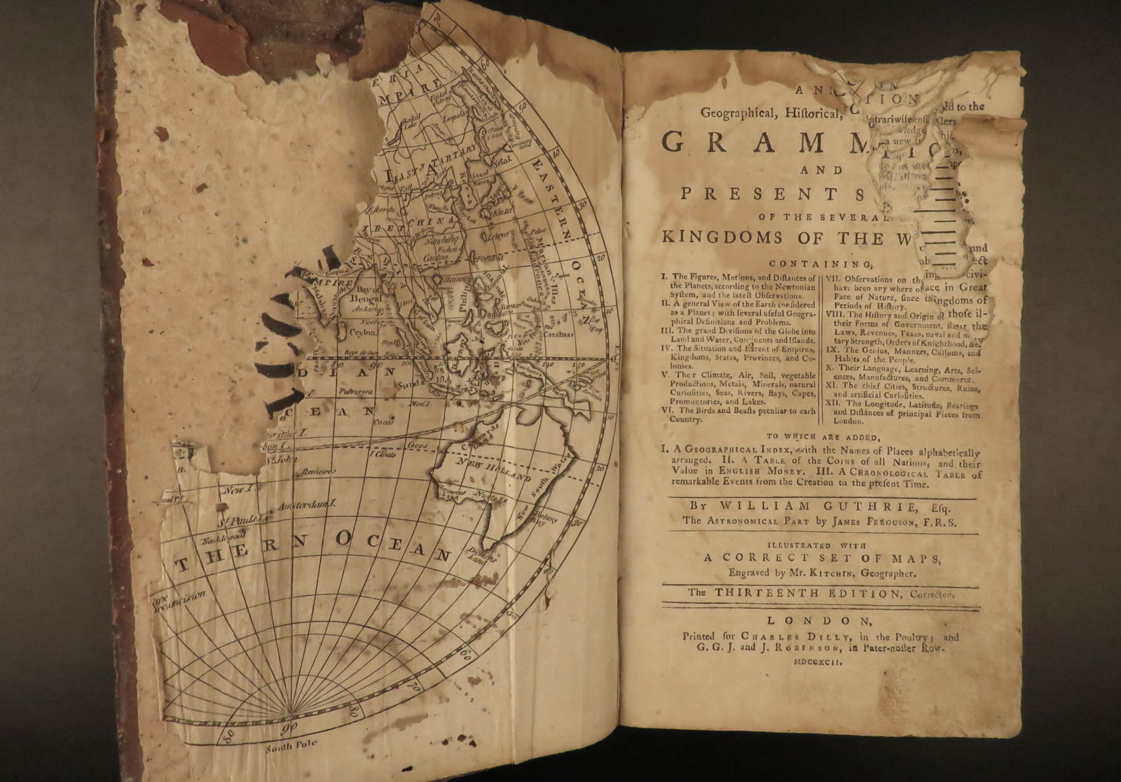
A new system of modern geography : or, a geographical historical, and commercial grammar; and present state of the several kingdoms of the world. … By William Guthrie, Esq. The astronomical part by James Ferguson, F.R.S. To which have been added, the late discoveries of Dr. Herschell
London: Printed for Charles Dilly and G.G. and J. Robinson, 1792.
Details:
- Collation:
- iv, [8], 926
- Wanting last page(s) of index table
- 23 plates, of which 21 are folding maps by Kitchin
- Frontispiece map, first 12 leaves present but damaged
- References: Lowndes 960; Sabin 29327; ESTC T 1381855
- Language: English
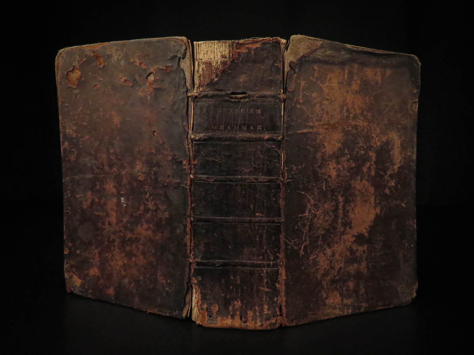
- Binding: Leather; tight and secure
- Size: ~8.75in X 5.75in (22cm x 14cm)
- Some condition issues as seen, but the maps alone (often selling for upwards of $100 each) present here a great value
- iv, [8], 926
Our Guarantee:
Very Fast. Very Safe. Free Shipping Worldwide.
Customer satisfaction is our priority! Notify us with 7 days of receiving, and we will offer a full refund without reservation!
21076
Categories
Medicine & Science
Voyages & Exploration & Maps
Authors
GUTHRIE, William
Printing Date
18th Century
Language
English
Binding
Leather
Book Condition
Excellent
Other Books you might like...
-
Sale!
 Add to cart
1775 1ed North Pole Voyage Arctic Exploration Illustrated John Phipps Polar Maps
Original price was: $1,500.00.$1,250.00Current price is: $1,250.00. -
 Add to cart
1798 1ed La Perouse Voyage Pacific Islands Japan New Zealand Shipwreck English
$950.00 -
 Add to cart
1799-1800 1st ed Isaac Weld Travels US & Canada Illustrated SLAVERY Indians
$599.00 -
Sale!
 Add to cart
1875 1st ed ISMAILIA Central Africa Slave Trade SUDAN Egypt Illustrated Baker
Original price was: $550.00.$450.00Current price is: $450.00.